My penultimate day in the Richmonds took me across several large stream valleys on the way to Red Hills Hut.
I’d set my alarm for 6:30, but when it went off, I was in no mood to get up. That didn’t stop the other people with a 6:30 alarm, and I finally dragged myself out of my sleeping bag about ten minutes later. By the time I left the hut, a little after 8, it was still a bit chilly outside, but was well on its way to warming up.
Continuing yesterday’s tedium, probably the slowest part of the trail today was a somewhat long rock field shortly after leaving the hut. Once I got past that, I managed a reasonable (though generally not fast) pace the rest of the day. Still pretty tired from the last week of ridiculous climbs, descents, and sketchy trail, I tried to conserve my energy, focusing more on making steady progress than trying to go fast.
That strategy seemed to pay off, at least for the first part of the day. The hike to Porters Creek Hut took me 3.5 hours, half an hour faster than the estimate.
After the rock hopping field, the trail had two more climbs and descents before reaching the hut. On the last downhill to the hut, the trail was actually rather agreeable, and it felt like I was hiking again. (Rather than slogging through terrible trail.)
After a break in the shade at Porters, the trail briefly climbed to crest over a ridge before descending. A the top, the mountains to the west opened up, and I got cell service, which allowed me to book a room for two nights in St Arnaud. After the Richmond Range (and nearly two weeks since I left Wellington), I’m quite looking forward to a zero after I get to town tomorrow.
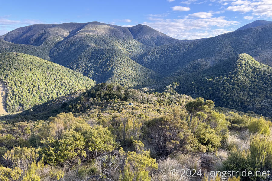
For much of the rest of the day, the trail bounced around ridges, steeply dropping down to and up from a few creek crossings. The creeks themselves were pretty trivial — right now. But they were all multiple (narrow) channels in wide, rocky beds that took several minutes to cross. Especially when seen from above, it was pretty clear that all of these creeks could become raging torrents after heavy rains. I was happy the most rain I’ve seen in the past week was the little bit that fell last night.
I was quite happy to cross all of these creeks without getting my feet wet. Only one proved a little challenging in that regard.
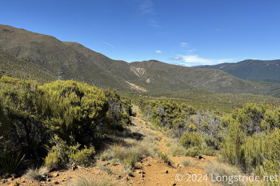
After the first such crossing, the trail went into a forest, with rather agreeable trail. After cresting a ridge, for most of the rest of the day, the trail was in a much shorter forest, barely taller than I was. At times, with the reddish rocks and soil, and stunted trees and shrubs, it almost felt like I was in a desert. The only thing missing was cactus.
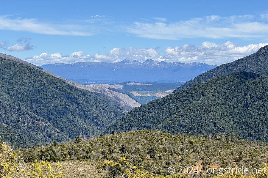
While the trail was bouncing along ridges and creek crossings, it was also following the Motueka River Right Branch upstream, from a respectable distance above. From the distance, it looked like a fairly large river, and I hoped the trail would not be crossing it.
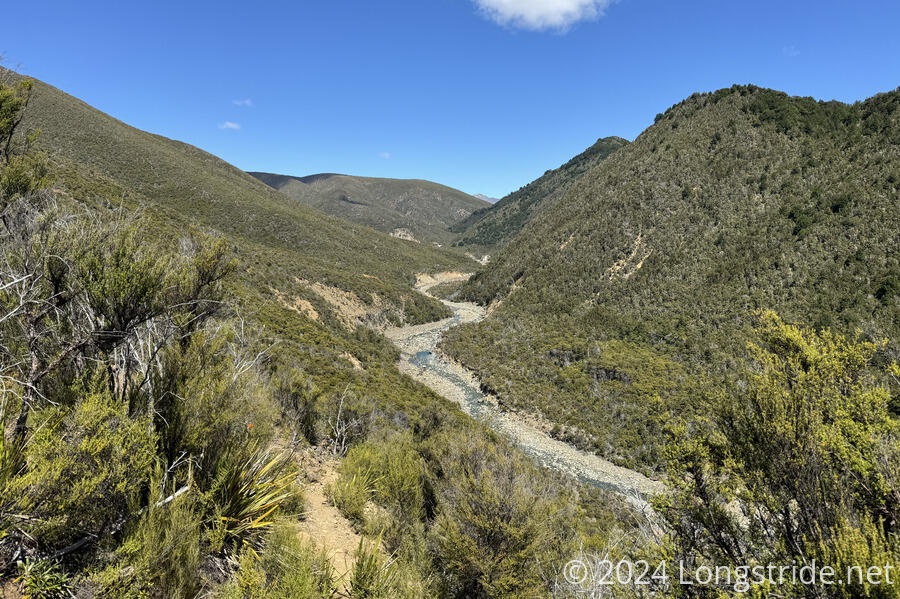
As it turned out, the trail did cross that river. The last of the day’s creek crossings, by the time the trail crossed it, the river had diminished quite considerably, and I didn’t recognize it as the river I’d been following until I looked at the maps later.
Eventually, on the trail’s final ascent towards Red Hills Hut, it stopped being so steep. So much so that it went through a few boggy areas. This was a little like the end of the climb up from Top Wairoa Hut yesterday, in that there were numerous small creeks flowing in (relatively) deep channels hidden by the grasses. It would have been very easy to step into one of them. (As with yesterday, having poles to use as probes helped quite a bit.)
I wasn’t the last person to leave the hut this morning, but very shortly after I left, those behind me passed. I didn’t see another hiker at all today until I was a few kilometers from Red Hills Hut, when I passed a northbounder.
About a kilometer before the hut, I stopped at a creek to collect and filter water. Red Hills Hut did have water (I’d confirmed with the nobo), but the hut’s water tanks have been dry recently. (Given the obvious arid quality of the landscape this afternoon, this made a lot of sense.) It seemed like a good idea to preserve the water in the hut’s tanks, in particular for northbounders, who have a dry stretch between St Arnaud and the hut. (Of course, this means I will have a dry stretch to town tomorrow.)
I arrived at Red Hills Hut about quarter to six, and was surprised to find that no one else was there. Apparently, everyone else from Hunters Hut decided to push on towards town, though that’s still another 20 km. (Or rather, 13 km to a highway via mountain bike track, after which they could hitch the rest of the way to town.) I should be able to make great time into town tomorrow. If the track leaving the hut even remotely resembles the last hundred meters of trail to the hut, it’s going to be very smooth hiking tomorrow.
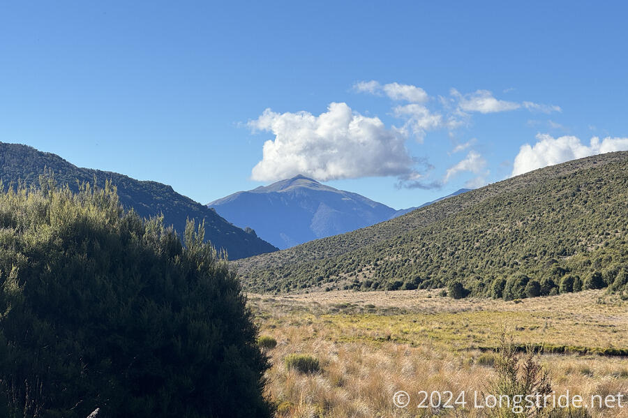
I cooked dinner, watching the clouds accumulate behind and above a conical peak in the distance. It was nice and relaxing; the first time I’ve been alone for dinner since Mistletoe Bay, a week and a half ago.
Curiously, this hut has no way to hang food bags inside. (I guess the maintainers think this hut doesn’t have a mouse problem?) Since I was the only person here, I managed to make something work, by hanging my food bags (which have more garbage than food) on a ring on a candleholder platform, suspending my food bags far enough from the wall and above the food prep table that no mouse should be able to get to them.
Tomorrow, I am very much looking forward to being out of the Richmond Range, and in town.