Today took me over Travers Pass, down the East Branch Sabine River valley, and up the West Branch Sabine River towards Waiau Pass.
I slept well last night, and woke up before my alarm. I attempted to go back to sleep for a little while, before deciding I should just get up and get moving. This proved to be a good idea, because once I looked outside, I found that the weather had much improved since last night: there was blue sky and I could see the top of the nearby ridges.
Rather than my usual load of 3 liters of water, I only took two. I figured that should be more than enough to make it to over the pass and down the mountain to the next hut, where I could easily refill. A kilo less weight I have to haul up and down the mountain should make it easier, at least, if not marginally faster.
From Upper Travers Hut, the trail started off reasonably nicely, crossing the Travers River one last time on a bridge. Then, the trail had a short stint through overgrown grasses; early in the morning, wet from dew and last night’s rain, this did not help my feet stay dry.
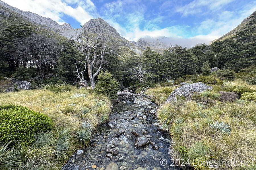
As the trail drew closer to the pass, it got steeper, and crossed a few boulder fields in an avalanche path. This was a bit slow, but with steep climbs and descents a large part of today and tomorrow, slow and steady is going to well describe a majority of my hiking the next couple of days.
For quite possibly the first time ever, I slightly shortened my poles on the ascent to Travers Saddle. This actually helped out a lot, and I was unclear why I’d been so resistant before to shorten and lengthen my poles as appropriate to the terrain. (Later in the day, I remembered why: when the uphill also includes lots of short, steep downhill sections, the shorter poles make that harder, and it’s a pain to keep changing their length.)
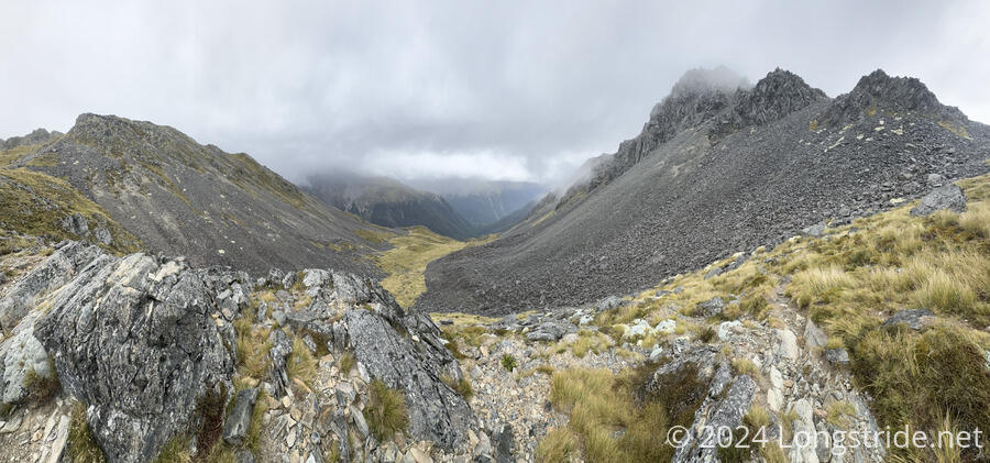
As I got closer to Travers Saddle, the wind picked up a bit, and clouds began blowing over the ridge in the direction of the pass. It seemed questionable whether I was going to have much of a view up top.
I didn’t really. The clouds obscured anything that might have been behind the nearby ridges, and especially once I started descending the far side of the pass, the mountains constricted my view to the valley ahead.
After I crossed the saddle and started my way down, a light rain started. I should have put my pack cover on then. Really, I should have put it on in the hut, but now that I was hiking, I didn’t want to stop. Fortunately, the rain was mostly mist from the clouds that were rising up from the valley, so my pack didn’t get too wet. And by the end of the day, my shirt was no wetter than it would have been from sweat+.
Once I dropped far enough to enter the forest, the rain mostly became a moot point. It was light enough that the forest absorbed nearly all of it before it got to me; the only way I could tell it was still raining was when the tree cover occasionally opened up.
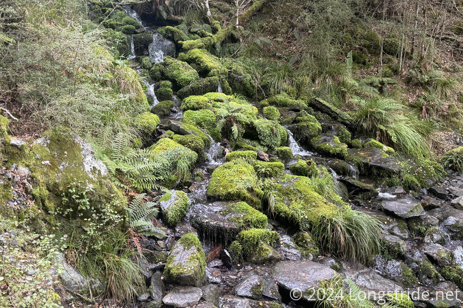
After steeply descending through the forest for quite some time, the trail began to roughly follow the East Branch Sabine River. I eventually crossed the river via a bridge over what appeared to be a bottomless pit, as the river cut very deeply into the rock, so far down that you could hear it, but not see it.
The trail worked its way further down the mountain, passing by a number of small streams, waterfalls, and mud pits that were all likely enhanced by the rain yesterday and today.
As I drew close to the West Sabine Hut, I thought that it would be nice if there was someone there who’d already started a fire. As it turned out, there was a group of eight people already in the hut, and they had the fire going. I put my socks on top of the fireplace; by the time I was ready to leave, they were completely dry, and nice and toasty warm.
After crossing the West Branch Sabine River on a swingbridge, I made my way along its bank and began to follow it upstream. For the rest of the day, the trail would follow the river up the mountain, occasionally veering away as the trail went through avalanche hazard areas, or other sections of very rugged terrain.
The trail was quite variable in how easy it was to hike. Sometimes, there were short or long stretches of great tread. Other times there were short boulder fields, or steep climbs through the forest. It made it quite difficult to estimate how long it’d take to get anywhere.
Further confounding were the distance markers to the hut. Yesterday and today, in addition to the orange directional markers, there have been yellow markers to indicate placement of possum traps, with an abbreviation for the hut and the approximate distance to the hut. These distances have generally undercounted the actual distance, but to Blue Lake Hut, my destination for the day, they were incredibly short.
My guess is that the distances were based on an idealized trail, and were never updated after the trail was rerouted many times from avalanche damage. (There were many times that the trail zig-zagged around obstacles, and the trail tread was either terrible or obviously freshly made.)
For nearly the entire afternoon, the Sabine River was quite loud, a constant drone of water rushing down the mountain.
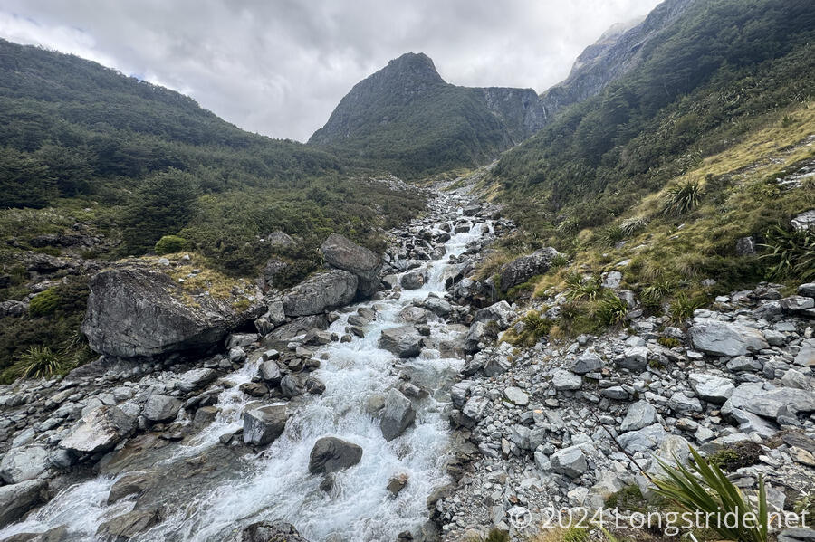
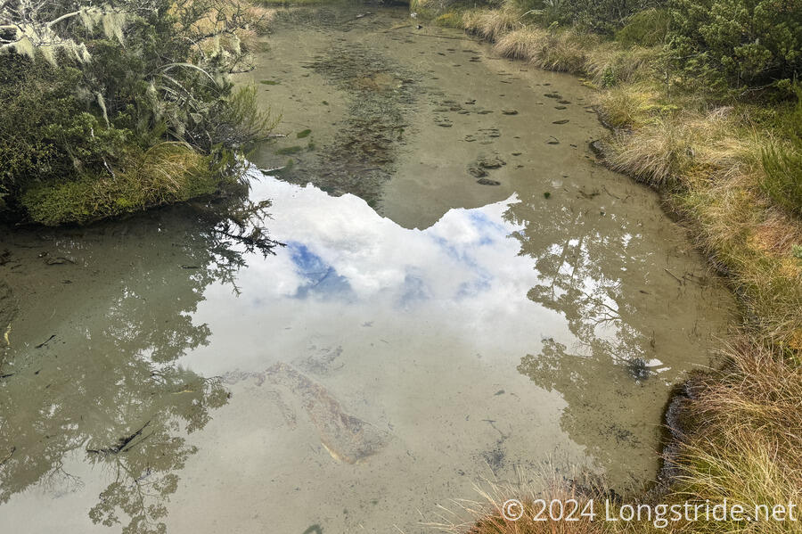
When the river wasn’t white from being churned up going over rapids, it was incredibly clear. This extended to all of the small creeks I crossed as well. This was most evident when I passed a creek that looked brown; when I got closer, I realized that was because it had a sandy bottom, and the water on top was completely clear.
I reached the Blue Lake Hut almost quarter to six, making today a very long day. There were three other southbounders in the hut, who I hadn’t seen before, as well as an older hiker heading south, but making his own path; and two northbounders.
There was also a hiker awaiting a helicopter evacuation. I didn’t get the full story, but they were an experienced hiker, and they fell and had one of their teeth cut through their lip.
About half an hour after I arrived, a helicopter landed on the grass helipad next to the hut, and less than ten minutes later, they were gone, with the injured hiker.
For much of the evening, a light mist fell; later, the rain picked up on occasion.
Tomorrow, weather permitting, I’ll go over Waiau Pass, which is supposed to be incredibly scenic. Also incredibly steep and difficult; I’m not looking forward to that bit.