An easy day brought me to the Harper River Campsite, setting me up to reach the Rākaia River Hazard Zone tomorrow at Lake Coleridge.
I again didn’t sleep well, waking up overheated three times during the night. Although I’d basically come to the conclusion last night, not sleeping well decided for me that I’d not try to push all the way to Lake Coleridge today. A 48 km hike would take all day, and the only good reason to push so hard would be if that would let me get to Methven tonight to resupply and take the (literal) school bus back to the trail on the other side of the Rākaia River tomorrow morning. But to have any chance of making it work, I’d have had to have left Hamilton Hut at 5 am, averaged 4 km per hour for 12 hours, and then very quickly gotten a hitch from Lake Coleridge to Methven in order to get there in time to do my resupply before the supermarket closes, so that I could get up at 5 am tomorrow to catch the school bus back to the trail at 6 am. None of which seemed likely, considering the 6:30 alarm I’d set.
So, I decided today would just be a “short” 19 km day to the only campsite between here and Lake Coleridge. With that decided, I ignored my 6:30 am alarm and instead slept in until quarter after seven, returning to the trail around 8:30.
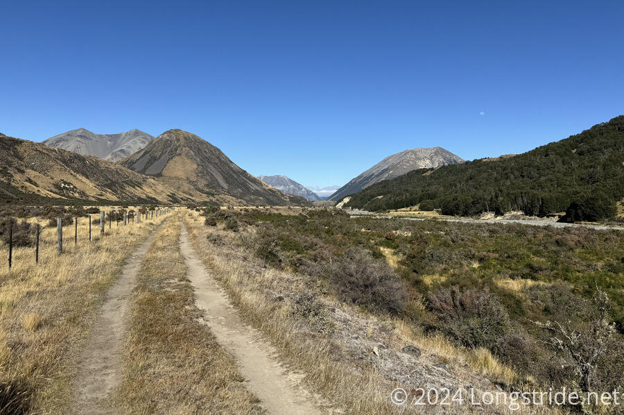
After following the hut access trail back to the TA, I followed an ATV trail down the valley, following the Harper River downstream. The track crossed the river quite a few times, but in comparison with the other rivers I’ve had to cross recently, the Harper was fairly low flow, and fairly shallow, rarely ever higher than my socks. I still got my feet quite wet, of course, since there usually wasn’t any way to rock hop across, but all of the crossings were quite easy.
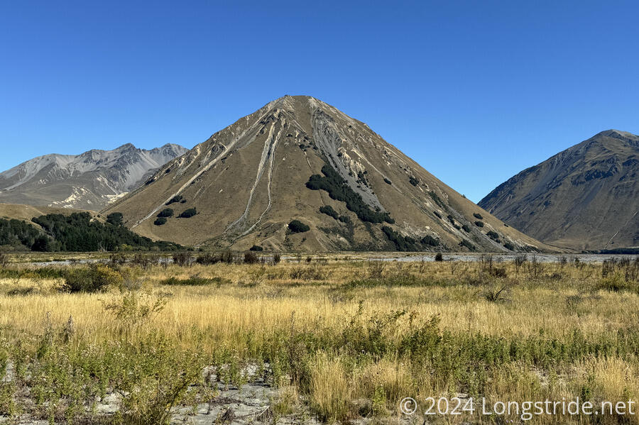
The weather today was excellent. Once the morning clouds got out of the way, there was a perfectly blue sky almost the whole day.
I did not meet very many people on the trail today. I only saw four northbound hikers, and they all passed before 11 am. But they said the trail ahead was quite nice (as much an ATV trail can be nice), which I was glad to hear.
At some point, the trail left Craigieburn Forest Park, and entered Glenthorne Station, a large sheep and cattle farm. (Surprisingly, I did not see any farm animals today.)
I stopped for a break a little more than halfway. Two ATVs passed, heading north along the road, and then again heading back south.
After my break, the dirt track changed to a rough gravel track, which felt a bit harder to hike on. (Though now, it was after noon, and the sun was much higher in the sky, and it was a lot warmer out.)
In the lower part of the valley, the gravel track climbed up on top of a gravel stop bank. Below, closer to the river, heavy machinery was pushing gravel around, seeming to form large slots for something. This seemed to have been a long ongoing practice; there were older slots, probably years old, that had some trees and brush growing out of them.
The gravel stop bank seemed to have been recently worked on, or at least used to move the heavy machinery, and it was very rough to walk on. In spite of the signs warning to stay on the trail, it was also not always clear whether I should have been on top of the stop bank or on some road or trail at its base. But, I guess I was where I was supposed to be, because there were ample workers on Glenthorne Station who saw me, and none of them said I was in the wrong place.
Eventually, I dropped off the stop bank, following a couple of gravel roads past an information sign on braided rivers, and to a road intersection going in several directions. The Harper River Campsite was a short distance off-trail beyond the intersection.
The 19 km today took me just under six hours, which was fantastic, as a sign towards the end estimated 7.5 hours back to Hamilton Hut.
The campsite was nice, with a large grassy area and a relatively new shelter with a table and benches, a picnic table outside, water, and a pit toilet. The shelter had ample space inside, as well as a few hooks that could be used to hang food away from rodents. (I saw at least two difference mice hanging around the shelter.)
I decided that I was going to just roll out my sleeping pad and sleep on the floor of the shelter, rather than set up my tent. Tomorrow, the time that would save me would be well worth it.
Arriving in the early afternoon, I was able to thoroughly dry my clothes, socks, and boots in the hot afternoon sun. I forgot to hang out my sleeping bag until almost near sunset, so it did not get nearly as dry as I wanted.
I had the shelter to myself for a while. The first other hiker to arrive was a sobo aiming to hike across the Rākaia River. This is usually a very inadvisable thing to do, and the TA Trust officially warns against it and highly encourages hikers to detour around both the Rākaia and Rangitata Rivers. Both rivers are in very wide riverbeds, are highly braided (which means they have a large number of channels), with an unsettled shingle bed (meaning it can be slow to hike), and the rivers can rise very quickly in response to rain anywhere upstream, which is often not evident until it’s too late.
Most hikers who do want to hike across the rivers want to do so because it is a very long detour around the rivers (62 km for the Rākaia River, and 137 km for the Rangitata), and can be hard (or expensive) to get a ride. In theory, the hike across the rivers is only a few hours, but with the unsettled shingle bed it can be slow going.
This hiker had a route that had them crossing the Rākaia considerably upstream of the end of the trail at Lake Coleridge, a bit west of the campsite. If there was ever a time to do the crossing, it was now, when it hadn’t rained for several days. I wished them luck and reminded them to stay safe.
Later, a few car campers arrived, including the trio from Arthurs Pass Lodge. There were also two northbounders, from Denmark. Hannah arrived late, having accidentally continued down the trail that led to Hamilton Hut, rather than returning to the TA. One of the car campers, from France, had previously met Hannah while they were both in Wellington.
I set a 6 am alarm for tomorrow, hoping to get started before 7:30.