A road walk and a rather nice hiking trail brought me away from Arthurs Pass, along a route with excellent scenery to the very nice Hamilton Hut.
I left the lodge around 8, turning down a ride to the trailhead from the group of older guys because I needed to get breakfast in town in order to have enough food for the section. About half an hour later, after I finished eating, I walked across the street from the cafe and began trying to hitch.
This was a hard hitch. Being still early in the morning, there was very little traffic passing through town, and all of it ignored me. Then, someone parked along the street directly between me and the approaching traffic, essentially killing any chance I had of getting a hitch from that spot. After getting a tip that a bunch of people were getting ready to leave from the hostel, I decided to just walk over and directly ask people for rides. A couple from Poland who were touring the South Island agreed to give me a ride five minutes down the road to the Greyney Shelter where I’d stopped yesterday, and I finally resumed hiking a little after 9:30.
After returning to the TA, I followed a trail that had been created specifically to get the TA off of the highway. Following the Bealey River on its right bank, this was a reasonably nice trail for a while, bouncing between a gravel path along the riverbed, and a nice forest trail with yellow arrow markers (instead of orange) with “TA” carved into them.
However, a couple of kilometers later, near Klondyke Corner, a campground, I managed to lose the trail. After overshooting the trail twice, I gave up trying to find the trail, and instead just followed the road. This would be a longer distance, but at least it would also take me over the Waimakariri River on the road’s bridge, rather than me having to ford the river.
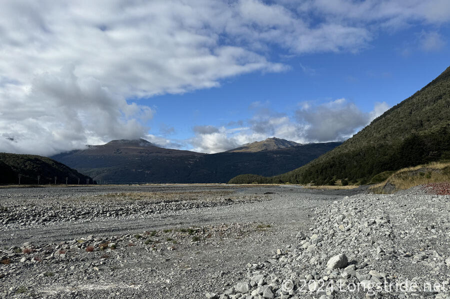
Up to the bridge, the two-lane road had a surprisingly wide shoulder, probably because it was a generally flat area. It only felt unsafe when a few drivers far exceeded the speed limit to unnecessarily zoom past slower traffic with an incredibly wide margin. I couldn’t really see either the Bealey or Waimakariri Rivers along the road, but I did get a nice view up the Waimakariri’s valley.
The bridge, though, was one lane, and I had to time my transit to go across immediately following a long line of cars that had accumulated going the same direction as me. I ran across the bridge, at least as well as I could with a pack on. Fortunately, about two-thirds of the way down the bridge, there was a short pull-off, which let me get out of the way of traffic that was coming from both directions.
On the other side of the Waimakariri, the trail joined the road, and after several more kilometers, I reached Cora Lynn Road, a gravel road towards a farm and the trailhead for the next section. At the trailhead, I stopped for a break.
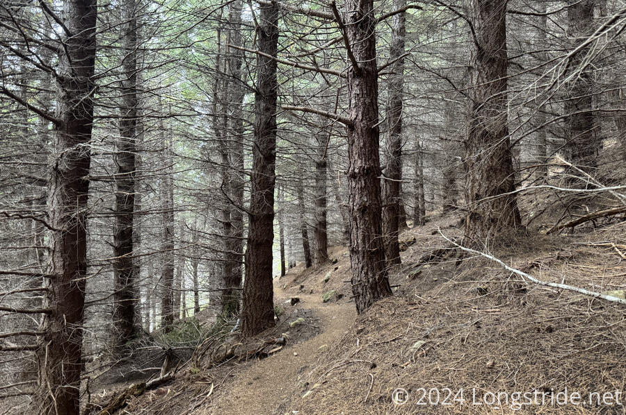
From the trailhead, I entered the Craigieburn Forest Park, and followed the Lagoon Saddle Track, heading uphill through the forest. After some climbing, the trail entered a pine plantation. The trees shaded most of the sun from reaching the forest floor, and the pine needles suffocated the ground. The only greenery was a few small shrubs and some moss, with the trees’ needles far in the sky and obscured by their lower branches. Had it been foggy, this would definitely have been a quite spooky forest. It was a bit chilly, thanks to it being overcast for most of the morning. It didn’t help that I was sweating a bit, so I was actually a bit cold for some of the afternoon.
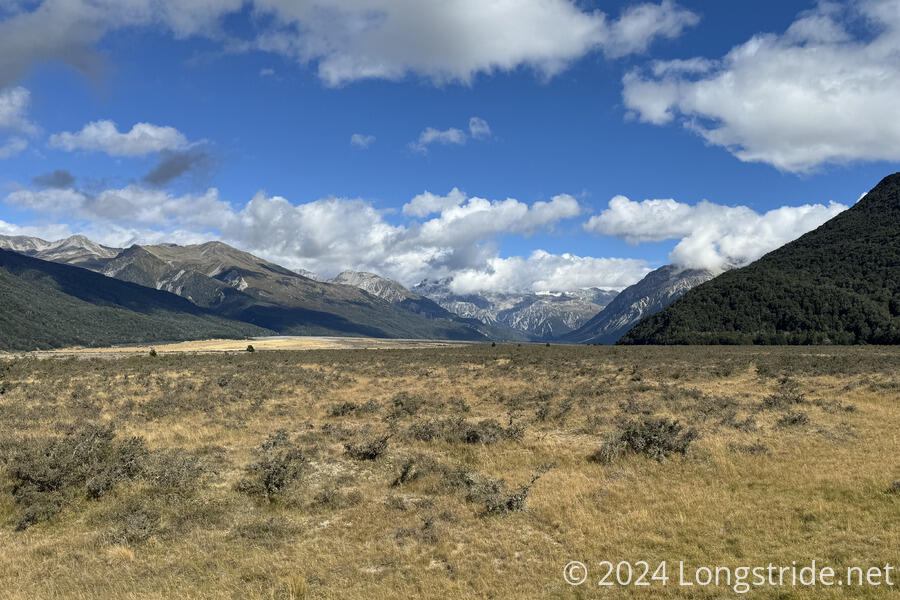
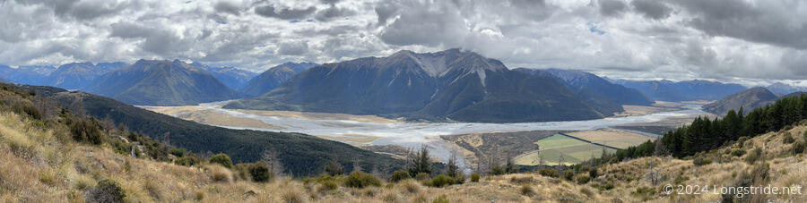
After exiting the pine plantation, the trail followed the side of the mountain, with great views down to the Waimakariri River. I could see (I think) the town of Arthurs Pass off in the distance.
After traversing a boggy area, I re-entered the forest. After crossing around the mountain near Lagoon Saddle, my climb for the day was finished, and the trail began its long descent. I went past the Lagoon Saddle A-Frame Hut, which I could see not even a minute downhill from the trail, but I decided not to detour there. I was starting to get tired, and I still had a few more hours to go to reach Hamilton Hut. I did, though, stop for a second break about 15 minutes later.
The trail downhill from the A-Frame Hut was generally pretty nice, and I made good time, except when the trail emerged from the forest along the Harper River, and was occasionally poorly marked. There were a fair number of creek and river crossings, but I only got my feet wet once.
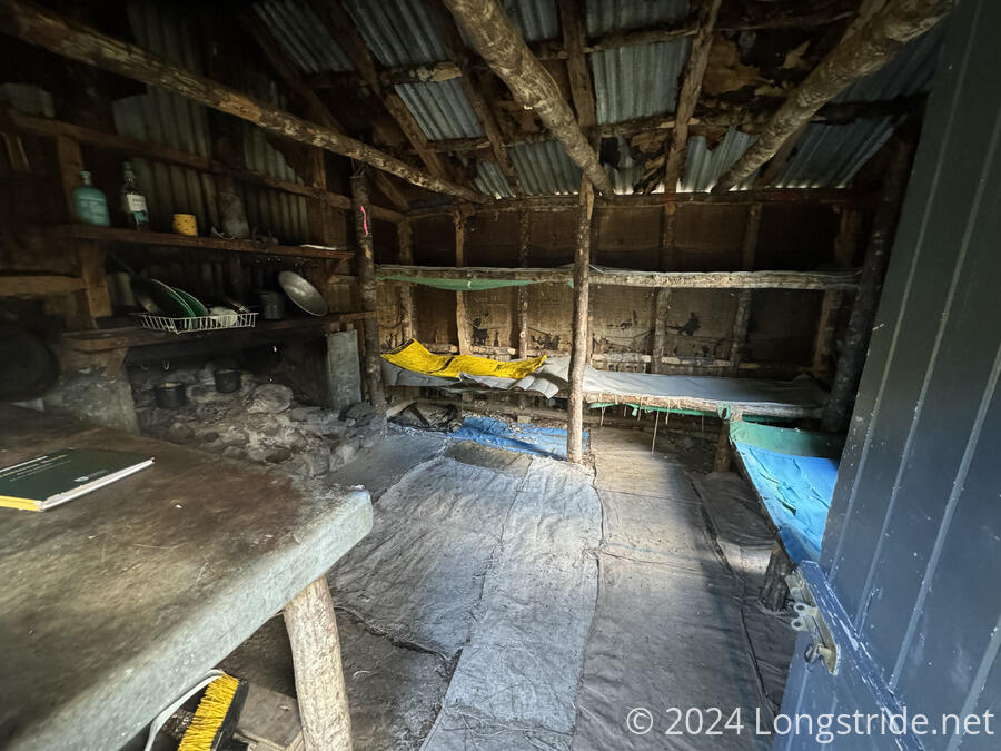
The trail went past the West Harper Hut, an “historic” hut in a bad state of disrepair. Rather than mattresses, like every other hut, this hut only had fabric bunks. There were large gaps in the door, making it easy for animals to enter, and nearly everything in the hut looked very worn or animal or weather-damaged. It would have worked to stay here in an emergency, but Hamilton Hut was only another hour and a half ahead, and though it was now fairly late in the afternoon, I still had plenty of daylight left to get to where I wanted to be.
After crossing another swingbridge, I reached the end of the Lagoon Saddle Track, which forks off into the Harper Valley Track (for tomorrow), and the Cass Saddle Track, which led me to Hamilton Hut, about five minutes off-trail. I reached Hamilton Hut around 7:30, one of my latest finishes on the TA so far.
Hamilton Hut is a nice, large hut, with 20 bunks in two rooms off a large common area.(It also has a radio link to the Arthurs Pass DOC office.) I picked an east-facing bunk, which ideally will have more sunlight tomorrow morning, encouraging me to get started earlier.
I got dinner started around sunset, and it appeared that I would have the whole hut to myself. After sunset, sobo Hannah arrived — I’d actually met her yesterday, when she did the Goat Pass section northbound. She’d made it to West Harpers Hut, had dinner, and decided the place was too creepy to stay there. I didn’t blame her.
Tomorrow has two options: a short 19 km day to the Harper River Campsite, or a 48 km day to the Lake Coleridge Powerhouse Lodge, on the north side of the Rākaia River. Going all the way is feasible, and would even be ideal, since it would keep me ahead of the weather. (Heavy rain is forecast in the area on Monday.) It would be a very long day, though.