An easier day of hiking than yesterday brought me over Goat Pass and down the Mingha River to the other side of Arthurs Pass.
Leaving Upper Deception Hut, the trail continued climbing up the Deception River, with a combination of forest track when the river was very steep, and river crossings when the river wasn’t so steep.
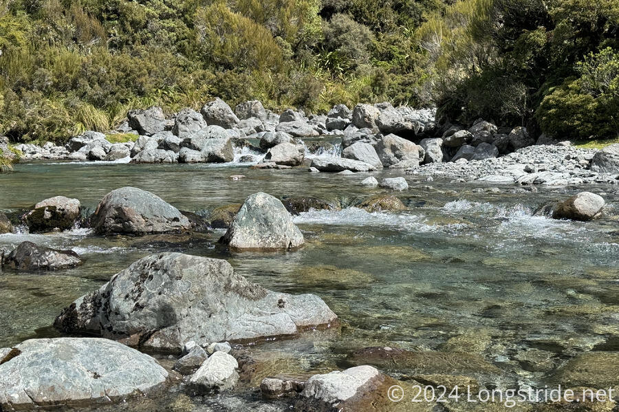
I didn’t bother counting the number of times I crossed the Deception River. Once my feet got wet, they stayed wet the rest of the climb up to Goat Pass.
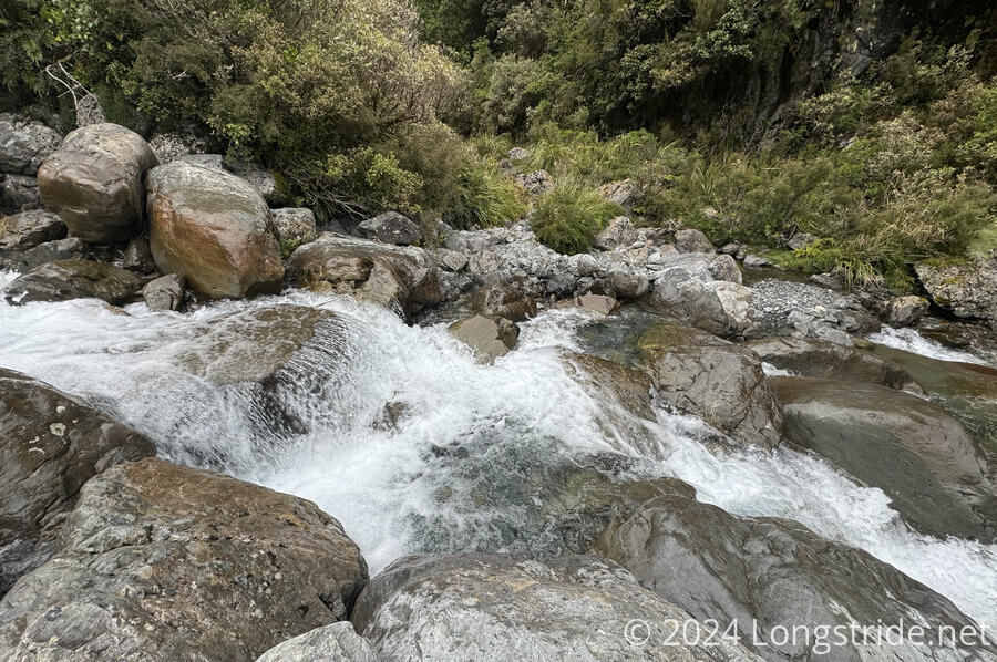
The main difficulty this morning was the river crossings. The river itself wasn’t terribly high, usually no deeper than knee deep, but with less flow and generally narrower than the river had been further downstream. (I was quite happy each time I passed a tributary stream, no matter how small; every stream passed was a tiny bit less water flowing in the river.)
What made the crossings problematic was that many of them were either immediately above, below, or in-between waterfalls, so there were often narrow or deep (above the bottom of my pants) channels of swiftly moving water. Some of these took some thought to decide where the best way to cross was. Perhaps tomorrow, with a lower flow rate, some of them would have been trivial to walk across.
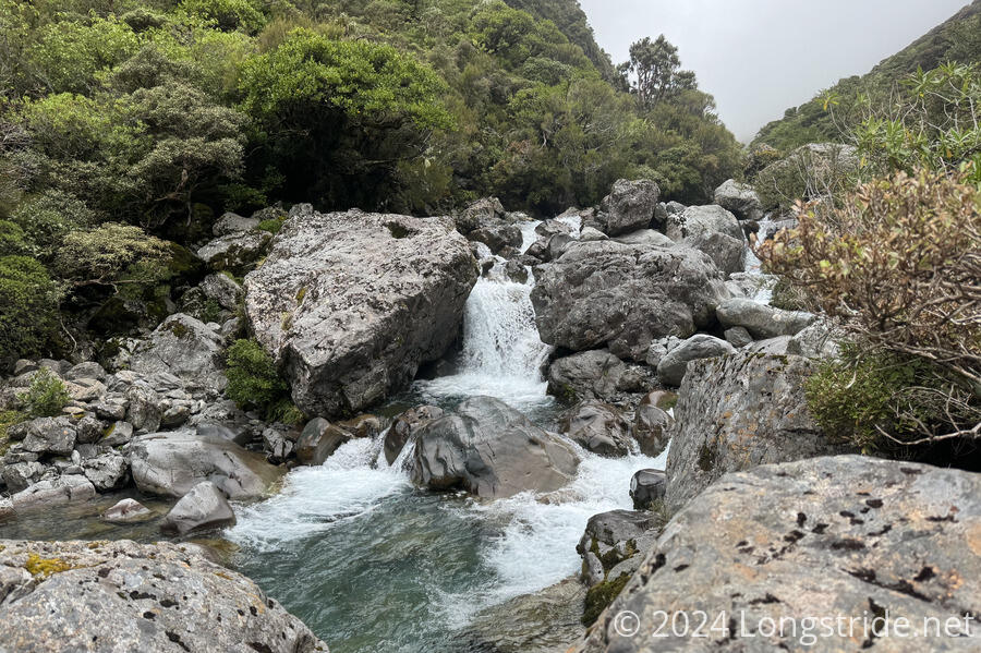
Eventually, the trail departed the Deception River, heading up a creek that was essentially nothing but a climb up a series of low-flow waterfalls. At one place, I had to take my pack off in order to squeeze through a very short opening in the trail between the ground and a tree branch. The alternative was climbing up a tall step in a waterfall that might actually have been easier, if not considerably wetter.
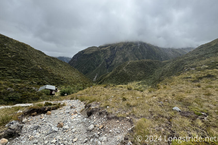
I passed three northbounders on my way up to Goat Pass Hut. The 2.2 km took three hours. At the hut, I stopped for a much-needed break, and was able to slightly dry out my shoes and socks. It was quite a bit chilly and windy at the hut, though it was actually warmer outside than inside the hut.
Goat Pass Hut is unique (at least among TA huts so far) in that it has a radio that can call down to the Arthurs Pass DOC visitor center. (Several of the huts in the Richmond Range had an antenna with a hookup inside the hut for a radio, but no actual radio.) Out of curiosity, I wish I’d asked when I was at the visitor center why the hut had a radio.
Two more nobos arrived while I was at the hut. I was quite happy that both they and the nobos I saw earlier had described the rest of the trail beyond the pass as being much better than the Deception River track.
A short, steep climb past the hut brought me to some boardwalk that took me through the boggy area around Goat Pass, and I started the descent towards the Mingha River.
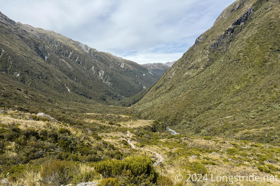
The trail was generally decent, and between that and the boardwalk, I was able to keep a fairly reasonable pace as I headed down the valley.
At my first crossing of the Mingha River, I saw a nobo perform a fairly impressive rock hop across to keep his feet dry. I just charged right through the river; he had the advantage of a better orientation of rocks, and with my ankle and persistent cold, I was not feeling very acrobatic today.
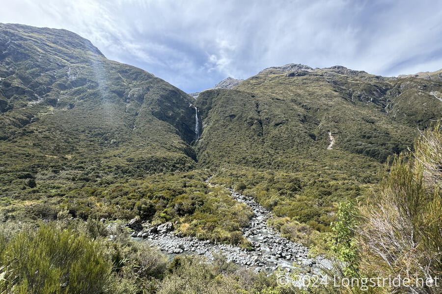
Above the river, there were a few impressive waterfalls, which over time have carved deep chasms in the mountainside. I’d have liked to see them after the rains three days ago, but getting here for that would have been thoroughly uncomfortable.
For the next couple of hours, I continued to descend the valley, crossing the Mingha a couple more times. In comparison to Deception River, the Mingha was generally wider and shallower, which made for much easier crossings. The trail itself was generally okay, though it had a few steep sections, and one place where the trail made a 120° turn to start a steep climb without any signage except already into the turn, with a trail leading straight into the river. I only saw the arrow because I went as far as the river, decided that couldn’t be right, and turned around and happened to look up at just the right time.
I stopped for a break four hours after leaving Goat Pass Hut. I’d only gone 6.5 km, so really, I hadn’t been going nearly as fast as it felt like I had been. The trail was reasonably good, so I continued to blame my cold.
After about 45 minutes, I had one last river crossing, over the Bealey River. A short while after that, I reached the highway to Arthurs Pass, stopping at the parking lot to the Greyney day-use shelter. Along the way, once I had cell service, I called the hostel and the motel in town, but they were still fully booked, so I booked another night at the Arthurs Pass Lodge.
As with my last hitch into town, the worst part wasn’t the waiting, but the sandflies. This time, though, it only took about fifteen minutes to get a ride into town. I immediately went to the Alpine Parrot for dinner, and then retreated to the lodge for a shower and rest.
There were a trio of older men I’d seen at the lodge the last time I was there, still there. One of them commented that my cold looked much improved. (I felt much improved, though not really as improved as I was hoping I’d be.)
Tomorrow, I’ll leave Arthurs Pass for good, starting the trek on the next section to the Rākaia River, a large braided river that I’ll have to detour around because it is too dangerous to cross.