A half-day brought me to the Morrison Footbridge, and Arthurs Pass, just ahead of the rain.
I was a bit dismayed to find this morning that a mouse had chewed through my food bag, hung on one of the posts in the entry room to Kiwi Hut. Fortunately, the mouse only got into one snack bar. At least this was my sturdier food bag, so it seems like should survive better than the bag that a mouse chewed through on the Continental Divide Trail, which basically ripped completely open when I applied even a little force to it.
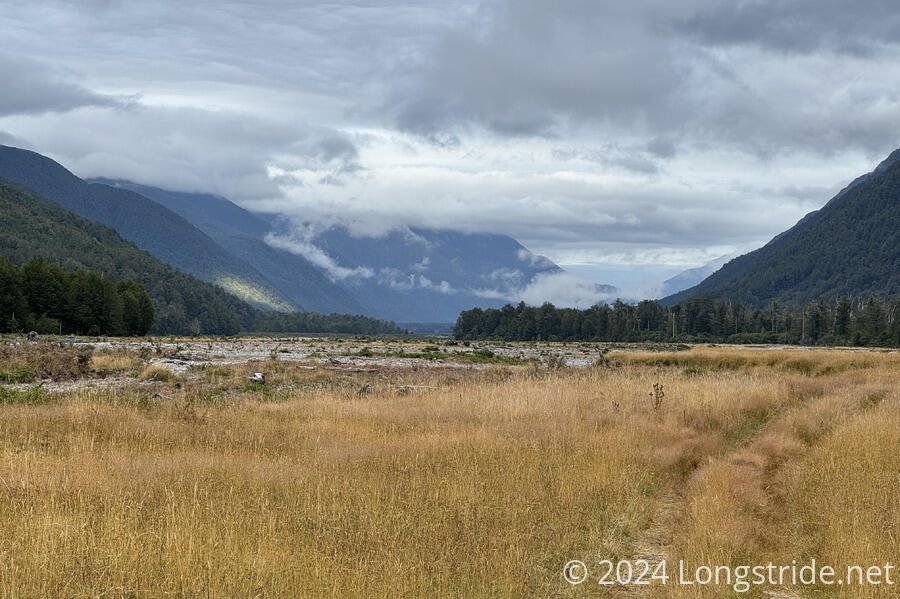
The trail this morning started off nice, a continuation of the meadow I’d started yesterday. After a couple of river crossings, that quickly changed.
The second time I crossed the Taramakau River, it was a little slower going, and sandflies were all over me as I waded through the river.
Shortly after that, the trail went through a brief stretch of overgrown trees with sharp, pointy leaves. Once I made it through that, I found a perfectly nice trail in the gravel just outside of the woods that, had I seen, I could have followed instead of getting poked at by the trees.
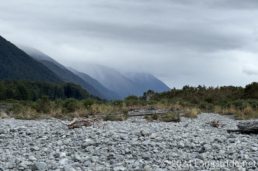
After a little while, the trail completely disappeared, and I wandered along the river’s rocky floodplain with no markers. I only knew I was going in the right direction because there was only one direction to go — downstream. At least I wasn’t the only one: I passed a northbounder who had similarly lost the trail.
The clouds, which had covered the nearby mountains when I left Kiwi Hut, slowly descended. Right on time for the forecast, raindrops started falling almost right at 10 am, very slowly picking up over the next half hour, but remaining largely unnoticeable.
After something like an hour walking on the rough riverbed, I found something resembling a trail, which turned into a nice ATV track. Nice, that is, until it crossed a creek, and then at some point after, left me substantially off-trail at the river.
I crossed the river and headed in roughly the general direction of the trail, finding myself in a cow pasture (with no cows, thankfully). Following one of the cow paths, I caught up with Adrian and Marine, who had left quite a bit before me, and had gotten substantially off-trail.
Thinking I’d seen where there was a side trail back to the TA, towards the notorious “Flood Track”, I backtracked a little while they continued on ahead on an alternate route to reach the highway sooner. I didn’t want to go that way since it’s not really an official exit since it crosses private land, but it would have been way faster than what I wound up doing.
Backtracking failed; I reached where a trail should have been, but a clearing dead-ended in an impenetrable wall of brush. I headed back towards where they had gone, picking up an ATV road that took me to the Ōtira River. This was evidently not the route they took, since I saw them in the distance crossing the river elsewhere.
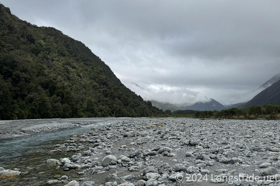
I followed the ATV trail for a while, heading upstream on the Ōtira and crossing the river several times. Fortunately, the river was somewhat braided here, so while I crossed the river so many times I lost count, the individual crossings were mostly shallow and straightforward to navigate.
This went on for another hour. I found a set of someone else’s boot prints, so I was happy I wasn’t the only person who took this route.
The Flood Track is notorious because it involves a poorly-maintained trail with lots of elevation change just to keep the trail away from the river. The TA trail notes explicitly suggest just walking in the river bed (like I was doing), which is supposed to be faster and easier. What I was doing wasn’t really very easy, mostly because I was trying to be easy on my sprained ankle, but I guess it was better than bouncing steeply up and down in (probably overgrown) bush.
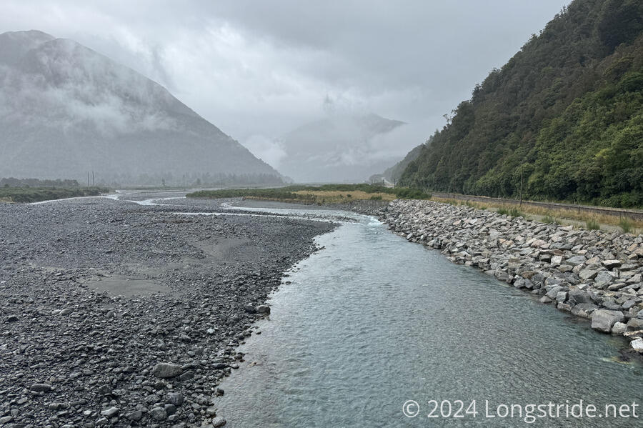
Veering towards the river’s right bank, so that I could pick up the Flood Track if I spotted it, I eventually saw a large orange trail marker, in the trees above a cliff. After one last river crossing, I followed an ATV track which just happened to take me up to the marker, and I followed the Flood Track for another kilometer and a half along mostly good trail to the Morrison Footbridge.
The footbridge, which apparently used to be a swingbridge — part of the swingbridge was still being used as the bridge approach from the trail side of the river — made for an easy crossing of the Ōtira, leading me to a railroad track and a highway.
For most of the time I was hiking, the rain oscillated between nothing and a very light drizzle. Now that I was done hiking and waiting at the trailhead for a ride into town, the rain picked up a little, and I had to put on my rain jacket.
It took half an hour to get a hitch into town. The worst part of the waiting wasn’t even the rain. It was the sandflies, which generally left me alone as long as I was moving. But when cars drove by (generally in sets of three or four!), I had to stand still and put on a good show while they proceeded to attack my legs.
My ride came from a woman who said she frequently drove down the highway between Queenstown and the west coast, picking up hikers when she saw them. She got me just in time — the rain picked up considerably a few minutes after leaving the trailhead.
The ride to Arthurs Pass was fairly impressive, passing a number of excellent views, or at least, views that would clearly have been much more incredible if there hadn’t been clouds. Along the way, we passed Macro, hiking up the highway, who declined our offer of a ride.
I got dropped off in the center of town, near the cafe, and attempted to get a burger. Unfortunately, I was five minutes late: the kitchen closed at 1:30 pm (!!). Fortunately, they had some pre-cooked meat pies available, and I got two and a brownie for lunch instead.
After eating, I walked through town, looking for a shortcut up to the Arthurs Pass Lodge, which was located at the end of a road up the hill above the main part of town. (My maps seemed to suggest there must be a shortcut.) I found one, but it seemed awfully steep and might have been part of a trail the nearby mountain. A little further on, I found another path that did take me up to the road, climbing up some very steep (and poorly maintained) stairs, and a few minutes later, I arrived at the lodge.
The lodge was already quite busy, with many TA hikers (including Adrian and Marine, and later, Macro), and other people doing other hikes. With 20 bunks, a common area, kitchen, shower, and electricity, it was more than adequate.
Though, I was really looking forward to some solitude. I think I’m coming down with a cold, and although I had some great conversations tonight, I went to bed early, quite more fatigued than I would have expected.