A very long day took me almost halfway from the Rākaia River to the Rangitata River.
As planned, I got up at 5 am. I moved all my stuff to the lodge’s common room so I could eat breakfast and re-pack my pack without disturbing the other two hikers in my room, who were not getting up at such an early hour.
It didn’t take long to walk from the lodge to the pick-up point for the “school bus”, a small passenger van hired to shuttle school kids from the rural area near the trailhead to Methven, and back. It’s fortunate that they offer cheap ($30 per person) rides to hikers to and from the trailhead before and after they do the school bus run, because all other shuttle services are quite expensive.
Also at the bus stop were five other hikers: Mikkel, Matt, Leonie, Masako (from Japan), and Irit. Mikkel plans to cross the Rangitata River, rather than getting a shuttle around. That seems to be the case for Matt, Leonie, and Masako, as well. (I didn’t really get a chance to talk to Irit, and then I didn’t see her again after we started hiking.)
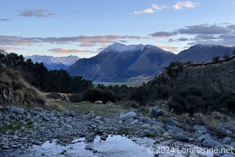
The ride to the trailhead took almost exactly an hour, and we started hiking a few minutes before sunrise. Nearby mountains were capped with snow; the bus driver said this was new since yesterday.
The trail started off going through a farm. After some initially rough and overgrown trail, some electric fences we had to cross, and a crossing of Glenrock Creek, the trail joined a dirt road. The road paralleled Glenrock Creek, taking us further up the valley, eventually exiting the farm and entering a conservation area.
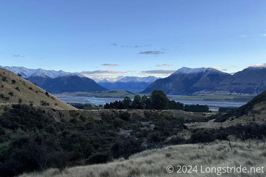
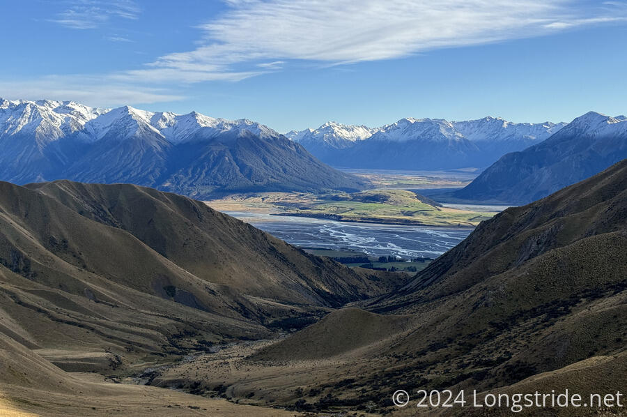
The road, an old farm road, continued to climb, switchbacking its way up and over Turtons Saddle. Before reaching the top, this provided increasingly good views back towards the Rākaia River. Once on top, the road continued deeper into the mountains.
It had been generally clear and cold, though now, clouds moved to obscure the sun. Above the saddle, the ground still had frost that hadn’t yet melted.
From the saddle, the road led to A-Frame Hut, which looks exactly like its name implies. Inside, three bunks were neatly nestled along with a table and a storage box which could be used as a chair. Now nearly three hours (and 9 km) into the day, I stopped there for a break.
Past the A-Frame, the road continued for a little while, and then disappeared. It appeared to cross a creek; I tried to avoid crossing by taking a higher path along the hillside. This was mostly successful, but was perhaps not the most expedient of routes. It also gave me an early glimpse ahead that there were cows along the route.
I picked up the trail again as it joined a dirt road, which went directly through where the cows were grazing. As I got closer, they seemed disinclined to move out of my way, so I tried to seek a way around them, through the bush. This worked for a little while, but then the bush got too thick to proceed, and from the new vantage point, I could see a marker up on a hill beyond the cows. There was no choice; I had to go through the cows.
Fortunately, Masako caught up with me, and the cows seemed more inclined to get out of the way of two people than just one. We followed the road past the cows and up the hill.
About half an hour later, the trail crossed a creek. Helpfully, there was a line of rocks that could be used for a rock hop, but unfortunately, the creek’s flow was too high, and the rocks were fully submerged, making a dry crossing impossible.
About ten minutes later, I reached Comyns Hut, and I stopped for a short break there. My original plan when I was expecting an 11 am shuttle to the trailhead a few days ago was to stop here. But, it was still before noon, and I didn’t want to spend the better part of the day sitting in a hut. So I decided to push on to the next hut, Double Hut. This was estimated to take 6-8 hours, so I knew I’d be finishing quite late. But, it’d put me in a good position to make it all the way to the end of this section, and the Rangitata River, by the end of tomorrow.
After leaving Comyns Hut, the trail followed the North Branch Ashburton River upstream. This involved many crossings of the river, with no way to make dry crossings. My feet were immediately wet, and remained so the rest of the day.
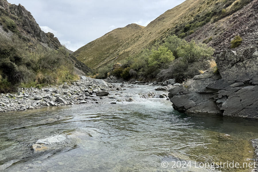
The trail, such that it was, was difficult to follow. Largely, there was no trail; I just had to make my own path between (few and far between) orange marker poles. Occasionally, there was a trail, but only briefly. Sometimes, a trail would appear, and then climb up a hill and disappear into nothingness, which was frustrating. The solution was to just stop looking for trail and just walk generally upstream.
The lower river crossings were quite cold. They seemed to warm up as I got further upstream and the sun came out.
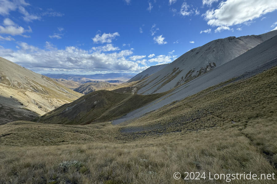
After nearly two hours of climbing up the river, the trail left the river to instead follow one of its tributaries, Round Hill Creek. Further upstream, the river forked a couple more times, each time significantly reducing the water I had to deal with, eventually opening up the possibility of dry crossings.
I took a break after nearly three hours (and only 5 km hiked from Comyns Hut). It was very slow-going. And I had to somehow pick up the pace, because I still had another 11 km to go. Before my break, it was generally sunny out. After, though, the sun went behind the clouds, and rarely came out again.
Fortunately, the creek couldn’t continue forever, and eventually I climbed up past any substantial water, reaching a moderately steep mountainside covered with tussock, and occasional tiny streams hidden beneath the grasses. However, all of the water took its toll. With my waterlogged boots and socks, and the rocks (and later, grasses) I had to constantly avoid, my left knee started to hurt whenever I moved it a certain way. This significantly slowed my progress uphill, and I frequently stopped for short micro-breaks to let my knee briefly (and only slightly) recover.
Angry knee aside, the river hike today felt a bit as though it was the Deception River on easy mode.
After I made it over the Clent Hills Saddle, the trail crossed a few scree fields and began its descent towards Double Hut. I still had to be careful on the descents, but my knee was a lot happier going downhill than uphill.
Shortly after six, I stopped for another break, mostly to rest my knee, but also because I really needed to stop and eat something. Fortunately, I’d made slightly faster progress.
For the next hour and a half, the trail continued (mostly) downhill, sometimes following a very dilapidated fence that was mostly fallen over. The hardest part of the descent was the tussock, which often obscured the trail itself. That, and the time the trail forked, with no indication of which route was the correct one, and I picked the wrong one, having to make my way down the tussock to get to the actual trail.
After one final water crossing, of the Swin River, which I managed to keep my feet dry (or rather, keep them from getting wetter) by going upstream a little bit and making my way across the river where it had split into two channels, I reached the trail junction for Double Hut.
Double Hut, unfortunately, was 1 km off-trail. Further than I’d like to go, but much closer than Manuka Hut, the next hut a further 5.5 km ahead. (Plus, I’d now gone 32 km, and it was nearly 8 pm. It was time to stop regardless.)
The only other hiker at Double Hut was Masako, the others having pushed on to Manuka Hut.
Double Hut could charitably be described as cozy. It was a little tired, but still did its job well. An older hut, it did not have a water tank; the nearest water was from another fork of the Swin, about a five minute walk away from the hut.
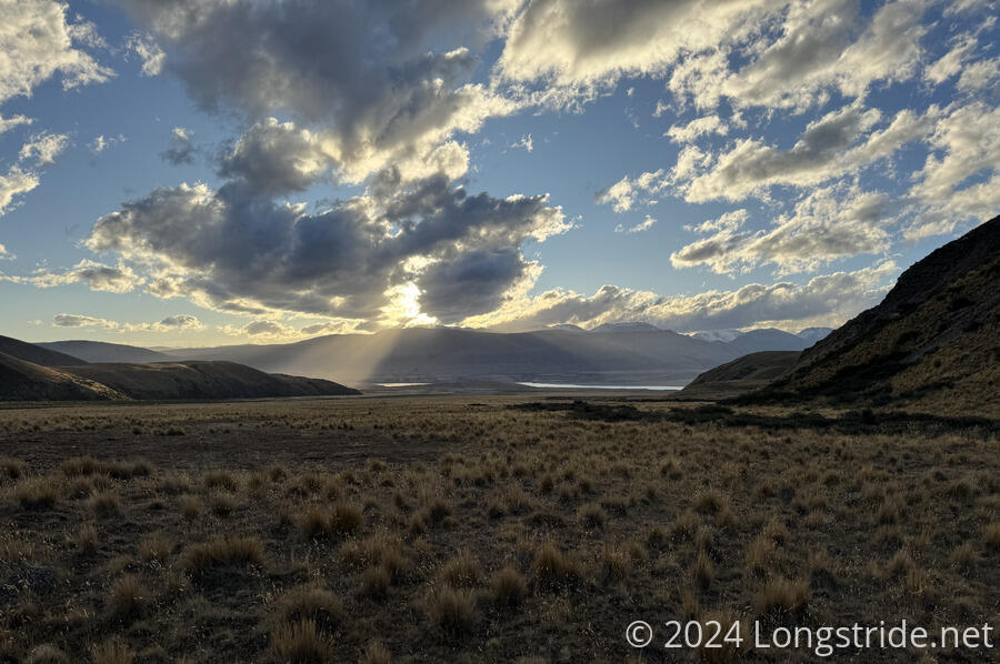
Once the sun set, it quickly became cold. I briefly went outside shortly before 10 pm; the stars were brilliant, and would be even better in another hour or two once the sun had further set.