Today, I crossed Stag Saddle, the high point of Te Araroa.
It was cool in the hut overnight, and several times, I felt a breeze blowing on me. It must have been fairly windy outside, or else the hut was more leaky then it initially appeared.
I only planned about 15 km today to Camp Stream Hut, and since it was cold, I wasn’t highly motivated to get out of my sleeping bag. So, I didn’t leave Royal Hut until almost 8:30. By that point, the sun was up and there wasn’t any shade around, so it didn’t take too long for it to warm up.
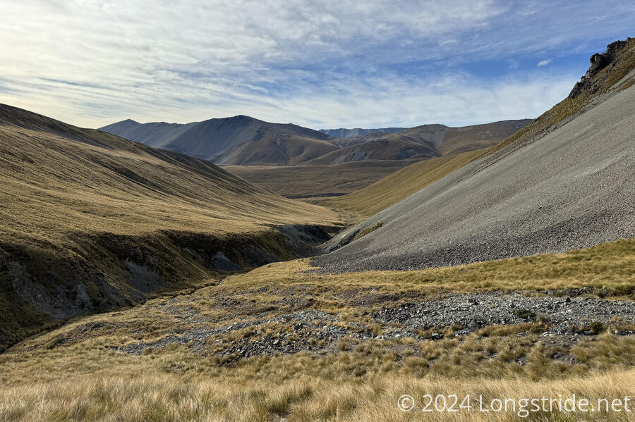
From the hut, the trail crossed Bush Stream for the last time, and followed one of its tributaries up its valley, crossing it a few times.
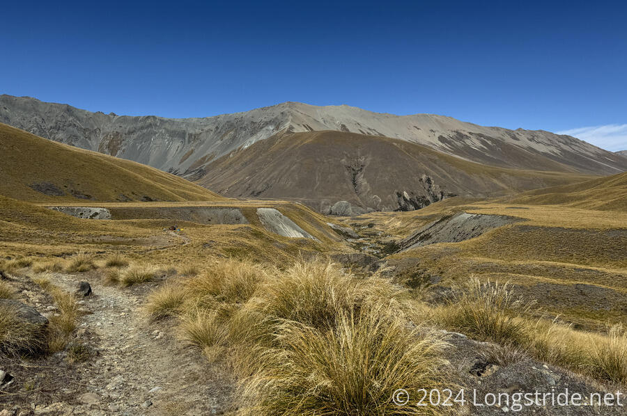
Unsurprisingly, the trail went through a lot of tussock, though it was generally easy to follow the path, partially because marker poles were placed more frequently than they sometimes have been.
The climb to Stag Saddle was generally fairly consistent, and not terribly steep. I made good time when I wasn’t stopping to take in the scenery; I could see back down the valley much longer than I would have expected.
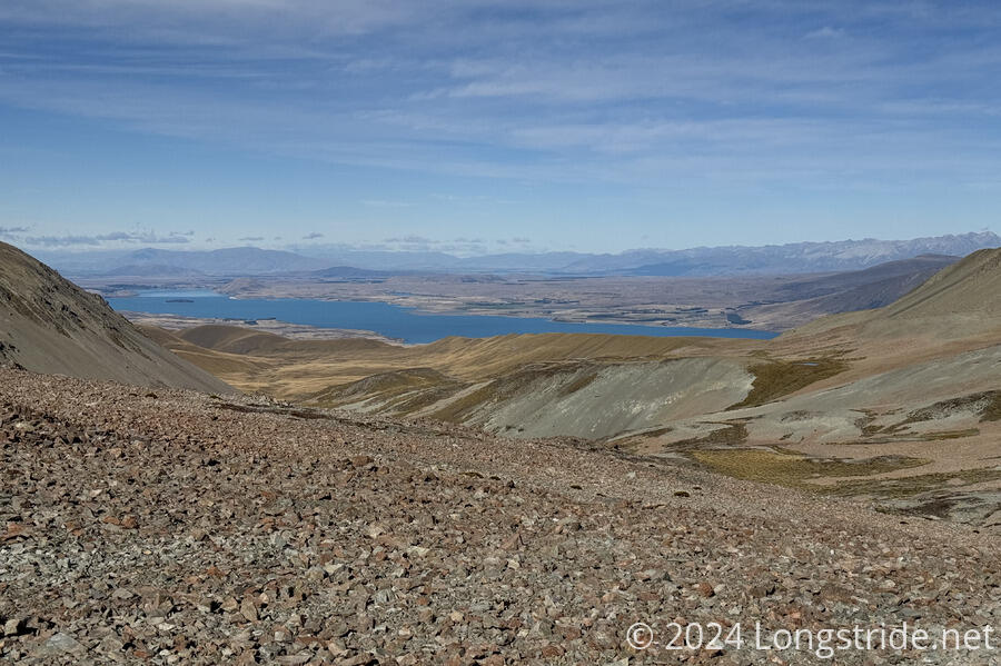
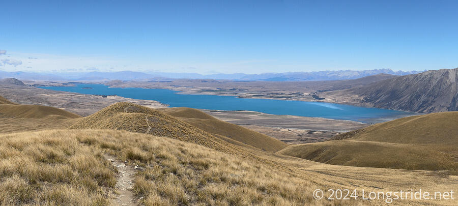
It took just over two hours to reach Stag Saddle. At 1,925 meters, it’s the highest point on Te Araroa, though it falls quite short of the high points of some other trails I’ve hiked. At the saddle, a small rock wall ringed a flat area, providing the barest of windbreaks for tenters. Ahead, Lake Tekapo’s bright blue waters stood out like a gem amidst a sea of drab brown grasses.
It was bright and sunny, with only thin wisps of clouds in the sky. But at the saddle, it was quite cold and windy. I sat down in the rock ring, which did little to block the wind, and took advantage of cell reception to book a bike hire from Lake Tekapo to Twizel, a roughly 50 km stretch of trail along a concrete cycle path with no camping. This also required me to book a place to stay overnight in Lake Tekapo tomorrow, and in Twizel on Monday.
This was difficult to accomplish because my fingers could barely work in the cold wind. I had to leave the saddle and head for lower ground to block the wind.
From the saddle, there are three choices: follow an older alignment of the TA that dropped straight into the valley, going directly to Camp Stream Hut; follow the current alignment of the TA that heads towards a ridge; or head straight out from the saddle across a boulder field below Beuzenberg Peak, towards a trail higher up on the ridge. I opted for the latter, mostly because I could see the trail going to the ridge, and the other two trails didn’t appear to be marked.
The boulder field was a bit rough, but it wasn’t all that long. Martin, who leapfrogged with me a couple of times between the hut and the saddle, zoomed ahead through the rocks, seemingly as if he’d found an actual trail.
I lost sight of him after he’d made it to the trail I saw from the saddle and disappeared behind the ridge. I fell behind while I was trying to book my rooms in Lake Tekapo and Twizel.
Once I got to the ridge, I was treated with an incredible sight. I could see across to the Southern Alps, with Aoraki / Mount Cook visible, a snow-capped sail sticking up behind a closer range of mountains. I could also see the entirety of Lake Tekapo, including its inlet, the braided glacier-fed Godley River.
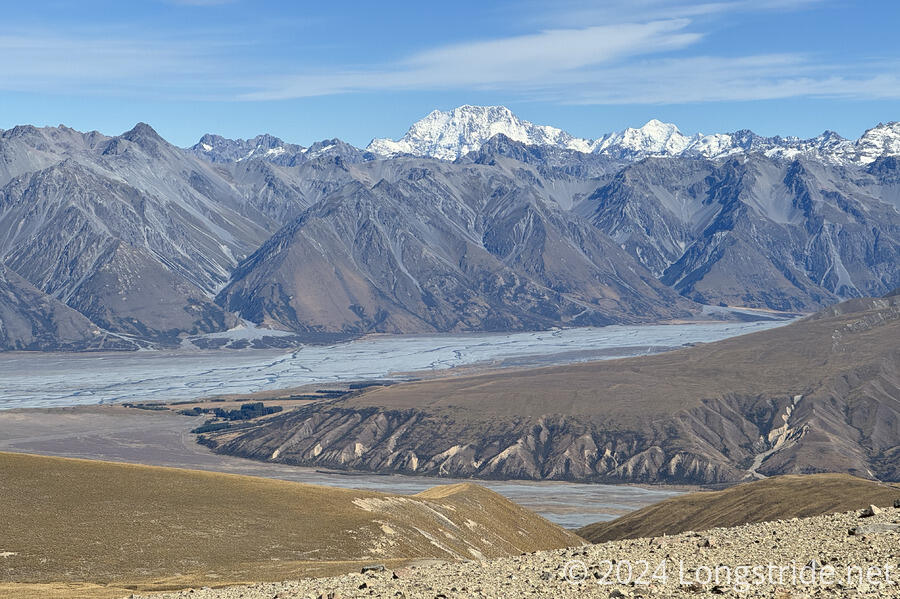
I followed the ridge for over an hour, all the while being treated to views of Lake Tekapo, the river, and Mount Cook. It was one of the finest ridge walks I’ve ever done, both in terms of scenery and the quality of the trail.
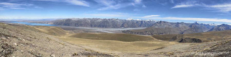
Eventually, after over four hours of hiking, near the end of the trail on the ridge, I stopped for a break at a spot next to the trail overlooking Lake Tekapo. It was one of the most scenic break spots I’ve had on the TA.
The trail followed the ridge for another ten minutes before dropping off, heading to Camp Stream Hut. Now significantly lower in elevation, the grasses grew taller and thicker, and it was slower going, especially when I lost the trail. Fortunately, I could see a marker pole, and also a dirt road that went past it, so I just made a beeline for the road. It was a little longer overall, but it got me where I needed to be faster.
Camp Stream Hut, despite its name, is not next to water. I had two choices: collect water on the way from Camp Stream, about three-quarters of a kilometer before the hut, or go another quarter of a kilometer after the hut down a steep trail to get to the stream. Not wanting to lug four liters of water further than necessary (and also, not wanting to stand there and filter four liters of water because there weren’t any trees to hang my water bag from), I opted for the latter. Especially since I had plenty of time: I was going to get to the hut before 3 pm.
The rest of the walk there, along the rough dirt road, was quick, though when I first saw the hut, I was momentarily worried by the presence of two tents. (Then I remembered they probably belonged to four day hikers I saw while I was walking down the ridge.)
I arrived at the hut to find it (and the tents) empty. After resting for a little while, I went ahead, down a steep dusty trail, to reach Camp Stream, to get water. Down and back with water took about 15 minutes. It’s one of the further water sources I’ve had on the TA, but it’s still close compared to some of the side-trails to water I had on other trails.
Camp Stream Hut is historic, originally built in 1898. As such, it’s somewhat tiny and cramped inside, with six bunks, a wood stove, a small table for food prep, and a couple of small benches. It’s so small that the bunk platforms are a tiny bit too small for the standard-sized mattresses, which were squeezed a little out of shape on the lower bunks, and flat-out didn’t fit at all on the top bunks.
After an hour, the four day hikers I saw on the ridge returned, having submitted Beuzenberg Peak, a mountain next to Stag Saddle. It wasn’t too far off-trail; if I had thought about it beforehand, I probably would have taken the time to summit it as well, given the relatively short day I had planned. They were at the hut for a couple of hours, before they packed up and continued south, probably returning to their cars.
Not long after they arrived, two northbounders from the US also arrived, Jack and Isabella, and we had a good conversation about the TA and other hiking trails. Around six, Annika and Marlene arrived, also having summited Beuzenberg Peak.
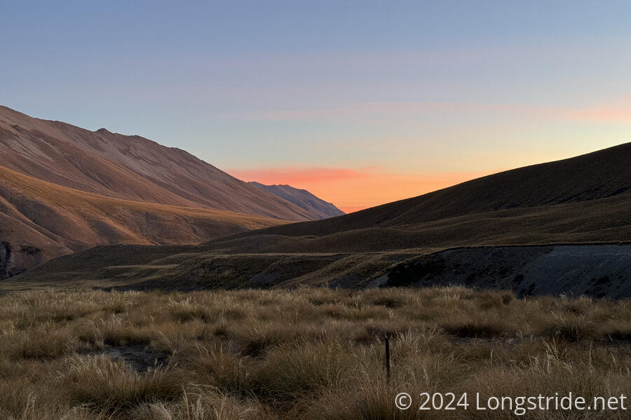
Much later, after sunset, another northbounder arrived. As it had started to get quite cold outside, she and Jack split some wood from the very large wood pile outside the hut and started a fire in the hut’s wood stove. My bunk was right next to the stove; It didn’t take long before it became nice and toasty warm.