A relatively short day took me further up Bush Stream.
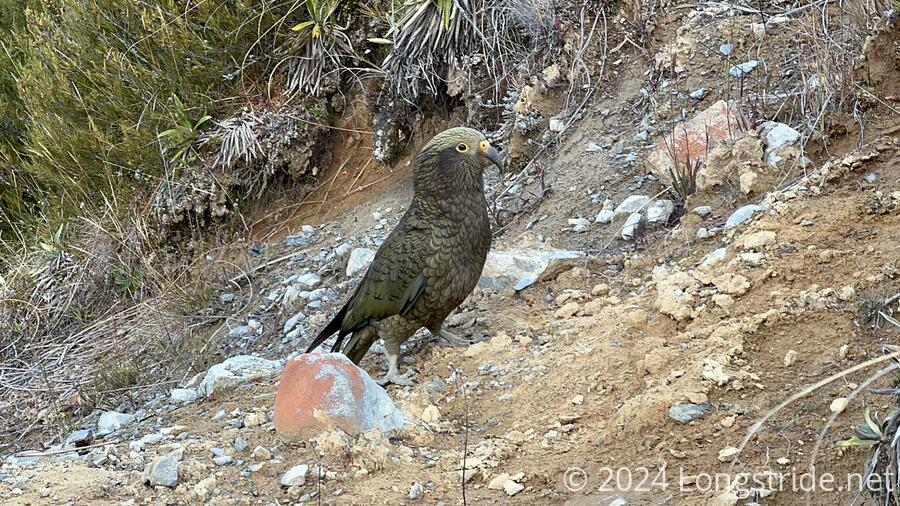
It was cold overnight, though the wind died down at some point. The morning’s excitement was kea, which were loudly squawking well over an hour before sunrise. They seemed to have a thing against the hut: other hikers saw one on the roof of the hut, attempting to pull nails out of the roof.
The kea continued to make themselves a minor nuisance until I left Crooked Spur Hut, heading up the mountain towards a saddle. Not even a minute after I left, a flock of six birds flew right over my head, landing in a space just beyond the trail. I managed to get some video of them — at least eight birds in total. I was surprised I was able to get as close to them in the wild as I was.
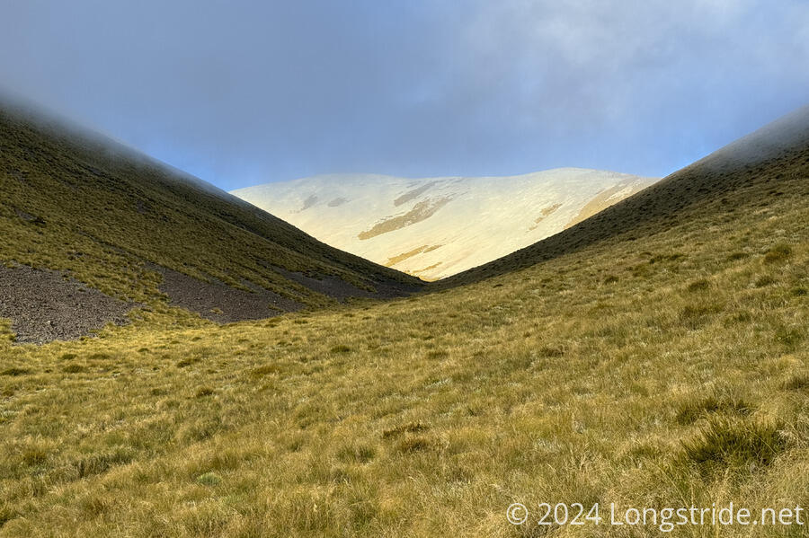
Past the kea’s hangout spot, the trail continued a steady climb, though fortunately not as steep as the climb up to the hut yesterday. The trail went mostly through thick grasses, which was a bit of nuisance on occasion, but the trail was generally fairly evident. Ahead, a slope of scree appeared bright white, as if it were snow; it wasn’t until I got closer that I realized there was no snow.
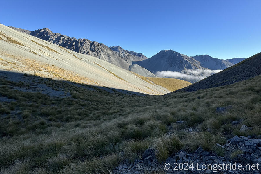
From the hut, the climb up to the saddle the trail crossed took me a little less than eighty minutes. I probably could have been faster, if I weren’t trying to reduce the strain on my left knee. From the “top”, I had good views to both sides of the saddle. Behind me, a pair of small clouds rose up from the valley I’d just climbed out of. Ahead, a mix of scree and grass slopes as far as the eye could see. Below, I could see two hikers; I initially presumed they were nobos, but that was quickly disproven when I didn’t pass them coming towards me.
Later, I caught up with them: it was Annika and Marlene, from the Netherlands, whom I saw at the Arthurs Pass Lodge and at Goat Pass Hut. (They’re hiking sections of the South Island southbound, but due to the rain, they did the section around Goat Pass northbound.)
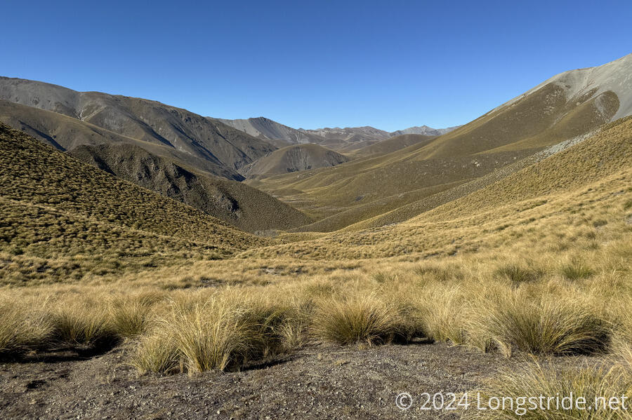
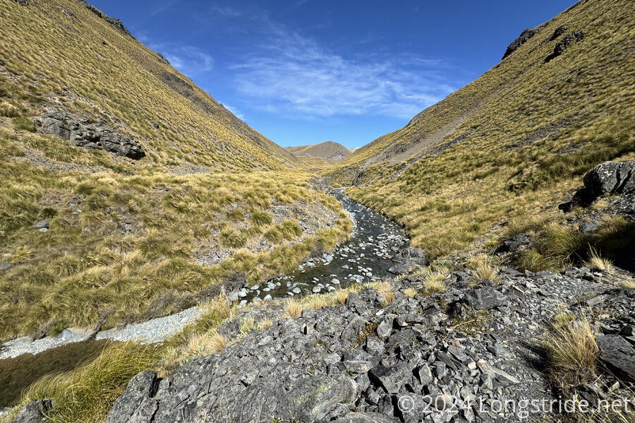
After the saddle, the trail generally descended reasonably gently (at least compared to the steep climbs yesterday and to the saddle) through more hillsides filled with thick grasses.
On the way to Stone Hut, where I’d take my first break, I only passed two nobos today, a rather small total given the large group at the hut and the many more I saw yesterday.
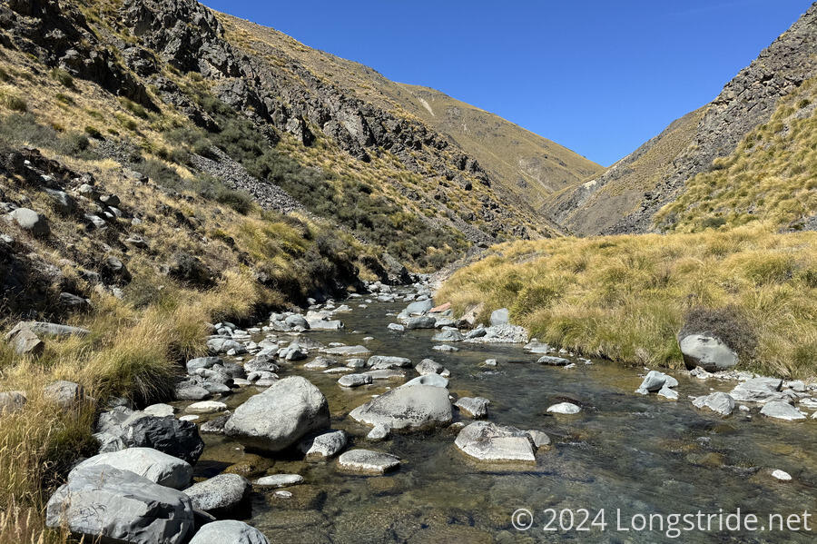
The long detour from Bush Stream yesterday and today, climbing up 800 meters and dropping back down 450 meters to rejoin the stream is to avoid a deep gorge the stream travels through.
The group yesterday assured me that there were dry crossings for everything I’d have to cross today. That held true up until the trail brought me to Bush Stream again, now some 330 meters higher in elevation than when I crossed it last yesterday. There used to be a bridge across the stream, but apparently it got damaged a few years ago and was removed by DOC. So to get to Stone Hut, I had to cross the stream. I made it halfway across dry, but there really wasn’t a good place for me to finish the crossing without getting wet. (If I had longer legs, or had been willing to try jumping, I might have been able to bridge a gap in rocks across the stream. But the chance of failure was high, so it was better to just wade through the shin-deep water.)
I took a break at Stone Hut, apparently so-named because it’s partly built of stone. I set my boots and socks out to dry, at least a little.
After leaving Stone Hut, I continued to follow Bush Stream on rather rough trail. After a few more (wet) crossings, the trail climbed up along the side of the river valley, and stayed there for a few kilometers. The trail was much improved as it got higher up, but it still traversed tussock, some grasses nearly as tall as I was, and the trail was occasionally hard to follow.
By 2:30, I reached Royal Hut, apparently named because a couple of British royals once visited the hut when they were children. The hut is in a bit of open expanse, so I was surprised its toilet was located on a ridge a fair climb above the hut.

It was a short day — only 15 km, and only 6 hours of hiking — but the next hut is another six hours ahead, over Stag Saddle, the high point of Te Araroa, and I didn’t want to attempt to hike that far. (Granted, I could have tented somewhere ahead. There’s apparently plenty of flattish space. But I’m not in a rush at the moment, and I’d rather not put too much stress on my knee until it stops hurting.)
Already there was Martin, a sobo from Australia. Shortly after, Snow, from Whakatane (on the eastern side of the North Island) arrived. Late in the afternoon, Annika and Marlene arrived.
Tomorrow will be another short day, over Stag Saddle to Camp Stream Hut. After that, it’ll be a very long (and mostly downhill) day to Lake Tekapo to end this section of trail.