Today, I crossed the Rangitata River, and made my way up Bush Stream towards the highest point on Te Araroa.
I got up around 6:45, and checked the Rangitata’s flow. It was still (slowly) dropping. So if people yesterday had successfully crossed the river, it should be slightly easier today. So I decided to cross the river with the other hikers from the shuttle.
We agreed to stick together, and that if we got to a point where we decided the river was too difficult to cross, we’d turn back and get a shuttle around the river.
It was considerably warmer than it was yesterday morning, which was great. Less great was the wind, and the weather forecast calling for rain about the Main Divide (of the Southern Alps) late in the morning. But we were starting around 8 am, and should be easily across before the rain.
The manager of the Mount Potts Lodge offered to drive the five of us as close as the farm roads would take us to the river. It was a few kilometers, so this easily saved us 25 minutes of walking down gravel roads.
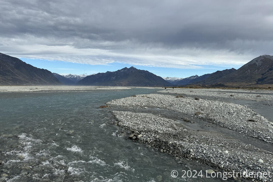
The Rangitata River is a large braided river in an unsettled gravel riverbed, which means the river’s channels constantly move around the riverbed. This means that any description of the river likely won’t accurately describe it in the future. Which is probably why the only specific advice we could find on crossing the river was to cross upstream of its confluence with the Potts River, which I crossed yesterday.
From the “trailhead”, we followed the edge of a farm paddock, going through a gate on its far side. After a few minutes, we reached our first water crossing, though it was a tributary of the Rangitata, and not the river itself. After that, we quickly reached the deepest crossing of the day, crotch-deep. It was a pretty fast flow, and the wind blowing in the same direction as the water didn’t help matters. But we took the crossing slowly and deliberately, and made it across safely.
A little while later, we had to climb over a (live) electric fence. Apparently, we’d gone the “wrong way”, and gotten inside a paddock rather than staying outside.
I lost count of the number of water crossings there were, but none of them were especially difficult. The last crossing we were expecting to be difficult, with a very fast water flow, but the last crossing was unremarkable. I suspect this was because we maintained a mostly west-southwest course, crossing significantly north of the trailhead on the south bank of the river.
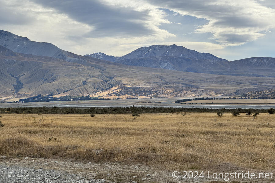
After our last river crossing, we climbed up onto a plateau, followed some twisty trails through some brush, and arrived at a dirt road. From where we started, this took just over an hour and a half, far faster than I was expecting.
Safely across the river, we stopped for a break. Most of us took our shoes off to clear out the gravel that the river deposited in our shoes.
It took about 45 minutes to hike down the gravel road to Te Araroa’s actual trailhead on the south side of the Rangitata. I stopped for a quick snack break there, and then continued up the Bush Stream Track.
The track started off down a dirt road, then weaved into some brush, before emerging onto another dirt road, which seemed more like it was an access road for a sheep farm the trail briefly went through than actually part of the trail. Either way, there was only one way to go: up the valley, towards Bush Stream.
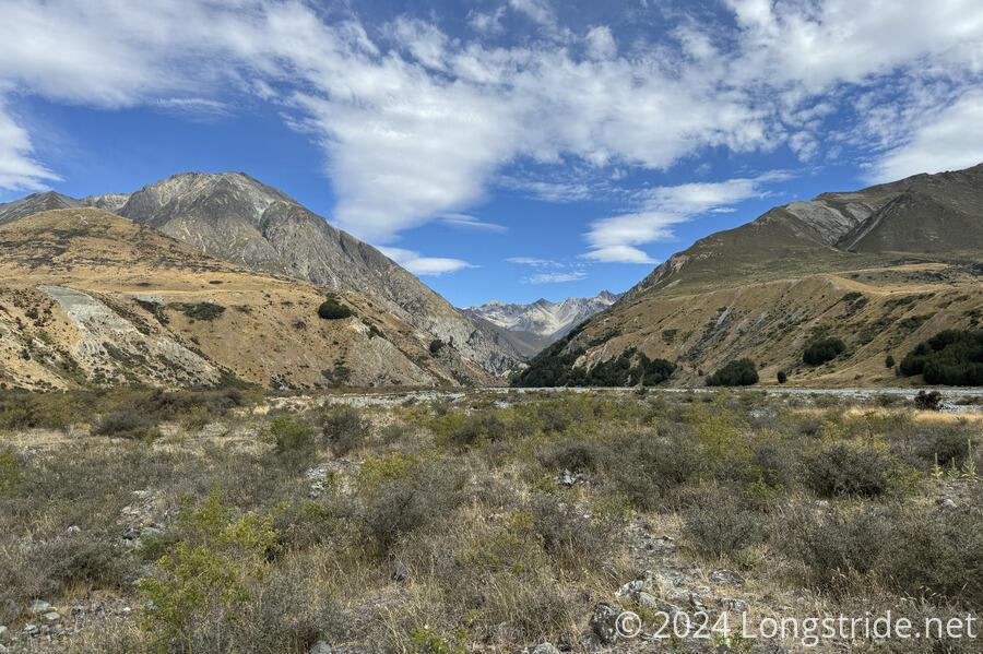
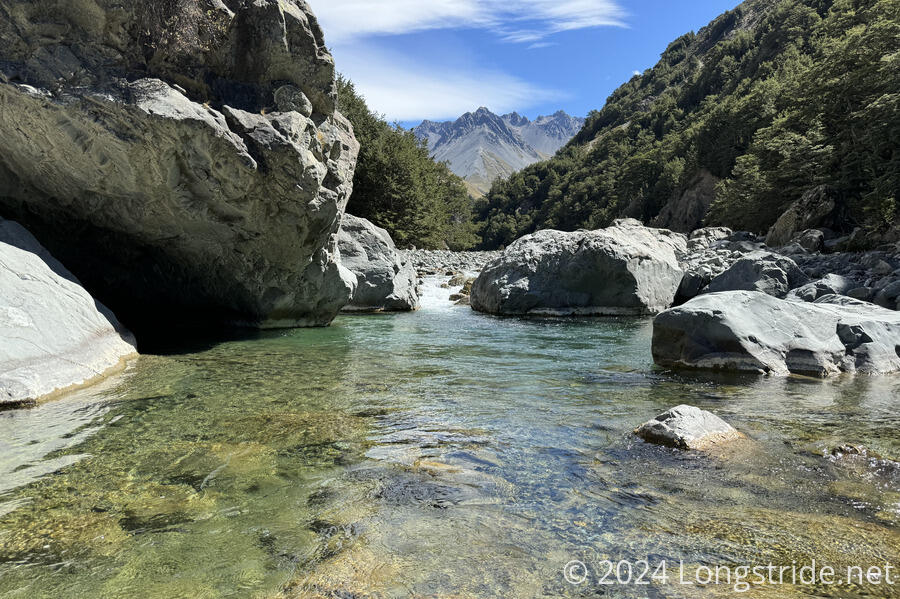
The trail started off quite flat, and only very gradually gained elevation. It didn’t even reach Bush Stream for at least a couple of kilometers, and it was a while after that before I crossed it the first time. If Round Hill Creek was like the Deception River on easy mode, this was like Round Hill Creek on easy mode.
Bush Stream’s flow was reasonably low, so most crossings were fairly easy. For a while, the stream bed was quite wide, so I could largely just walk straight up the valley. Often, I could actually find something resembling a trail, which helped me make faster progress. The only hitch with stream crossings was that Bush Stream often had deep pools. But these were usually easy to spot and easy to avoid.
After about 4 km, my left knee started hurting again, the same as two days ago during the climb after leaving Round Hill Creek. Since I wasn’t in a terrible rush — I was only going a total of 10 km (past the TA trailhead) to Crooked Spur Hut — I took the hike slowly, and stopped for half an hour to rest my knee a kilometer later, halfway between the trailhead and the hut.
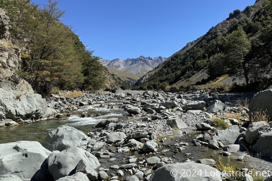
The trail continued to zig-zag its way across the stream and up the valley. At one point, it appeared as though the trail was going to climb up the side of the valley, but the fairly decent trail appeared to be scuttled (with a bunch of branches placed to block the trail), and that climb did not appear on my map. While it would have been nice to have a good trail rather than the creek (and hunting for paths in the gravel, which I seem to be getting better at), I wasn’t going to risk taking a trail to nowhere. I already had one of those on Round Hill Creek.
The trail continued a gentle climb up the stream, until it departed the stream for a very steep climb 140 meters up and over the valley wall, dropping back down to rejoin the creek, having cut off a bend or two and returning to the stream about 40 meters higher than it left.
From what I could see of Bush Stream, this was entirely unnecessary. I probably could have just hiked up the river (or along its bank) and gotten to the same place faster with less effort (and wetter feet).
After the steep up-and-down, the trail made another ludicrously steep climb up to Crooked Spur Hut. With my knee quite angry with me, this felt like it took forever.
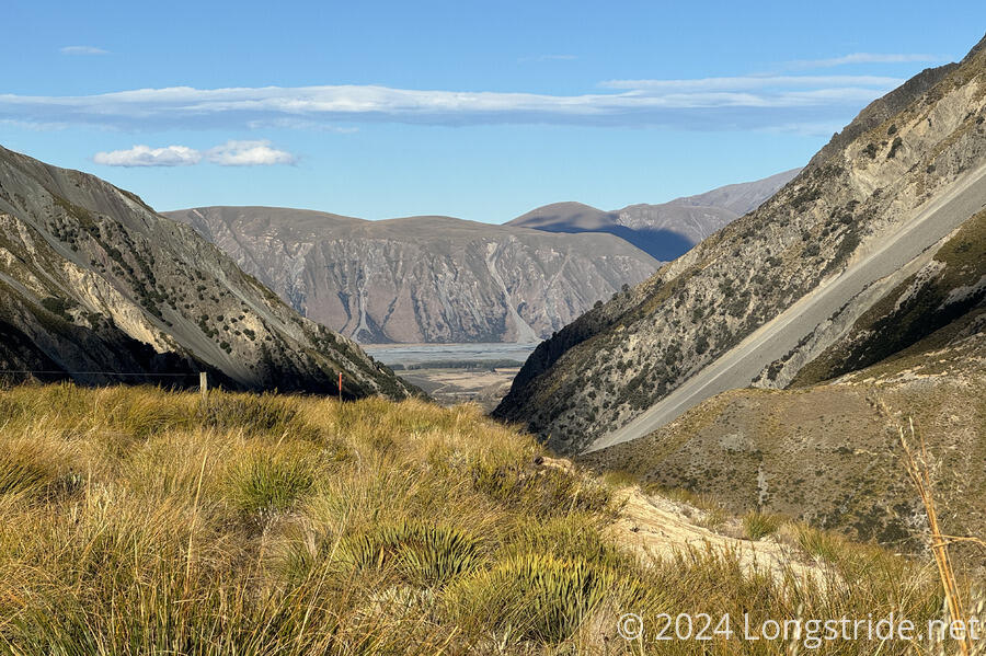
Along the way, I got increasingly nice views back towards the Rangitata River, though I was far enough away that I couldn’t really see the river.
Arriving at the hut, I was surprised to see seven unfamiliar hikers (all nobos) sitting in a circle outside. Not seeing any of the group I crossed the river with, I was concerned there wouldn’t be any bunks left. As it turned out, I got the last (top) bunk, only because some of them were tenting. From my group, only Masako was here; everyone else had pushed on to the next hut.
I was quite happy to be finished hiking around 4, after two very long days. I wasn’t exhausted, so much as glad to be off my feet and able to rest my knee.
From the hut, I was now high enough that I could see the Rangitata River, off in the distance.
Later in the evening, the wind picked up considerably, making it difficult for two people who were tenting to set up their tents. Crooked Spur Hut is also fairly airy; there are numerous holes in the walls and roof that air could blow through. (This would probably be a bad hut to be in while it’s raining.)
Apparently, there are kea in the area; someone recommended not leaving trekking poles outside because the kea would nibble on the cork handles. (I wasn’t planning on leaving my poles outside, but, this was good to know.)
Tomorrow will be a shortish (in distance) day, as I finish a steep climb, then drop back down to Bush Creek and continue to follow it towards Stag Saddle, the high point of Te Araroa.