A soggy day took me down the Mararoa River’s valley to Careys Hut.
I had a 6:30 alarm set, but wasn’t very interested in getting up, especially once I discovered it was raining outside. I got an updated weather forecast; rain ending sometime soon, and rain again between 11 and 1. I crawled back into my sleeping bag and went back to sleep until after 7.
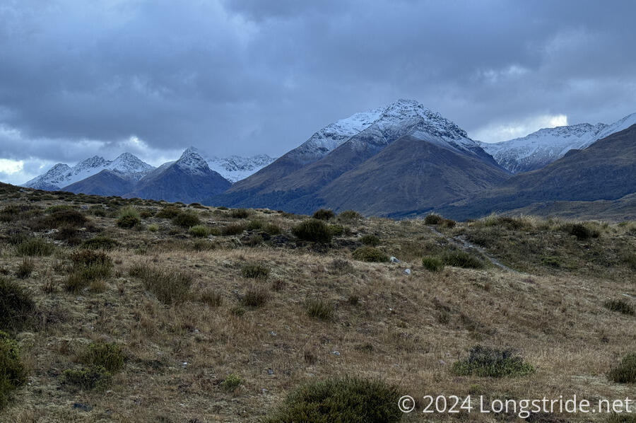
The next time I ventured out of the hut, the rain had stopped, and the clouds had lifted enough to see that there was fresh snow on the nearby mountains.
The calm didn’t last very long; it started pouring rain for a while, and I decided I wasn’t going to start hiking until the rain had calmed down. The hut vibrated in the wind, making something of a humming sound. Apparently, overnight there had been a bit of a storm that made quite a racket, but I slept right through it.
I finally left the hut around 9:30, the third out of four to leave, making my way across a swingbridge that spanned the Mararoa River I got water from last night. The river was noticeably higher than it was yesterday.
For the first time this trail, I’d put on my rain pants. My legs would have been quite cold without them — I wasn’t going to hike with my pants legs on in wet conditions.
After crossing the bridge, I immediately made a wrong turn, because I couldn’t see a marker pole and it was still raining a little, so I didn’t want to get my phone out. I realized it a few minutes later when I did pull my phone out to confirm, because the last thing I wanted was to go off-track in a bog. Once I realized the mistake, it didn’t take too long before I saw the pole I couldn’t see before, and was able to veer off to intersect with the trail without completely backtracking to the bridge.
Unsurprisingly, the trail was very waterlogged. Numerous small streams crossed the trail, not even in any permanent channel, rather just water over the carrying capacity of the land flowing whichever way took it downhill.
About half an hour from the hut, I reached the first significant creek I had to cross today. If it hadn’t been raining, it would have been trivial to cross. But now, there was a gushing torrent of water and some significant rapids. It seemed as though there were a couple of options to get across, but I didn’t really like either of them. Then, Michael arrived. We checked out a possible upstream crossing, but that looked even worse than where the trail crossed. But, a little further downstream, we found a more reasonable crossing, and made it across.
Twenty five minutes later (with Michael long gone ahead of me), I reached a second flooded creek crossing. As before, there were a few obvious places to cross, but none of them felt safe to me with the level of water rushing through. At least this one was scenic, with the creek seeming to originate from a waterfall coming out of a stand of trees around the creek’s gorge.
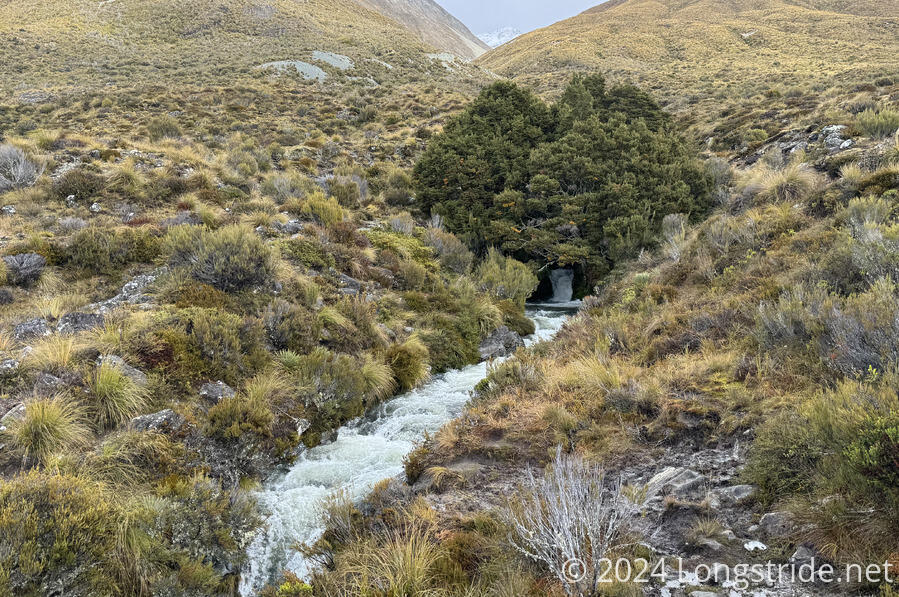
I was stuck here for about 25 minutes, unable to pick one of three bad options to cross. Instead, I went downstream a fair distance, below more waterfalls and rapids, and crossed at a place where the creek had the opportunity to calm down. It was a bit wider, but only maybe about shoe-depth, and was quite easy to cross.
I initially just headed uphill and vaguely in the direction of the trail, until I spotted a pole ahead on a fence line. Once back at the trail, I had to crawl under the (barb wire, of course) fence, which had its lower (non-barb) wires held up ever-so-slightly to enable crawling under. Thanks to the rain, there was a puddle of mud at the crossing point.
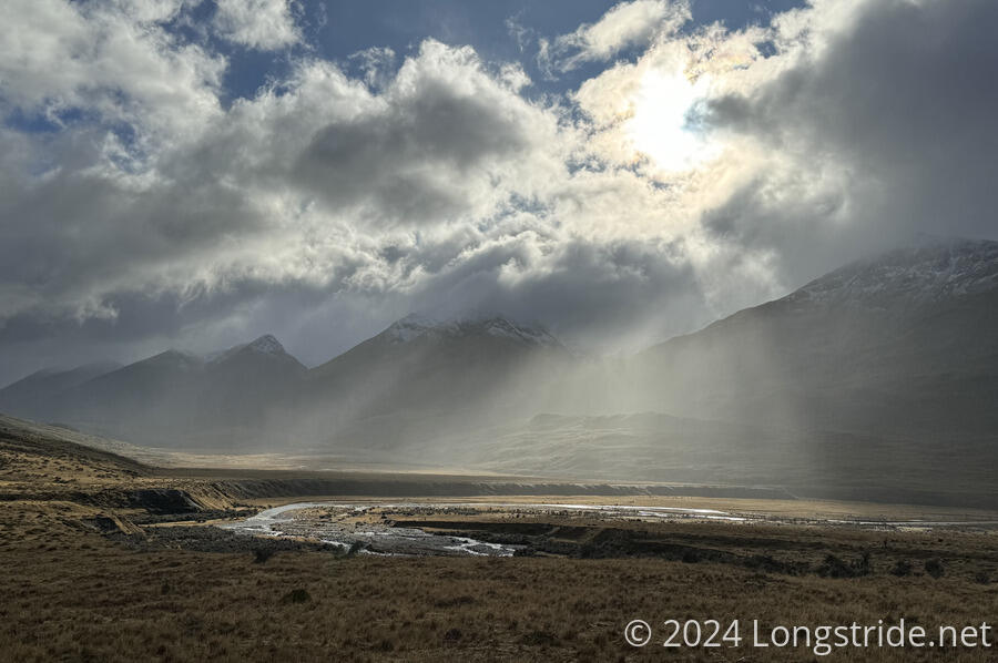
For most of the day, the wind and rain came and went, with the sun often shining through. I think today I’ve gotten the most rain while being in direct sunlight. Fortunately, it was cold enough that I didn’t have to take either my rain jacket or rain paints off.
After that second sketchy crossing, the water crossings the rest of the morning were largely mundane. Most of them were small flooded streams or excess water running off (or often, on) the trail. There were a couple of larger creeks, but without cascades to churn the water up, they were simple to cross.
After one of the creek crossings, the trail followed a farm road for a couple of kilometers, greatly speeding my walk. (Mostly because it was very easy to see where the trail was going, not because it was that much better than the rest of the trail.)
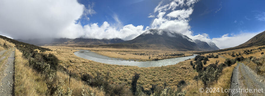
After crossing another swingbridge over the Mararoa River, my first break was at Boundary Hut, 12 km from Taipo Hut. It took me 4.5 hours, but if it hadn’t been for the rain, it would easily have been less than four. Somewhere in the last 1.5 km, I again lost my Nalgene water bottle, which must have fallen out at one of the many water crossings that I jumped or lunged across. At this point, searching for it would have been more trouble than it’s worth, and I can make do with my foldable bottles until I get to town, Te Anau, in a few days.
From Boundary Hut, the trail followed an ATV road for the next 6 km, to Careys Hut. That was fairly easy. The road still had places where it was flooded, or where water was running across or down the road, but it was a road, just wet.
For a good part of the time between the two huts, the sun was out, brightly shining on me, while there were rainclouds in the valley ahead of and behind me.
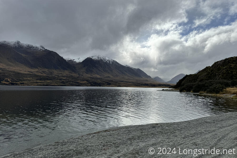
Careys Hut was my destination for the day, located on North Mavora Lake, filled by the Mararoa River. It was a short day, but the next reasonable stopping point, another two hours further down the ATV road, was a campground, and with rain forecast overnight, I wasn’t about to use my tent if I could avoid it.
Already at the hut were Michael and Perrine. Mikey had said he wanted to make it all the way to Kiwi Burn Hut, a further 26 km ahead, and if he’d stopped here, was long gone.
The hut seemed like it was once someone’s house. It has a fireplace, an old stove, and a (nonfunctional) outdoor shower.
Later, two guys in a truck drove up the ATV road, and wanted to know if we’d seen any deer. I did, yesterday, but that was of no help to them. They drove off. Some time after that, after we’d all finished dinner, on their way back out, they got their truck stuck on the side of a hill a bit up from the hut. We watched them for a few minutes as they rocked it loose from whatever it was stuck on.
Tomorrow, my original plan was to go to Kiwi Burn Hut. However, that involves a ford of the Mararoa River just past the hut. With the rain today, and forecast for tomorrow, I’m not feeling very excited to ford the river. (Nor to hike the trail past the hut, which is reportedly on a farm, and very rough and overgrown.) Fortunately, there’s a swingbridge across the river that would take me to a road that the trail will eventually follow, so I’m considering camping just short of the bridge, and doing a roadwalk the entire day on Friday, then hitch into Te Anau for resupply.
Hopefully, the rain called for tonight won’t be as much as we got yesterday. I don’t expect dry feet tomorrow, but it sure would be nice if I could.