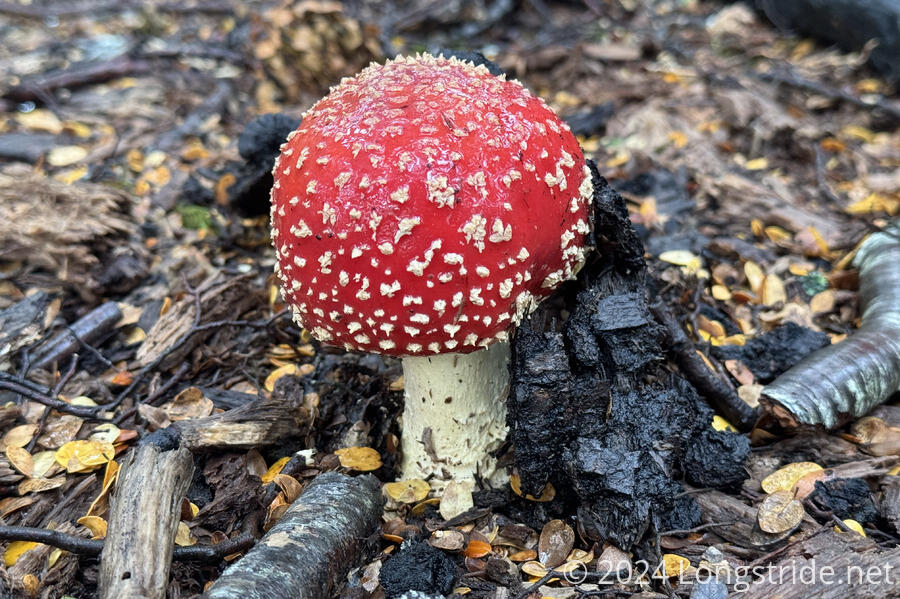
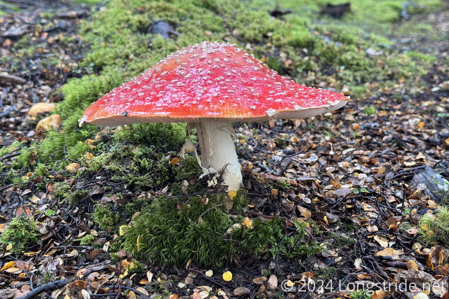
Passing along lakes and rivers (and wetlands), nearly the entire day today was along water.
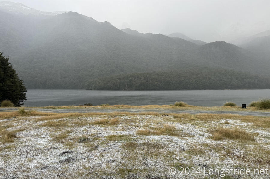
With sunrise after 8 am for the first time, and miserable weather outside this morning, I slept in, and didn’t get up until almost 8, and left the hut around 9:20, by which time, the rain had stopped.
The rain overnight had left even more snow on the nearby mountains. It looks nice, but it’s a (cold) reminder that it’s starting to get late in the season. (Fortunately, it should take less than three weeks to finish at this point!)

Leaving Careys Hut, I followed a 4WD road that took me to the Mavora Lakes Campsite. For the most part, this was an easy walk. The complication came from all of the rain that’s fallen over the last several days, which has let numerous puddles on the road, and has swollen all of the creeks crossing the road. I did a reasonably good job of keeping my feet from getting wetter, but it was inevitable that I’d meet a puddle or creek that wouldn’t let me get around or through without getting my feet wetter.
Although the weather forecast I got this morning suggested that the rain would end sometime between 8-10 am, that was not actually the case. While the rain had stopped before I left the hut, it started again later, coming and going over the course of the morning. I even got some hail for a short while. And during a brief interlude between rains, I very briefly saw a faint rainbow.
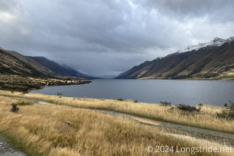
From the hut, the road climbed up the side of the mountain above North Mavora Lake. As I got closer to the campground at the south side of the lake, the road came closer to the lake shore, sometimes even going directly alongside the edge of the lake. Often, there was a separate trail a little further into the woods adjacent to the lake. This was pretty helpful, because the forest trail was usually a little bit easier to walk on than the loose gravel on the lake shore.
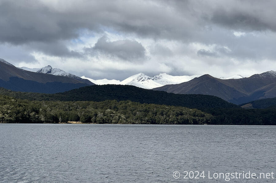
To the north, mountains with snowy peaks were prominent. There will probably be many more snowy mountains in the days to come.
I stopped near the entrance to the campground for a snack. Light rain started shortly before I continued, but after I got started, it began to hail and became quite cold, as it would be when lots of little ice cubes fall on you. I stopped for a few minutes in the shadow of a toilet to get out of the hail, which helped a bit. I could see to the south that the storm was coming towards me, and that it was clearing ahead, so I wouldn’t have to wait too long. Once the hail mostly stopped, I kept going, occasionally ducking into small stands of trees to get out of the still cold rain for a bit. By the time I’d made it to a swingbridge across the Mavora at the south end of the campground, the rain had mostly passed.
While I was going through the campground, a guy parked at one of the campsites offered me a ride to town. While I much appreciated the offer, I knew (hoped) the rain would be a temporary thing and that good weather was coming. (And, I’ll get to town tomorrow, anyway.)
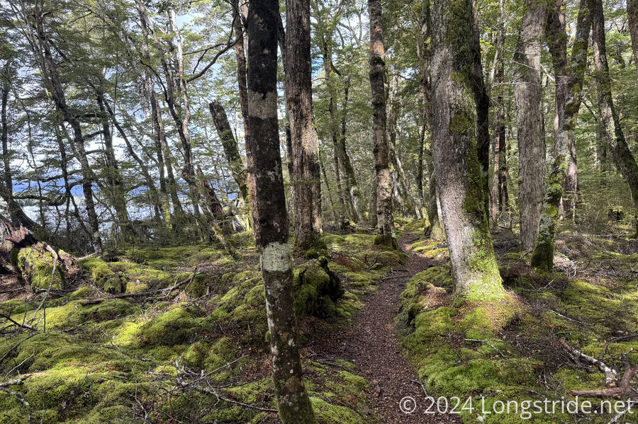
Once across the swingbridge and into forest, the trail improved significantly, in that it was a very nice trail in the forest. The sky continued to clear, and it was nice and bright out.
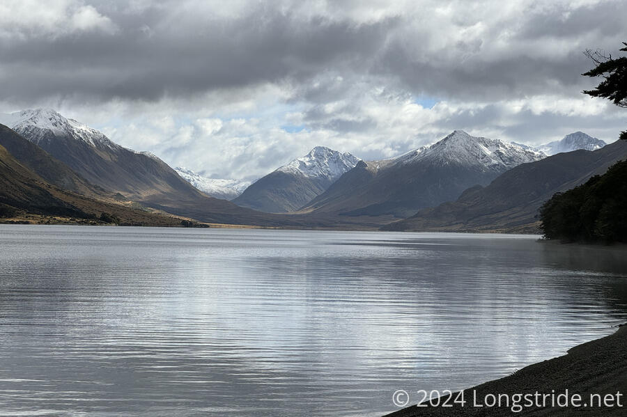
To the east, a few mountains had been nearly completely covered with bright snow.
Over the rest of the afternoon, the weather was generally decent, though there were occasional short bouts of light rain and hail.
Through the forest, I was usually within sight or earshot of the Mararoa River, which occasionally looked to be flooded. I generally made pretty quick progress along the nice trail, until I reached the South Mavora Lake Swingbridge, which crosses the Mararoa River just south of that lake. (It goes to a trailhead on Mavora Lakes Road; the TA does not cross it.) Beyond the swingbridge, the trail became a lot messier. There were a lot more fallen trees that I had to climb over or otherwise go around. A couple of times, there were faint trails that detoured around very large fallen trees, but it was never entirely clear that they were an “official” detour. Especially since sometimes, they seemed to just go off into the forest randomly and steeply, and took a while to return back to the trail.
This felt unsafe sometimes, but I always knew what direction the trail was supposed to be in, so I wasn’t worried too much about becoming lost.
I did a reasonably good job of keeping my feet dry today, despite the rain and hail. Naturally, I was disappointed when I reached a creek that was much too wide and deep to get across without getting my feet wet. Just beyond that, trail went through wetlands that kept my feet soaked for a little while longer.
The trail then returned to the forest, and was very nice the rest of the way to the Kiwi Burn Swingbridge. This bridge also spanned the Mararoa River, to a trailhead of of Mavora Lakes Road.
There was also a good campsite in the forest is before the bridge. I decided that I was going to stop here. While I could easily have made it to Kiwi Burn Hut, only a few kilometers ahead down what is supposed to be very good trail, the trail beyond the hut is through overgrown farmland and requires a fording of the Mararoa River.
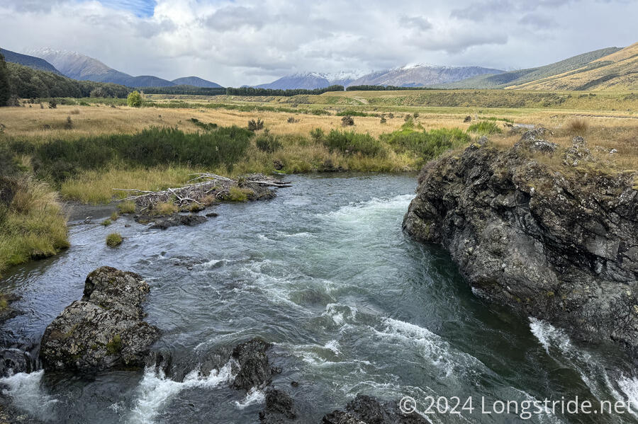
The river seemed to be gushing quite well. I was not inclined to ford it at the intended location, beyond the hut and its confluence with Kiwi Burn.
Since there are no other opportunities to camp for a rather long distance past Kiwi Burn Hut, this left the bridge campsite as the only reasonable place to stop. Tomorrow, I’ll cross the bridge, and follow the road nearly all day until the TA itself joins the road. (Then I keep going to a highway, and hitch into town.)
I got water from the river and set up my tent. Perrine showed up about half an hour after I arrived; Michael left Careys Hut before me and I never saw him after.
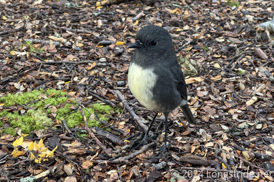
A robin seemed to take great interest in both my tent and Perrine’s, hopping around and investigating our tents and packs until sunset.
Tomorrow is going to be a long roadwalk, but at least it’ll be better than lousy farm trail, and I might actually see something interesting.