A longer day than planned brought me to the Telford Campsite, just north of Mount Linton Station.
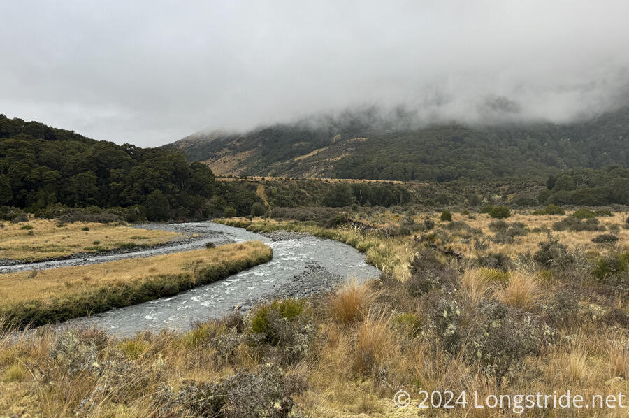
I left Aparima Hut about half an hour after sunrise. Fog earlier in the morning had lifted, though it was still cloudy and humid. After crossing a swingbridge over the Aparima River, the trail followed the river upstream, from a distance, heading back to the Takitimu Forest through more marshland.
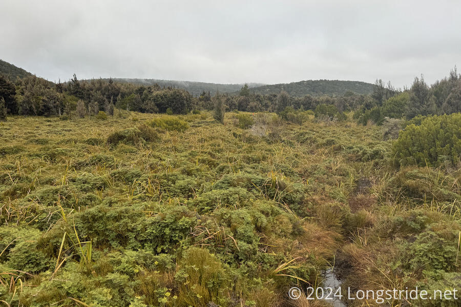
This was, of course, a bit slow going since I wanted to keep my feet dry. Largely, the trail was a bit of a ditch in the ground filled with water, but I could often walk alongside the trail on a higher path to stay out of the water.
In the forest, the trail gradually climbed away from the Aparima River, curved around a mountain, and descended to the Wairaki River. It was a bit slow for me; while it wasn’t steep, there was plenty of mud, water, and slippery roots (and the occasional short but steep climb up or down rocks or tree roots), and it took a fair bit of concentration to keep from dunking my feet in the water or slipping on the roots.
It also felt like I was coming down with a cold. Even though the trail wasn’t very steep, the climbs still felt a lot more draining than they should have been.
Around 1 pm, the clouds finally appeared to thin out, allowing the sun to shine through and giving a small bit of blue sky.
The last part of the descent to the Wairaki River ran downstream parallel to the river for nearly an hour. During this part, the trail was very wet. I still tried to avoid getting my feet wet (even though I knew I’d probably get them soaked crossing the river), because I didn’t want to get more mud into my boots than necessary.
After crossing the Wairaki River, a short climb brought me to the Lower Wairaki Hut. The trek to the hut from Aparima Hut took a bit less than six hours, including an earlier break. This was a bit surprising; I’d expected it to take me longer, given the effort I’d put in to avoiding getting wet.
The DOC sign at the hut still suggested that it’d take another eight hours to go the 8 km to the Telford Campsite. This felt a bit ominous. But the TA trail notes suggested this should only take four hours. I decided that, given it was still relatively early in the day (2:30 pm), and it was faster than expected to get to Lower Wairaki Hut, I’d give it a go. The DOC estimate was probably overcompensating for the steepness of the next section.
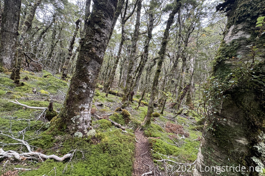
From the hut, it was a slow, steep climb through initially wet forest. As I got further from the river, the trail dried out, though the forest itself was still wet, with large old trees and moss and lichen growing on nearly every surface that wasn’t the trail.
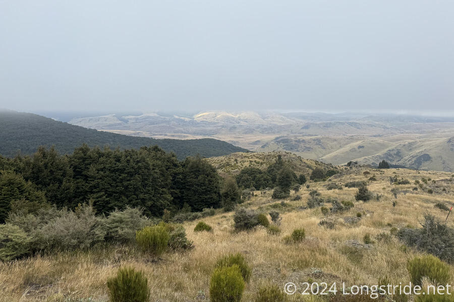
As I got near the top of the climb, the sun disappeared behind clouds. I suspected I wasn’t going to have much, if any, view at the top — the Telford Tops — an exposed rocky ridge. This is the last time the trail is over 1,000 meters, and is supposed to have views to the south coast.
Continuing to climb, the clouds grew closer (and lower), and by the time I was above the forest, I was in cloud. The trail was marked with poles, but they were often hard to see because the cloud was so thick. This was disappointing.
The trail was a little less steep on the way down, and once I got below the clouds, I had a hazy view of the surrounding farmland, belonging to Mount Linton Station, one of the largest farms in New Zealand.
On the way down, I had to stop briefly for a quick snack; I’d become super-hungry.
I reached the Telford Campsite, located next to a fence and stile leading to Mount Linton Station, and up on a hill above the Telford Burn. It wasn’t much of a campsite; there were about half a dozen areas of flattened grass that had been used in prior days for tents, a small creek for water, and an otherwise completely out-of-place pit toilet (because New Zealand seems to be allergic to digging catholes). But, it worked. (And it’s the only place to camp until after making it all of the way through the farm.)
It took me just under four hours to make it here from the hut, so I was very glad I did this today. If I’d stopped at the hut and did this section tomorrow, I’d have either been stuck in a field with a bad sandfly problem for most of the day, or else felt pressured to go all the way through the farm, which would have made for an excessively long day.
I have a reservation and shuttle into Nightcaps the day after tomorrow, though. I’ll have to call them tomorrow and see if they have availability tomorrow night. Otherwise, I’ll have to keep going another day past there and hitch into the next possible town, Otautau.
Looking into the rest of the trail, I realized that, if I can get into Nightcaps tomorrow for resupply, then from there, it should be five days to Riverton, which would be my next resupply opportunity. After that, it’d be a day to Invercargil, and then one last day to Bluff, and the southern terminus.
All of a sudden, the end of the trail feels very close. In a week, I should be done!