A day of forest and marshland brought me to Aparima Hut, near the river of the same name.
Yesterday, I arranged for a 9 am shuttle back to Princhester Road, where I hitched in to Te Anau from. So I was up at 7:30 to eat breakfast and pack, and was ready to go five minutes before the shuttle arrived, right on time. Another twenty minutes later, I was back where I finished yesterday.
It was a bit cold and dreary out, with the clouds low over the nearby mountains. I got a hot chocolate and cinnamon roll from the cafe at the intersection. (Next to it was a wool shop for the farm I was about to walk through.)
While I was drinking my hot chocolate, I found the room key for the hostel still in my pocket — I’d forgotten to turn it in when I left again. I called the hostel to apologize, and arranged to leave the key with the cafe, and someone would eventually be by to pick it up.
From the cafe, I continued down Princhester Road, both a public road and the main access road for a sheep and cattle farm. Following the road the entire distance to its end, I arrived at Lower Princhester Hut, located at the edge of the Takitimu Forest adjacent to the farm.

With the relatively low clouds, it was also rather humid out, and maybe even a bit warm. The clouds were lifting, though, which was important, since after I took a short break at the hut, I had a steep climb up a mountain and I didn’t want to be hiking into a cloud.
Before leaving, though, I took note of a sign indicating the distances to the next trailhead and the huts and campsite in between. The sign suggested four days to the road at the end of this section, and also a seven hour estimate for the roughly 8 km between one of the huts and the campsite after it. This was in contrast with the four hour estimate in the TA trail notes, and in support of my four-day plan for this section, but it was still disconcerting that there was so much disagreement over the time it would take to hike that segment.
From the hut, the trail climbed up a mountain, following a somewhat steep and occasionally difficult trail. Usually, the trail was pretty nice, but there were occasional narrow sections of washed-out trail or steep climbs up rocks and trees. There were lots of roots, which were often a bit slick from being wet. There were also no views to speak of on the way up. This was not a fast section for me; the three kilometer climb took almost two hours.
Initially, the humidity made the climb somewhat oppressive, but the clouds gradually lifted, and as I got towards the saddle at the top, a little bit of breeze was able to flow, taking the edge off the humidity a little.
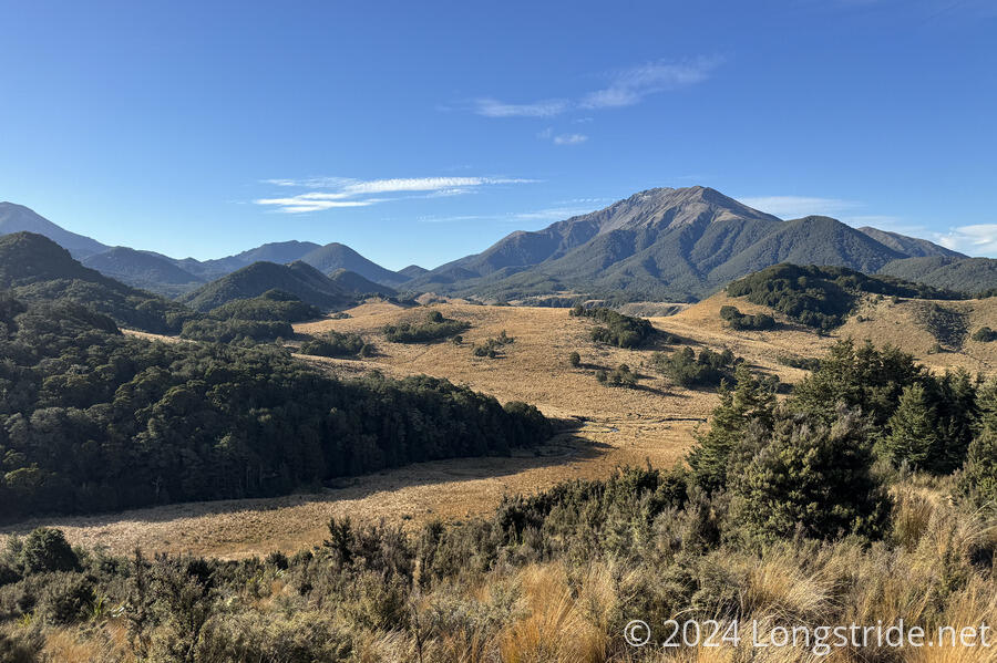
From the saddle, the trail dropped down the other side of the mountain, crossing a creek and exiting the forest. This brought me to another annoying walk through a bog, guaranteeing wet, uncomfortable feet.
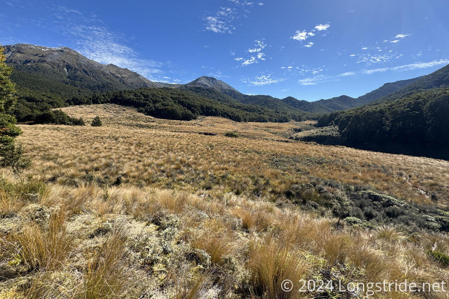
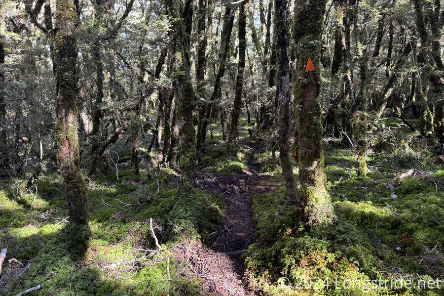
For the rest of the day, the trail alternated between forest and marshland. The forest trails were incredible to hike, easily some of the best forest trail tread on the TA.
The marshland was frustrating, between constantly re-wetting my feet and the sections that went through overgrown tussock. More than once, I found myself off-trail, following a trail through the grasses that wasn’t actually the trail. There were an adequate number of poles to indicate the path, except the tussock was usually taller (sometimes even as tall as me), so you couldn’t see the poles until you were nearly on top of them.
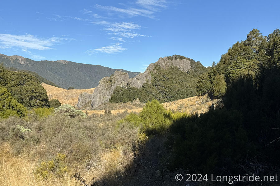
At least there was some interesting scenery along the way, including a large rock outcrop in the middle of the grasslands.
There were occasional mud pits in the marshland, but I was able to avoid most of them. Towards the end of the day, though, I stepped into a mud puddle up to my knee. That was partially caused by my trying to pick up the pace. It was already after 6:30, with sunset only another hour away, and clouds were starting to settle on the nearby mountains.
After one last climb, the trail re-entered forest, on the nicest, widest, easiest forest path I’d seen all day, and I raced down the path towards Aparima Hut. A few minutes out from the hut, I could smell smoke, and I guessed that someone had put on a fire, which would be great news for my wet boots and socks.
As it turned out, there are actually two huts. The fire was lit in the smaller, original hut, occupied by a family, with all of the TA hikers in the newer, larger hut. (The family was originally in the new hut, but opted to move huts so that all the TA hikers expected to be here tonight could be in one hut together.)
In our hut (sadly, without a fire) were Matt and Leonie, three other hikers, and Tam and Lee, whom I last saw at Captains Hut two days before entering the Richmond Range; it was great to see them again after so long. (Not surprisingly, they’d skipped numerous small sections and roadwalks, but a thru-hike wasn’t their goal anyway.)
Tomorrow will probably be a short day, six hours to the Lower Wairaki Hut, the next hut on the trail. There’s a campsite four (or 7-8) hours after that, but with there being less than twelve hours of daylight, I have my doubts about committing to hiking that long. Still, I set a 6:30 am alarm for tomorrow, and hoped for the best.