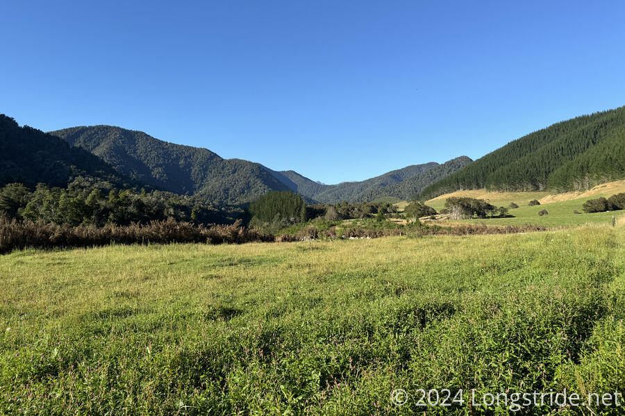
A long road and trail leads along the Pelorus River towards the Bryant and Richmond Ranges
It was a bit cold overnight, and for the first time, the Zpacks tent I switched to for the South Island had condensation on the inside. (This was expected, of course, I just thought it would be sooner.)
I left the Pelorus Bridge campground around 7:30, starting a long roadwalk through farmland. Fortunately, there wasn’t much traffic. Most of the early traffic was farm vehicles, including a milk tanker. Later, a van went through with kayaks. Maybe an hour later, I passed the van on its way back to town, with the kayakers getting ready to get in the water.
Some cyclists who stayed at the campground passed me as well; a younger couple, and three older women who had been with the RV I tented next to. The women were going surprisingly slowly; the first one to pass me did so when we were going up a slight incline, and I was walking nearly as fast as she was. (I was briefly tempted to see if I could match her pace, but I had a long way to go today and I didn’t want to overexert myself so early in the day.
I made quick progress, despite having a pack over-full with food. It took less than three hours to hike the 13.7 km to the end of the road. I stopped for a break there, taking the opportunity to dry out the wet ground sheet for my tent. About an hour before, I passed a junction to a track closed to vehicles due to water damage. The road I was on continued onwards. A sign pointed towards the Mount Richmond Forest Park, ominously with a “No Exit” warning.
After my break, I continued down the trail that began from the end of the road. About half an hour later, I reached a boundary marker for the Mount Richmond Forest Park.
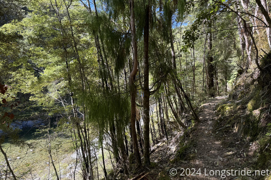
The trail generally followed above the Pelorus River, on occasionally rough but generally good trail. I made good time, beating the four-hour estimate for this section by a whole hour, and sweating profusely as I made my way through the forest.
I passed Lee and Tam again — they’d hitched most of the road walk. Tam caught up with me just before I reached Captains Creek Hut for a break.
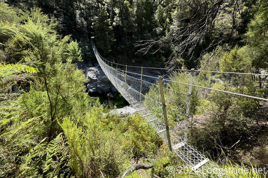
At the shelter, Tam mentioned that the weather forecast was for 33 °C (91 °F), which explained why it felt so hot (and why I was sweating as much as I was). She went for a swim in a swimming hole in the river near the hut, waiting for Lee, while I continued on, crossing the river on a rough suspension bridge and continuing through the forest, a little more slowly than before to try and not get too hot. (Fortunately, the forest was quite shaded, and much cooler than the open area around the hut.)
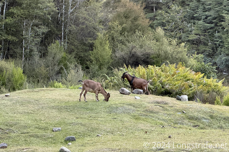
The slower pace didn’t stop me from getting overheated, and I stopped for a break after an hour. Another forty-five minutes later, I exited the forest into a clearing at Middy Creek Hut. Four goats, grazing in the grassy area behind the hut, quickly took off running, but came back later in the evening to graze.
It was still somewhat early — only 4:30 — and I very briefly contemplated continuing on to Rocks Hut, “only” another 5 km ahead (but 650 m uphill). I decided the 27 km I’d already gone today was enough, and to just take the time to relax (and dry out my wet clothes).
The hut was sweltering, and yet it was still impractical to open the windows: sandflies outside were bad, and I didn’t want to risk them getting inside. I hoped the hut would cool down sufficiently once the sun dipped behind the trees.
Three other hikers arrived over the next few hours. First was Kennedy, a local doing a route including the nearby Mt. Fell. Next was Cam (“Silo”), hiking with Dash, who showed up a little later.
Cam and I moved the picnic table out of the direct sunlight and into the shade of the hut, by which time my soaking-wet hiking clothes were bone-dry.
By dinner time, the sandflies had gotten worse, and we’d all put on extra clothing (except for Kennedy, who just used more DEET) to cover up from the biting bugs.
Kennedy had packed somewhat hastily for his few-day trip, forgetting his spoon, and instead eating his re-heated dehydrated meal with his (fortunately not-yet-used) trowel.
Cam and Dash had originally planned to continue on to Rocks Hut, but were waiting for the third member of their party, Irit, before continuing. She never showed; they assumed she’d decided to stay at Captains Creek Hut. (They plan to make it to the picnic area near “near” Hacket Hut tomorrow, to hitch into Nelson for resupply. I’m planning on staying at Hacket Hut tomorrow, at the bottom of the hill before a long climb into the Richmond Range.)
After the sun dipped behind the mountains and it was still uncomfortably hot in the hut, we finally opened one of its windows which had a screen, hoping that the mesh was small enough to give the sandflies trouble getting in, and the hut cooled off a little quicker. At 9:30 pm, though cooler, it was still hot enough that I was sweating just lying in my bunk.