The second day in the Richmond Range, over Mount Rintoul, was an extraordinary difficult day.
It was a bit windy, with clouds coming over the nearby ridge, so I delayed leaving Slaty Hut for a little while. However, the weather forecast was still pretty good for today, so after it sorta-kinda looked like the clouds were rising, I left the hut, heading towards Mt. Rintoul Hut, an estimated 8 - 10 hours away.
After about 20 minutes, I reached the top of the bowl surrounding Slaty Hut to the south, and with cell service from there, checked the weather. The updated forecast was much the same as it had been before: weather today may be cloudy, but good, better in the afternoon. But, the ridge was still covered in clouds, and I didn’t particularly want to walk along the top of an exposed ridge in clouds and wind. I waited there for about 15 minutes. Then, after the wind picked up a bit and I started to get wet from the moisture in the clouds, I decided to turn back towards Slaty Hut and wait there for the weather to improve.
About two-thirds of the way back, I ran into another hiker, who’d come from somewhere further north; she seemed untroubled by the clouds and wind on the ridge, and I halted my return. It seemed like maybe the clouds were rising and it was clearing up a little, but they just may have been wishful thinking. But what convinced me to start moving forward again was the sun poking a hole in the clouds and shining into the valley below the hut.
A little further on, the trail traveled just below the summit of an unnamed peak on the ridge. I decided to bag the peak, because why not, but also because my map suggested the trail did summit the peak, and there was a trail more-or-less going right there and I accidentally took that rather than the actual trail, assuming the trail did summit the peak.
The peak was basically a small rock outcrop with a cairn on top. I didn’t bother to climb all the way up, but I tagged the cairn with my pole, calling that “close enough”. However, when I turned around to return to the trail, either the rock I was standing on or the next one I stepped on shifted, and I lost my balance and fell, hitting the ground hard with my left arm and wrist.
I feared I’d just given myself a stupid hike-ending injury, and was very glad I had the PLB. But I collected myself, and was relieved that nothing seemed broken. (Even my poles somehow made it unscathed!)
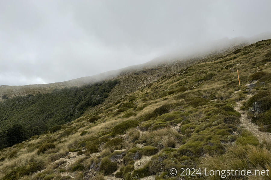
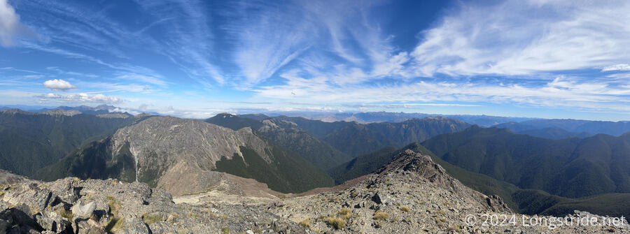
After a few minutes to calm my nerves, I continued on, following the trail as it wound its way along the ridge and giving me a good view of another nearby ridge and valley.
About an hour later, I stopped for a break before the first of three steep climbs today (the latter two being the summits of Little Rintoul and Mt. Rintoul). My arm and wrist were a bit sore, but seemed to be doing okay. The clouds were slowly rising, though there was some fog blowing over the ridge I’d just crossed.
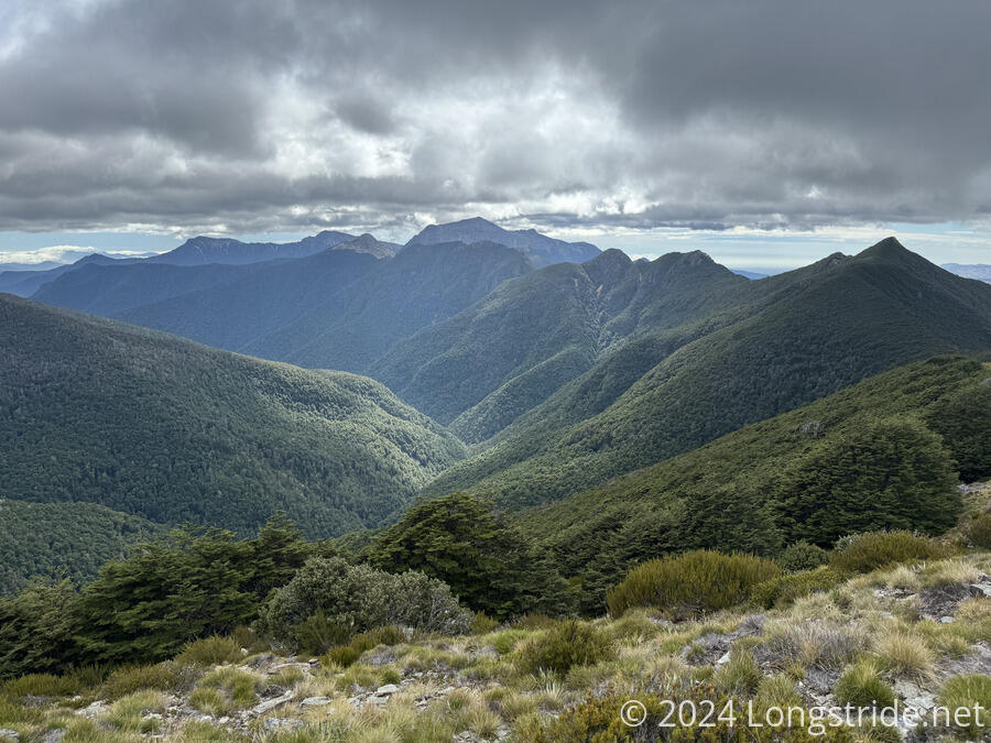
Climbing up to another ridge, I got a good view to the southeast, where the large braided Wairau River flowed through its valley. I also saw what seemed to be a rainwater barrel just off the trail, though I didn’t bother to check and see how much water was in it.
Slowly proceeding down the trail, I took another break at the first of two junctions leading to the Old Man Hut. The hut, 200 meters (vertically) down steep trails, is certainly an option, but one which I was all too happy to be able to avoid. An hour off-trail, it didn’t make sense to go there except to stay overnight.
Between the two junctions, I got a view down to the hut, and was quite glad I didn’t have to go there.
Shortly later, I got my first clear view of Little Rintoul, as the clouds that had been obscuring it all morning finally blew away. I could see, roughly, the trail along the ridge in the forest, then climbing above the treeline towards the summit.
As I knew it would be, the climb to Little Rintoul’s summit was quite steep, starting in the forest, then climbing up rocks and scree, mostly along a path that was clear to see. It was relatively straightforward, but I took it slowly, keeping a calm pace up the mountain.
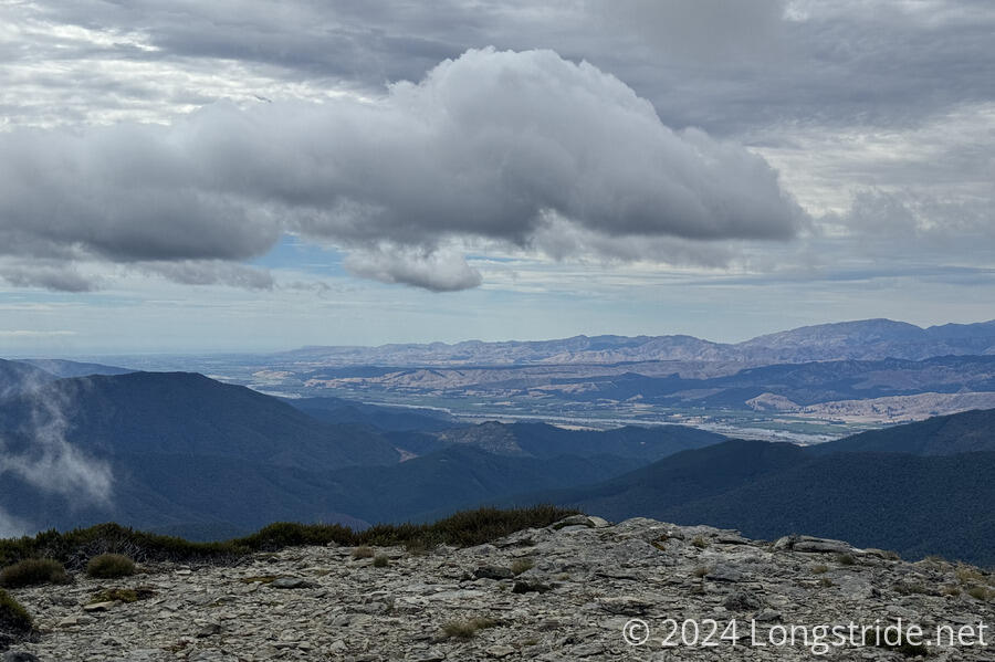
The view at the summit was okay, but nothing spectacular. I assumed the view from Mt. Rintoul, a little over 100 meters taller, would be better. But to get there, I had a steep drop off the other side of Little Rintoul, and a just as steep climb up Mt. Rintoul.
This was a quite hard descent. Very steep, a couple of times I had to sit down and scoot or slide down rocks to safely advance. It might have been fun if it was the only challenging part of the day, but I was quite tired already, and ready to be done with the day.
At the bottom of the saddle between Little and Mt., a small rock outcrop joined two sections of trail, with a deep gully separating them. It wasn’t possible to “hike” down this rock: it required actually climbing down. And I couldn’t see what I was supposed to do.
I briefly considered throwing my poles (and my pack) across to the other side, which would make climbing down a lot easier (given I couldn’t see the handholds), but I was afraid they’d just bounce down the side of the mountain and become lost to me.
After being frustrated for a few minutes, I took my pack off and sat down at a wider spot on the trail a few meters back, both to calm my nerves, and figure out an escape plan, if necessary. Having fallen earlier and hurt my arm did rather shake me up, so when it came to dealing with this obstacle, I was not in the best of mindsets.
What I came up with, which I absolutely did not want to do, was to go back over Little Rintoul, go down to Old Man Hut, stay there overnight, then take a trail south to Lower Goulter Hut, and from there, exit the Richmonds onto a dirt road that paralleled the Wairau River. I didn’t like this plan — especially since I should have been able to move forward, since every other southbounder seemed to have managed to do so — but at least I had an option now.
But after half an hour of being stuck and not seeing what I needed to do, I decided I needed to turn back. There didn’t seem to be anyone else approaching from either direction that could help, and I needed to go somewhere. Staying in pace wasn’t an option, and if I waited too long, I’d run out of daylight to make it to either Old Man or Mt. Rintoul Huts.
Fortunately, only a couple of minutes after I turned back, I saw another sobo hiking towards me. He was moving much faster than I was, so I didn’t see what he did at all to get down, only that he was down before I got back in view. But, from his much better vantage point, he was able to guide me to the foot- and hand-holds I needed to use to climb down. It was still a little tricky, since there were loose rocks that would have made for great handholds if they weren’t likely to fall out if used, but I made it down in one piece.
It was almost a little embarrassing, but when you need help, the best thing to do is ask for it!
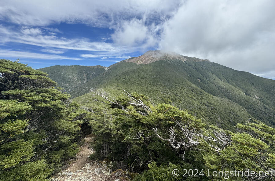
After that, the rest of the climb up Mt. Rintoul was straightforward, though slow, between being very steep and also involving climbing through a rock field. Along the way, the whole end of one of my poles fell off. Fortunately, the tip landed nearby, and didn’t go flying down the mountain, so I jammed it back on and hoped it would stay. (It did.)
Once I reached the summit, I took some pictures, and then immediately continued on. On a better day, I’d have stopped for a break there to take in the view, but now, I was way past exhausted, and the only things on my mind were the steep drop down to Mt. Rintoul Hut, and getting there before all the bunks in the hut were taken.
From the summit, the trail meandered gently along the ridge, then after some steep sidling just below the ridge, reached a steep scree field of very loose small rocks. “Walking” down that was more sliding than walking. It was kind of fun, actually, but deeply erosive to the mountain. I felt sorry for the northbounders who have to climb up the scree field. (And all future southbounders, who now have slightly less of a mountain to hike down.)
Back at the Tokomaru Shelter, a magazine left there had a full-page comic artwork on hiking on scree. One part of the picture discussed what to do when you take one step forward and slide half a step backwards. At the time, my thought was, “If it’s that steep, a trail shouldn’t be routed there”. But one step forward, half a step back is exactly what I imagine climbing up this scree would be like.
Below the scree field, the trail dropped into forest, only slightly less steep than above the treeline. But at least now the ground was firm, and I managed a surprising pace, mostly motivated by getting to the hut before the other guy right behind me.
Once I got to the hut, I was relieved that there were still two spaces left, both top bunks, and I took one of them. (The other space filled up shortly after.)
Dash and Silo arrived later (and wound up tenting). There was also a group of five other southbounders (including Brandon, who helped me between Little Rintoul and Rintoul), and Mark, who lives in Auckland and comes to the South Island for a week or two every year to go hiking.
I was a little surprised that Mark seemed nonchalant about the views in the Richmonds. But after some time reflecting, I decided I wasn’t terribly impressed by them either, at least not compared to other mountains I’ve been in. The quality of the views today, while nice, was definitely not commensurate with the difficulty in getting there.
In the evening, shortly before sunset, fog started to blow in, obscuring the hut’s view out to the Tasman Bay. I decided I was going to sleep in a little tomorrow. I am quite sore after all the steep hills, and I need a good night sleep to recover.