Today, I entered the Richmond Range, a challenging high-elevation section of Te Araroa.
Unusually for me, I was the first one awake at the hut, which delayed my exit as I tried not to make a lot of noise.
While I was eating breakfast outside, a small bird flitted around the picnic table I was standing near. It didn’t really try to get at my food, but the way it strutted around and postured made it seem as though it expected me to feed it.
I wound up leaving at 8, easily a half-hour later than I wanted. But, the sun was still behind the mountains, so it was cool (and damp) out.
From Browning Hut, I followed a reasonably nice trail downhill, taking a detour on an “all weather track” because of a slip that rendered the low route along the river impassable. (Or at least, very sketchy. The all-weather track started off with a step climb, so I took the low-water track far enough to see that I didn’t want to try and navigate the slip, after my rough day yesterday and the steep climbs ahead of me today.)
Hacket Hut, my planned destination yesterday, took a little over an hour to reach, and was easily the fastest section today. I took a short ten-minute break to mentally re-set for the next section: once I left Hacket Hut, I was committing to entering the Richmond Range. (A two-hour side-trail from the hut leads to a picnic area and a road.)
From Hacket Hut, I began the “easy” part of the 5.8 km climb to Starveall Hut, with nearly 1,000 meters of elevation gain. The easy part was along Hacket Creek, which the trail zig-zagged across many times. Wanting dry feet for the climb, I tried my best to rock-hop my way across each crossing. Thanks to low water levels, for the most part, I was successful. However, towards the end of the creek, there were a couple of crossings where the water level was just a little too high, and I had to get my feet wet.
It was a lot of effort expended to keep my feet as try as possible, and it worked out well, but it did make that part take far longer than if I’d just stomped across (or just straight up) the creek.
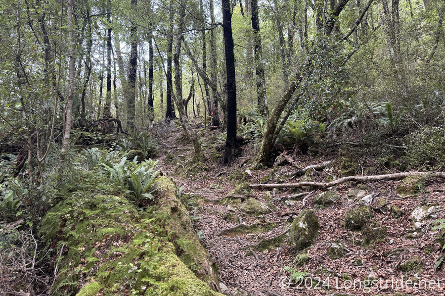
Leaving the creek, I began the very steep bulk of the climb, more-or-less straight up the mountain. Though the trail was steep, it was generally well-formed. A couple of stream crossings were a little tricky because the streams had cut a pretty deep channel through the mountain, which required corresponding drops and climbs on either side to cross.
Heavily forested, there wasn’t much in the way of views until I got to Starveall Hut. A couple of times, the forest thinned enough to grant a glimpse of mountains or a nearby ridge, but no really good views.
As has been the case for the past several days, it’s quite warm out, and once I started the main climb, it didn’t take long for my shirt to become soaked. Hiking in those conditions is exhausting, and I stopped for a break a little less than halfway into the climb. (I was hoping to have been able to make it the whole way, but coming from Browning rather than Hacket made that implausible.)
Including the break, it took four hours to reach Starveall Hut from Hacket Hut. On a saddle just above the treeline, there were reasonable views to the nearby mountains. From the picnic table in front of the hut, trees framed a window to the north, glimpsing part of the Tasman Bay, north of Nelson.
When I took my shirt off to dry it out in the sun, I discovered that it has started to fray on the right shoulder. There are a few small holes, which no doubt will turn into a bigger problem later. Fortunately, I have a replacement shirt in Auckland; I just need to figure out when and where I want CareFree to send it. (This shirt I wore on the last half of the Continental Divide Trail, so while I hoped it would, I didn’t expect it would last all the way through the TA, and brought a replacement just in case.)
Leaving Starveall Hut, the trail began a steep climb above the treeline. This rewarded me with excellent views; I could easily see Nelson to the north, and several other ridges nearby. Nelson is the oldest city on the South Island, and second-oldest in New Zealand.
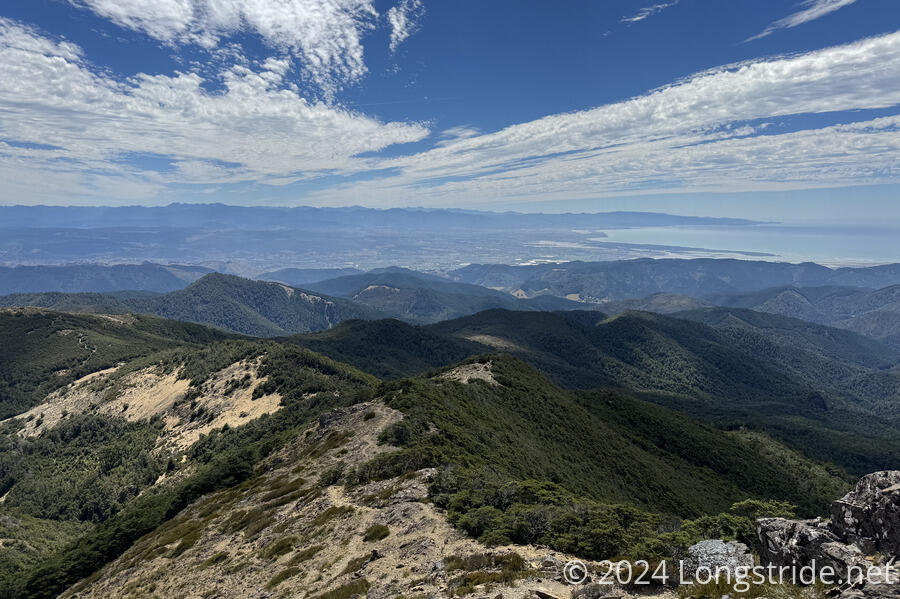
I could even see Mount Taranaki, a distinctive conical mountain in the southwest of the North Island, some 250 kilometers away.
The steep climb was followed with a steep descent, though that quickly entered a forest of stunted pines. I traveled through the forest for another couple of kilometers, again coming above the treeline and arriving at Slaty Hut. This took two and a half hours from Starveall. I hiked all of the sections today in the estimated time indicated in the trail notes, which gives me a good feeling about how long it’ll take to do tomorrow’s sections (and suggests I’ll really need to get started as early as possible — the estimate is ten hours for 15 km).
Along the way, I had opportunities to summit both Mount Starveall and Mount Slaty, but given how tired I was, I didn’t seriously consider doing either one of them, even though they were fairly close to the trail. I won’t have to wait long for summits, though: the trail will give me a couple tomorrow.
I reached Slaty Hut a little before 5. Already there were northbounders Jack (UK) and Tim (Australia); arriving shortly after were Erin (Tim’s partner), and Eva (Czech Republic). They all came from Mt. Rintoul Hut, my destination tomorrow. Later, Arjuna arrived, from Rocks Hut.
We all had a good conversation; I was surprised to hear that the “Legend of Darien” (the woefully underprepared hiker CareFree and I’d met in the Northlands) had reached even nobos nearly three months removed.
Tomorrow is expected to be the hardest section of the Richmond Range, the climb to, and over, Little Rintoul and Mount Rintoul. But hopefully, there should be some good views there, as they will become the highest points I’ve reached so far in New Zealand.