A short day bounded with road walk took us through a mixture of dense and light forest, as we made our way towards the Tararua Range.
CareFree and I started off to overcast skies just before 8 am, continuing down a gravel forest management road that was surprisingly easy to hike. Before we left, we saw three vehicles come from the direction we came from last night and head off down the trail; we later passed them working on the trees in the pine plantation. We saw one of them half-way up a tree, in the process of cutting off all of its lower limbs.
The road continued gradually uphill for a few kilometers. At roughly the top of a hill, we reached a picnic table with probably the last cell service we’ll have for a day and a half, and then the trail climbed over a stile and headed into a dense forest.
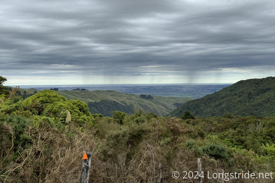
While we had cell service, we checked the weather. It’s not looking great for when we expect to be going through the Tararua Range (starting the day after tomorrow). Hopefully, the forecast will improve between now and when we get there, but the current plan is to make it to the Makahika Outdoor Pursuits Centre tomorrow evening, and re-evaluate then.
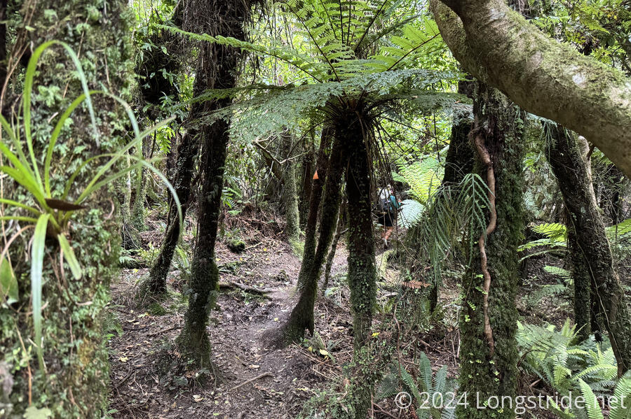
The next bit of trail through the dense forest was nice, though it was dark enough that I had to take off my sunglasses to see the trail. It was a little muddy at the top, diminishing after we started going downhill for a bit towards a stream. It seemingly hadn’t rained recently, so that’s probably why it was still nice.
About half an hour into our descent, it started to rain a little, and I reached for my pack cover to start to put it on. Instead, I found that my pack cover was not in the pouch it was supposed to be in. It had fallen out!
This was pretty frustrating, not the least because I’d already lost my pack cover once, on the Tongariro Alpine Crossing, and hadn’t even gotten to use it since I replaced it. But, more importantly, we have a lot of rain in the weather forecast, and many of my “dry” sacks are no longer waterproof, most critically the one for my sleeping bag.
I was originally going to just leave my pack cover behind, until CareFree pointed out that there was nowhere we could actually replace it. (I suppose we could go into Levin, the next town near the trail and hope they have an outfitter, but that’s no guarantee, and we weren’t planning on going into town anyway, so this would be a substantial departure from plan.)
I figured that the most likely place I’d find my pack cover was at the picnic table. I’d tried to sit down with my pack on, and it seemed possible that it might have scraped against the table and fallen out then. That was 2.1 km back from where we were. Leaving my pack (and CareFree) behind, that’d take about an hour to round-trip. A better scenario was that it just fell out sometime after that, but probably still close to the picnic table, since I was behind CareFree for probably the first half kilometer, and she probably would have noticed it if it fell out when I was in front. The worst case scenario was that it had fallen out before then, on the road from the hut, which might add another hour. But I was trying not to think about that possibility while I charged back up the mountain. In the end, I found it on the ground about 0.3 km before I made it back to the picnic table. The whole runaround cost us an hour, but at least I still had my pack cover.
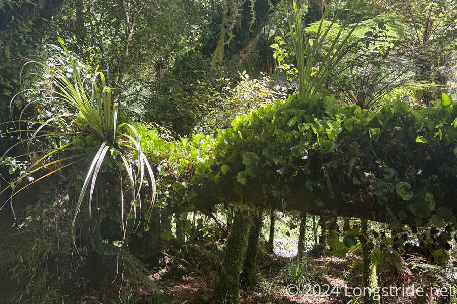
Shortly after I started back, the rain stopped, though even the short bit of rain was sufficient to make the muddy sections of the trail noticeably muddier, and some of the formerly dry sections were now a little slippery. On my return trip, the clouds blew away and the sun came out, though not much direct light made it to the trail.
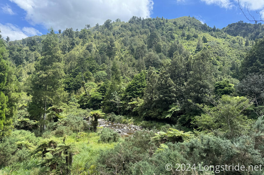
After I took a break, we continued, finishing our downhill and reaching a stream. Fortunately for us, this and the next stream crossings were fairly easy: the water level was low enough that we could just rock-hop across. (We had a number of other stream crossings later in the day, and were able to keep our feet mostly dry.)
The trail used to go through Tokomaru River, following the river upstream for a while. However, it had been recently rerouted (either or both because of a slip that dammed up the river upstream, or because the river crossing was on private property) onto a very steep trail that climbed straight up and down a ridge adjacent to the river.
This was a tiring section, and the very humid air (and sweat) collected on my shirt, completely drenching it. Occasionally, a nice warm, dry breeze would waft through, but that was always fleeting.
We stopped for another break at the bottom of the descent, at a clearing with a picnic table, the site of what used to be a dwelling for James Burtton, a farmer who worked land on the other side of the river from 1908 - 1941. To service that, he built a rough road that the trail then followed, up to the next dirt road.
He also built a suspension bridge across the river near his homesite, and met an untimely demise when it collapsed while he was on it, dropping him onto rocks below.
We followed Burtton’s road for a little under two hours. It was probably in somewhat rougher condition now than when he last used it, but it was still fairly nice to walk on. It no longer felt like a road, rather more like a nice trail, zig-zagging through forest and clearings as it gradually climbed up the Tokomaru River valley. Burtton’s road ended at a dirt road, which we then followed for another half-kilometer.
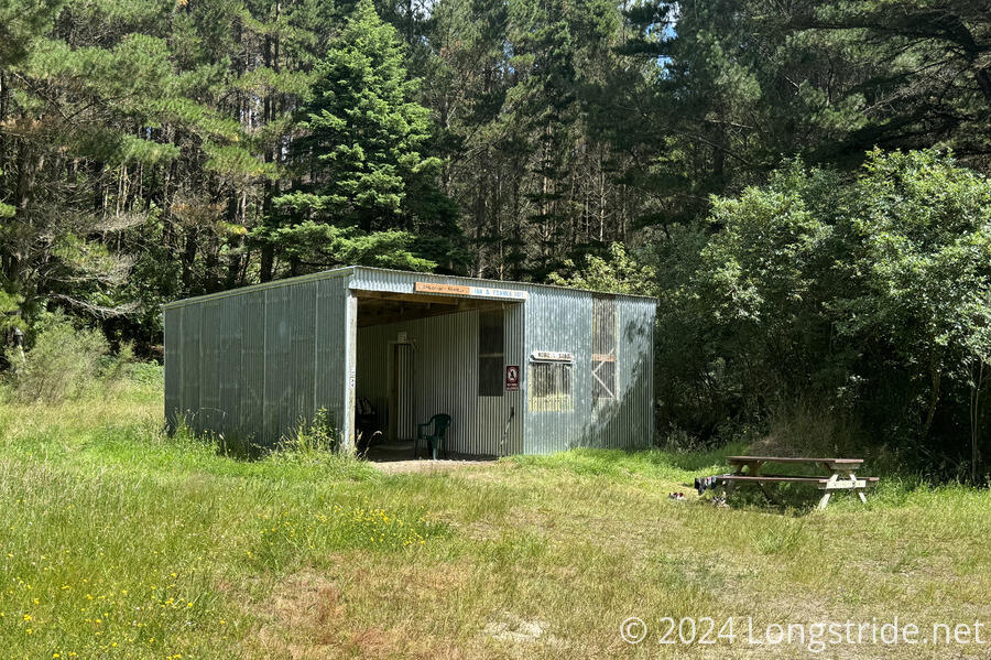
Our destination was the Tokomaru Shelter (aka Ian & Frank’s Hut), (re)named after two men who had worked with the Te Araroa Manawatū Trust for 15 years, helping to promote Te Araroa and build trails that were eventually incorporated into the TA. They are responsible for this shelter being available to TA hikers: they’d identified a derelict (but still standing) farm shed adjacent to the TA, and secured access, support, and funding to convert the shed into a hiker shelter.
For a once-derelict shed, this is now a nice shelter: there’s a small sleeping platform for maybe four people, as well as tables, chairs, and an actual door to keep heat in at night and sandflies and mosquitoes out. A privy and small creek rounded out the amenities.
We slowly relaxed at the hut. We’d only hiked just under 15 km (more like 19 km for me), but it was tiring nonetheless. We would have liked to go further, but the next guaranteed campsite is quite a distance ahead.
About an hour after we arrived, another pair of hikers arrived, a couple from the Czech Republic. We first saw them when they passed us on the steep downhill; we then passed them at the bottom when they’d stopped for a break. They didn’t stay long, only long enough to filter water and tell some stories; they seem to be in a rush, needing to finish the trail by some time in March.
Again with a hut to ourselves, CareFree and I had a nice quiet, relaxing dinner.