A long series of cycle paths, gravel walkways, grassy tracks, and a little road walk brought us to the Whare o Moturimu Hut, a nice shelter in the middle of nowhere built specifically for TA hikers. And, we reached an important milestone: Halfway!
CareFree and I left the motel shortly before nine, retracing our steps from two days ago back to the Manawatū River Walkway, and continuing east, along the river. The park surrounding the walkway seemed more lively than it was on Sunday, with more people out (including a group of at least a dozen people walking).
CareFree switched to her new pair of shoes today, leaving behind the pair she’d worn since Hamilton. We hoped they’d work out for her better than her old pair, which had deteriorated past the point of being acceptable on-trail.
After a short distance we turned off the path to cross a pedestrian and cyclist bridge across the Manawatū River. A sign next to the bridge showed a counter of cyclists and pedestrians that had crossed the bridge. As of when we passed, the counter was up to 183 cyclists and 209 pedestrians today, and over 23,000 pedestrians this year so far.
On the other side of the river, we followed a cycle path through Massey University, which started in 1927 as an agricultural college, and is now one of New Zealand’s largest universities. We passed under a road being used to transport cattle, and followed the cycle path, which became a walking path, as it took us past quite a few research pastures (most of which didn’t seem to be in use at the moment). Quite a few side trails branched off to different parts of the university and residential neighborhoods, and there were quite a few picnic tables at the occasional viewpoint.

A nice theme of the first part of the trail today is that it was designed to keep us off roads as much as possible. And it did so with well-maintained track, so it was quite enjoyable. The trail designers may have been a little over-enthusiastic, though. At one point, instead of just crossing a road, the trail sent us on a 400 meter trek on a trail down one side of a road, under a bridge, and back up the other side of the road!
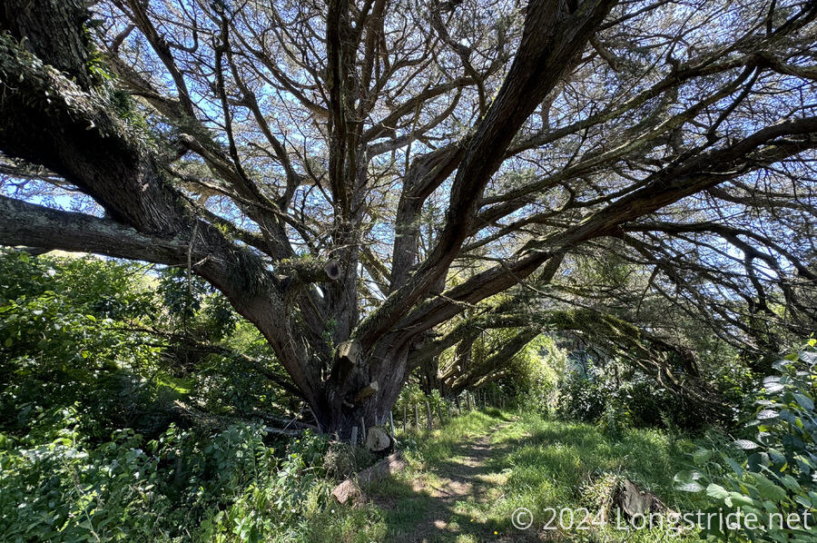
Generally, it was fairly windy today, though the wind was often moderated by the large amount of trees. Except for some of the road walks, most of the trail today had ample tree cover. It was really quite pleasant to hike.
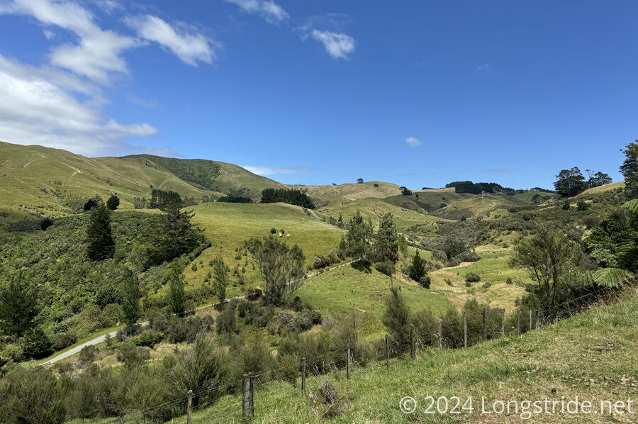
After about 12 km, our mostly-trail streak came to an end, and the TA became routed over low-traffic paved and gravel roads for the next few hours. Entering into the foothills of the Tararua Range, we did get some good views, especially when the trail hit local high points.

Our second break was coincidentally at trail km 1499.9. When we continued, we passed two 1500 km markers written in small stones on the trail. One of them was very hard to read (and nearly impossible to photograph) since it was grey stones on a grey gravel track. The second marker also read “1/2 way”, which was a little early: the trail is officially 3028.9 km this year. Later, at km 1510.2, we passed a 1500 km halfway sign from 2016/17.
For me, with alternates taken so far factored in, my hike of the TA should be 3061.9 km, with my halfway point at km 1493.0. We passed there about a minute before noon.
One of the roads we were on had an 80 km/hr “courtesy zone” sign with icons for cyclists, hikers, and horses. It’s a shame they have to request drivers show courtesy, but I’ll still take it.
We took our last break at the Kahuterawa car park, a trailhead for several hiking and mountain biking trails. A recently-built shelter over several picnic tables under provided a nice shaded rest spot.
From there, we entered the Arapuke Forest Park (arapuke = “pathway to the mountain”) and followed the interestingly named “Back Track”, a road turned cycling and hiking trail after it suffered too many slips, to the point that road maintenance vehicles couldn’t traverse it.
Along the way, we made our closest pass to the wind turbines on the hills we’d been seeing all day (and since walking towards Palmerton North from Bunnythorpe). We were close enough to be able to hear their deep woosh as they rotated.
Back Track brought us to another gravel road, which led us to our shelter for the evening, the Whare o Moturimu.
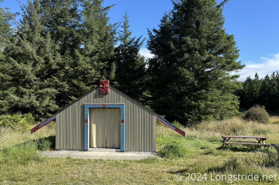
The hut is named after the logging village that used to be nearby, from 1903-1913. On the site of the hut, workers used to make camp; later, farmers had a stock yard and hay barn here. It is in the Gordon Kear Forest, which is actually owned and operated commercially by the Palmerston North City Council. The hut, built in 2019 specifically for TA hikers, is the only place in the forest where camping is allowed.
It’s a nice place to stay; inside it’s quite spacious and bright with skylights and a large window in the back. It doesn’t have mattresses like DOC huts, but it does have two sleeping platforms with a thin foam surface that’s softer than wood. A creek for water, picnic tables, a (very nice) pit toilet, and a trash can round out the services.
Inside the hut, we were very surprised to find a pair of CareFree’s old shoes: the same brand and model, and not very worn, though a larger size.
We hadn’t seen any hikers today, but we’d started late. I half expected to find a bunch of people here already once we got here, but there was no one when we arrived, and we had the place to ourselves. With our zero yesterday, pretty much everyone we knew from the canoe trip had already signed in the guest log yesterday or earlier (some early enough to show they’d skipped sections of the trail between Whanganui and here). So that bodes well for the next several days: we shouldn’t have much competition for hut space through the Tararuas. We took the opportunity to enjoy a nice, quiet dinner with no one else around.
In yet another gear malfunction, my battery no longer charges devices plugged in either of its USB-A ports. This prevents me from charging my watch. (Fortunately, its USB-C port still works to charge my iPhone.) I used CareFree’s battery to charge my watch. The shopping list for Wellington continues to grow: this’ll be one more thing I’ll need to replace.
As evening progressed, clouds blew in from over the next ridge. Hopefully, that won’t turn into rain overnight.