Today, I crossed Mount Linton Station, one of the largest farms in New Zealand.
One of the requirements for crossing Mount Linton Station is that access to the 28 km of trail is granted only during daylight hours. It was unclear whether that meant sunrise to sunset, or dawn to dusk. So I erred on the side of caution and started about 15 minutes after sunrise. The real deadline for the day, though, was making it to Struan Flat Road, on the south end of the farm, by 5 pm, which was the latest I was requested to be there for my shuttle to Nightcaps. This didn’t give me much leeway; the section is supposed to take 8-9 hours.
From the campsite, I crossed over the fence into Mount Linton Station, and paralleled the Telford Burn for about 20 minutes, until the trail dropped down to the river to ford it. It was an easy crossing, only about boot-deep, but it was still annoyingly early in the morning to get cold, wet feet.
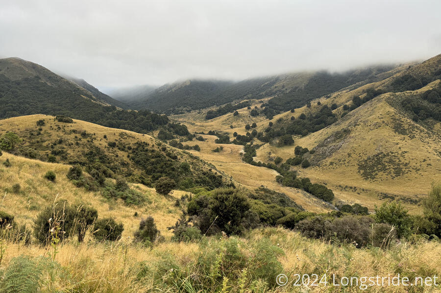
On the other side of the river, the trail quickly joined a farm road. For the rest of the day, the trail was largely on farm roads, which made the day’s trek much easier than if I’d been on trail all day. Shortly after, just beyond an intersection, was the first of several warning signs directed specifically at TA hikers, warning us to stay on the trail or police would be called “immediately”. These signs were placed on the roads a short distance past turn-offs and served as good (if aggressive) “you’re going the wrong way” signs, though there were a few times that the correct way to go was not immediately obvious and I saw the wrong-way sign before the marker indicating the direction the trail actually went.
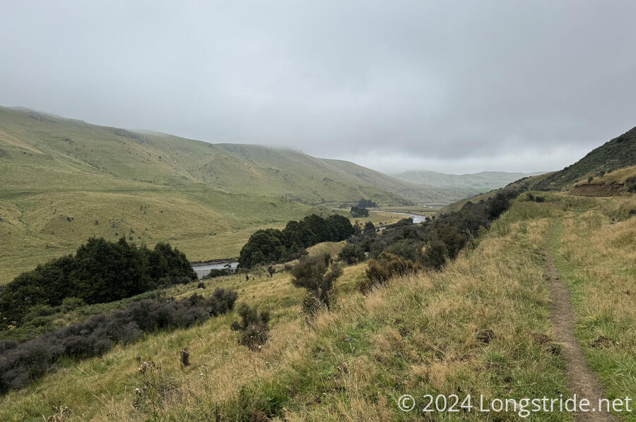
The sky was generally cloudy and overcast all morning, with an occasional drizzle. The gloom certainly added to the ominousity of the wrong-way signs. After following farm roads generally southwest around folds in the mountains, the road brought me around to the Wairaki River (which I’d forded yesterday afternoon). Across the river, on the side of a mountain, a herd of sheep grazed, plentiful white dots against the green grass.
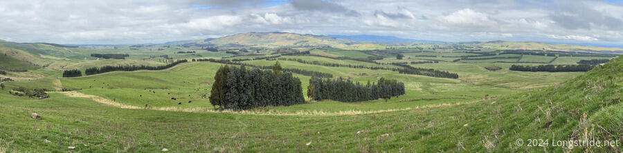
There actually was a fair amount of actually green grass today, instead of greenish-brown or brown grass. It wouldn’t surprise me if, as the trail starts to move away from the Southern Alps and towards the south coast, the trail moves out of the mountains’ rain shadow and towards getting rain blown in directly from over the ocean.

After following the Wairaki River downstream for half an hour, the road turned towards the river, depositing me at its side. Crossing the river, wider than it was yesterday, and only sock-height, I then waded through mud and marshland to get back to a road, which I then continued to follow downstream.
Unsurprisingly, there were a large number of gates and stiles on the farm roads, though most of the gates had been open. The gates all had “please use stile if gate is closed” signs, a departure from every other gate I’ve seen so far on the trail. Except for here, the rule had been to leave gates as you found them (and some gates explicitly said to keep them closed). I guess that here, it’s a matter of, if people don’t open the gates, they can’t get accidentally left open or improperly latched. But for the gates that were closed, it was annoying. The first such gate, I’d missed the trail going to the stile, because most of the stiles were right next to the gate, and this one was down a steep hill on an unmarked trail a short distance before the gate.
Later, the marked trail diverged from the official TA maps, which was somewhat irritating, because the trail notes had explicitly called out a prior trail relocation that was updated on the official TA maps but not on the base maps, and that care should be taken to follow the line in the official maps. Adding to the annoyance, the official map showed the trail following a farm road (with a wrong-way sign) that switchbacked up to the top of a hill, where the marked trail charged straight up the side of the hill along a fence line, in the grass.
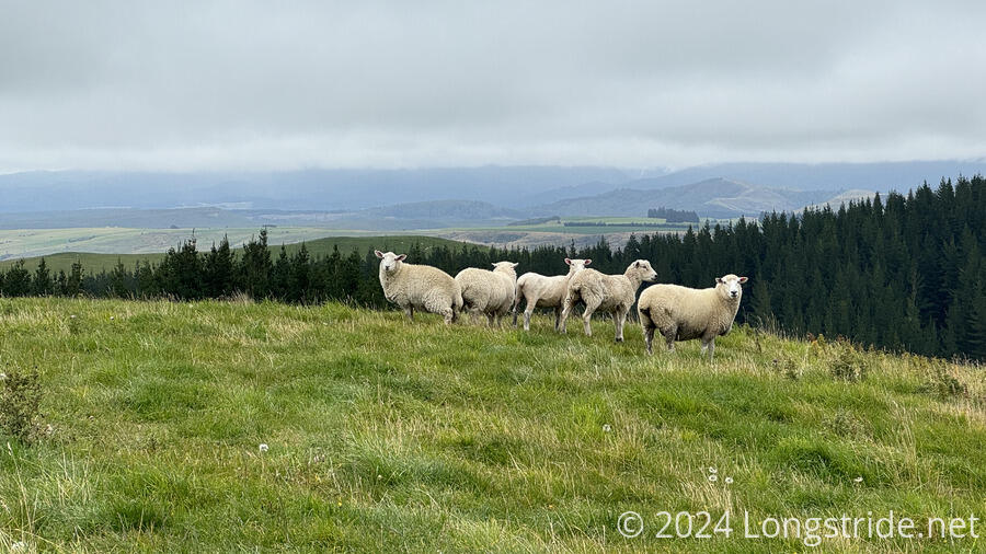
Just beyond the end of that climb, I was “rewarded” with a small group of sheep observing the valley below, one of the first really nice views of the day. I stopped for a break a little while later, on the side of a hill a fair distance from the sheep. (Finding a spot to sit down was a little challenging, though, thanks to all the sheep poop near the trail.)
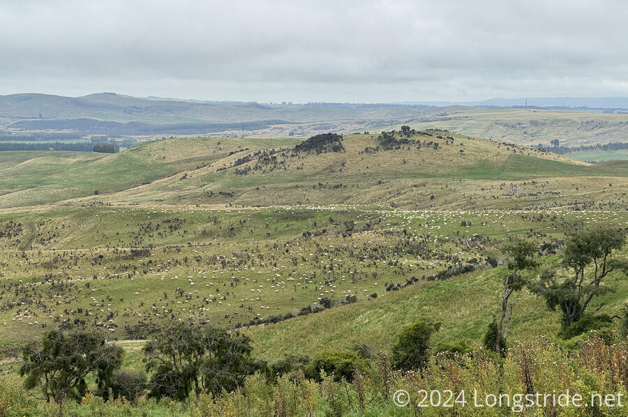
A little further on gave me a view of one of the largest herds of sheep I’ve ever seen, covering a significant portion of a hillside.
Beyond that, the trail turned off the farm road, following a trail past the edge of a pine plantation. Part of it had already been harvested, a brown scar on the land next to exotic pine trees. Up a hill alongside the pines, the trail brought me to a cow paddock, with cows standing right next to the stile in the pen. At least the cows near the stile moved when I started to climb over it, but there were plenty of cows sitting directly on the road I needed to follow, and they showed no signs of moving out of my way. So I went around them, on the side of a hill, through rough, uneven grass with deep hoof-shaped divots.
After I thought I’d gotten past all of the cows and was back on the road, the road took me around a steep hill to another group of cows, some of which were also on the road. These cows would have been quite difficult to go around, because of the steepness of the hill, and I was a little worried when I found myself between a calf and (presumably) its mother. Fortunately, the calf got out of my way and I was able to get away from them before there was any problem.
The road continued to follow the hillside for a while longer, before following paddock fence lines. Before dropping down a hill to a series of paddocks, I got once of the nicest views of the day. The clouds had started to clear and part, giving a little bit of blue sky and direct sunlight. If it had been like this all day, it would probably have felt a lot less monotonous.
After some more cow and sheep paddocks, the trail crossed a stream via a bridge. Crossing one more stile brought me to the trailhead on Struan Flat Road. A sign noted that the trail was exiting (or entering) farmland, and requested hikers to clean their boots and use the disinfectant in the “footbath provided”. If there really was a footbath, it was well-hidden by the overgrown grass at the trailhead.
Shortly before reaching the trailhead, I’d texted the Nightcaps Hotel to let them know I was near the trailhead. Not having received any response, I walked the short distance to the intersection at the end of Struan Flat Road, and waited, figuring that that was a more convenient place to get picked up. (And, get dropped off tomorrow, since the trail continues down the other road.) Just as I was about to sit down to have a snack, a truck from the hotel arrived, and about 15 minutes later, I was checked in and in my room.
The Nightcaps Hotel, under recently new ownership, includes a restaurant with a bar, though they only have kitchen staff on the weekends. Which is not surprising, since Nightcaps is a tiny town (it seems lucky to even have a Four Square). On other days, a house meal is available — whatever the family that owns (and lives in) the hotel is cooking for themselves. Tonight, it was roast beef, which was incredibly good. It may well had been one of the best meals I’ve had on trail.
After dinner, I went to the Four Square and did my resupply, four days (88 km) to Riverton. After taking a day to get there, the trail will go through the Longwood Forest, the last forest on the trail, and one of the muddiest. Depending on how the Longwoods go, this might be my last resupply.
While I was getting my resupply, another hiker arrived. We coordinated to arrange for an 8 am shuttle back to the trail tomorrow.