After 150 days and 3074.5 km of hiking (and also canoeing and cycling), I reached Bluff, the southern terminus of Te Araroa.
Today was, I think, the first time daylight saving time changed for me on the trail, shifting sunrise (and sunset) an hour “earlier” than it was yesterday. Of course, when your day is driven by sunrise and sunset, and not the clock, this doesn’t have much practical difference. Unless you’re in town, where the clock time actually is important.
CareFree and I started our day with breakfast at the cafe attached to Tuatara Lodge, which was pretty good; my last meal of the trail was pancakes and eggs, with hot chocolate and a berry smoothie.
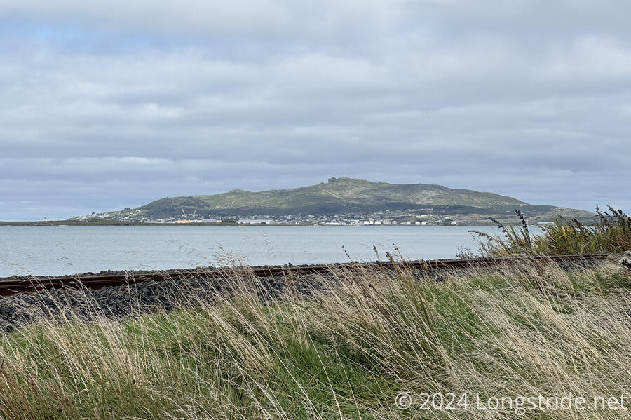
We set off from the lodge around 8:30, returning to the trail about 15 minutes later. Leaving the road that brought us into Invercargill, the trail joined Te Ara Taurapa, the Invercargill to Bluff Trail, a gravel cyclepath that took us along the estuary formed by the Waihōpai and Ōreti rivers. The sky was mostly overcast, though occasionally, small patches of blue made it through the clouds.
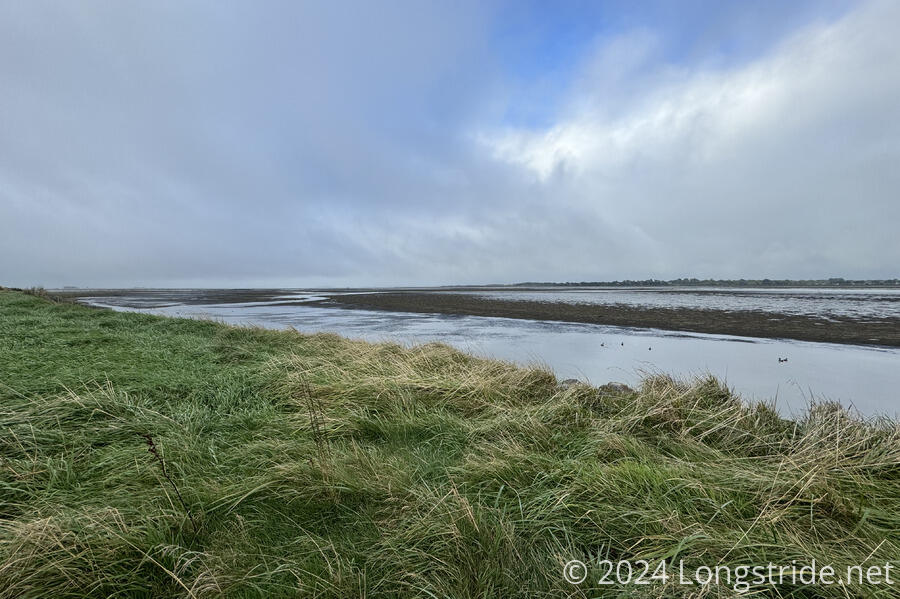
The cyclepath was completed and opened in 2021, and forms a vital link for Te Araroa. Before it opened, access between Invercargill and Bluff was along the shoulder of Highway 1. (Which, at least, is a nice bit of symmetry. Due to a trail closure near the northern terminus, we started the TA with a road walk along SH 1 on the first two days of the trail.) The cyclepath follows the estuary south for a while, before eventually cutting inland and following next to the shoulder of SH 1. CareFree was excited to walk this stretch: when she’d initially hiked the South Island in 2018, the trail was on the highway’s shoulder, and she hitched around much of this section.
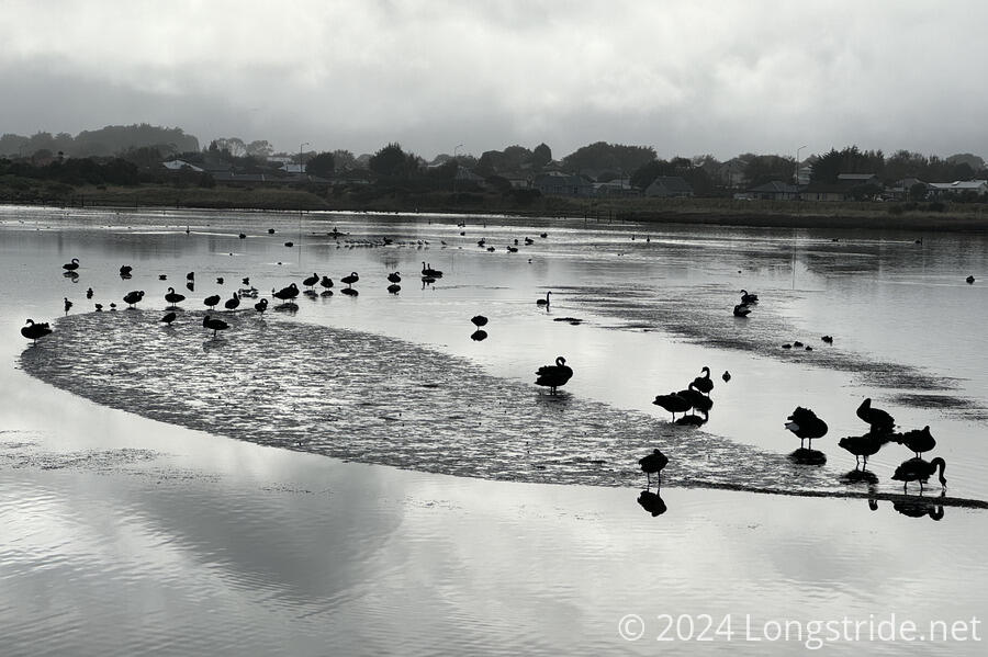
A small flock of black swans occupied a small lagoon partially formed by the narrow stretch of land the estuary portion of the trail followed. It took a bit of staring to determine if the swans actually were black, or if they just looked that way due to the direction of the sun and the overcast skies reflecting on the water.
After a little further, a sign next to the trail cautioned that the trail ran along Invercargill’s sewage treatment plant, with accompanying associated odors. The sign felt a little weird. Partially because most smelly sections of trail don’t have signs announcing that fact, but also because the odd wording on the sign suggested that the odors were explicitly “authorized” (instead of being an expected byproduct), and went out of its way to say that the sewage plant was a lawful operation (I would certainly hope so!).
After circling around the sewage treatment plant, and its odors, the trail gradually turned inland, leaving marshland for farmland. Ahead of us, we could see two other hikers, maybe a few minutes ahead, who were maintaining a pace just fast enough that we never really got closer to them. I wanted to catch up with them to see who they were, but we eventually lost them after we stopped for a break inside a bus shelter alongside SH 1, sheltered enough to keep us out of a light drizzle. We’d made good progress, getting more than a third of the way to the terminus in under two and a half hours.
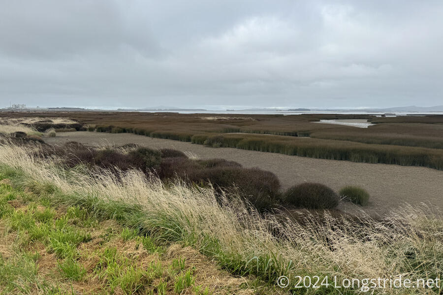
Another two hours on the cyclepath next to the road took us mostly along farms, a dairy processing facility, a small pond, and the occasional house, past the estuary and alongside Bluff Harbour.
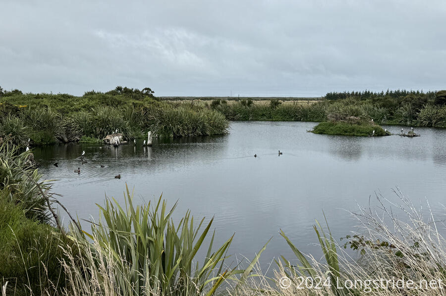
There wasn’t much to see in this stretch, save for the pond and a view towards Bluff once we reached Bluff Harbour.
We briefly stopped for a break at a gravel turn-off next to the road, possibly for access to the railroad tracks that ran between the cyclepath and the water. A little further ahead, we reached the outskirts of Bluff, marked with large rust-colored metal lettering. Distracted by the Bluff sign, we missed the obvious trail signs behind it, and continued down the road for two minutes before we realized our error.
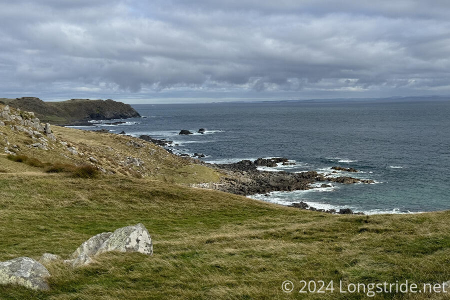
Going the correct way, taking the trail behind the sign, brought us into a farm, on the west side of The Bluff / Motupōhue, the hill that makes up the bulk of the roundish peninsula that borders Bluff Harbour to the south. This was fine, at first, but after crossing a few electric fences via stiles, the trail became another annoying farm walk that seemed to try and throw everything possible at us as the trail wound around the south end of The Bluff. Besides the electric fences and stiles, there were some tiny creeks and boggy areas, uneven terrain with large divots in the ground made by cows, and of course, cow patties and a small herd of cows (and a bull) standing directly on the trail.
After over 25 km of (granted, nearly flat) gravel walkway, the shift to a farm trail was both welcome and extremely exhausting, and I slowed significantly, especially when we had to detour around the cows that showed no interest in moving away from the trail. At least there was a nice view of the coast, with waves crashing high on the rocky shore, but I was very much ready to be done.
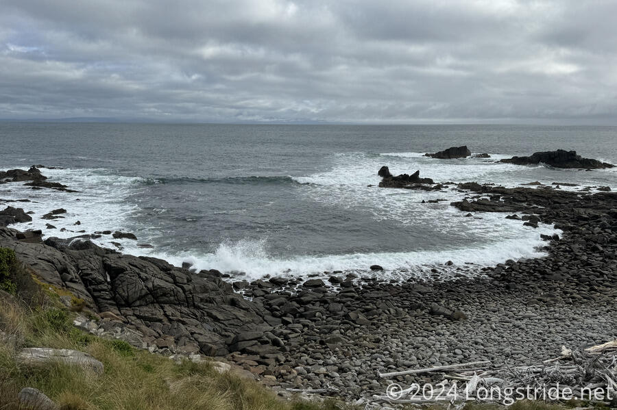
Bouncing up and down on the hills along the coast eventually led us out of the farmland and along nicer trail that cut through short bush, to the southernmost point on the TA, a picnic table at a trail junction near a viewpoint and memorial for people who died in a plane crash just off the coast in 1998. We stopped for a break. Tired as I was, we kept it short, since we still had a few more kilometers (and the bulk of the day’s elevation change) ahead of us, and sunset was just over two hours away.
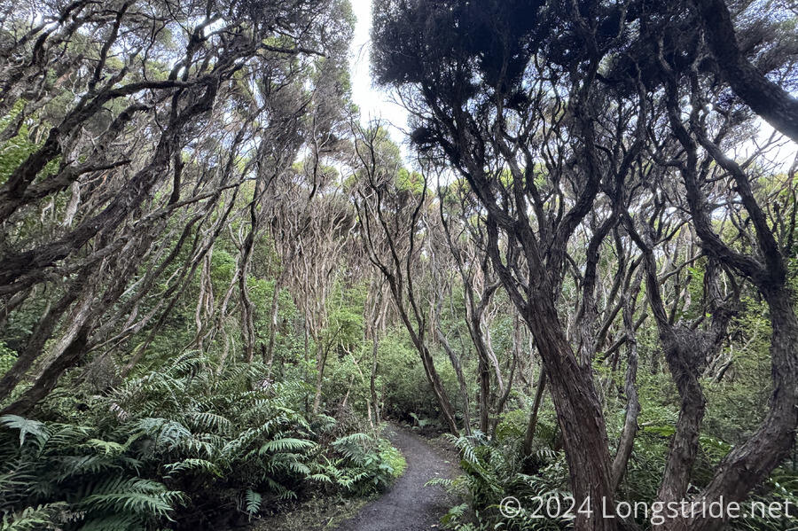
From the picnic table, on nearly immaculate trail, we climbed somewhat steeply up The Bluff to the hill’s summit. After a short while, the bushes turned into a very thick forest that covered the trail, nearly completely blocking the sky and turning the trail into a tunnel. With the sun hidden behind clouds and the trees, it was dark enough I had to take my sunglasses off in order to see well.
The break, excellent trail, and the imminent conclusion to the TA — the terminus was just under 4 km ahead — energized me, and I rocketed up the hill towards the summit of The Bluff. Given my lackluster performance through the farm, CareFree was surprised at how quickly I charged up the hill. She was even having difficulty keeping up!
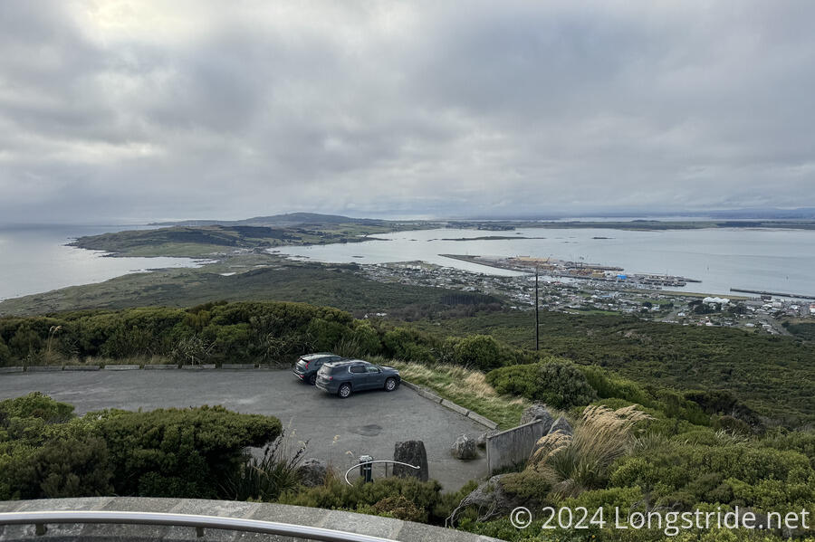
The trail exited the forest into a parking lot, and we took a short detour from the trail to circle our way up a concrete path to an observation tower at the summit. At the top, the last summit of the TA, there was a 360° panoramic view of the surrounding area, including the town of Bluff, Bluff Harbor, and the isthmus between Invercargill and Bluff.
We didn’t stay at the summit very long, since there were several other tourists already there, and we were itching to be done. Sunlight was ticking, and besides hiking down the east side of the hill to the terminus, we still needed to find a way back to Invercargill.
The hike down Bluff Hill was uneventful, and really, rather a blur. The trail left the forest, joining a road and going past a restaurant before emerging at Stirling Point. After 148 days, 23 hours, and 55 minutes of hiking across New Zealand, I reached the southern terminus of Te Araroa, a signpost with distance markers to many world cities, similar to the one at Cape Reinga 1,403 km away (as the crow flies). The trail, being somewhat circuitous, was 3,074.5 km, not including ferries and road detours.
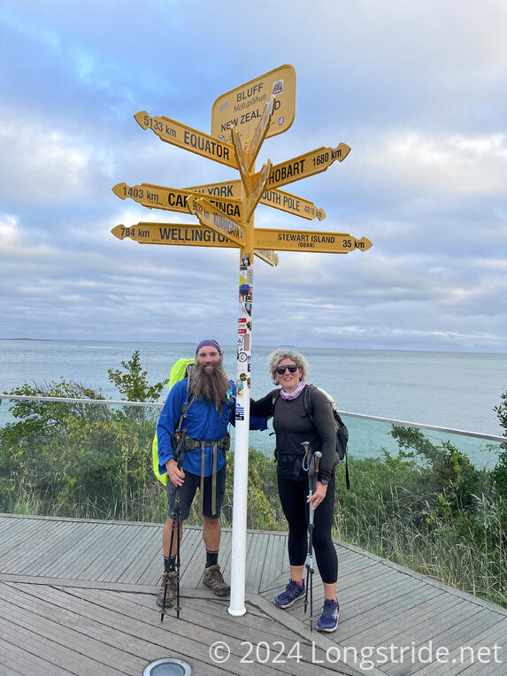
Stirling Point was a nice view, somewhat similar to Cape Reinga, except there were more tourists and one very, very tired hiker, almost too tired to really take in the view.
If it had been earlier in the day, and I really wish it had been, I would have liked to have sat down, taken in the view, and had the time to reflect on my journey across New Zealand. But nearly 35 km today (and 33 km yesterday) left me drained, and I was too tired to feel much of anything except relief that I was done and could rest now.
We still needed to get back to Invercargill, a half-hour drive from the terminus. Fortunately, one of the tourists there, an Israeli named Miki, was happy to give us a ride back, almost without us having to ask. We only spent about ten minutes at the terminus, one of the shortest times I’ve spent at the end of a trail. But it didn’t feel rushed, in the way our departure from the southern terminus of the North Island did.
Miki dropped us off outside the Tuatara Lodge. After showers, we again got dinner at BurgerFuel, and then turned in to bed early.
Te Araroa was over, and I was too exhausted to enjoy it.