The penultimate day on Te Araroa was a long walk along Oreti Beach, bookended with roadwalk in Riverton and Invercargill.
I woke up this morning to a drizzle. It had dissipated by the time I left the holiday park, but the dreary and overcast morning set the expectation of lousy weather for the rest of the day.
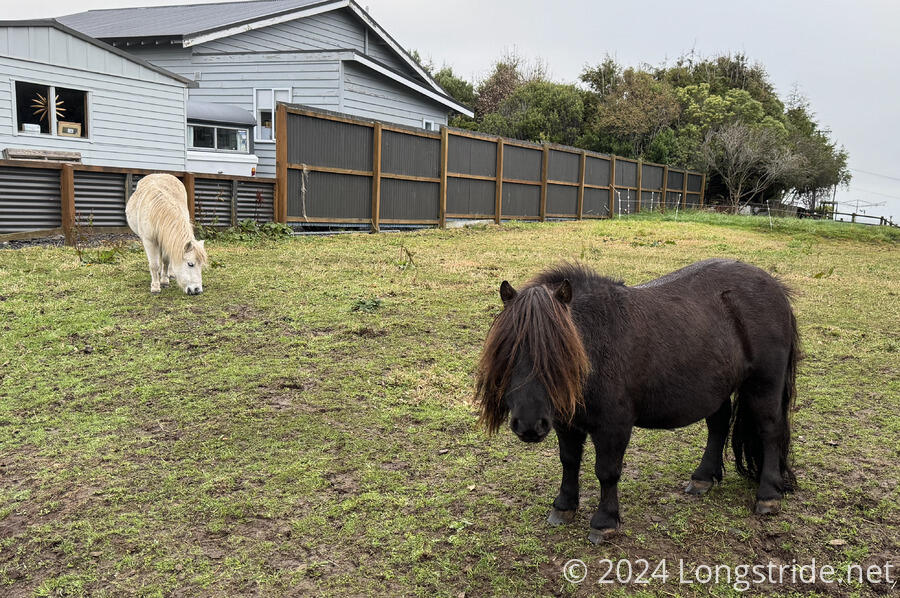
Continuing downhill on the gravel road I arrived on last night, I passed a house that had a pair of shaggy ponies. The more “emo” of the two had long bangs covering nearly its entire face.
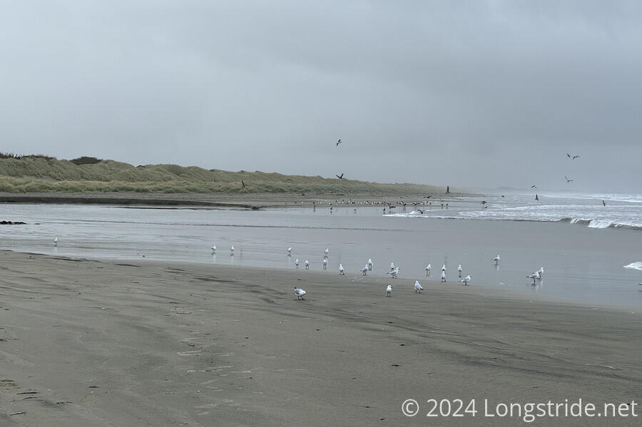
After a short walk through Riverton, the trail quickly reached Oreti Beach, which it followed for much of the rest of the day. Like Tihaka Beach yesterday, the sand was fairly hard and easy to walk on. And like yesterday, high tide wasn’t in my favor. About 14 km into the day, I would reach the Waimatuku Stream crossing, which is reportedly straightforward at low tide, and much more difficult at high tide. Assuming the beach continued to be easy to walk along, the math suggested I’d get there roughly around high tide. Which wouldn’t be great. But, that was a problem for future me to deal with, once I got there. Worst case, I could just take a break and wait out the tide a little while.
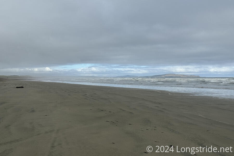
For much of the morning and early afternoon, it alternated between overcast and gloomy, and overcast, rainy, and gloomy. Fortunately, the rain never amounted to much more than a light drizzle, though I did eventually put on my rain jacket because the wind from the ocean breeze was starting to soak the seaward side of my shirt. The beach gradually shrunk as the tide came in, but was wide enough that the ocean didn’t run me off the beach like it did yesterday. I was lucky that it continued to be very easy to walk, even though the walkable area of the beach was shrinking.
Although today is a Saturday, there weren’t many people out on the beach in the morning and early afternoon, most likely because of the less-than-amazing weather. Early on, I passed a guy out walking his dog. Later, I passed a northbound hiker, which very much surprised me, as it’s getting to be quite late in the season. They said the stream crossing I was concerned about was only shin deep, but they’d timed it to get there about two or three hours before high tide. Unfortunately, I forgot to ask them where they crossed, and that’s usually important with estuary crossings.
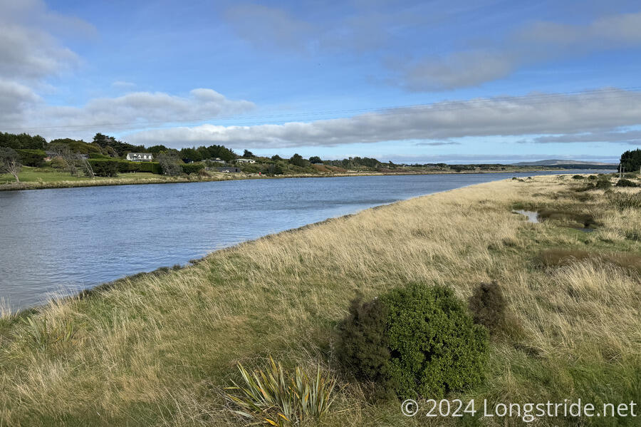
There were sea birds occasionally, but the largest groups tended to be at the estuaries. I think the most birds were around the large estuary that bisected Riverton, at the start of the beach. They’d mostly disappeared by a kilometer later, and then came back again as I crossed Taunamau Creek and Waimatuku Stream.
Wanting to kill time so as to get to Waimatuku Stream when the tide was on its way out, I took my time at the smaller Taunamau Creek crossing, taking off my boots and crossing the creek in my crocs. The extra time probably didn’t make that much of a difference in the tide when I did get to the larger crossing, but having dry boots and socks and feet for the whole day did help immeasurably. (Well, as dry as my boots could be, given they’d been soaked in creek crossings and mud the last few days and didn’t really dry out much last night.)
Once I got to Waimatuku Stream, maybe an hour and a half after high tide, I took my time to figure out the best crossing point. This crossing was a little challenging, only because the stream seemed to have a deep but narrow channel. Roughly about once every minute or two, the waves surged quite far up the channel, making the water much deeper. (Maybe fifty meters from the ocean, when the waves were going out, the channel was at least hip-deep, as indicated by my trekking poles getting in way too deep.) I eventually crossed much closer to the ocean, where it was “only” about as deep as the bottom of my pants, but I had to rush a bit to get across before another wave brought the water up to my hip. If I’d waited for the tide to go further out, I probably would have had a less deep crossing, but it was also raining, and I didn’t want to just be standing (or sitting) around in the rain. Once I got across, though, the rain stopped, so I also stopped for a break.
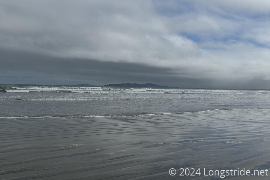
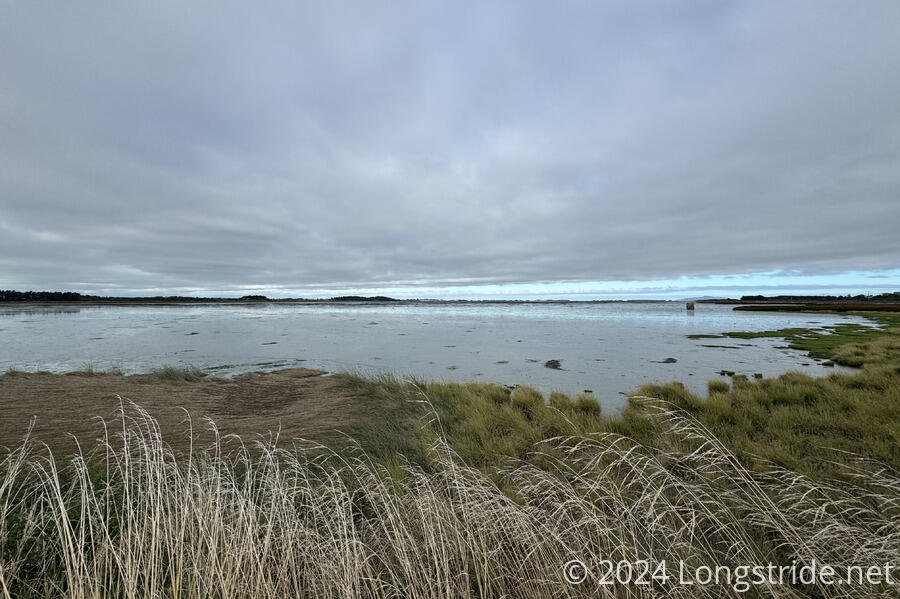
Afterwards, the weather started to clear a little bit, with some blue sky ahead. I was able to see Bluff ahead, and Stewart Island out in ocean. It was nice to finally be able to see something, because it was becoming very boring seeing nothing but beach, ocean, and grey clouds as far as the eye could see. Even the dunes were mostly featureless; along most of the beach ran a couple-meter-high wall of tussock, with little variation or landmarks, except when creeks burst through.
As the afternoon progressed, the sun started to come out more. Later in the early afternoon, as I drew closer to Invercargill, I started to see more people on the beach. Initially, another guy out running with his dog, then a pair of guys collecting seaweed off the beach. Later, there were more people, and more cars, especially as I got closer to the main road to and from the beach.
I left the beach on that road, initially gravel, then paved, turning east towards Invercargill. After a while, I noticed there was a walkway just off the road, but traffic on the road was low and it had a wide enough shoulder that I didn’t feel the need to expend the additional effort to move to the walkway, which was a bit more curvy than the road.
A bridge over the Ōreti River brought me to Otatara, a suburb of Invercargill. It was possibly the nicest part of the day, from a weather standpoint, though I can’t say the walk along the main road of a slightly ritzy community was more stimulating than the featureless walk along the beach earlier in the day. At least there was a Four Square, and I stopped for a brief snack, soda, ice cream, and a meat pie. (By this point, I was nearly completely out of food; all I had left were two packets of ramen, which weren’t going to be of use at the moment.)
Further along the road brought me past the Invercargill Airport, a small one-runway affair, and across a bridge over the Waihopai River, which emptied into a marshland formed between the Ōreti and Waihopai Rivers and the Tasman Sea. Along the way, two cyclists stopped to congratulate me on being nearly finished. One of them, who had done the TA cycle route last year, said the weather forecast tomorrow should be good. I doubted that, given what I’d seen when I’d looked at the weather forecast this morning, but I was willing to be temporarily optimistic about it.
Between the wetland and the road, a recently-completed upgrade to the stopbank along the marshland was bookended with an art display reminiscent of a canoe and oars, and also raised the trail a bit above the traffic. I was a little disappointed that the artwork only extended a few meters from either side of the end of the stopbank, leaving featureless sheet metal and a wall that was hard to see over blocking the view of the marsh.
Passing the end of the stopbank brought me into Invercargill proper, and I departed the trail to head to my lodging for the evening, the Tuatara Lodge. CareFree arranged for us to stay here for three nights.
Despite a long walk today — 33 km from Riverton, plus another kilometer from the trail to the lodge — I got there an hour before CareFree did. (Fortunately, we realized this was likely to happen earlier in the day, and she arranged for them to let me check in if I got there before her.)
I was pretty exhausted from the long walk, which also probably had the least amount of elevation change in a day since somewhere on the North Island, and it took about an hour of relaxing in our room before I had the energy to get a shower. We grabbed dinner at a nearby BurgerFuel, and then snacks for tomorrow at a convenience store.
Tomorrow, another long and mostly flat day will take me to the southern terminus of Te Araroa, Stirling Point, on the outskirts of Bluff. It’s been a long, tiring, incredible journey across New Zealand, and tomorrow will mark its conclusion.