With forest and mountains behind me, Te Araroa begins following the south coast of the South Island.
I didn’t sleep well overnight, and accidentally turned off my alarm instead of snoozing it when it went off, so I slept in an hour longer than planned, and didn’t get up until almost 8 am. After having been raining for most of the evening, the rain had finally started tapering off around then, and when I left Turnbull’s Hut a bit after 9, it seemed as though the clouds might clear and there’d be blue sky.
That turned out to be wishful thinking. The sky darkened for a little while, and the clouds came back, though at least it didn’t rain any more.
Continuing down the mountain, through the forest was slow going. As expected, the rain overnight left mud pits all over the place, though they generally weren’t as deep as the ones yesterday, and I was able to get around them without getting my feet too wet.
I had the thought that there didn’t seem to be many of the vines that were a common feature in North Island forests. I couldn’t recall seeing many vines in any of the South Island forests I’d hiked through, including the Longwoods. Naturally, shortly after, I started seeing more vines. But clearly, vines are much more likely to be present in native forests than in plantations.
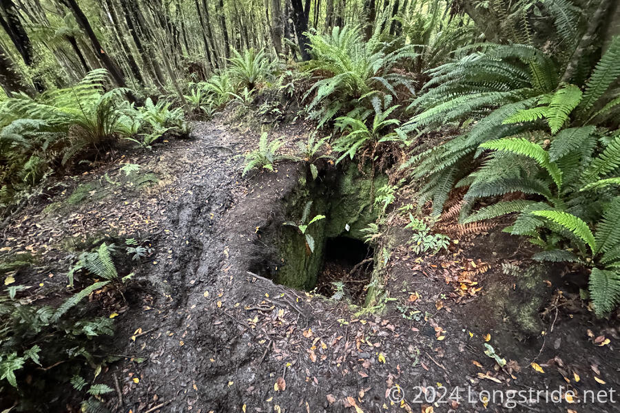
The trail, following Turnbulls Track, continued to follow a water race. As I got closer to the end of the forest, other evidence of past mining activity appeared, including old mine shafts. The mine shafts helped show why the forest was so muddy: the dirt was just a thin layer atop rock, making it hard for water in the soil to drain away.
After nearly four hours, the trail crossed two bridges and the mud nearly immediately disappeared. Near a parking lot, this section of trail was maintained to a much higher standard, and had a number of signs explaining the mining history of the area. At the exit to the parking lot, I saw my first official trail sign with distance to Bluff: 88.7 km (estimated to take 28 hours).
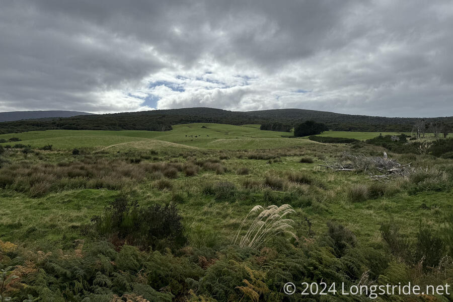
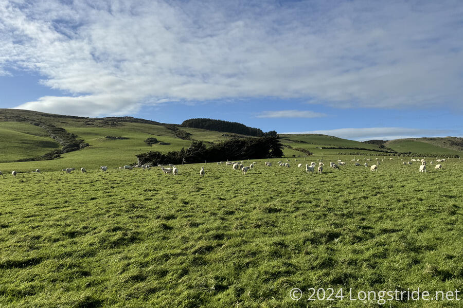
I stopped for a break in the parking lot, then continued on, following a short dirt road, and then the paved Highway 99. For a while, I had a view back to the Longwoods, and the sheep and cattle farms beyond the forest.
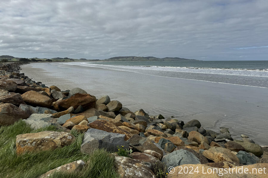
Turning off the highway, I followed a road to Colac Bay and Tihaka Beach. After initially following a road paralleling the beach, the trail continued past the road end onto the beach, beginning my first beach walk on the South Island. Like most of the other beaches on the North Island, there was a good stretch of the beach where the sand was damp and easy to walk on, though high tide was approaching, and the easy-to-walk section of beach rapidly shrunk. Once the incoming tide caught me by surprise and drenched my feet, I left the beach, climbing up to the actual trail, on the dunes that ran along the edge of the beach.
Now in late afternoon, with still quite a distance to hike, I called on my partner — now in Dunedin on the east coast and on her way to meet up with me in Invercargill tomorrow — to find me a place to stay in Riverton. Very quickly, CareFree found me a place at the Riverton Holiday Park, on the outskirts of Riverton on the way into town.
Even though I was a short distance off the beach, the roar of the ocean was still quite loud. A good breeze blew in from the ocean, and the waves continued to crash loudly against the beach. Off the coast, Stewart Island was barely visible, shrouded in clouds.
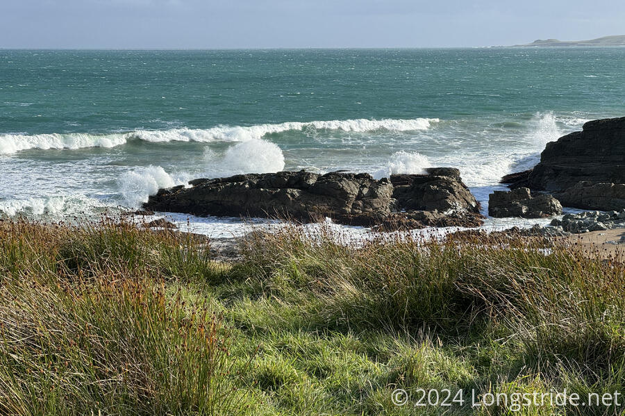
The trail eventually left the beach, climbing up and down along the cliffs adjacent to farmland (mostly sheep, but some cattle as well). This was a much rockier section of the coast, with outcrops dividing up the beach into smaller sections, and rock formations in the water, now mostly submerged at high tide, caused the waves to break and splash high in the air.
The constant up and down (along with the loose rocky gravel on the edge of the beach between climbs) was slow and tiring, but the trail eventually left the beach for good, going through lush green sheep pastures. (Some of these were fenced in for deer, which much higher fences than would be required for sheep.)
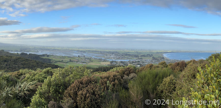
The trail eventually left the sheep paddock, entering forest in the Moores Scenic Reserve, climbing steeply up and over a hill on fantastic well-maintained trail. A short spur took me to a viewing platform at the top of a hill, giving good views of both the ocean, and towards Riverton and Oreti Beach, which will form the bulk of tomorrow’s hike.
On the other side of the hill, the trail quickly reached a car park, and I followed a gravel road downhill to the Riverton Holiday Park. I’d initially hoped for lodging closer to town, since I wanted to do a tiny resupply since I’m very nearly out of food, but I got to the holiday park only about half an hour before sunset, quite ready to be done with the day. Any resupply could wait until tomorrow morning.
I quickly got checked in and shown to my room, an old Caravan RV trailer. Although it had the equipment for water and a stove, it had no water or gas access, though that was fine since it was located close to the restrooms and kitchen and lounge.
The trailer also had a heater, which kept it nice and cosy, and also got my socks dried out. It’ll be great to start tomorrow with dry socks, though there’s at least a few creek crossings tomorrow along Oreti Beach that’ll probably get everything soaked again.
My first order of business was a shower — my legs and hands were still quite dirty from all of the mud yesterday and this morning — followed by dinner. (Any time I had to touch my boots, which was often since the mud-covered laces refused to stay tied, I’d get more mud on my hands.) I’d run out of tuna to add to my ramen, since there weren’t any tuna sachets at the Nightcaps Four Square, but I’ll survive a slightly smaller dinner since I’ll be in Invercargill tomorrow night. From here, it’s just two more days to the end of the trail.