A road walk took me into the infamously muddy Longwood Forest, from where I got my first view towards Bluff and the southern coast of the South Island.
Some fog this morning quickly lifted, but it was largely cloudy or overcast the rest of the day. Before leaving the hut, another hiker arrived, confirming our suspicion yesterday that everyone else I’d expected to see yesterday had gone into Otautau for resupply.
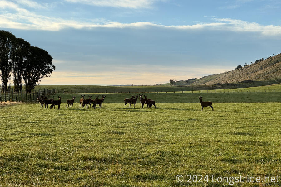
From Merriview Hut, I continued south on Merrivale Road, a gradual incline past several deer farms to the Longwood Forest.
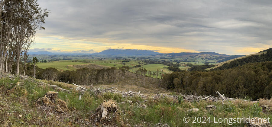
Initially, the road went past a partially logged pine plantation, before entering a eucalyptus forest. Wind picked up, though the forest functioned as an effective shield. As I got further up the road, it gradually degraded, getting more rutted and muddy, with several small trees having fallen and blocking the way. Further along the road, the eucalyptus forest eventually transitioned to native forest.
I stopped for a break after about 8.5 km, at the end of the road and start of the Longwood Forest Track. A bit of an open area for parking, with somewhat soggy ground, it was less sheltered from the wind, and I was briefly concerned I’d have to put my fleece back on to stay warm.
Leaving the road and entering the Longwoods Conservation Area, a signed warned that the area is part of an old mining area, and if leaving the track, to beware of hidden mine shafts and eroded water races. Once upon a time, this area used to have a significant gold mining operation, though that long ago dried up.
At the entrance to the conservation area, a sign suggested it would take nine hours to hike to Martins Hut, the next hut on the trail. Though I’d made fast progress along the road, I’d had a little bit of a later start than I wanted, and sunrise is already after 8 am. Now 11 am, nine hours of hiking would put me at the hut after sunset, and quite possibly much later than that since the cold I felt I was coming down with last night sapped my energy. Eventually, I decided that it was not feasible to hike all the way to Martins Hut, and instead decided to aim for a reported campsite on the other side of Bald Hill, on the road down from the summit, near a stream.
That decision made it easier for me to take my time going through the forest. Rather than feeling the need to rush through the mud and standing water on the trail, I instead did my best to avoid getting my feet wet or muddy at all, taking advantage of the many short side trails around the mud. This was, of course, slow, tiring, and time-consuming, but it did keep my feet fairly dry, which helped morale on a day when I didn’t really feel all that great.
I made slow, but steady progress as the trail climbed to the summit of Bald Hill. Being bald, the summit area made for an ideal place to put a few antennas and comms gear. I took a short detour from the trail to tag the actual summit, and then continued down the gravel access road away from Bald Hill.
The bald summit area provided my first view towards the South Island’s south coast. From there, I could see Stewart Island / Rakiura, and several other smaller islands peppered in the ocean off the coast. More importantly, I could see Bluff Hill, on the peninsula containing the southern terminus of Te Araroa. If I can meet my planned schedule (complicated by not making it all the way to Martins Hut today), I’ll be there in just four days.
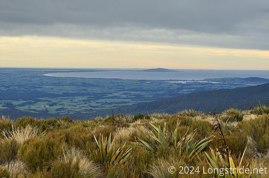
Being able to see the end of the trail instantly improved my mood. It was hard to recall another time I’d been so elated by being able to see something ahead, probably because none of the other trails I’ve hiked have provided an early glimpse of the terminus, save for the Appalachian Trail.
I walked down the road for a couple of kilometers, to the place I’d intended to camp. Unfortunately, a truck was parked there, and there wasn’t really room to set my tent up and allow for them to leave without driving over my tent. I stopped for a snack break there so that I could filter water from a nearby stream, and decided to push on, stopping at the next reasonable place to camp.
That was at a parking area just before an old quarry. The quarry itself looked flat and reasonable, but was fairly open and exposed, and there were lots of tire tracks around a rusted out old car in the middle of the area. The parking area just before, though, was up a couple of meters from the road on a berm, which meant that if it rained overnight (which I was expecting), my tent would probably not get flooded out. And, it was right up against forest, so I had wind protection from at least one side.
Tired, it took me a while to actually get my tent up, but once it was, I was able to lay down and relax. A light rain briefly fell shortly after my tent was up, but it stopped long before I started to cook dinner. Over the next few hours, a few trucks passed going either way on the road, often honking and waving at me as they went past.
The weather forecast is calling for a light rain overnight, and randomly throughout the day tomorrow, which is not going to be great. The worst part of the mud in Longwoods is in the saddle between the next two mountains, Little Baldy and Longwood, and however it might be today, after a few days of no rain, it’s only going to be worse tomorrow.
CareFree and I also have tentatively planned to extend the hike past Bluff, including some trail on Stewart Island as a “cooldown”, since the island is supposed to be very beautiful, and there’s a good chance to see kiwis, which I have not yet seen in New Zealand. The weather forecast when we might be there is looking particularly horrible, with lots of rain. But, that’s a later problem. All I need to do for right now is focus on making it out of the Longwoods, and on to Bluff.