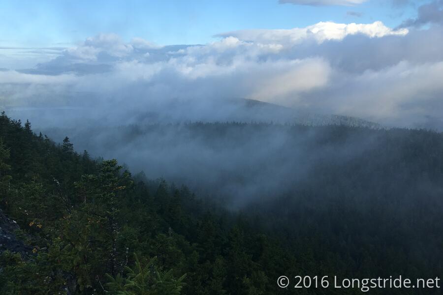
I left the shelter shortly before 7, hoping to make it 20.7 miles today to the East Branch Lean-to. The day, of course, got off to a rocky start, as the trail continued across the ridge of Chairback Mountain. Reaching the exposed summit, a strong breeze blew clouds between and over the next mountain to the (compass) north, and it was fairly clear I’d be going over that mountain shortly.
The final descent off Chairback Mountain was difficult, both because it was steep and rocky, but also because of the blazes: a sign pointing to trail north appeared to be pointing down the mountain, when the trail actually turned left, and three different SOBO blazes made it difficult to tell where it was intended for the trail to go. After a slight detour in the wrong direction, the different angle I viewed the blazes at made it clear where the trail intended to go, and I was able to get back on track.
As expected, from the ridge of the next mountain, I was able to see where I had just hiked, now that the clouds had cleared off. Once the trail started to descend that mountain, it became a lot easier, especially upon crossing Katahdin Ironworks Rd. I stopped for a break shortly before fording the West Branch of the Pleasant River, after about 4.5 miles, collecting the water I’d need for the rest of the day.
After crossing the river, I took another break, as I chatted some more with Mothly Stud, and Monarch (who hikes incredibly fast). Mothly Stud again was giving away food to lighten his pack; this time, I got some doughnut holes.
After crossing the river, the trail became incredibly nice, with a gradual climb up Gulf Hagas Mountain. The trail, wide, soft, and obstacle-free, was clearly very well maintained here, and obviously heavily used by locals.
After another five miles at a very nice pace, I took my second break at the Carl A. Newhall Lean-to.
After a steep climb after the shelter to the summits of Gulf Hagas Mountain, West Peak, and Hay Mountain, a combination of speed and rocks caused me to slip and fall, slamming the side of my leg into the rock. After sitting to rest for five or six minutes, I kept going, but stopped after a quarter of a mile, deciding that this would be a good time to actually take a break.
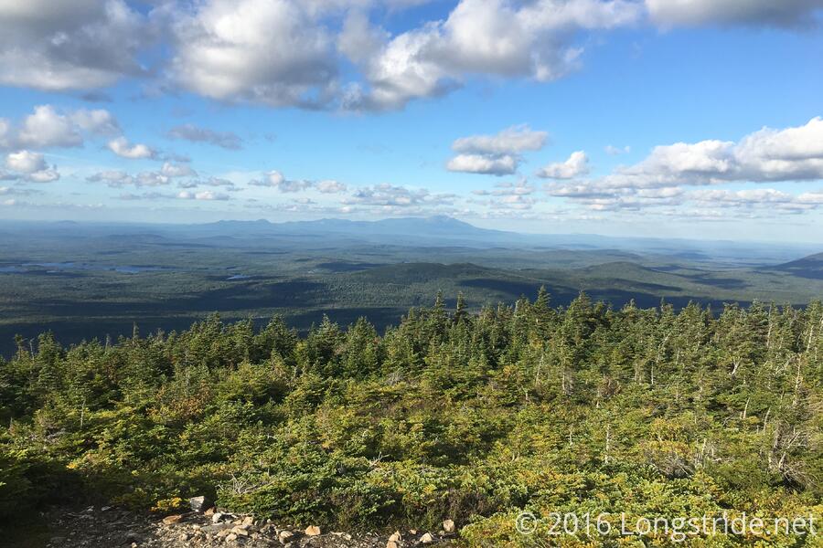
Continuing from there, I summited White Cap Mountain; the climb to the summit being slow only because it was steep.
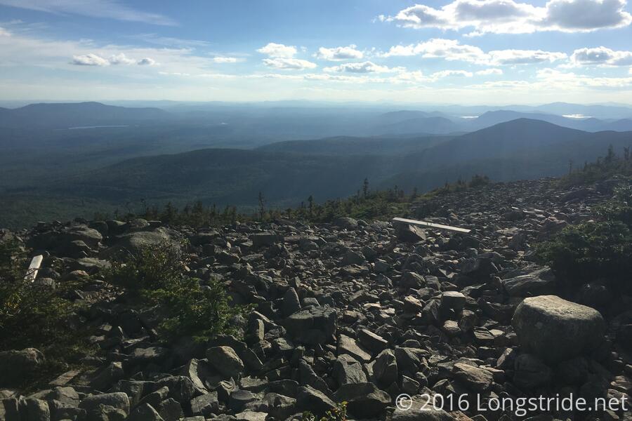
White Cap, apparently named because of the exposed white rocks at its summit, offered a short side trail at its summit to the north face of the mountain. This provided my first view of Katahdin, 73 trail miles away, but only about 30 as the crow flies.
The rocks made descending White Cap slow, but I made it to the Logan Brook Lean-to, 17.1 miles from where I started, shortly after 6 pm. Since I was clearly not going to get to the East Branch Lean-to today, I stopped here, at a very crowded shelter and campsite. This is a little bit of catch-up from where I ended yesterday, but it’s still behind where I wanted to be. Still, if I leave early enough tomorrow, and if the trail is as nice as the elevation profile makes it seem, I just may get to my food drop on-time.