Three tidal estuary crossings and half a beach brought us to an old camp on a farm.
We had a pretty relaxing morning, and decided to leave for the Horahora River an hour early, giving us a chance to stop for a break there and evaluate the water level in case we might be able to cross earlier.
Leaving James’ place via a surprisingly steep driveway, we reached the edge of his property, with a sign for the TA pointing down his driveway, and also a sign reading “Private Property. Entry by prior arrangement only.”. With the major trails I’ve hiked in the US predominately on public land, or else on an easement on private land, it seems weird on the TA that the trail is routed through areas with this sort of restriction. But, it does seem to allow for a more interesting trail.
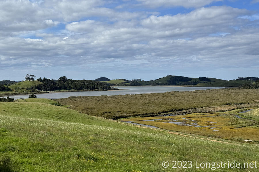
The route along gravel and dirt road to the Horahora River was mostly nothing spectacular, but there was a nice view towards some wetland near the river.

It was mostly overcast during our walk to the river, but the sun briefly came out, and we momentarily regretted leaving as early as we had; half an hour later would still have been plenty of time, with less sun exposure. But the sun didn’t stay out too long, so it wasn’t really much of an issue.
We waited for about an hour before crossing, during which time we could readily see the river level dropping. Chris waded across first without his pack, confirming the route James told us.

I crossed barefoot, which was uncomfortable on the shelly river bottom. I’d have preferred to use my crocs, but knowing that there was a muddy mangrove swamp at the other end of the river made me not want to use them, at risk of getting them muddy also (or worse, losing them in the mud). In retrospect, I should have worn them for the river crossing, and then taken them off for the swamp walk.
The swamp — full of smelly black mud — was about 500 meters long. It was kind of gross to walk through, but my feet weren’t as badly caked with mud at the end as I was expecting. I wound up with a few small cuts on my toes, but fortunately, we had some antiseptic that I was able to rub on my feet after I cleaned the mud off. (That still took longer than I wanted, though.)
Another hour and a half along paved roads was largely uneventful. We had some more views of the ocean; we passed a cafe that had closed 15 minutes earlier; we passed a nice public toilet. CareFree found a 5000 Vietnamese Dong bill on the side of the road, and then discarded it, deeming it essentially worthless. I teased that she could have bought a cup of coffee if she ever went to Vietnam. (I later looked it up; 5000 VND is worth about NZD $0.34, and can buy a pack of instant noodles or two bananas in Vietnam.)
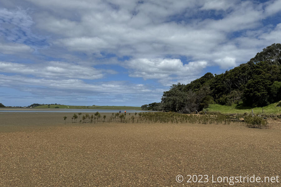
Reaching the Taiharuru River, we started with our boots on, since the ground looked firm enough. The tide was sufficiently out that we got a good start, however, after going around a muddy area near some mangroves with limited clearance from the water, we stopped to take our shoes off. This time, I wore my Crocs, but when I attached my boots to my pack, I apparently didn’t do a good job on one of them, and one of my boots fell off. Fortunately, a likely disaster was averted; Jess noticed this, and picked up my boot, giving it back to me a short while later when I stopped to adjust my crocs. (She’d apparently called out, but I unfortunately couldn’t hear her over the sound of crunching seashells under my feet.)
The mangrove swamp on the south end of the river initially seemed easier (or rather, less muddy) than the one on the Horahora. I charged through fairly well with my Crocs, but at the exit to the swamp, the mud suddenly got much deeper and thicker, and on the very last step to get out, the mud pulled one of them off. Not willing to lose a shoe (which had been a birthday present from CareFree), I had to go fishing for it with my hands. By the time I made it out of the swamp and up a short rocky climb to a grassy hill, I now had two very muddy feet, two muddy hands, mud-caked cuffs on my shirt, a pair of crocs carrying three times their weight in mud, and nearly-completely mud-covered trekking poles. It was (at the time) really not fun.
After taking another break to clean my hands and feet well enough to continue, we followed a path through a pasture out to a paved road.
An exhausting climb up the paved, then gravel, road, past some houses with an incredible view back to the Taiharuru and the Pacific Ocean.
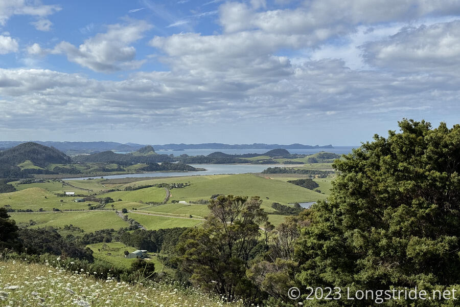
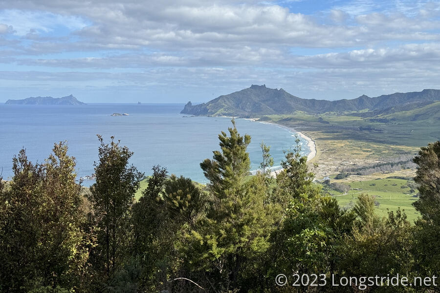
The road gave way to a nice (but still steep) trail in forest, taking us up Kauri Mountain, with a wooden observation platform and bench at the top. From there, we could see Ocean Beach, the next beach we’ll cross. Beyond that is Bream Head, a ridge we’ll hike up to and along tomorrow. We stopped for a brief snack.
The trail turned back into gravel road, and as we crossed a nice creek, we began to discuss what to do about camping. The two main obstacles ahead were another tidal creek, and a beach that was disappearing with the tide. We had two options: pause and collect water, which might delay us long enough to not be able to cross the tidal creek ahead (or else hamper our movement on a diminishing beach), or just push on and hope we’d make it through fast enough.
We opted to push on, and after a slightly steep drop down to Ocean Beach, quickly reached the creek we needed to cross. It wasn’t too deep — yet. After taking our boots off, we made short work of the crossing, though Peter and I got hit by an untimely wave pulsing up the creek that nearly got our pants wet.
The beach was somewhat annoying to hike. Unlike Ninety Mile Beach, the sand was not particularly easy to hike on, since the tide had come in enough to cover the hard packed sand, leaving us only rough soft sand to walk on. CareFree commented that if Ninety Mile Beach had been this tough, she wouldn’t have made it all the way down its length.
Fortunately, we only had about 3 km of beach to walk, before we climbed up onto the dunes and followed a tight and overgrown trail to Jagger’s Camp, a somewhat run-down camp attached to a farm. The koha (donation) camp had a few flat areas for tenting, six small cabins, showers, toilets, and a cooking barn with some small gas stoves, tables, seating areas, and running water.
CareFree and I quickly set up our tent, letting a few new-to-us hikers clear out of the cooking area so we could have a more quiet dinner with Peter and Susanna.
Because of our late start, it had been a late (though not especially long) day, and we were tired.