After continuing along Ocean Beach, we traversed the Bream Head ridge, arriving at Whangarei Harbour, ready to cross on a ferry tomorrow.
CareFree and I woke up a bit earlier than we’d planned, thanks to a couple of really loud and annoying birds that started chirping around 5:30 am, half an hour before sunrise.
We got off to a good start; despite camping on a grassy field, our tent was remarkably dry, which made it a lot easier to pack up.
We scheduled our ferry for tomorrow to cross Whangarei Harbour with Blair. Initially, we’d asked for 11 am, since that’s when we thought he would first be available, but he proposed 8 am. This was perfect, given we’d be camping about a two minute walk from where his ferry departs, and would prevent another late start.
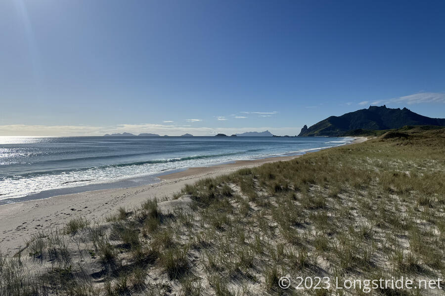
We walked back to Ocean Beach, and continued south, again near high tide, giving us a strenuous, but steady pace down the beach.
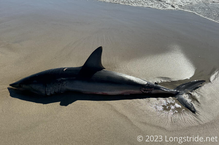
About half an hour down the beach, we came across a dead shark, about two meters long, that had washed up. It had a few small wounds and a large bite mark near its tail that was presumably its primary cause of death.
About two thirds of the way down the beach, the trail climbed an extremely steep dune. Though anchored a bit with some grasses, the sand eroded away with every step. Fortunately, there were also good handholds, in the form of grasses and roots and woody stems of a few trees. It’s hard to see how a trail even exists here one a few people climb it, but we were able to make it work.
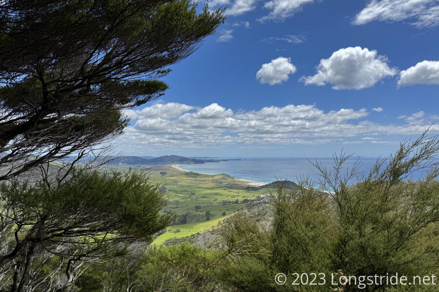
At the end of the beach, a more firm but steeper trail began the climb up Bream Head, and CareFree and I stopped for a break at a small flat area on a shoulder that afforded a great view of the surrounding area. Peter and Susanna continued on.
We had a quite nice break before continuing on, resuming our slow, steep climb up Bream Head. As we got higher, we got a glimpse of an oil refinery across Whangarei Harbour, which we’ll pass by tomorrow. The trail was fairly nice, though once it entered forest it became a bit more rocky and rooty, with some occasional stairs. Just before that, the trail passed the remains of a World War II radar station.
The climb was slow and tiring, but the trail stopped just short of summiting Bream Head, itself a jagged rock outcrop down a short side trail that required more climbing than I was willing to crest.
We continued downhill for a short while, somewhat steeply with a few staircases, before trail leveled out for a while. We stopped for a break at a well-placed bench with a view.
We continued on, making another steep climb up Mt. Lion, which the trail actually did summit. We caught up with Peter and Susanna just finishing their break at the summit. Almost immediately on the way down, an extremely long run of staircases followed; CareFree counted well over 1000 stairs, easily the longest staircase I’ve ever descended. They were well-built, though, and it was not difficult to maintain a steady descent.
We emerged from the forest, and stopped momentarily to comment on how ridiculous the stairs were, when I spotted a bench a little further down the hill and moved quickly to get there to sit down.
The bench we stopped at was at a trail crossing, and we followed the other trail down to a trailhead that ended at a parking lot and toilets.
From there, we followed a paved road around Calliope Bay. The bay itself didn’t look very enticing, especially with the oil refinery in the distance.
Along the road, a school bus stopped and offered to give us a ride. CareFree especially was tempted, because this wasn’t a particularly fun road walk — the scenery wasn’t great, especially further on once it departed from the shore. We’d also missed a general store that had ice cream, and we were really looking forward to that.
We again caught up with Peter and Susanna at a fork in the trail. They opted to continue on the official trail, while we took a detour, going the opposite way around Mount Aubrey, a mountain on a small peninsula into Whangarei Harbour, so that we could go past a restaurant to get ice cream.
The cafe we were looking for was closed, but next door was a Fish and Chips restaurant, so we got our ice cream, as well as cheeseburgers.
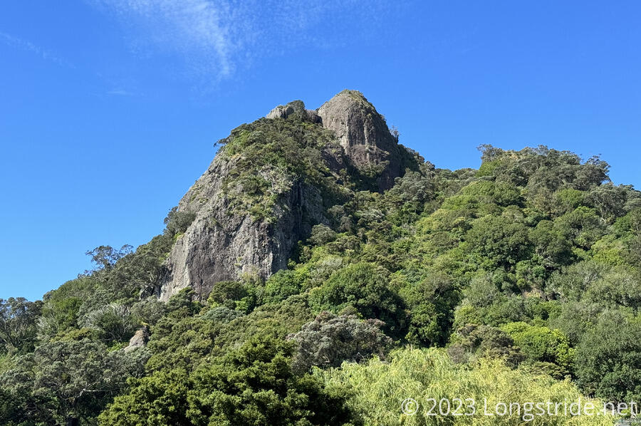
The mountain the trail (and our alternate) went around had rock spires reminiscent of some rather incredible spires we saw in La Gomera in the Canary Islands. These weren’t quite so impressive, but it was scenery I haven’t yet seen in New Zealand.
We arrived at the Reotahi Bay campsite shortly after 5. Having already had dinner, camp was relatively low-effort; we just needed to set up our tent. I took full advantage of a restroom with running water to finally get my Crocs cleaned off after yesterday’s swamp mishap.
By evening, our little bubble was all here: Peter and Susanna, Jess and Chris (who’d stopped early yesterday and hiked over 30 km today to get here), and Martin.
Thanks to the long, steep ascents and descents, today was one of our most tiring days so far. It was also second-shortest so far, behind the roadwalk from Ahipara to Kaitaia.
With CareFree getting off the trail tomorrow, we tried to do a bit more planning for where she would come back, but that’s still very much up in the air, depending on how long she has to remain in Auckland, and how quickly I progress. The weather forecast for next week is not looking amazing, either, with rain forecast for several days. But, we’ll figure it out…


