On a rainy day, we completed the Timber Trail, arriving at a campsite in Ongarue.
We had a good choice of campsite last night. The nearby meadow, which became occupied by several other hikers and bikepackers, wound up fairly soggy from the rain overnight. The improvised tarp-tent our car camping neighbors built last night was heavily sagging, due to collecting a night’s worth of rainwater, but was somehow still standing.
We left our campsite, in a drizzle, a bit after 7, returning to the Timber Trail and speeding along. In contrast to the trail yesterday, the track here was not as well-drained, and had running water and small puddles that needed avoiding.
Half an hour after we started, and passed the campground where one of the cycling tour operators was based from (and where we would have stayed had we decided to rent bikes, rather than walk the Timber Trail), a sign notified us that the next exit was Ongarue, in 42 km. Not that we really had any other choice; of course we had to go forward.
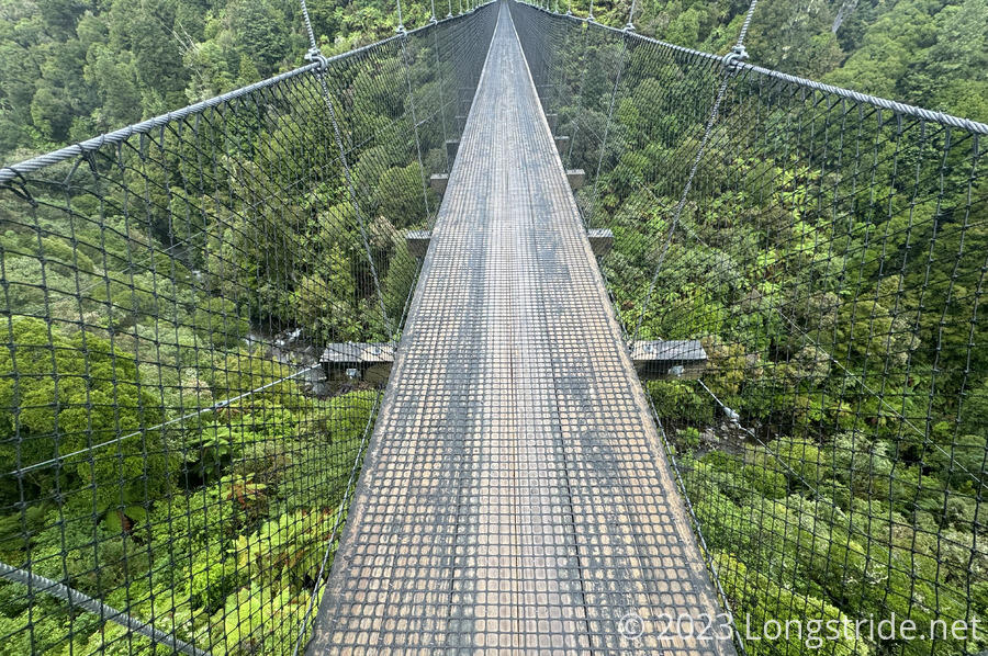
We crossed a suspension bridge over Maramataha Stream. At 141 meters long, and 53 meters above the stream, it is the longest suspension bridge on the Timber Trail, and also, the longest suspension bridge the DOC is responsible for.

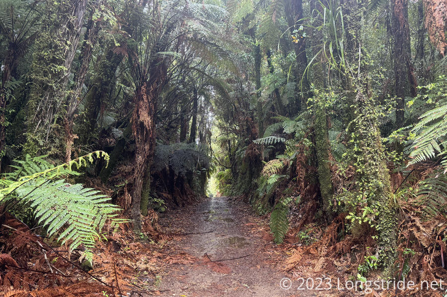
A little while later, the trail changed to follow an old lumber tramway alignment, originally constructed to facilitate logging the trees in the Pureora Forest. Many historical signs described the operation and construction of the tramway and some of the important people involved. One story told of a lost (cash) payroll when a horse slipped on mud and its rider fell off, and it took them two weeks to find the horse, still with its saddlebags intact. It seems that even then, they couldn’t manage to build trails in New Zealand to cope with the mud!
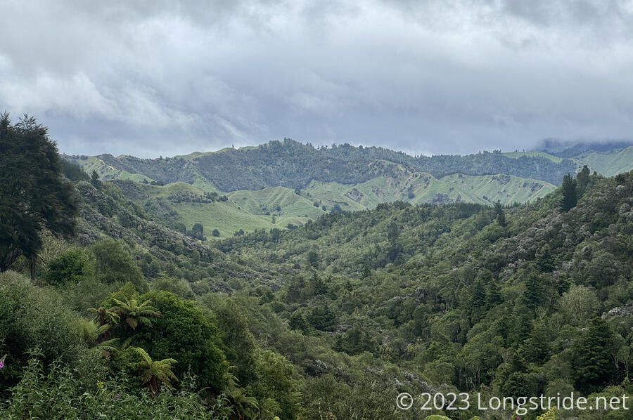
All morning, the rain changed back-and-forth between a drizzle and a moderate rain. There were a few viewpoints, but the clouds obscured any views we might have had. Still, we were able to make fairly good progress so far. Despite the rain, the trail was still quick and easy to follow; since it was intended for cyclists (and originally built for trains), it’s not steep at all.
Because of the rain, we kept hiking longer than we normally would have before taking out first break; at 14.6 km, this was probably the longest stretch we’ve hiked on the TA without stopping for a break. We stopped at another shelter, which though small, still kept us dry.
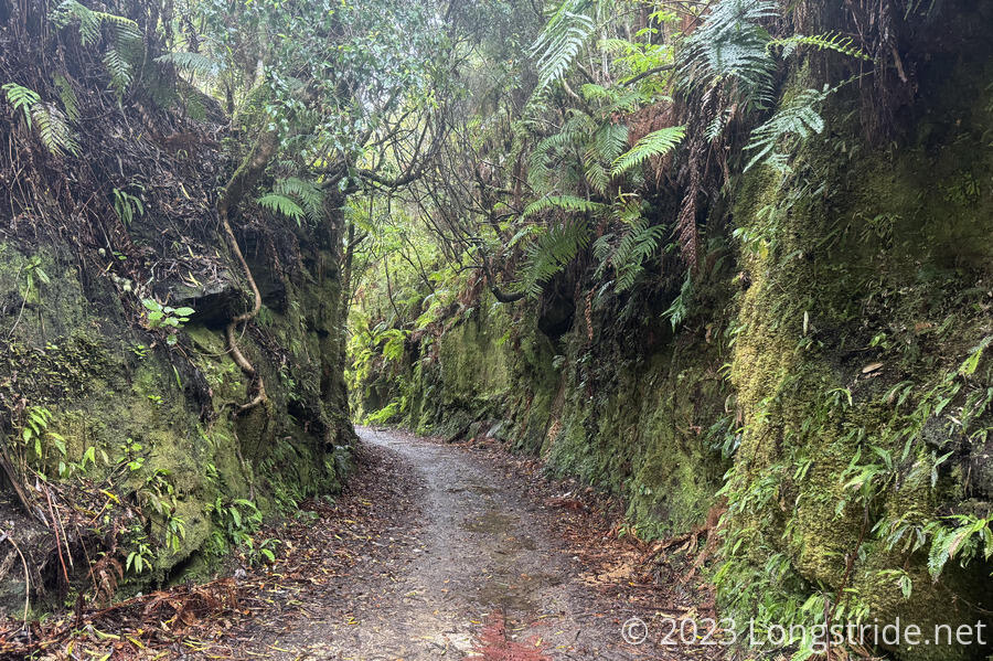
Due to its need for track straight enough for transporting lumber, the tramway trail often cut through rock, making the trail a just-wide-enough corridor between two vertical cliffs.
At our second break, now 25 km in, also at a shelter, we met two cyclists from the Netherlands. We saw them pass us yesterday afternoon. Six other cyclists and three hikers on bikes passed us in that stretch as well.
We got lucky with the rain: it had stopped raining shortly before we got to the shelter, and the sun even came out briefly. Then, just after we were inside, it started raining harder than it had all day. The rain briefly let up a bit once we continued, but then we got trapped in a downpour for a while.
Our next major sight was the Ongarue Spiral, consisting of a bridge and a tunnel to deal with a significant elevation change in a tight area. According to a sign, it is one of only 81 known railway spirals, and the only one you can ride a bike through.
Routing the trail through the tunnel was a significant effort; a nearby creek had been diverted to go through the tunnel after a flood in the 1950s damaged the rail line and a new road built so trucks could operate instead. The creek had to be re-diverted to its original course and the tunnel repaired in order to route the trail through it.
After the spiral, save for a few brief periods, the rain largely stopped. We made our way towards Ongarue, getting there around 6. Not bad for a 42.1 km day, our longest so far (and just short of a marathon by less than 100 meters).
We stopped at the Bennet Road Campground, which featured a large shelter with benches around its perimeter, a smaller building with benches and a sink space for cooking, and two toilets. We briefly chatted with a few younger hikers at the larger shelter. Then Peter and Susanna, whom we hadn’t seen since before Auckland, waved to us from the “kitchen”, and we moved there to talk with them.
We had a nice catch-up conversation with them while we cooked dinner. The day before we did, they had gone through the section of trail along Mangaokewa Stream, which we had skipped around with a road walk. They confirmed that our decision to skip it was a sound one: the trail was overgrown, heavily eroded, and it took them a long time to make it through. They were happy to hear we’d also be starting the Whanganui River Journey on January 6th, same as them.
After we cooked dinner, we set up our tents in a grassy area between the two shelters. Sheep from a nearby farm made a lot of noise around sunset, but at least the rain had stopped, for now, anyway.
Tomorrow — Christmas Day — we’ll have another (probably) rainy day to Taumarunui, where we’ll take a couple of days off — it’ll have been over two weeks since our last zero.