Today, we hiked the first half of the Timber Trail, a cycle track around Mount Pureora.
With a 36 km day planned to take us to the Piropiro Campsite a little short of the halfway point of the cycle path, CareFree and I had set a 5:30 am alarm to get up early, and left our cabin shortly after 7.
At the start of the Timber Trail, we were greeted by with a sign offering that the 84 km trail would take 28 hours to walk. This was assuming a 3 km/hr pace, which seemed like an unusually low pace for what’s supposed to be a well-graded bicycle trail. With the exception of the TA’s diversion from the Timber Trail to summit Mount Pureora, we expected to go significantly faster than that.
The signage at the start of the Timber Trail and its per-kilometer signposts referred to the trail as “The New Zealand Cycle Trail”. This seemed a bit self-aggrandizing, given the trail only started construction in 2010 and was fully completed in 2013. So I immediately wondered if the trail would live up to its own hype.
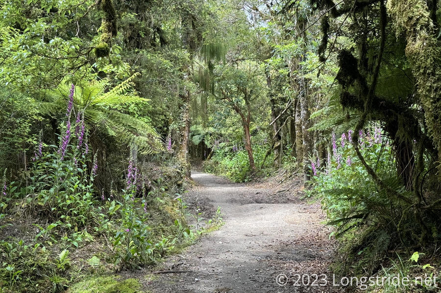
At the start of the trail, the tread was a nice dirt floor, though it wound back-and-forth rapidly through a dense forest. CareFree said she felt like she was getting dizzy, and I’d lost all sense of what direction we were going in at all. (The sun was hidden behind clouds, so we didn’t have that as a frame of reference.)
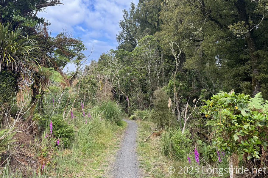
Frequently, on the sides of the trail, were deep pits dug out to collect water, presumably for drainage. I guess it was like that because this area was relatively flat and it was a simple way to get water off the trail while also being bike friendly. It didn’t seem like a sufficient strategy in heavy or persistent rain, but in comparison to most of the trail we’ve seen in New Zealand so far, it showed a surprising amount of work put into drainage.
One of the nice features of the trail were occasional information displays, color-coded to distinguish between plants and animals (green); and trail and local history and Māori culture (brown). One of the first such displays briefly described the circumstances that led to the end of unsustainable native forest logging in New Zealand and the establishment of the Pureora Forest Park, including (in 1978) some of the first protestors who lived in trees to try and prevent them from being felled.
A later display described the naming of the mountain. From the display:
Kahu was a woman of great mana (status and dignity). She trekked to these lands, named Maraeroa, in search of her son Raka-maomao. It was a difficult trip and she became sick.
At last Kahu and her group came to the northern side of a mountain. They rested in the sun.
Then they followed the stream to the summit, and offered prayers for Kahu, so the stream became Waimiha (wai = water; miha = special incantations).
Kahu was bathed in the water, and the miha comforted her. She revived, and recovered to full health.
The mountain became known as Pure-ora-o-Kahu (The ritual purification of Kahu)
From its start, the trail gradually increased in elevation, as it headed towards the summit of Pureora, and we made very good time. There was a mix of forest: some native forest, some clear-cut areas, and plenty of forest regenerating from prior logging activities.
At one viewpoint, as the trail rounded a bend, there was a picnic table and a sign indicating there was mobile phone reception, signage I’ve never seen before on trails (but often wished for).
While going through the forest, we were occasionally taunted by the New Zealand Cheeseburger Bird, and realized the main difference between it and the US cheeseburger bird call. The US call sounds like “cheese-BUR-GER”, emphasizing the meat (most cows in the US are used for beef). The New Zealand call sounds more like “CHEEESE-bur-ger”, emphasizing the dairy: cattle farming in New Zealand is primarily for dairy.
Also along the trail are a few shelters, small red huts with benches on the inside. They’re great for sitting down and getting out of the sun (or the rain). It’d be possible to sleep overnight in these, but it would be hard to fit more than one or two people. Toilets were also installed near these shelters.
We stopped at one of those shelters for a break, after about 10 km. When we continued, the TA diverted us from the Timber Trail, taking us up the Toi Toi Track to the summit of Pureora. (The Timber Trail doesn’t summit the mountain, instead going around the west and south sides of the mountain about 200 meters below the summit.)
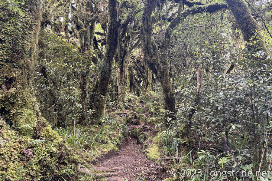
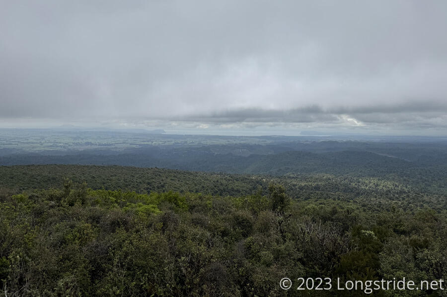
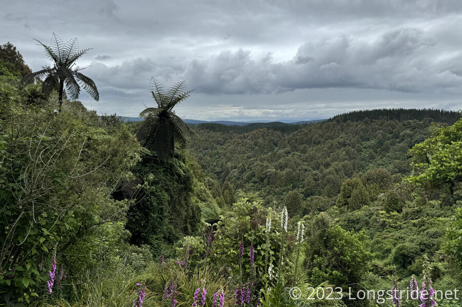
In contrast to the Timber Trail, this was a steep hiking trail through wilderness, with thick forest and rocks and roots leading up to the summit. But it was dry, and easy to hike, and half an hour later, we reached the summit. At 1165 meters, Pureora became our new highest point in New Zealand. It was fairly cloudy out, so we didn’t have the greatest view, but we could see Lake Taupō, the largest lake in New Zealand. If the sky had been clearer, we should have been able to see Tongariro, Ngāuruhoe, and Ruapehu, the three major volcanoes of Tongariro National Park.
From the summit, we descended back to the Timber Trail via an unmaintained track. Past a DOC sign stating that, we pushed through very dense overgrowth for maybe 50 or 100 meters, before the brush cleared up. From there, it was a relatively straight-forward hike down a steep abandoned trail. In the dry conditions we had, it was like a short obstacle course, only 800 meters long, of steep trail, old trail construction, and eroded foot paths, with the occasional small mud pit. We had a good time, though after rain, this would have been a lot less fun.
Back on the Timber Trail, we resumed our rapid pace. For a little while, the sun came out and we had a bit of blue sky, which was a little annoying given that we didn’t have any of that when we were on top of the mountain.
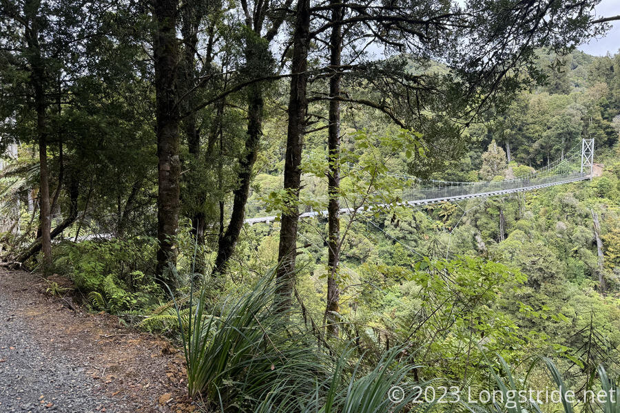
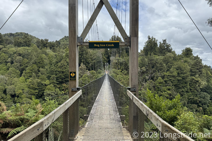
Another major feature of the Timber Trail is its several suspension bridges. On its descent from its apex, the trail designers had a choice: wind around deep river chasms, or span them with bridges. In several cases, they chose for bridges, making for several of the DOC’s longest bridges.
The first, and longest for the day (though not the longest on the trail), was the Bog Inn Creek bridge, over the creek of the same name.
Over the rest of the afternoon, we crossed four suspension bridges, though none of them were near as long as the Bog Inn Creek bridge.
We stopped at another shelter for a break; while we were there, three younger hikers that camped at Pureora Cabins this morning (and whom were still in their tents when we left) cycled past.
Later, at another break, two bikepacking cyclists zoomed past.
Apart from the bridges, and a view of Pureora (where we could clearly see the trig marker on its summit), the rest of the day was mostly unremarkable. It was nice tread, and nice forest, and we made good time.
Around 5:40, we reached the Piropiro Campsite, and were surprised to find a very large clearing with quite a few car campers, all of whom were clearly here for several days. Most had large tents set up. At least two also set up outdoor stoves and a generator.
CareFree was nonplussed by this development. I shrugged; there was plenty of flat area to set up our tent, and there was water, and a few pit toilets, and it’s not like we were paying anything for the campsite anyway.
I picked a site near a a run-down shelter with a tarp over its roof. It had a concrete floor, so we weren’t going to cowboy camp (or set up the tent) on that, but it did provide a nice shelter, and also a chair. CareFree had wanted to camp further away, but the only place further away from any of the car campers was in a low-lying meadow (which would be bad news if if rained overnight as we expected). (I pointed out that the car campers were probably too busy with their own camping to bother us, even if they might be a little loud.)
We set up the tent, gathered water from a water tank, and cooked our dinner. Meanwhile, we watched a family just up the hill come back from the forest with long branches obviously snapped off of trees. At first, it seemed like they were collecting wood for an excessively large fire, but as we watched them hack away at the wood, it became clear they were creating large stakes for a tarp. It took them quite awhile to fashion their stakes and then get the tarp set up, but it gave them a (hopefully) dry place to set out their tables and inflatable chairs.
We were surprised at how nice the weather had been today. We didn’t get a whole lot of sunlight, but there wasn’t any hint of the rain that had been forecast for this afternoon. Tomorrow, though, will likely be a different story.