With some time to kill before getting to Whakahoro for the Whanganui River canoe trip, we took a day off to hike in Tongariro National Park.
After a slow start this morning, we began by partially retracing our steps, leaving the holiday park and heading to one of the trailheads near the one we arrived in town from yesterday evening.
We followed the Taranaki Falls Track to its junction with the Tama Lakes Track, and followed that track towards the lakes.
This trail was much better maintained than the late trail yesterday, with boardwalk in places and a gravel track, though it was showing some places where the gravel had eroded away, exposing the mesh underneath, which was occasionally a tripping hazard. (The mesh is large enough that it can trap a trekking pole, making it easy for the basket to get lodged against the large hexagonal structure of the mesh.) Still, this trail represented a significantly better level of maintenance than many sections of the TA.
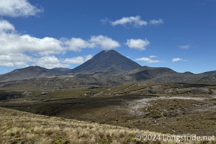
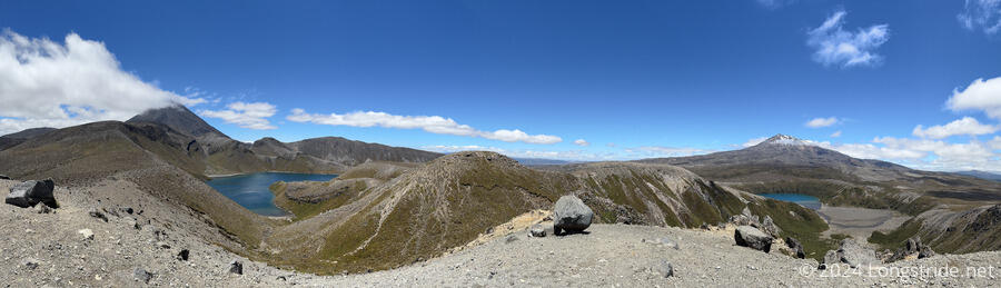
The initial highlight of the trail was the great views of both Ngāuruhoe and Ruapehu, neither of which were obscured by clouds.
Once on the Tama Lakes Track, we generally headed east, over rolling hills from old lava flows. Clouds gradually formed around Ruapehu.
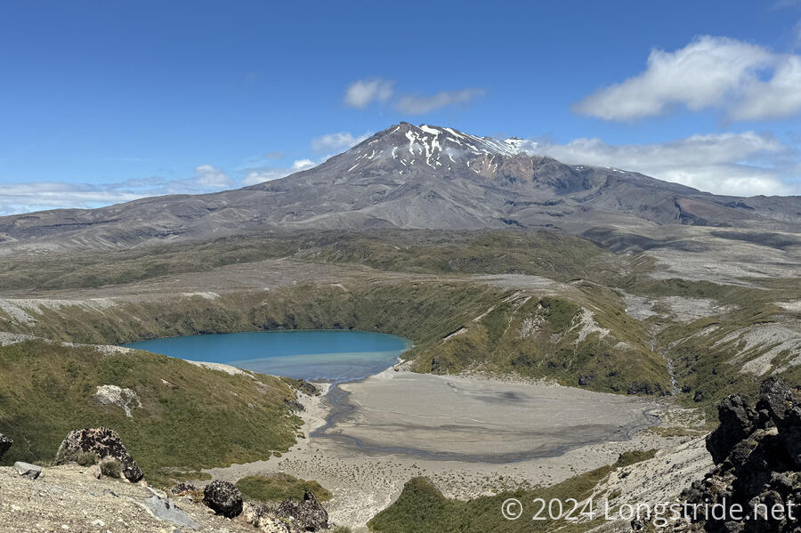
It took us a little under two hours to hike from the holiday park to the Lower Tama Lake viewpoint, with a nice overview of the lake and a small sign describing the formation of the lakes. (They are volcanic craters that have filled with rainwater.)
We took a snack break. While we were eating, a helicopter flew over us, heading in the direction of the Tongariro Crossing. It seemed as though someone would be part of the two rescues per week statistic today.
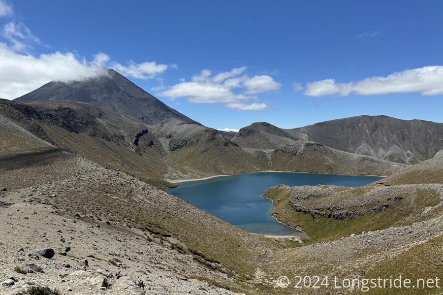
The trail up to the viewpoint for Upper Tama Lake was less developed, just a dirt track. A relatively short, moderately steep climb brought us up to a saddle where we could see both lakes.
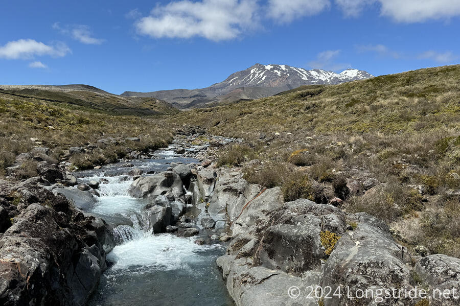
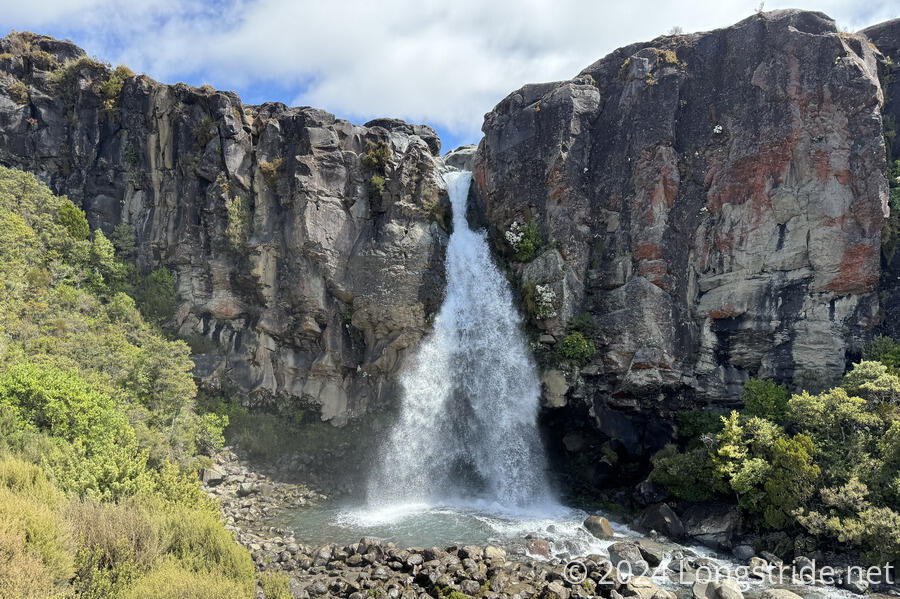
It took us about 80 minutes to return to the junction with the Taranaki Falls Track. Continuing around on that trail, we very quickly came to Taranaki Falls, a waterfall on the Wairere Stream we’d crossed earlier.
Another 25 minutes along the Taranaki Falls Track brought us to the junction with the TA, and we retraced our steps back to town, and then the holiday park.
Before we started our hike, we confirmed that we’d be able to stay in the cabin we’d been put in yesterday — that was unclear yesterday, and we were glad we didn’t have to move our stuff to the bunk room. We also had a very tiring time in the kitchen cooking dinner. With at least eight cooking stations, four sinks, and four tables for people to sit at, it was quite loud and chaotic. An uneven distribution of cooking and cleaning equipment (e.g. there was one bottle of soap and one drainboard that floated around the cooking area) made everything somewhat disorganized and slower. (I guess they expected the car campers to bring their own pots and pans and utensils?)
Anyway, we’ll be quite happy to head out tomorrow morning to resume the TA. More hiking through Tongariro National Park will bring us to National Park Village tomorrow.