Another strenuous day in the Tararua Range took me to Mt. Crawford, the TA’s high point in the Tararuas, and then on a long, steep descent to Waitewaewae Hut on the Ōtaki River.
After rain all day yesterday, the rain stopped in the early morning, and the clouds thinned, to reveal some blue sky. It was a substantial improvement over the weather yesterday.
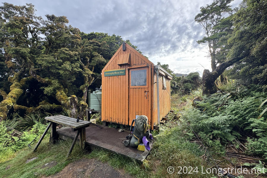
Dracophyllum Hut was tiny, so even though it was warm enough last night, none of my clothes dried at all. I put on my second set of dry pants and underwear, and hoped I wouldn’t regret using them today.
Today’s plan was simple: go to Nichols Hut, 5 km (and four hours) ahead; and if the weather continued to be good, continue up the ridge to summit Mt. Crawford and descend to Waitewaewae Hut (8 km, also 4-5 hours).
I’d hoped to leave “early”, but didn’t depart the hut until just before 8. This was fine, but starting an hour earlier would have made the latter half of the day much nicer.
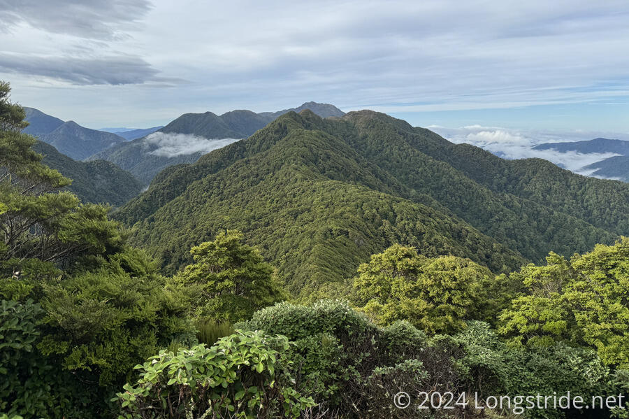
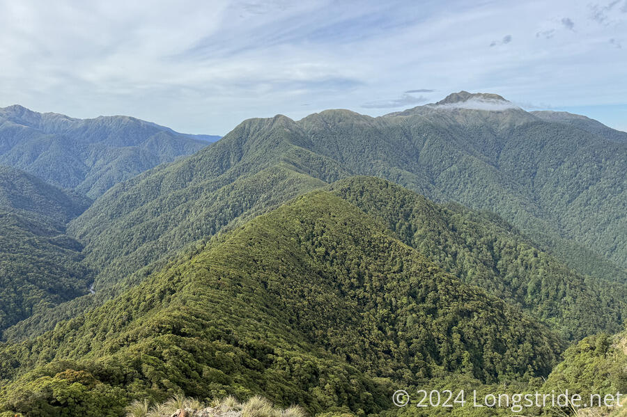
Leaving the hut, the trail first passed a nice viewpoint, giving a view of the ridge to the south. It was a good preview of the trail to come: first forest, then exposed, rocky ridge. Where it was forested, the effects of the wind flowing over the ridge were clearly visible on the trees, which looked smoothed-out from the west.
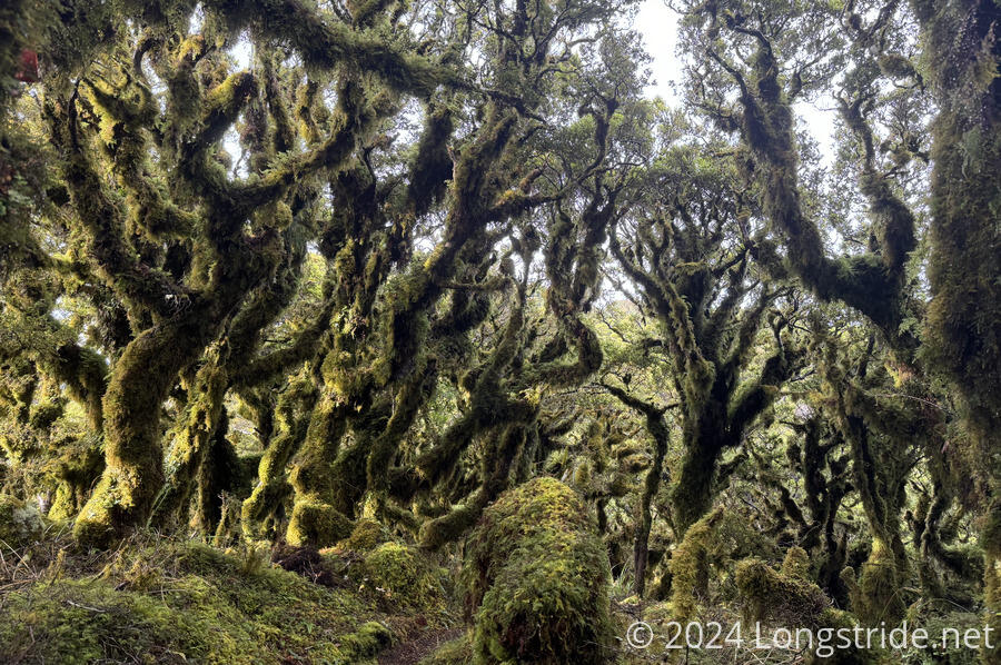
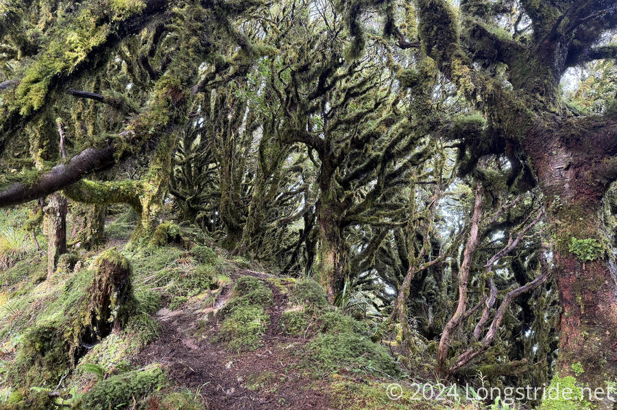
The first kilometer or so out of Dracophyllum wasn’t too bad, while it was in the forest. Sometimes, it looked rather spooky, when the lighting was just right. Other times, it was a bit more open, but still with a dense jungle feeling.
The next kilometer, though, was a lot more difficult, with some very steep and difficult rock scrambles. Really, it was more like rock climbing. The worst of the ascents were probably a meter or a meter and a half up, but it felt like a much larger distance for someone who’s a hiker, not a rock climber.
The ascent of the ridge did give me some good views of the surrounding range, and I could finally see Mt. Crawford clearly. The trail then dipped back into forest for another kilometer or two before re-emerging on the exposed ridge covered with tussock grasses surrounding a narrow trail. In the forest, it seemed like some fog was starting to blow in, but it cleared out fairly quickly.
Shortly before noon — about four hours after I left Dracophyllum Hut, so I made fairly good time — I reached the trail junction to Nichols Hut. The hut, a fair distance down the side of a steep slope, seemed a nice place to take a break. At least, better than the ridge, which didn’t really offer much of a good place to sit down. And the hut’s porch did have a chair sitting outside its front door, calling me.
I slightly regretted going down to the hut, which took almost ten minutes through barely-visible trail. (And nearly as much time to climb back up to the ridge when I finished my break.) Still, it was much more relaxing to sit down on a chair than on the grass.
While at the hut, the weather didn’t meaningfully change. It was mostly clear out, with some nearby clouds. There didn’t seem to be any sense in staying for too long; if there were clouds blowing in, it’d just get worse the longer I waited. So after about 40 minutes of relaxing (and trying to dry out some of my wet clothes), I headed back up to the ridge, and continued along towards the summit.
In spite of the 2 hour estimate to reach the summit, it only took me about 80 minutes. The worst part of it was the grasses somewhat obscuring the trail, and the occasional steep rock scramble. Otherwise, it was generally easy trail, though occasionally steep.
Clouds did start to blow in as I approached the summit, though. by the time I got there, the entire western side of the ridge was hidden in cloud. It was actually rather remarkable: the clouds blew in from the west side of the ridge, and the ridge, in conjunction with the winds blowing up from the eastern side of the ridge, formed a wall following the ridge.
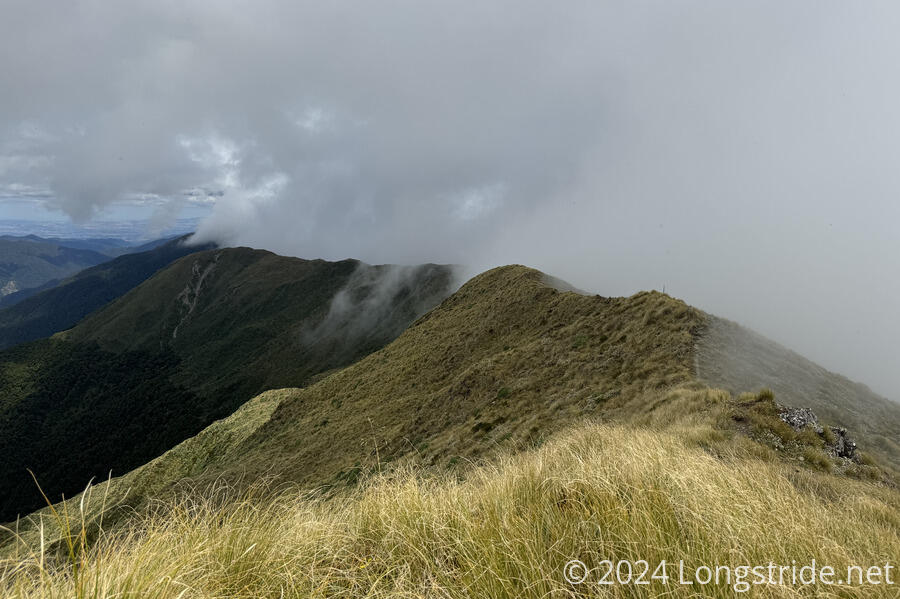
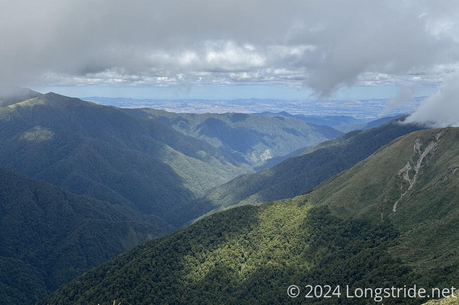
This meant that by the time I got to the summit, I only had a very limited view, of the ridge to the east, and out along the valley to the south, towards the ocean.
Following the ridge from Mt. Crawford, the trail eventually turned west, to leave the Main Ridge of the Tararuas, following a few more annoying rock scrambles. I got sprinkled with a little bit of rain on the way, and didn’t bother to put on my pack cover since I assumed the rain was coming from the cloud flowing up the ridge, and it’d stop once I turned off the ridge. Once the rain picked up enough to warrant putting on my pack cover, I stopped for a brief to do so and have some snacks, during which time the rain stopped.
From Mt. Crawford, I was on the exposed ridge for almost two hours, before re-entering the forest. Along the way, I passed a pair of seniors with absolutely gigantic packs slowly climbing up to the ridge without using trekking poles. I briefly marveled at how anyone could manage to hike with packs that heavy without any poles, before returning my focus to the steep downhill awaiting me.
Reaching the forest began a very steep continuous descent through a trail that was more a path through a jungle gym of tree roots one had to climb over or down. The longest stretch of dirt trail from the top of the forest to the end of the descent was maybe fifty meters. It was a long, arduous descent. In about 3 km, the trail dropped over 1 km in elevation. That took over two hours.
The forest along the way was more of the same: beautiful, rugged, dense, jungle, and I couldn’t wait to be done with it, if only for the sake of my knees.
I passed an older couple of hikers, Tam and Lee, who’d left Nichols Hut earlier in the day, and were going glacially slow due to problems with his knees. They seemed in good spirts, though.
Near the bottom, it began to rain, very much to my displeasure. It was already hard enough to hike, with the tree roots already slippery from yesterday’s rain. More rain today would just make it harder.
Reaching the bottom of the descent, the trail meandered around a bit before crossing the Ōtaki River on a “swing bridge”, a sort of rickety suspension bridge with a bend in the middle allowing the bridge to cross not just the river, but end higher up on the other side.
After more zig-zagging through a very wet and muddy forest, I finally reached Waitewaewae Hut, an absolutely beautiful shelter just uphill a bit from the river. Already there were Brenda and Emma, who hiked the TA last year and decided to be “Hut Angels”, staying at the hut over a long weekend to provide trail magic. Today was the last day there were here, so they didn’t have much left, but they did still have some sodas, as well as chocolate, chips, homemade brownies, plums, kale, and corn on the cob.
After I got settled and changed into dry clothes, we chatted for a while as I cooked dinner. The next hiker to arrive was “Wild Turkey”, also a triple-crowner (plus a few other US trails). Tam and Lee finally showed up over an hour and a half later, about when we started to get worried.
There was no cell service at the hut, so I tried, unsuccessfully, to use the satellite feature in my iPhone to send my current location so CareFree would know where I was. There appeared to be too many trees (and the hut) obstructing the view of the sky.
As arduous of a hike as today was, I probably did not eat enough today, only having the one break at Nichols and a mini-break with only some nuts when I put on my pack cover. Hopefully that won’t be a problem for tomorrow.
I am more than ready to be done with the Tararuas. Ideally, I’d like to hike all the way to Waikanae tomorrow, which would keep me on my original schedule, but it’d be a 36 km day, with two significant climbs.
Today does mark a somewhat significant milestone for me: I’ve now spent two full years on long-distance trails. Hopefully, there will still be many more years of trails left to come!