The Raetea Forest is as muddy as it is beautiful. It was unfortunate, then, that it was very beautiful.
We did not see Jaya or Abhay this morning, but they left us a surprise, a small plate of sliced guavas.
As I was repacking my pack this morning, I noticed that its handle was on the verge of completely fraying off on one side. Fortunately, this is not a complete disaster, since I can lift it with its straps, but it will make putting it on a bit more of a hassle.
We departed at 7, heading up a moderately steep dirt road that gave us an overview of the property, before veering further away into the mountain.
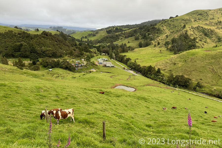
We passed the campsite further up the mountain, which had a nice overlook, but which would likely have been damper and colder than where we stayed yesterday, which might have hampered our relatively early start. (The Raetea Track is notorious for its mud, and we expected a long day.)
In a first for me, a bird perched on a branch above the road took a giant shit on me when I briefly stopped during the somewhat steep climb.
We eventually reached the Takahue Saddle, which provided a bail-out point to the forest. (Unfortunately, the bail-out involves a lengthy road walk, which is presently dangerous because that road is the alternate for SH-1, which is partially closed for repairs in the area.)
A giant palm arrow pointed at the route down the other side of the mountain; a small set of blow-downs appeared to block the actual trail forward.
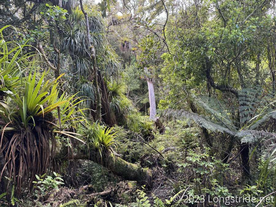
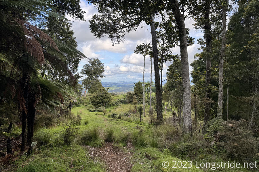
The Raetea Forest is a very thick, dense forest, filled with many different kinds of trees, including some Kauri. The trail into the forest was a bit steep, and consistently muddy. Fortunately, the mud wasn’t terribly bad unless you misstepped; it was generally easy to avoid. We stopped for a break at a local high point, pleased with our progress so far. It was humid and we were sweaty, and going a little slow, but we were making reasonable time.
After that first peak, though, the trail became substantially muddier, which slowed our pace quite considerably. What we thought was a reasonably good pace turned into a slow slog. My boot came off in the mud, which took a few minutes to resolve, since CareFree had to come back and rescue it while I tried to not get my other boot and now-shoe-free foot stuck in more mud.
This section contained our slowest kilometer, 47 minutes.
After two muddy descents and steep climbs (which tended to be less muddy when the trees allowed a breeze in), we reached the summit of Raetea.
After we left the summit, it was initially a bit windy and cool, and the trail itself pretty dry as it followed a narrow ridge for a short while. The mud picked up as the trail descended, but it was never as bad as it had been before the summit, and we were able to make slow, but better, progress.
Once the trail finished its descent from Raetea, it leveled out for a few kilometers, and, though still a little muddy, was much more in line with the type of nuisance hiking I was familiar with from the Appalachian Trail. I got a bit of a second wind in this stretch and made pretty good time; with my slogging through the earlier trail today, CareFree was rather astonished with the pace I set here.
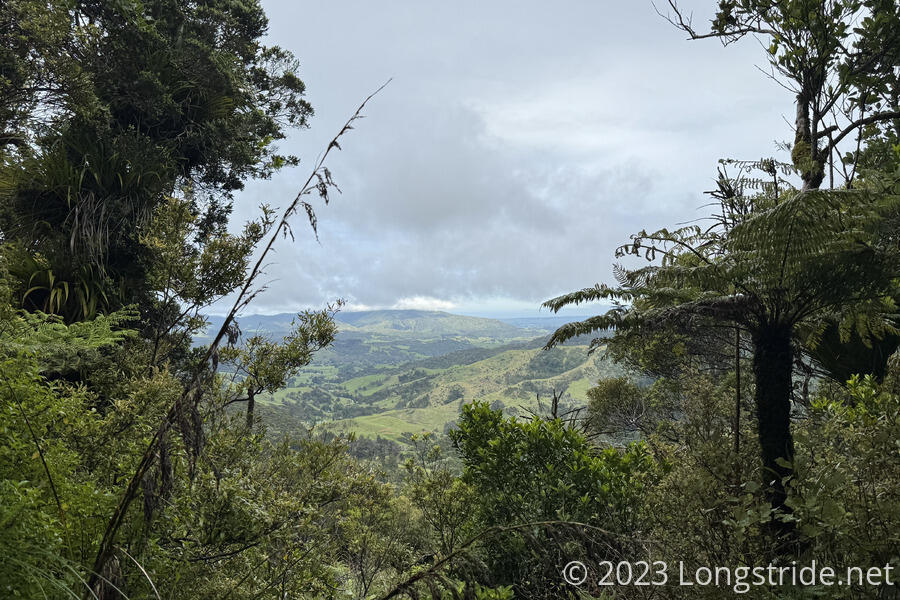
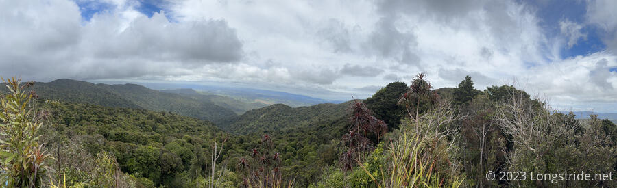
Eventually, the trail exited the forest, giving us a fantastic view, and entering onto private farmland.
We started the day with a lot of extra water, and we were glad we had it. As we exited the forest, both of us had just drained the water bladders in our packs.
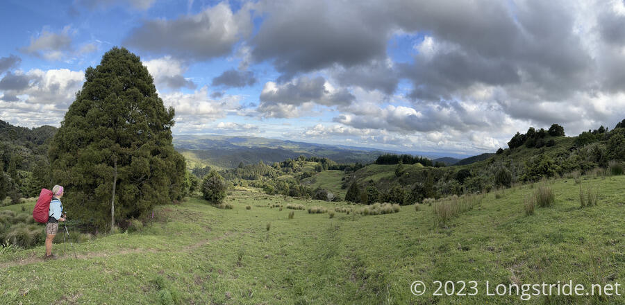
Heading downhill, we briefly lost the marked trail, instead following some cow paths to a creek, and picking up a dirt road that led us in the direction we wanted to go.
We passed a horse standing on a dirt road higher up a hill; it started following us, slowly at first, and then faster as it got uncomfortably close. Escaping the horse, we took a bit of a wide detour to stay away from some cows and their calves that we’d scared a little while earlier.
Exiting the property, we heard a pair of dogs in the distance, and kept a rapid pace up for a bit to put distance between them and us.
Around 7:20 pm, more than twelve hours after we started hiking today (and only progressing 19 kilometers), we reached a small campsite on Makene Road, with a pit toilet, a picnic table, and a small but well-flowing creek.
After we set up our tent, we took the opportunity the creek provided to wash the mud caked on our hands and legs — this was likely my dirtiest day on any trail — and rinse out our socks. (They were now too wet to wear, but at least they were “clean”, and could potentially dry out, weather permitting.)
Shaun had left after us, but passed us during the first climb in the forest, so he was already here, as were Peter and Susanna, as well as two other Germans and a Frenchman. A few other hikers arrived after us, including an Australian, and an Englishman with a bright orange pack.
Tomorrow will be an easier day, a road walk to the Puketī Forest, our second and final northern forest.