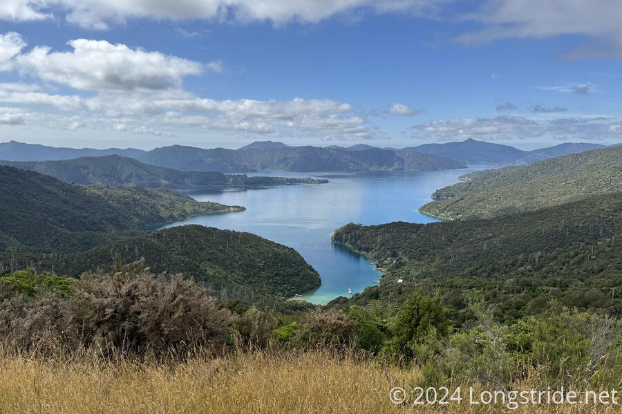
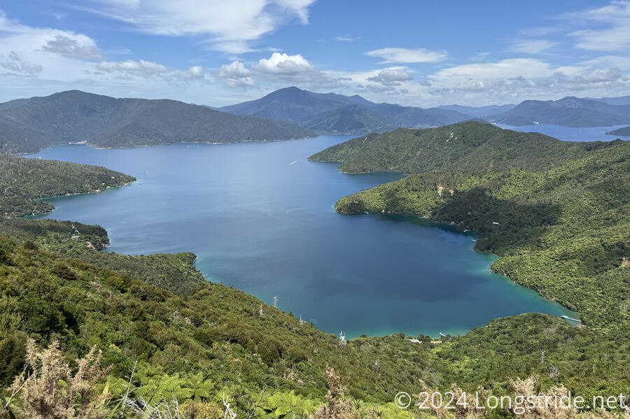
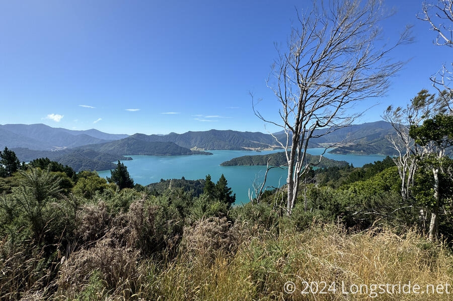
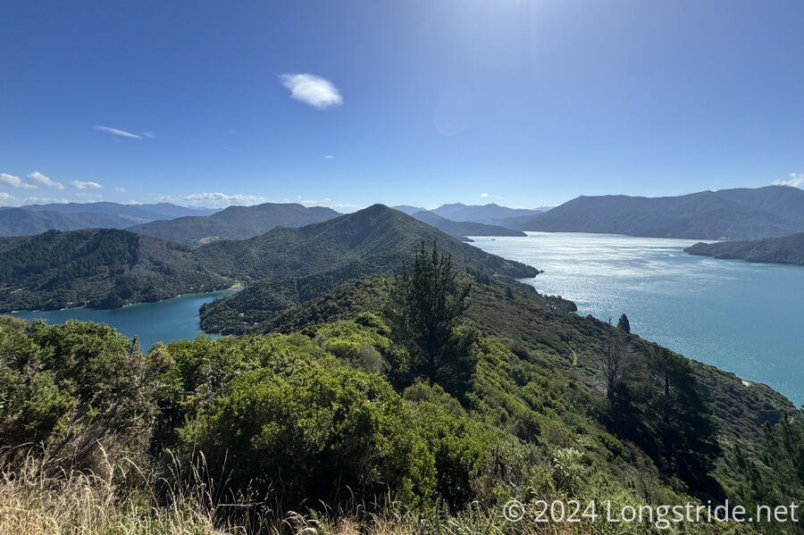
The second day on the Queen Charlotte Track (and the South Island) largely followed a ridge, giving views of both Queen Charlotte Sound to the south and Kenepuru Sound to the north.
With a plan to go about 23 km to the Cowshed Bay Campsite, I’d set my alarm for 6 am, hoping to get on the trail by 8, and have a relatively relaxed day on the trail. I left about half an hour late, but was still able to make excellent time hiking on the Queen Charlotte Track, thanks to its (usually) good and wide tread.
While the views yesterday were limited to the various bays and coves off the Queen Charlotte Sound, climbing up (rather steeply, at times) to the ridge brought access to the Kenepuru Sound, to the north. Quite different in character, Kenepuru Sound has a much greener tint, especially close to its eastern extent, which ends in a valley clear-cut and seemingly used for farming.

At a viewpoint (with a toilet, which were somewhat frequent), I passed a dozen hikers milling about. I expected to be faster than them, but I also hoped they weren’t heading in the same direction as I. (They were. At the next two campsites I reached, they all eventually showed up while I was taking my break.)
I would have said the toilets were surprisingly frequent, but, when I was at Parawai Lodge in the Tararua Range, the toilet there had a sign on it making somewhat a big deal about wanting people to use the toilets, and not poop in the woods. I hope the availability of toilets on the trail continues; I have yet to have to dig a cathole, and it seems entirely possible I might be able to make it through the rest of the TA without having to dig one.
I passed two poles with directional arrows, one with about a dozen New Zealand cities, and about 15 minutes later, one with about a dozen world cities. In front of the base of the world cities pole, there was a goat skull with horns (and still some fur)! Presumably, there was a goat nearby that a hunter killed; otherwise it doesn’t seem likely someone actually hauled it up the mountain from somewhere else.
When I reached the Bay of May Coves Campsite, I took my first break at the campsite’s cooking shelter to get out of the sun. A weka patrolled the area near the shelter; I kept a close eye on my stuff when it was near.
Up on the ridge, I had cell service. I checked the weather; it’s still looking great for today, but there’s a lot of rain forecast for tomorrow. I began considering going further today, to allow for a short day tomorrow into Anakiwa, just past the end of the Queen Charlotte Track. Adding another 7 km to my day could make tomorrow just 12 km into town, which I should be able to easily do before the rain starts.
As I continued, I was appreciative that the trail was often well-shaded. The forest also generally continued yesterday’s trend of being somewhat loud, though today there were a few fewer birds.
At the Black Rock Campsite shelter, with plenty of time left in the day, I made the decision to go the extra distance, to the Mistletoe Bay Eco Village, in order to set up a short day tomorrow. I called the YHA in Anakiwa; they were fully booked. They recommended the Smiths Farm Holiday Park a few kilometers further. I didn’t get a chance to try calling them before the large group of hikers rolled in, but I did manage to book a campsite for tonight.
After getting some distance away from the group (as in, half an hour down the trail), I tried calling the holiday park, but couldn’t get through. I couldn’t tell if it was a problem making calls, or if the phone number was bad or disconnected. So, I have no idea where I’m going tomorrow.
Towards the end of the day, as the trail took a fairly steep descent, the generally nice character of the trail turned into a rough washed-out dirt road. (Probably because parts of the trail originally were dirt roads.)
Because I was in a bit of a rush (I’d told Mistletoe Bay I’d be there at 6, which was a bit optimistic on my part), I skipped past two viewpoints a bit off trail. Later this evening, when I was reviewing the maps, I noticed that the second one summited a peak. I was disappointed I’d skipped summiting a mountain within easy reach, especially since it’s unlikely I’ll be back here again. (I briefly had, and dismissed, the notion of going back to bag it tomorrow morning. But, with the rain forecast, I don’t have the time.)
I reached Mission Bay a few minutes after 6, which was pretty good given I hadn’t taken into account it was about a kilometer off-trail.
The reception had a sign saying it was open, but no one was there, so I called the number given to check-in. They asked if I wanted anything from the camp store; I said yes, when they said they had ice cream and cold soda. Five minutes later, I had my cold beverages and ice cream, and retired to the kitchen to relax.
After eating my ice cream, I set up my tent, got a short cold shower (because I didn’t have the foresight to ask for change for the shower), and cooked dinner in the kitchen.
Tomorrow, I have no idea where I’m going, other than forward. If it weren’t for the rain, I could push 30 km to Havelock, the next resupply point before entering the Richmond Range. I’ll just have to get up early, hope I make it to town before it rains, and maybe I’ll be able to make something work.