Another long day today got me a lot of off-road roadwalks and a few nice views.
I actually managed to get up a good 40 minutes before sunrise. I thought I would be a little slow in the dark packing everything to leave, but I was reasonably efficient about it, and from when I got up to when I left was only about 80 minutes.
I made use of the shelter’s privy before I left, and noticed its somewhat unique construction. It appeared to be built like a double privy (sort of like “Fort Relief” on the AT in Maine), but with two doors, one of them locked, and a wall between the halves so only one side could be in operation at once. (Usually, what I’ve seen is that privies that are designed with multiple “piles” have a wide base and require the privy body to be moved from one side to the other when it gets “full”.)
I left the shelter a little after 7:30, and made it back to the trail at quarter after eight. On the way, I picked up a stick to use as a trekking pole so that I’d have one in each hand. It helped considerably with the uphill, but once I got back to the trail, I discarded it because it was pretty heavy.
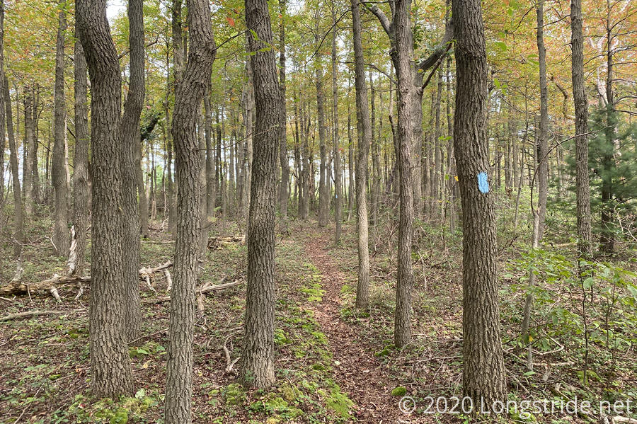
It was warmer in the hollow than it was on the ridge, mostly I think because of the breeze blowing over the mountain. The trail continued to be somewhat overgrown, but around nine, the trail brought me along the edge of Buchanan State Forest, and the trail became a lot better.
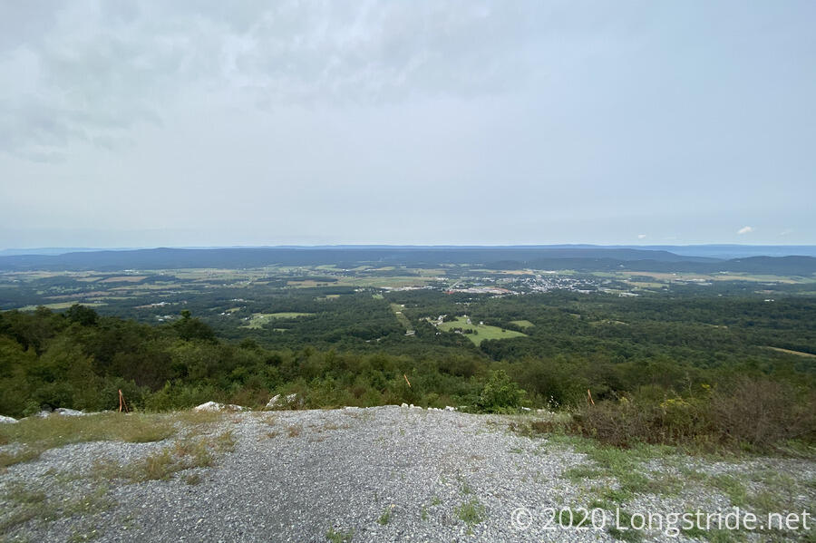
The trail wandered out of the state forest and onto private land for a bit, and near a busy road, gave me the days first view. Nearby, there was a picnic table, so I took a break and made use of it.
The trail then descended downhill a bit to avoid the road, PA-30, which sounded quite busy with truck traffic. Unfortunately, this section of trail seemed like it hadn’t been maintained in ages, and there was very thick overgrown grasses (and worse) on a somewhat steep trail, and it was very unfun to hike. Fortunately, that didn’t last long — just until the trail brought me up to the road so I could cross it.
During another climb, I found another branch to use as a pole. After a little trimming, it was maybe a little too tall for what I wanted, but it wasn’t terribly heavy, and worked well. This one I kept.
Back in the state forest, the trail joined a nice grassy road for awhile, before departing and becoming the nicest trail I’d been on all day.
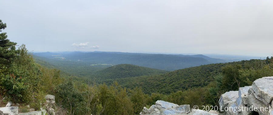
That trail brought me to the Big Mountain Overlook, a great view of the valley to the east. Road-accessible, there were two women and a very excitable dog at the view there when I got there, and two men further back. I talked to the two men briefly; one asked if I was hiking the Appalachian Trail. (Not terribly far off!)
After the overlook, it was downhill for a long while, mostly on grassy roadbed, allowing me to make up for lost time in the overgrown areas this morning. Feeling pressed for time, I skipped going to the Big Mountain Shelter, which I think is going to be the only shelter on the Tuscarora that I’ll miss seeing. I took a half-hour break on the side of the grass road, and continued on; the trail soon reentered the woods and became a trail again, as it entered Cowans Gap State Park.
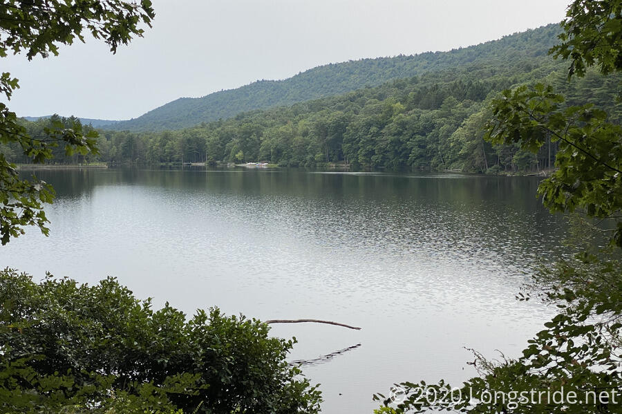
It was a rocky and occasionally steep downhill from the border of the park to its main area around Cowans Gap Lake, but it was a nice hike. Not having done any research on the park prior to getting there, I was a bit surprised by the extent of the area. Along with several picnic areas, there was a beach and swimming area in the lake, which also meant restrooms and showers; I probably could have found water if I’d looked, and there was food service (only open on weekends at present, continuing my trend set in New York on the AT of missing park food service). There were quite a few people around; I briefly batted with a woman who was familiar with the Tuscarora — she lives near Sleepy Creek in West Virginia!
The trail continued on asphalt paths through the lake area, crossed the dam on the north side of the lake on a gravel path, and then headed out of the park via a trail which became a gravel-and-grass road.
The rest of the day, I think, were on roads of some sort — gravel, dirt, ATV, gated no-access forest roads — and were all very easy to hike. It definitely made up for the overgrown areas earlier today.
After crossing one last paved road today, after crossing a bridge over a creek, I saw a hunter in an extremely bright orange vest, sitting on the ground behind a tree, with a rifle. I suggested to him that no one was going to miss him, except maybe the deer.
One last jaunt down a road bed brought me to my destination, Burd Run Shelter. It was a small shelter, and with the overcast skies and forest cover around, it was quite dark inside: still with an hour and a half before sunset, I had to use my headlamp to see inside.
A spring a short distance ahead on the trail provided me with water. Barely flowing, a small pool had also been dug and lined to provide a place to collect water from. Being a bit careless by sloshing my water bag through the pool (rather than using a scoop), I also collected a fair amount of yellow sediment. Nothing my filter won’t solve, though. On my way back, I realized you could see the shelter through the forest from the spring, helping to show just how close the spring was to the shelter.
A light breeze was blowing, so I took the opportunity to hang my tent over the shelter’s railings to dry it out. My ground tarp and tent body dried out nicely; the rainfly was a bit more wet, so I left it out overnight.
Today was over 19 miles of hiking, and it only worked because of the sheer quantity of roadwalk. My plan for tomorrow calls for a 22.6 mile day. In normal circumstances, this would be ambitious, but doable. With trail maintenance being what it is (and also there only being only twelve and a half hours of daylight), there’s not enough time in the day to hike that distance. I resupply tomorrow in Spring Run, which barely has anything, but other nearby towns near the interstate have rooms. Maybe I’ll be able tomorrow to find a way there and back.
I set a 5:45 am alarm. Whatever I wind up doing, it’s sure to take a lot of time…