Today started off with moderate hills through a burn area. For several miles, the forest was burned on both sides of the trail (though the trail itself was left unscathed). This was clearly an intentional burn, and not a forest fire, though it's unclear whether this was related to the recent fires in the area (as in, a controlled burn to limit the spread of the actual fire).
After about 7 miles, we reached the Black Bear Resort, where we are staying tonight and tomorrow, to implement a slackpacking plan.
Today, we are being shuttled about 8 miles further down the trail, and we will hike south back to the hostel (with emptied packs, so we will go faster and with less effort). Tomorrow, we’ll be shuttled about 20 miles past that, and we will hike back to where they drop us off today. This will give us about 28 miles of the trail, done in the "wrong" direction, with extremely light packs, letting us cover a day and a half's worth of the trail with relative ease.
Unfortunately, Beast hurt his foot on the hike to the hostel, so he wasn't able to do today's section; but it's nothing serious and he'll be back on the trail tomorrow.
Because I was being rushed by hostel staff, who also needed the shuttle van to run to another town to pick up parts for a trailer, I didn't actually get absolutely everything out of my pack that I could have. Tomorrow should have a slightly lighter pack. Still, with a 10ish pound pack (rather than 40), hiking was almost effortless. I practically flew up and over Pond Mountain (which, had we been going north for this section, would have come at the end of the day, and with a steeper uphill than heading south). Really, slackpacking makes you feel like a superman.
While I was flying down Pond Mountain, my pack cover fell off (probably from not really being secured to the much smaller pack). Fortunately, a SOBO section-hiker named Brew called out that it had fallen off, and he even packed it back in its bag while he was walking to me (and I back to him). Thanks again, Brew!
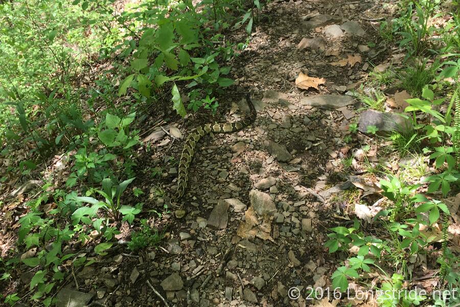
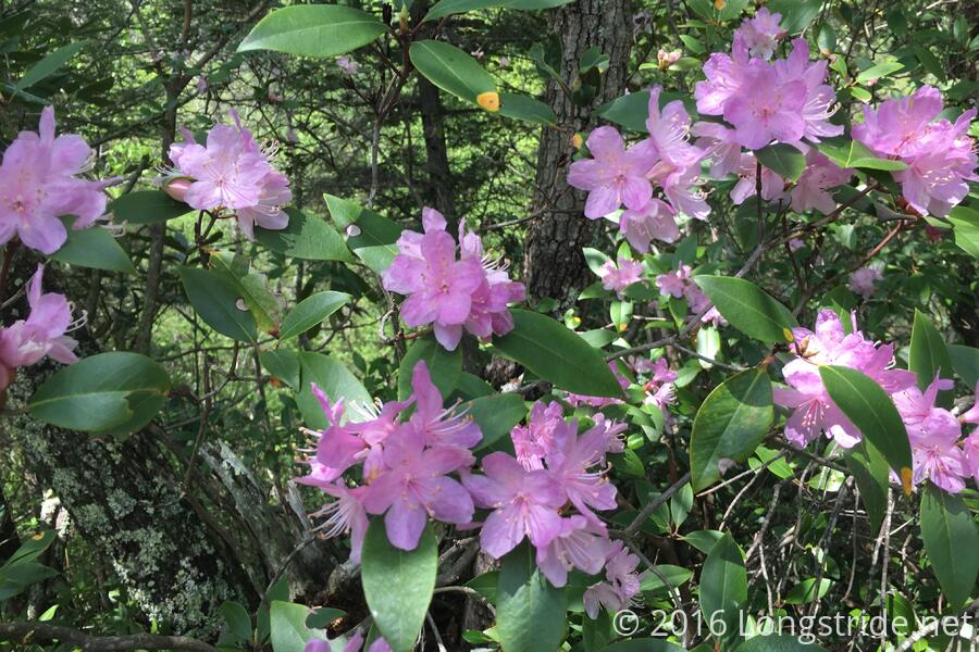
Shortly before reaching the Laurel Fork shelter, I had my first encounter with a rattlesnake on the trail. Fortunately, it was mostly off to the side of the trail, so it wasn't difficult to walk around it. The trail made up for it with some rhododendron blooms shortly up the trail.
The shelter in this area, Laurel Fork, is easy to miss going north. The side trail to the shelter is up a steep hill that forks off the AT going behind if you're heading north; the sigh is mounted on a tree some 15-20 feet off the ground and only visible when heading south. I passed by one NOBO who had missed this. (I called out about a minute or two later when I saw the sign; I hope he heard and came back).
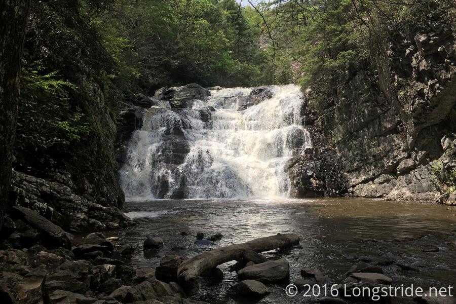
Just before reaching the hostel again was Laurel Falls. Leading up to the falls was a somewhat challenging rock path only a few feet wide and right next to the river (a misstep could send you swimming). The falls itself looked nice, but the view was then rewarded with a very long, steep, set of rocky stairs heading uphill.
After making my way back to Black Bear, I discovered that Sassy had set up my tent to let it air out and dry, which was pretty awesome of her to do. It was mostly dry by the time I got back, and when some gusts of wind blew through, I had to chase after it and put it away.