The morning got off to a good start. Penny made me a cheese and egg omelette for breakfast, and also gave me a few hard-boiled eggs and a salami and cheese sandwich for lunch. We set off for the trail around 7:15, and made it there at 8:20, delayed a bit by traffic. At the trailhead, as I was getting out, were three other hikers, who began walking down the road to the facilities I waited for Penny at two days ago. Penny and I said goodbye, and I resumed my trek north. (Thank you so much, Penny and Edwin, for your hospitality the last two days!)
Very early in today's hike, I passed the 700-mile-remaining point. Shortly after, I met Mama Bear, a videographer two weeks into her section hike. (This explained the largeish camera she was carrying.) We struck up a conversation, and I wound up slowing my pace a bit so she could keep up, and so we could carry on a conversation.
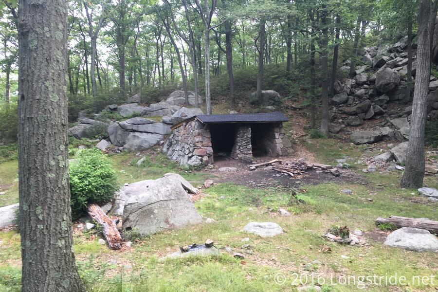
We passed the William Brien Memorial Shelter, which was, except for its roof, built completely out of stone. We thought it was pretty cool looking.
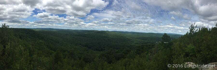
My first break was atop Black Mountain, which featured a distant view of the New York City skyline. I didn't want all three of the hard boiled eggs Penny made, so I traded one of them to Mama Bear for some of her trail mix, of which I've actually had almost none on the trail. Her hiking partner, James, caught up with us there (I had passed him still at camp shortly before I passed her), and we all chatted a bit; them mostly about where they were planning on going today. Tomorrow, they were planning on staying at the Graymoor Spiritual Life Center, a hiker-friendly monastery. I mentioned I was going to the Hemlock Springs campsite, and suggested they consider that; from there, Greymoor was just over four miles, giving them a very easy day tomorrow.
Mama Bear and I continued on, while James continued to rest at out break spot awhile longer. He was also planning on taking a half-mile detour to a rest stop near a road crossing to charge his phone and get water, which Mama Bear and I were not inclined to do. I wound up parting ways with Mama Bear a few miles later at a stream, she stopping to collect water.
I took my second break just after Seven Lake Drive, and was surprised to find I had no cell reception for the first time since Pine Grove Furnace. Mama Bear passed me while I was stopped, and I caught up with her again as we began the climb up Bear Mountain.
The climb up Bear Mountain was quite nice. Although it was steep, and had a lot of stairs, the trail was well-maintained and easy to hike. The trail became very nice gravel near the top of the mountain, likely to support the (presumably) large numbers of tourists the mountain must get. Coming down the other side of the mountain, and especially towards the recreation area near the lake at the bottom, the trail was especially well maintained, featuring the finest set of trail stairs I've had the pleasure of hiking. (Normally, I hate stairs since they're more work to navigate, and they're often very uneven and irregular in height and length, but these were superb.)
Climbing up Bear Mountain also brought the 1400th mile on the trail. Unfortunately, there was no marker.
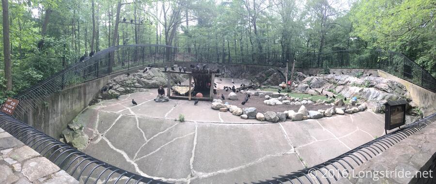
Shortly after the recreation area was a zoo of native wildlife. (I was so hoping to see an elephant, just to have a truly absurd answer to "What's the largest animal you've seen on the trail?".) The bear cage featured two bears, and about a hundred vultures. Just past, the trail reached its lowest elevation, 177 feet above sea level. It's all uphill from here, I guess.
The recreation center had a concession stand, which I declined to take advantage of because I had already walked 30 feet past it, and I figured the zoo would have its own stand. This turned out to be a mistake; there was only the one stand. Boo. At least I got a soda from a vending machine in the park.
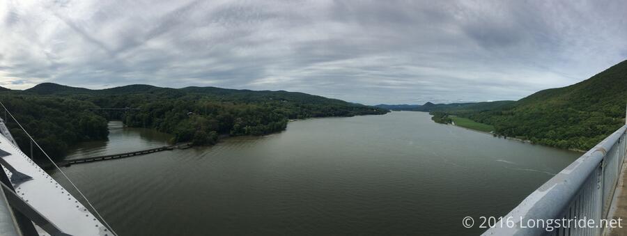
A long bridge and steep hill later, I reached the Hemlock Springs Campsite. A rarity of named multi-tent campsites, it was right on the trail. However, it's name was a lie. There was only one spring, and it was pretty awful. The water barely had any motion to it; it was almost a stagnant pool.
Just before the end of the zoo was a restroom, which I used before taking a short rest, during which I chatted with one of the park staffers (Mike, I think). At the base of the steep hill before the campsite, I immediately regretted not taking a deuce at the restroom. This led to the first order of business at the campsite, after claiming a tent site, being finding the landmine zone and dropping a mine. I'm starting to get a little better at site selection, but the trees continue to have annoying roots that make it really difficult to get the requested 6 inches of depth.
I noted that there were almost no bugs during today's hike. I'm assuming this is because it was actually pretty dry out, rather than the permethrin I sprayed on my clothes yesterday.
Mama Bear eventually showed up, having stuffed herself at the concession stand, but also in pain from a leg injury from a fall the other day, that was exacerbated by today's hike. Since the weather tonight was forecast to be completely dry (and I hadn't yet put up my tent), she suggested not putting up my rainfly. I opted to give this a try. It's less time to set up and take down, and it'll be cooler.
James also eventually arrived, and set up camp at a third campsite up a hill from where the two of us tented. The three of us had dinner together, with conversation stretching well past hiker midnight, before I called it quits for the evening and went off to sleep.