As I mentioned yesterday, today’s hike is 16.7 miles from ME 27, over the Bigelows, the last major mountains before the Hundred Mile Wilderness, to East Flagstaff Road. With a 7:30 am shuttle planned, I was able to “sleep in” until about 6:30. The shuttle wound up not leaving for the trailhead until closer to 8, though, delayed as a result of picking up hikers from other hotels.
After a brief stop at the gas station to pick up breakfast food (and sodas), we got to the trailhead around 8:30, and got started. Papa Monkey excellently opted to start without us, and got to the trail and started hiking around 7:30, presumably figuring that everyone else would catch up with him later. (I’d have preferred to have started that early myself, but it didn’t occur to me to get an early ride to the trailhead apart from the rest of the group.)
About 1.8 miles in was 2000 mile marker. This one was a little late, but not terribly misplaced. The trail to there was relatively flat, and I maintained almost a 3 mph pace, somewhat unnecessarily trying to keep up with the other hikers in the shuttle, some who had a few minute head start as I was still eating breakfast when we got to the trailhead. As a result, I somewhat over-exerted myself, and ran out of steam upon getting to the somewhat steep hike up the Bigelows.
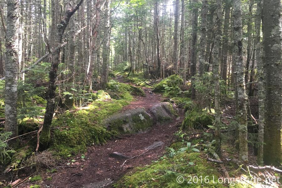
Tired, and not looking up as much as I should have, I missed several blazes and a sign marking the AT turning right, as the trail going straight turned into another trail. Fortunately, I didn’t get very far before I saw a blue blaze, and retraced my steps to rejoin the AT. The diversion probably only cost me a few minutes, but it contributed to the frustration I was experiencing from the steep hill, and I wound up taking a ten minute break at the base of a rock climb just short of four miles in. The break being early, I decided it would be short and soda-only, to lighten my load (by a pound) and give some quick calories, without killing too much time.
The trail continued up, to The Horn, the southernmost peak on Bigelow Mountain, where it went above treeline. The wind picked up considerably there, and the rocky summit reminded me of the Whites.
I took my second break about halfway between The Horn and the West Peak of Bigelow Mountain, my average pace having slowed from almost 3 mph, to under 2 mph.
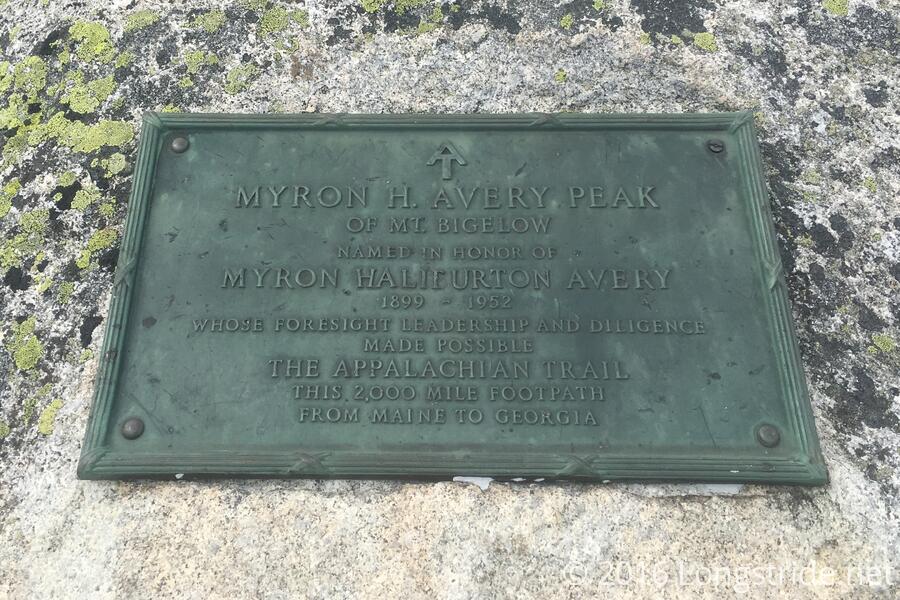
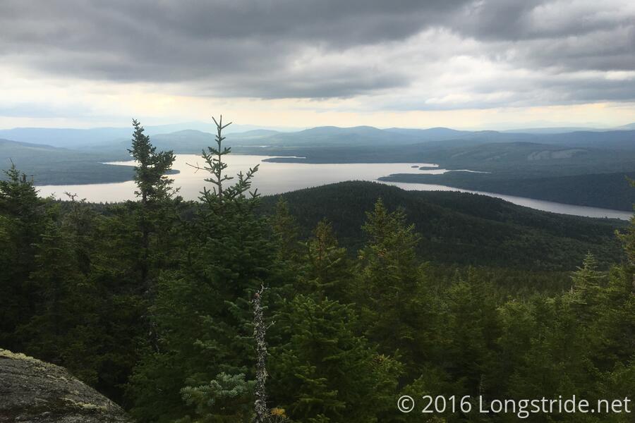
The final major climb of the day was to Avery Peak of Bigelow Mountain, named after Myron Avery, who was the founder of the PATC, the first 2,000-miler, and responsible for extending the AT from its originally planned terminus on Mt. Washington to Katahdin. (I found myself grumbling a bit, thinking, “I could have been done by now!”.)
It was suggested to call Stratton Motel upon arriving at Avery Peak to schedule the pickup at East Flagstaff Rd. Still very windy when I got there (to the point where having a phone conversation wasn’t really feasible), I continued on until the trail dropped below the treeline, at which point there was no longer signal. This somewhat annoyed me, being that I was bringing up the rear of a group I didn’t necessarily trust to wait for me at the trailhead.
I continued down Bigelow Mountain, and up Little Bigelow Mountain, stopping for a break halfway up the smaller mountain, my average pace having slowed even more.
On the way up Little Bigelow, I passed Lou and Julie as we were navigating a particularly tricky section of a rock climb. They mentioned that Papa Monkey had passed them much earlier in the day, considerably ahead of the rest of my group.
The top of Little Bigelow was a long rocky ridge, roughly level. Once I made it about halfway down Little Bigelow, the trail got much less rocky, and I was able to considerably increase my pace, finally making it to the trailhead around 6 pm. Unsurprisingly, there was no one there, and no cell signal.
I began walking “north”, to the next trailhead along the road, and fortunately, got a weak cell signal there, and was able to call for pickup. Had I not gotten signal there, the only other option would have been to continue to walk towards town, which would not have been much fun, and hope for cell service or someone out driving who could give me a lift into town. (I never asked if there had been a contingency plan for picking me up had been no signal. I suspected there wasn’t, and didn’t really want to hear that.)
The weather today had called for rain, and in fact, looked like it was going to storm this morning. Fortunately, we didn’t get any rain, though it looked like there may have been some rain last night, though, since earlier in the morning, the rocks looked a bit slick.
My shuttle back to town wound up taking over an hour to arrive; the shuttle picked up a flat tire on the way, and Marching Band had to turn back and return in his private car (which also sat lower to the ground, reducing his speed on the dirt road). While discussing options with Marching Band (Stratton Motel's manager), and expressing some reluctance at going along with the plan decided on yesterday after hearing that that group wanted to leave Farmhouse at 8, I was offered a cot in the motel's office instead. I accepted. I was exhausted and sore after a much more strenuous day than the elevation profile led me to expect, and a cot at Stratton Motel all but sealed my decision to zero tomorrow. (Also, as late as it was, I'd never get my resupply done in time tonight, or tomorrow morning.)