Today marked my return to Springer Mountain and the Southern Terminus of the Appalachian Trail. And while hiking the AT again isn’t my goal for right now, I must admit, I did have the brief thought of just hiking the AT again rather than hiking the Benton MacKaye Trail, as planned. As much fun as it might be to revisit the AT, though, that’s not why I’m here today.
The train to Gainesville was much quieter than the one I was on three years ago. There were far fewer people, and no loud obnoxious kids. That said, I didn’t really sleep too well, and I drifted in and out of sleep over the course of the night.
I woke up just before the 6:30 am alarm I set, which should have been about half an hour before we arrived in Gainesville, only to find that the train had been delayed by an hour due to bad weather. This was somewhat bad news for Michael, who was already on his way to pick us up from the train station, and he wound up having to wait until our train finally arrived. (Fortunately, he had podcasts to listen to, so the delay wasn’t a total loss for him.) Our train arrived a little after 8, and Michael gave us a lift to the nearest IHOP for a much-needed breakfast. After that, we were off to the trail.
We arrived at Amicalola Falls State Park around 10 am. There was a group of about eight or ten hikers (and one dog with saddlebags) planning on thru-hiking the AT gathered by the visitor center’s AT Hiker registration room. One of them also hiked in 2016, though I never met him; he was behind most everyone, and summitted Katahdin in December!
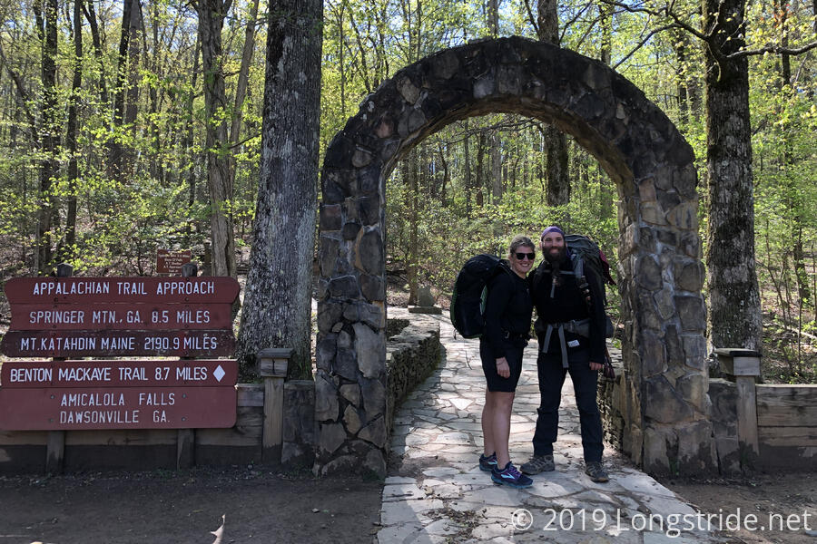
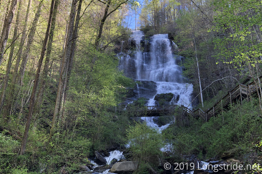
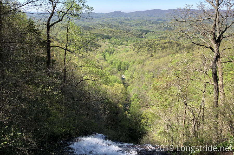
After making use of the facilities and refilling our water bottles, Michael, CareFree, and I left through the arch and started up the approach trail, climbing up a series of 600 stairs to make our way to the top of the falls. Now, almost a month later in the year than when I was here in 2016, the forest was considerably greener, which was especially notable once we arrived at the top of the falls and were able to look out over the surrounding landscape. It’s the nice bright green of newly-budding trees.
Michael joined us for a couple miles, turning back where the approach trail crossed a creek, and CareFree and I continued on, passing every other hiker we came across. About halfway to Springer Mountain, we stopped for a break at a nice campsite on the side of the trail, just as a family and their two dogs left to resume the trek up the mountain.
For most of the day, it was cool and clear out, with not a cloud in the sky. The wind alternated between calm and gusty (though not too gusty), likely the remnants of the storm the blew through the area yesterday, and it was somewhat refreshing. Much of the trail was lined with new plants — there were many stands of May Apples in the forest adjacent to the trail — and it was a fresh new look at the trail I hiked three years ago. Truth be told. I didn’t actually remember much of the Approach Trail at all. There were a few bits and pieces I recognized, but most of my recollection has been dimmed by the passage of time (or more likely, I just didn’t record that memory at all, being far too distracted by the entirely novel experience of starting on a 2200-mile hike). It was quite a bit rockier than I remembered, though.
Along the way to Springer Mountain, we took a short detour, hiking about a tenth of a mile along the Hike Inn trail to peak-bag Amicalola Mountain. We briefly pondered a second detour to summit Black Mountain, but there was no trail to that mountain’s summit, and we weren’t keen on bushwhacking through the brush.
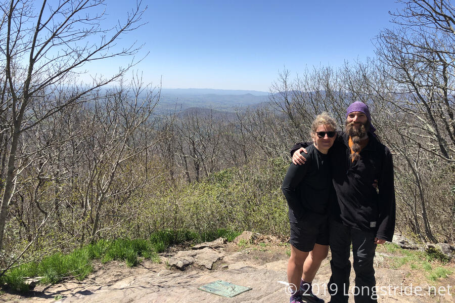
We arrived at Springer Summit around 2:40 pm, and took a break there for a bit to take photos and sign the register hidden under the back of the rock with the AT plaque on it. There were three log books there; I meant to check to see if I could find my entry from 2016, but then someone asked if I could take a picture of them, and I forgot about it when I was done with that.
After our brief stay at the summit, we continued on via the AT to Springer Mountain Shelter (which I somehow didn’t realize was there three years ago!) for a proper break where we could sit down at the shelter’s picnic table. Before we got there, we ran into a GATC ridge runner, Captain Planet, who had formerly thru-hiked the AT (in 2015, I think she said), and was now volunteering with a group of other trail volunteers to help new AT hikers make it through their first days on the trail. She was happy that we were hiking the BMT — she rather enjoys the trail — and suggested that we probably wouldn’t see anyone.
Our brief stay at Springer Mountain Shelter was uneventful, and another tenth of a mile along the AT brought us to a fork, where the Benton MacKaye Trail diverges. Taking the trail less traveled, we turned right, and headed downhill, away from the AT.
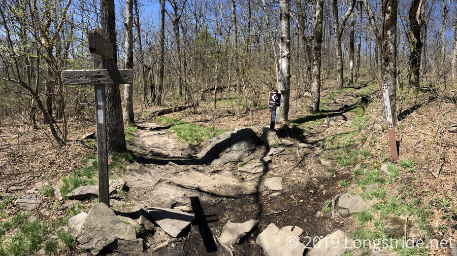
It was quite clear immediately that the BMT is less frequently hiked than the AT. The ground wasn’t as worn, and there were places where grass was growing on the trail bed. It’ll be nice to go where (relatively) few people have gone before, for a change. In as much as the AT is wilderness, when we turned onto the BMT, it immediately felt more remote and untraveled.
I’ve said often that sometimes, it seems that the AT’s goal in life is to kill as many hikers as possible by causing them to trip and fall on the many rocks and roots that cover the trail. The BMT is apparently no different; not even half a mile in, CareFree tripped on a tree root and fell, lightly scraping her knee.
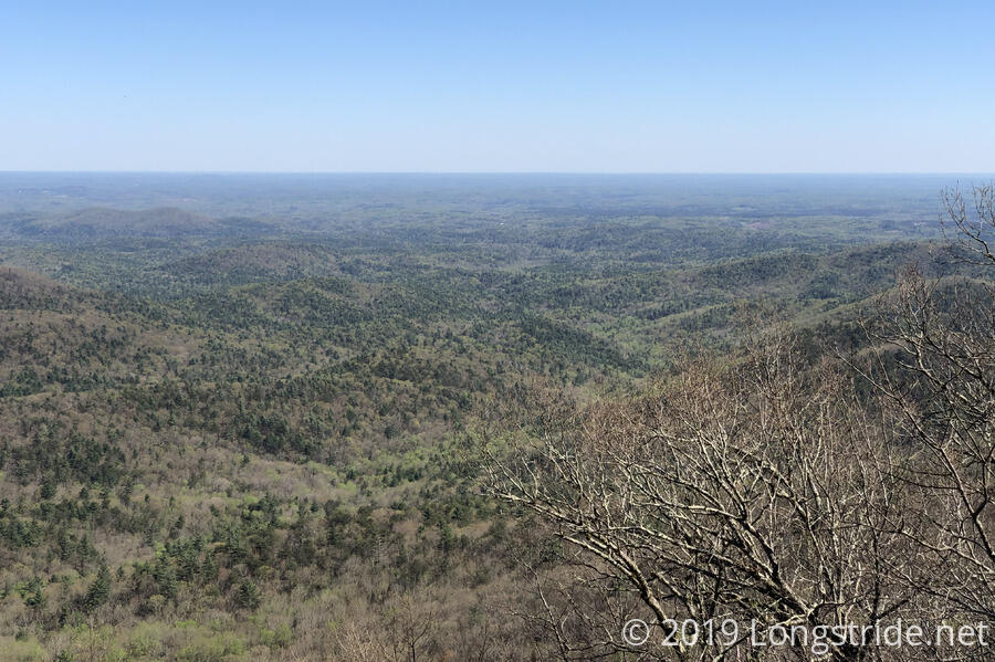
A little further on, we took a quick detour to Owen’s Overlook to take in a nice view, and then continued on to our planned destination, Underwood Creek, the first water source on the BMT with a campsite. Along the way, I felt my energy level quickly draining, and I was starting to get a bit of a headache.
We reached the creek around 4:45, crossing via carefully tree-branch-and-rock hopping. The north side of the creek has a campsite; it’s a large enough area that you could get two or three tents if you needed to, but unfortunately, the ground isn’t flat, and there are lots of rocks and roots in the ground; there really wasn’t a good place at all to put a tent; rather, a choice of differently-bad alternatives. But, we found a spot that worked well enough, and made do with that. With my headache worsening I lied down in the tent for a little while, eating two Jolly Ranchers for sugar and drinking some water; my headache lessened over the course of the next hour, going away completely once I finally cooked and ate dinner.
The campsite itself was fairly simple. It had a large fire ring, which we didn’t use, easy access to Underwood Creek for water, and one tree had a nail hammered in, providing an easy hook for me to hang my water bag from for filtering. (This was really helpful, as almost all the low-hanging branches on all the trees near the campsite had been broken off at some point in the past.)
After we got comfy in our sleeping bags, we realized that some of the roots we put the tent on were a bit too pokey for our comfort. We didn’t really want to move the tent — not that there was any better place to put it — and instead decided to use our Z-seat foam pads to serve as a buffer between the ground and the tent; whatever was under there wouldn’t be able to poke through the foam.
Night fell, and we huddled in our tent, tired, and sore, but a good first day of hiking, and CareFree’s first in the Appalachians.