Our second day on the BMT brought us some steep climbs, but also nice rivers and waterfalls, as we began to turn west through Georgia and away from the Appalachian Trail.
It was much warmer out this morning than yesterday, which was nice, although the improved temperature did not manage to lure CafeFree and I out of our tent early. I don’t think we got up until after 8:30, and even then, we were very relaxed about breaking camp, and we didn’t leave Underwood Creek until a little after 10.
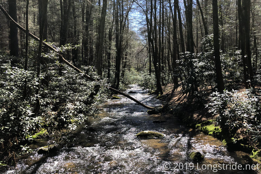
As we continued north, there were fords of two creeks in rapid succession. Using a combination of branch- and rock-hopping, we made it across dry, and after the second creek, we noticed footprints in the mud — to me it looked like one person and a dog. Given Captain Planet yesterday told us we wouldn’t see anyone, it seemed a little surprising to see clear evidence so soon of someone else hiking the BMT. So who are they? Maybe we’ll catch up with them and find out.
After about twenty minutes, we crossed the Appalachian Trail for the first time today. After a few miles, we crossed the AT again. We saw our first other people of the day when the BMT joined the AT, just south of Three Forks, where there is a footbridge that crosses a river. That river crossing was one of the highlights of my second day on the AT in 2016, and it was nice to see the area again with a bit more foliage.
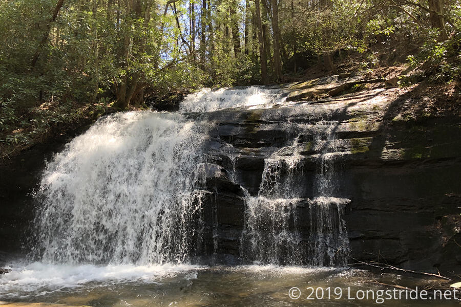
On the short one-mile stretch where the BMT and AT coincide, we saw about a dozen other hikers (some thru, some not). In contrast, we didn’t see anyone else on the BMT until we stopped at our campsite this evening. At the junction where the two trails diverge, there is also a side trail to Long Creek Falls. I skipped going there three years ago, so I was happy to take the detour this time. Conveniently, it was about five miles from where we started, making it a good place to take a break.
The falls was a welcome diversion. While there, we also met two hikers; a woman hiking the AT, and a guy hiking with her for about a week. He had previously hiked the AT, as well as the PCT, and has plans to hike the CDT this year.
After about 20 minutes, we returned to the trail. As the AT heads towards the east the BMT turns westward. Also joining the BMT at the junction is the Duncan Ridge Trail, which splits off from the BMT in about 20 miles, forming a loop with the AT. (If I’m remembering correctly, the AT-BMT-DRT route is said to be the hardest hike in Georgia.)
At another creek crossing above the falls, we again saw footprints in the mud; someone else is definitely hiking this trail ahead of us.
Some steep uphills brought us to a bald, though there were no views; the surrounding trees were all too tall. There was internet access, so we stopped for a bit to make use of all one bar of our reception. While there, we heard a woodpecker pecking away at a tree somewhere nearby. This wound up being a longer than expected unplanned break, but given we’ve lost our trail legs from the PCT, it was a welcome one, especially with another steep uphill that eventually followed.
On our way out of the bald, we saw a small pile of shotgun shell casings on the ground. I think it’s fine that people can use hiking trails for hunting, but it would be nice if hunters would be as considerate as (most) hikers and pick up their trash.
Over the course of the day, we passed a number of fairly nice campsites. I suspected they were only as nice as they were because of the relatively low traffic on the BMT; they weren’t used enough to toughen them up (like Underwood Creek clearly was). It also helped point out a big difference between the Appalachians and the mountains on the Pacific Crest Trail: due to the nature of the PCT’s construction, there’s fewer areas of flat land available for random campsites.
We stopped for our second break at Bryson Gap around 3:20. The gap had a nice campsite, and signs of spring were clearly evident: the tops of the trees all had bright green leaf buds. In another week or two, it’s going to be notably more leafy out. Our original plan, when we were hoping to start from the parking area near Springer Mountain, rather than take the Approach Trail, was to camp here yesterday. Instead, it became our destination for the day, with a possible stretch goal further on — ideally, we’d like to be slightly ahead of our plan so we have a shorter hike on Friday when we’re going into the town of Blue Ridge.
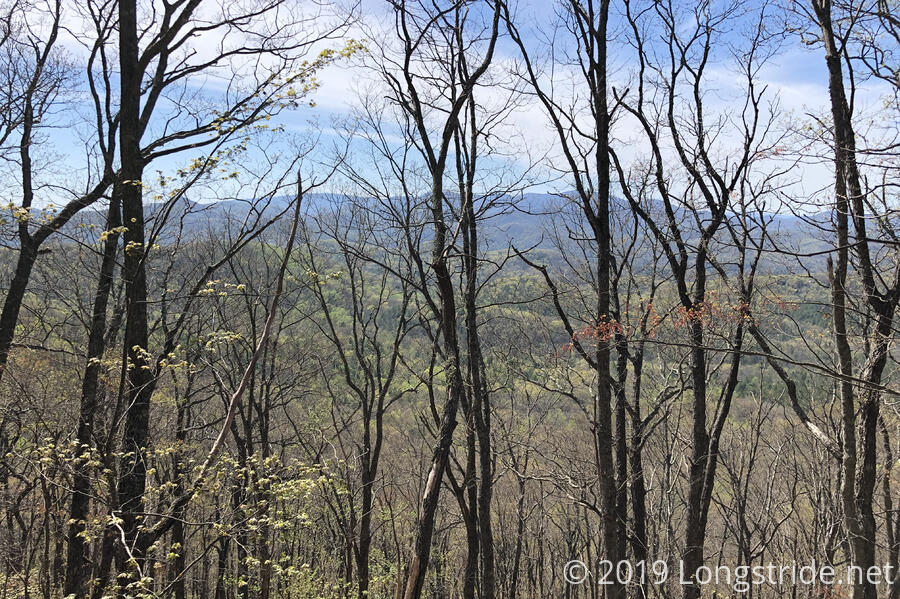
Shortly past Bryson Gap, a small rock outcrop just off the trail gave a nice view of the surrounding landscape, if a bit occluded by nearby trees. In another couple of weeks, it would probably be very hard to see anything from there.
A bit further on, a large butterfly landed on a small plant. It was a bit skittish, so I didn’t get a good photo of it, but it was another reminder of the beauty we have on the east coast that isn’t out west. There were butterflies on the PCT, to be sure, but few were as large and colorful as what we have out here.
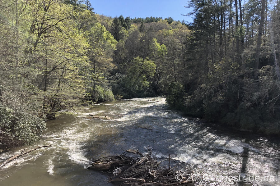
A little under three miles from Bryson Gap brought us to the Toccoa River and the incredibly wobbly footbridge across. CareFree and I started to walk across together, but the wobble of two people got to be a bit much, so we went across separately. The Toccoa River is easily the largest body of water we’ve crossed on the BMT, but that’s not saying much since we’re only 15 miles in.
There are a large number of nice campsites on both sides of the river, though we opted to stay on the north side because we’d actually get some sunlight in the morning. Unfortunately, there’s a parking lot only a quarter of a mile further north, which means this is a popular location for local residents. Once we crossed the bridge, we immediately saw two groups of people: four middle-aged guys with beer bellies (and large cans of beer), and, a family with several kids.
The four guys appeared to be camped further down the river bank, and we were hoping the family wouldn’t be staying overnight. We grabbed a campsite near the bridge, about 20 feet from the river. Unlike yesterday, it was flat and sandy, with no rocks or roots to cause us problems. After we got the tent set up, though, we saw two piles of chopped up vegetables next to a tree nearby. Someone had clearly had a picnic, and didn’t properly dispose of their food. We hoped we wouldn’t be besieged upon overnight by hungry animals looking for more tasty food.
As we cooked dinner, the group of guys kept walking from between their campsite and somewhere towards the bridge. Eventually, we supposed in an attempt to make conversation, one of them asked us as they were walking past, “Do you know where the nearest parking lot is?” As a long-distance hiker, I’m used to getting weird questions from locals or day-hikers who should probably know better (or who should t expect that I know the answer to what they’re asking), but I think that was one of the oddest questions of that sort I’ve gotten. I wondered how they got here if they didn’t know where the parking lot was, since they were clearly not hikers, and why of all possible questions, that was the one they picked.
After we finished dinner, we noticed three people on the south bank of the river. They were definitely hikers. Maybe we’ll meet them tomorrow. I suppose that’ll depend on whether or not we can get up at a “reasonable“ hour.