Today, I Left Lordsburg, now on my way to the next trail town, Silver City, which I’m very much looking forward to as it will be my first zero on the trail.
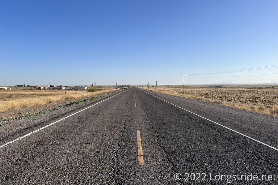
I left Lordsburg just after 7, opting to not start the 3.3 mile roadwalk out of town on state highways in the dark. The road was very nearly flat, with a slight incline starting after passing under the train tracks on the north side of town. With little traffic and a wide shoulder, there wasn’t much danger of getting hit. A road sign claimed Silver City was 45 miles ahead; it will take about 75 miles to hike there.
As I walked, a distance ahead, I could see another hiker also walking alongside the road. It seemed I was catching up, at least a little, but they were far enough ahead it was hard to tell.
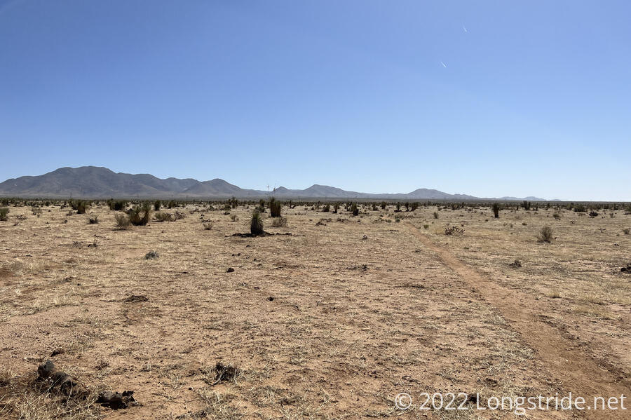
I was able to cut the roadwalk a little short by leaving the road just before a junction and walking along the grass between the road and a large barren field. Plenty of other hikers had apparently also done this; there were well worn paths in the otherwise knee-high grass. These paths lead to a barbwire fence which, in one segment, had its bottom wire raised up to allow crawling under. So with little other choice, I did.
This was yet another cattle pasture, though it had definitely seen better days. It was probably the flattest pasture I’ve hiked through so far, but also one of the most barren and desolate. Most of the ground was partially dried caked mud, and was very pleasant to walk on, especially after the hard road.
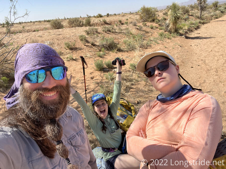
After about ten of fifteen minutes of charging through the field (and still slowly gaining altitude), I caught up with the two hikers immediately ahead of me, Bumblebee and Pale Ale. (I’d originally met Pale Ale on Day 3, between morning camp and the empty trail magic; she was one of the two hikers that day I’d met who’d started going southbound from Lordsburg to the terminus.)
The three of us continued hiking together, chasing after someone else who was ahead of us. (We never caught up with them, so we never figured out for certain who it was, though later we suspected it was the Czech couple.) I joined the conversation in progress, about D&D. (When I ran into Bumblebee on Day 4, she was listening to a D&D podcast, so my arrival had startled her.)
As we headed through the field, we saw ahead two deer-like animals, possibly pronghorns. They ran away before we could get close enough to get a good look at them.
After about seven miles, we stopped for a snack break underneath a tree that provided a little bit of shade. It must be because we’re gaining altitude, but there have been more (though not very big) trees near the trail than in the section south of Lordsburg. Sometimes a little bit of altitude can make a big difference.
Back in camp on Day 1, Bumblebee mentioned setting an alarm to take a selfie every day at 10 am. Since I often forget to take selfies while on the trail, this seemed like a great idea to steal.
The morning was mostly flat with a gradual incline, but as we climbed and approached the mountains ahead of us, the terrain started to get more bumpy as we entered the foothills.
South of Lordsburg, there were random cow bones near the trail. Today, we passed a nearly full skeleton of a cow, with some fur still on its skull, lying beneath a small tree adjacent to the trail, in a small depression, so we didn’t see it until we were nearly on top of it. It was a bit startling, and a definite reminder of how harsh the land we’re going through is.
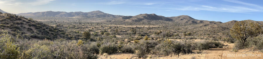
As we continued to climb into the mountains, we reached the boundary of the Gila National Forest. (Though as seems typical, the was no indication of which National Forest it was, I had to look it up.) At the gate that marked the entrance to the forest, we joined a dirt road that we would follow for a long while this afternoon.
Shortly into the forest, we spotted Izzy sitting under a tree, and went over to join them for a nice shaded break. We’d originally planned to go a few miles further to a windmill with a water tank, but there was shade and known company here, so this was as good a place as any.
We decided to sit out the hot afternoon sun under the tree — you could see the nearby mountains shimmering from the heat in the air. I cooked dinner, having been lugging enough water from town to actually be able to do this.
Two wasps (which Bumblebee named “Rico” and “Charolette”) occasionally flew over to check us out. Fortunately they weren’t being very aggressive, but they still insisted on invading our space. I sprayed myself with insect repellant (mostly intended for mosquitoes, but which I’ve had some success with bees before), but they didn’t seem to mind it much.
Some time into our three hour long break, we saw another hiker going past. Pale Ale thought it was someone she had met earlier on the trail, and called out to them. Alas, it wasn’t who she was expecting, but they joined us anyways.
It was Numbers, who also had an extensive hiking resume (including a prior CDT hike). He joined us for the remainder of our break, and hiked with us to our next stop.
From our shade tree, we continued uphill, following the dirt road uphill, deeper into the mountains.
After 45 minutes, we reached reached the Engineers Windmill water tank, where we were able to easily get (and filter) water from the tank. A large tree provided shade. During the time I was there, there were twenty hikers that stopped to take a break or refill water. That included the group of six; the five of us; the Czech couple; Grand Parambulator and Bonanza; and a few other hikers whose names I neglected to write down.
To put this into context, the CDT has long been considered the triple crown trail most fabled for its isolation and lowest hiker count. I regularly saw 20+ people per day on the AT (2016) and PCT (2018), but only occasionally that many people in one place at the same time (and mostly in the southern sections of those trails before the majority of hikers are weeded out). In 2019 (the last not-covid-impacted hiking season), there were 164 successful thru-hikers of the CDT. Granted, not everyone who starts finishes, but to get roughly an eighth of a successful class in the same place at the same time is simply staggering.
I filtered my water, and sat in the shade talking with my fellow hikers, though as time passed, most of them set off down the trail. After an hour and a half, I finally departed as well, hoping to get further down the trail to make getting to tomorrow’s water source easier.
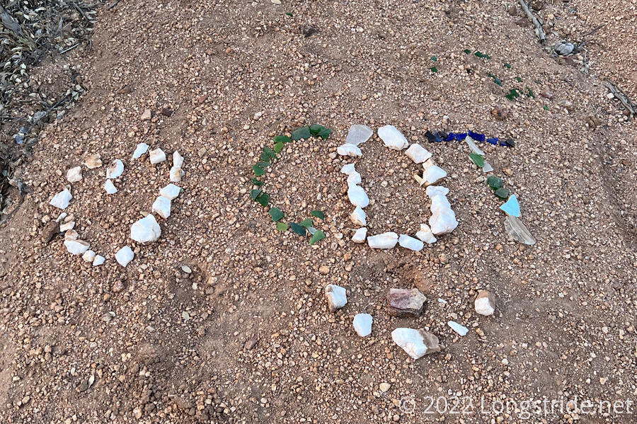
Today set a milestone: I’ve now hiked over 100 miles (and in only six days)! It took me eight days to reach that milestone on the PCT, and ten on the AT. (Though that also reflects the relative difficulty of the terrain on those trails, compared to the CDT, which has been relatively flat so far.) Naturally, there were two different “100” markers written in stones on the trail.
The trail continued to follow the dirt road that led me to the water source, and then split off, following a patchwork of forest roads. The turns were well marked, and it was not at all difficult to follow.
Continuing to climb higher, I got still more views back to Lordsburg, as far as nineteen trail miles from town. By then, due to the setting sun and the haze in the distance, it was hard to pick the town out from the background hills, but the two water towers to the south of town still stood out quite clearly.
A few minutes after sunset, I found a small campsite just off the trail, and quickly set up in the fading light.