Today brought me above 8,000 feet for the first time on the CDT, with the steepest climb to date.
A bit slow this morning, I left camp around 7:30. At least four hikers (including Pale Ale and Izzy) passed by while I was in the process of packing up. There had been some wind overnight, but it had all died down by morning. Some thin wisps of clouds slightly moderated the sun, but not by much.
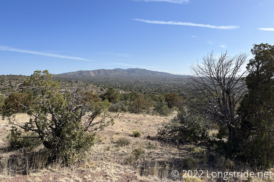
Near the end of yesterday, the trail crossed over whichever mountain it had been climbing, and now it was on its way down the other side. With there being more light out, it was a lot easier to see that this side of the mountain was much greener. It was a beautiful change of scenery.
The trail wound its way down the mountain in a way somewhat unlike the CDT so far, and the trees and occasional cactus reminded me a lot of some sections of the PCT. At least in the early morning, there was a lot of shade; and the trail temporarily lost its “top of the world” vibe that it had yesterday.
Apparently, there are still cattle that graze in the Gila National forest, so there still have been several gates to go through today. However, in contrast to the hiker-unfriendly barbwire stiles or fences, the gates in the national forest are actually gates that swing open, restrained by a link chain that goes through a slit in the gate. These have been really easy to open and close.
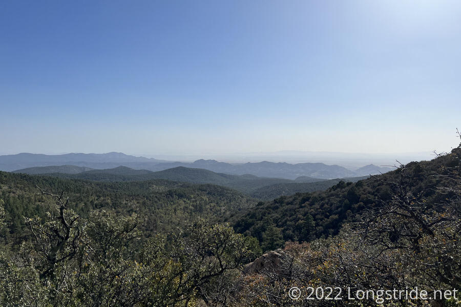
Today, the trail climbs to its highest point so far, just over 8,000 feet, at Burro Peak. From the early morning, the mountain was visible in the distance, and gradually got larger as the day progressed. This would also be the steepest and most-altitude-gaining climb of the trail so far.
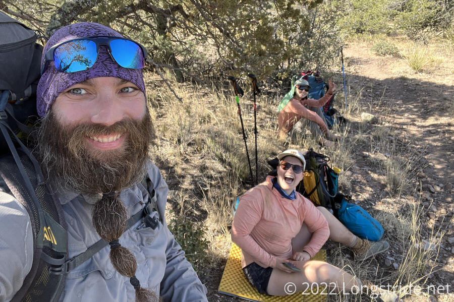
I stopped for a break after about five miles. Pale Ale and Izzy caught up in succession. Yesterday, during one of our breaks, Pale Ale mentioned another hiker who made a small pouch on his pack for his spoon. We though it a funny idea and didn’t see why it would be necessary to have a spoon accessible so easily. But then Pale Ale made a granola and powered milk (plus water) combination that she thought was pretty good, and offered met a bite. But, my spoon was buried in a food bag in the bottom of my pack, essentially completely inaccessible. A spoon pouch suddenly seemed like a good idea.
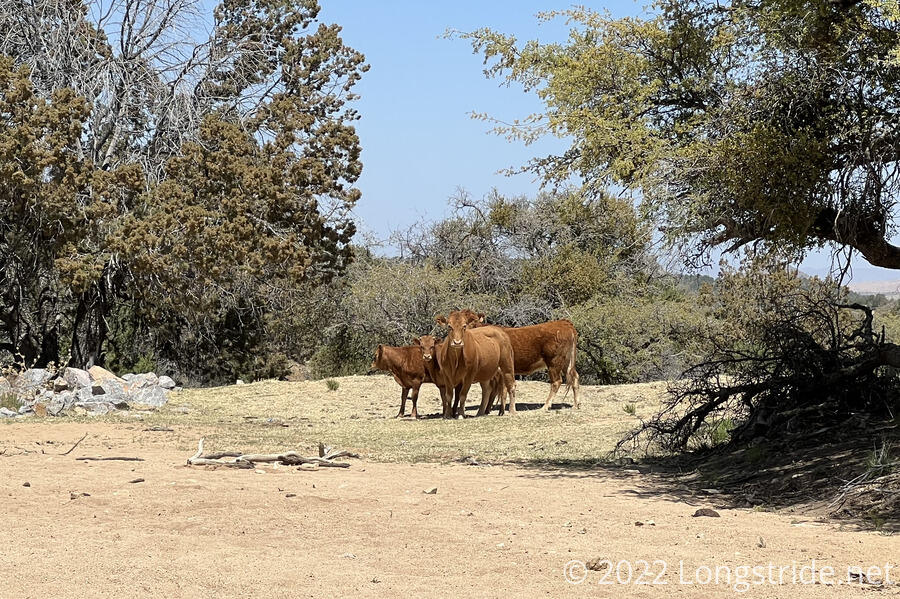
An hour later, I stopped at a water tank used for cattle, my first water source of the day, joining several other hikers who were there already. While we were sitting and chatting, I turned around a noticed that there were four cows that had suddenly (and silently) appeared, and who were staring at us, judging our threat level. They eventually decided we weren’t going to get between them and their water, especially once we started to leave.
One of the hikers, Winnie, let us know that his wife was doing trail magic at the next parking lot, with sandwiches and snacks. So that was something nice to look forward to as the trail continued to climb towards Burro Peak.
On the way to the parking lot, two horseback riders passed me. Later, just after they passed me again on their return trip, I saw the most neon-green horse manure on the trail I’ve ever seen. It was almost as if the horses had been fed green food coloring. During this time, when I managed to get cell reception, I booked two nights in a bunk at Triple Crown Hostel in Silver City, so I have a place to stay for the day after tomorrow, and my first zero the day after.
Eventually, I reached the parking lot. On my way to the promised trail magic, there was another hiker, Moose, who was giving out cold sodas — one to go with the sandwiches, and one for when we leave to climb up the mountain.
Winnie’s wife, “Cyndi Loppers”, provided peanut butter and jelly sandwiches, and there were also some bags of chips and other snacks. Winnie was there also, and shared a few beers as well.
Armed with the energy from a sandwich, a beer, and two sodas, I headed uphill towards Burro Peak. In the hot afternoon sun (and burdened by a water carry), it was a slow and difficult climb. And only being a week into this hike, my trail legs (and especially my uphill legs) have not yet come in. I wasn’t quite hiking from shade-to-shade, but it felt like it at times.
I’d hoped to be able to make it to the summit in one push, but I only made it halfway before I stopped — initially just to clear some rocks out of my shoes, but then I lingered for about 15 minutes to rest.
As I ascended, the forest turned into a pine forest, and felt very different from other high areas on the trail. With some views being considerably more green than desert, as with this morning, it was a welcome change to the trail, though likely temporary when the trail descends off the mountain tomorrow.
On the way up, I also completely drained my pack bladder. I’d half expected this, and I still had a liter of water in a bottle easily accessible, and another two liters in a bottle I’d have to take my pack off to get. So while it was less convenient than just using my pack bladder, I wasn’t worried about running out.
Near six, I reached the summit of Burro Peak. At 8020 ft, it’s the highest mountain I’ve summited since I climbed Freel Peak on the Tahoe Rim Trail last year. The summit wasn’t very exciting; there was a marker, a cactus just off the marker, and not much of a view.
The hike down the north side of Burro Peak was even steeper than the climb up, and the rapid descent And late hour put the sun behind the mountain, making for a very nice hike with a light breeze, even if I was still pretty tired from the climb.
I passed a few hikers getting water just off-trail, but I kept going because my initial plan was to meet up with Pale Ale and Izzy at the Burro Mountain Homestead, a lodge and RV a park that offers free tenting to CDT hikers. There’s also water, and a store (with ice cream) that was already by this point in the day.
About half a mile later, I reached a small campsite just off the trail, and decided that it would be better to stop there instead and hike back the half mile to get water, rather than go a mile off trail to BMH. (I’d also have to hike a mile back to the trail tomorrow morning, and tomorrow is already looking to be a long day with a long water carry.)
Tomorrow is going to be one of the longest water carries so far, almost 19 miles to the first likely source of water, a riparian area, and another three miles to a water tank. So cutting a “bonus mile” off the hike was preferable.
I quickly set up my tent, and then began uphill to get water, first passing Winnie, and then Pale Ale and Izzy in the process.
By the time I was able to start cooking dinner, it was already after sunset, and it was dark by the time I finished and was in my tent.
This was also the highest I’ve camped on the CDT so far, at just over 7,000 ft.