Today was a long day of hiking to get to water and set up for going into town tomorrow.
With over 17 miles get to the next water source, I wanted to leave as early as possible. Naturally, that meant 7:30 instead of 6:30 or 7 as I’d hoped, but at least it was still a little cool as I started to head further down from Burro Peak.
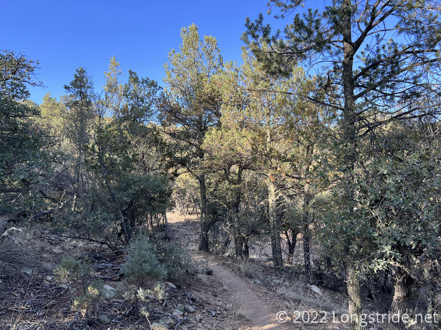
Now that I am in a proper (if a bit thin and dry) forest, I came across my first blowdown, a tree on the trail I had to step over. (I would have expected my first blowdown to be in Colorado, but, I’ll take all the forest I can get.)
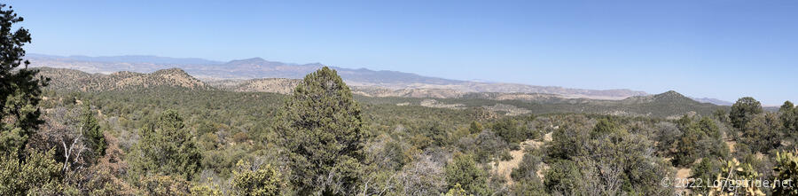
Unfortunately, the forest is not endless. A view to the north showed both forest, and desert beyond.
I made fast progress this morning. One uphill was a little slow, but the rest was mostly gentle downhill, and I made it a bit over six miles before I stopped for a break.
Right after my break, the trail crossed a dirt road. Somehow, instead of crossing it, I wound up turning and following the road somewhat steeply uphill to another road. I guess I forgot to look for footprints; but the road was somewhat rocky and footprints would have been easily broken up. Fortunately, it was a very short detour.
As the morning progressed, there was the expected double-whammy of the forest getting thinner and the sun getting higher in the sky; my shade was decreasing.
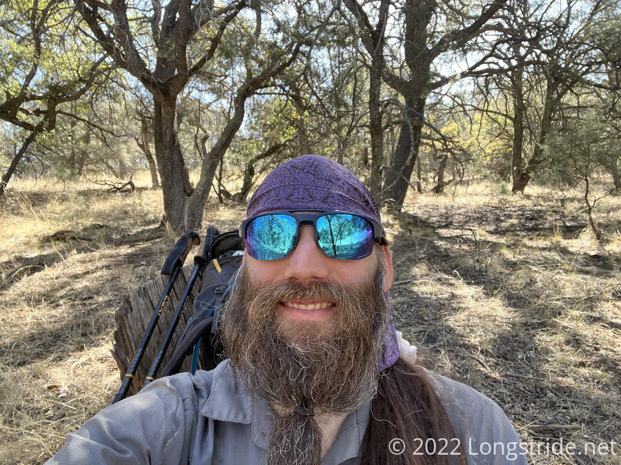
The annoying wooden gates with wire clasps returned. This time, the top clasp was actually made out of barbwire, and it took both me and another hiker right behind me (Cricket, who appears to be from India, or at least somewhere in that general part of the world) to get it closed without injuring ourselves.
My second break was not quite five miles from my first. While the occasional bit of breeze has been cool and refreshing, the sun and growing lack of shade have been tiring, and the long and steep uphill yesterday has left my legs a bit tired; all the uphills today are slower than they ought to be.
In the afternoon, I leapfrogged with a couple of hikers who’d stayed at the Burro Mountain Homestead last night with Pale Ale and Izzy (and Bumblebee). The three of them had apparently contemplated staying there until the store opened this morning so they could get ice cream. It was warm out; I wished for ice cream. Alas, the ice cream fairy did not deliver.
On a mission to make it to water (and a bit tired from the heat), I didn’t really pay much attention to the trail this afternoon. It almost felt like I was a zombie hiking.
Just before 5, I reached a canyon with a sandy bottom, and a turn to the Saddle Rock Riparian Area, where there was supposed to be flowing water. I made the turn off the CDT to look for the water, and found a tiny stream flowing through cow pies.
I kept following upstream, hoping to find the source, or at least somewhere that cows may not have pooped. I eventually reached what appeared to be a spring (but later, I realized the source was probably farther beyond than I went) and small waterfall a short distance before a rock and concrete wall across the canyon.
I was a little nonplussed at the condition of the water, but the next “good” water was still a couple more miles ahead, and I was really tired. So I collected and filtered water here and cooked dinner (while trying to make sure none of my stuff came close to the numerous cow droppings in the area).
About two hours after I left the CDT, fooded and watered, I felt much better. My initial plan had been to camp here, but it had become clear while I was eating that there wasn’t even remotely a good place to set up. So I returned to the CDT and continued on. At least, and distance further I made it today would get me into town that much earlier tomorrow.
Leaving the junction to the water, I heard some kind of horn or siren, and saw two cows ambling towards a side road with a gate, mooing in very low tones. Later, another hiker suggested that the “horn” was the bull, which I had not seen.
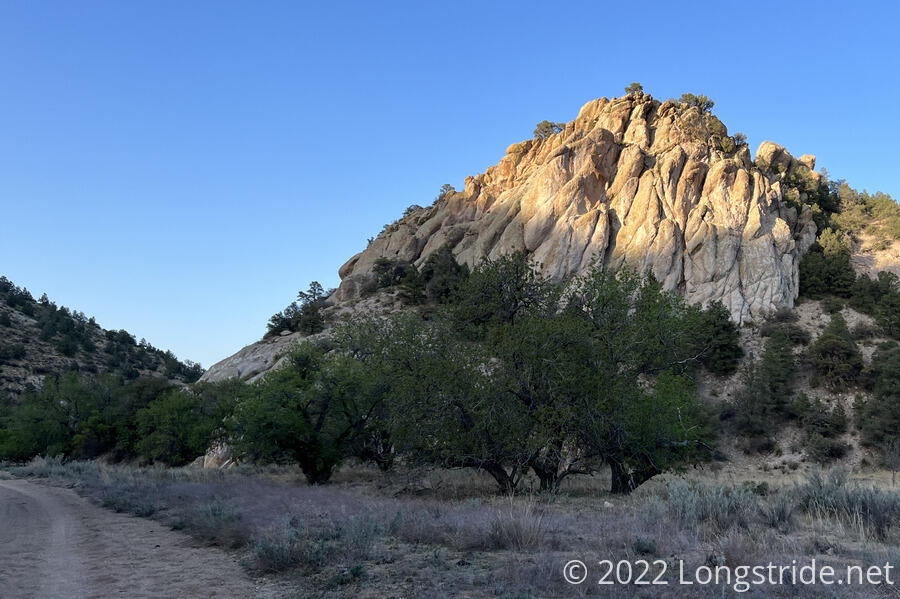
The trail continued to follow a sandy road in a steep-walled canyon for many miles, with lots of opportunities for campsites. Every so often, I’d pass by a cow or two; they were uninterested in me and I kept as much distance as possible while staying on the road.
Possibly because the sun was setting and I was cooler and more energetic, the “cow canyon” (actually, Miller Canyon, according to maps) was actually the most memorable part of the day for me. It did have a number of interesting rock formations. As well as more cow pies than almost anywhere else I’ve seen.
Since it seemed like finding someplace to set up my tent would be fairly easy, I kept hiking until just after sunset, deciding to set up on a little hill next to the road.
That initial site selection was a bit less than optimal, and I couldn’t actually find a flat place to set up that wasn’t already taken by two tents, cow poop, or some small white flowers that a hummingbird was actively feeding on. I relocated to the other side of the road, in an actually flat spot.
Today was 22.1 miles, my second-longest so far, and my feet were a bit unhappy. But I’m glad I went further than planned today, because tomorrow is a thirteen mile roadwalk into Silver City, and the sooner I can get to the road, the less time I have to spend hiking on it when the road becomes hot.