Our longest day on the trail yet brings us to a new height, many meadows, and a distant encounter with a bear.
It was warmer than expected last night, which made it a bit easier for CareFree and I to get out of our sleeping bags, and we got started a little earlier than usual, though only because we were making a side-journey to Freel Peak, the highest mountain in the Carson Range of the Sierra, that was a mile off trail and over a thousand feet up.
The Tahoe Rim Trail crosses a saddle near Freel Peak, but does not go over the mountain itself. From our campsite, it only took us about 20 minutes to get up to the saddle. Even on the short climb up to the saddle from the campsite, we were feeling a bit winded, probably due to the altitude (nearly 10,000 feet).
We took the summit trail east from the saddle, and began a steep climb up a sketchy zig-zag trail made mostly of loose sand and rocks. It felt like each step we took made it slightly more difficult for the next person behind us to ascend the mountain.
About half-way, the trail climbed above the tree line, and began a steady ascent along the side of the mountain, with the view gradually getting more expansive with every step forward (and uphill) we took.
It took us roughly an hour to travel about a mile to the summit, and the views there made the side-trip well worth the time and effort. This was easily our best view of the Lake Tahoe Basin so far.
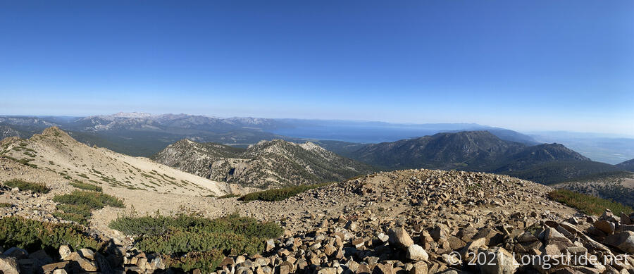
It was a bit windy at the summit, but we took our time and enjoyed the view. We both signed the summit log, and CareFree recorded a birthday greeting for a friend she met a few years ago on the Te Araroa in New Zealand. Freel Peak is now the highest mountain I’ve summited — 42 feet taller than San Jacinto — though far from the highest elevation I’ve hiked. (That distinction goes to the trail leading up to Mount Whitney.)
It took us roughly an hour to descend from the summit back to the trail. We made much better time, but stopped to talk to two groups of two hikers on their way up. Both pairs were day hikers, but one of the pair was also hitting two other peaks on the same ridge.
In our descent down the sketchy switchback segment of the trail, we got off-trail slightly and dropped onto the TRT a bit south of where we should have been, cutting off about two tenths of a mile of trail.
We continued down the mountain for another half hour, and then stopped for a break alongside the trail next to a creek, and took the opportunity to refill water for the next part of the day.
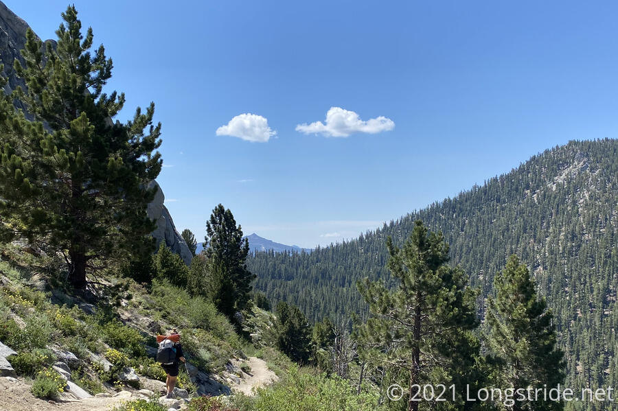
The trail continued south, dropping down a mountain and giving us a variety of views, including towards a curious pyramid-shaped mountain with (as far as we could tell) some kind of tower on top.
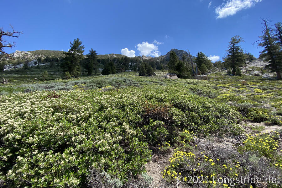
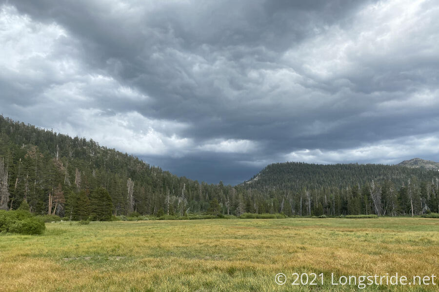
The trail also took us along a beautiful wildflower meadow.
Completing its decent, the trail then turned uphill, giving us a slightly steep climb over two miles that, near its top, seemed to zig-zag incessantly to avoid actually going over the top of whatever hump the trail was going over.
On the way up and down, we passed by more meadows, giving us views both away from and towards Lake Tahoe. We briefly stopped at a view of the lake, and had a short chat with a PCT thru-hiker who was adding the Tahoe Rim Trail as a bonus to his hike. After he left, we also chatted with a local woman hiking the TRT whom we had seen at Star Lake yesterday — she said she felt a little creeped out when we hiked away (after we’d finished dinner) with a thunderstorm approaching (In a sort of, “what do they know that I don’t” scenario.).
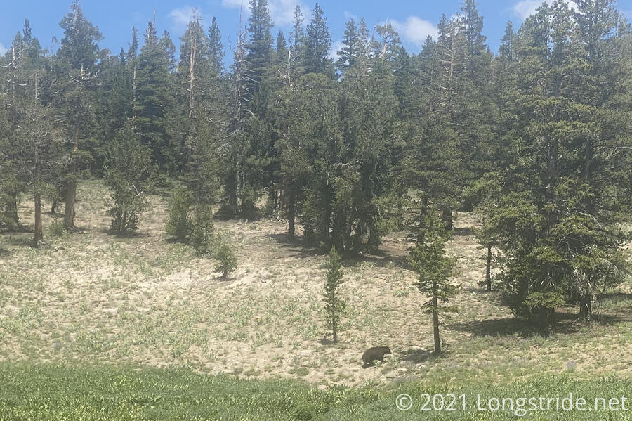
We continued on, the trail bringing us to even more meadows. On the other side of one of them, probably about 500 feet from us, we saw our first bear of the hike. It seemed pretty large, but also pretty uninterested in us, as it ambled along the other side of the meadow. We took some photos and video, but given how big it was, decided that it would be prudent to move on as quickly as possible.
At our next break, leaving just as we arrived, was the hiker we’d met on the bus from South Lake Tahoe yesterday. Later, the local woman caught up with us; apparently, the bear had ambled into the meadow and was even closer to her than it was to us!
Eventually, the trail decided it had given us enough views and meadows, and dropped us into a forest, through which we zoomed along at a fairly rapid pace for this hike. Shortly after four, we stopped at Grass Lake Creek to collect water and cook dinner. We’d been planning on stopping at a lake for the evening, but flowing water is almost always preferable to lake water, and with our final destination for the day uphill, if we could cut out the weight of dinner from our packs, it’d be an easier hike for us.
While we were cooking dinner, at least half a dozen bikers zoomed into the woods, coming from the nearby trailhead. Also, several rock climbers headed into the woods.
CareFree also made a new friend: a bee decided that her sock (on her foot) was the best thing ever, and spent several minutes crawling over (and under!) her foot.
We took a little under two hours to cook dinner and filter our water, and we headed on, briefly stopping at the Big Meadow trailhead to dump our trash in the trash dumpster, and make use of the trailhead toilets.
A short jaunt uphill brought us to “Big Meadow”, a large (but not the largest we’ve seen) meadow with little but short grass growing, from which we could see another storm brewing. Not wanting to get rained on before we got to camp, we increased our pace, and charged over a mile uphill over a rather steep (for the TRT) trail.
On the way down from the climb, we briefly left the forest and got a somewhat open view of the sky, and found that the thunderstorms appeared to have moved in a different direction. We’d escaped getting rained on.
Eventually, we arrived at the (really not very) Round Lake. We passed by the first campsite right as we arrived at the lake in favor of one a little further up the trail, which perhaps gave us a cleaner area to set up our tent, in exchange for being a bit smaller.
Around the lake, large boulders made of conglomerate rock littered both sides of the trail, having fallen out of a sort-of chimney-shaped rock protruding from the mountainside above.
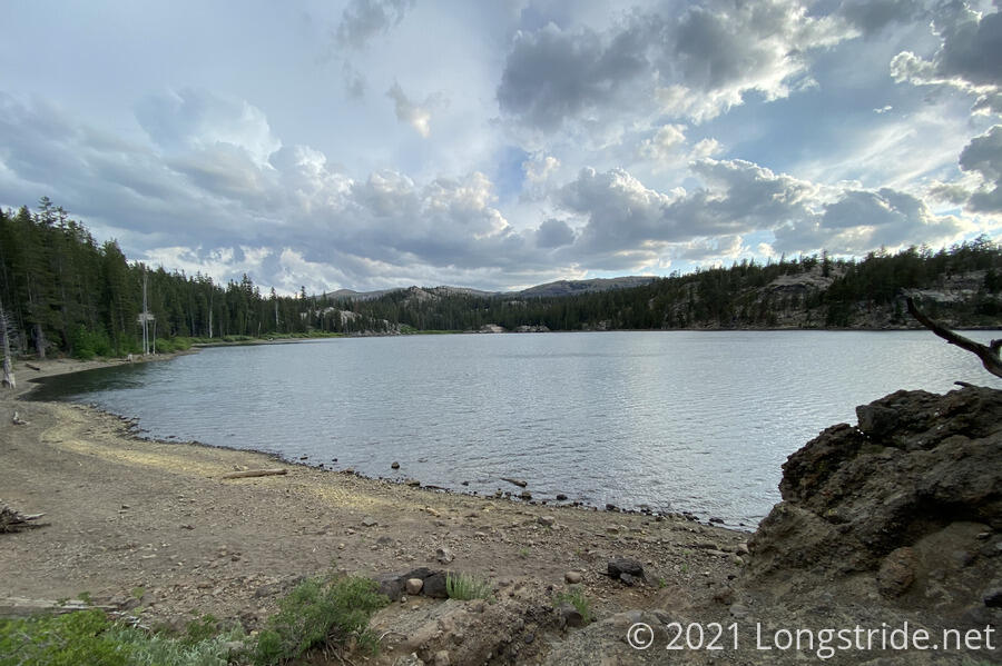
We set up camp, and tried to enjoy the scenic lake. This was somewhat difficult to do, thanks to the very many mosquitoes that insisted on making a meal of us. We enjoyed a quick cup of tea, and then retreated into our tent, exhausted from our longest day on the TRT yet.
Tomorrow: the TRT joins the Pacific Crest Trail, and we head back to South Lake Tahoe for one last town stop before we enter the Desolation Wilderness.