Today returned us to the Pacific Crest Trail, which we’ll follow for a few days
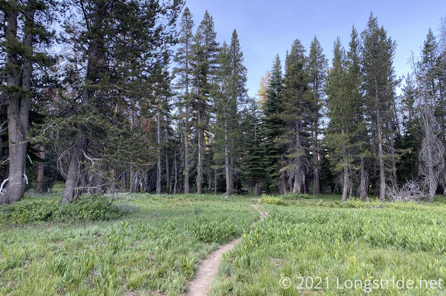
It was again warmer than expected last night, which, in combination with the early-rising mosquitoes, made for a more efficient morning. CareFree and I left camp around 7:15 am, as we continued to head along Round Lake, and then more forest and meadows.
After about 45 minutes, we reached our first major waypoint of the day, the Tahoe Rim Trail’s intersection with the Pacific Crest Trail.
As we expected, this section of the Tahoe Rim Trail is considerably wetter than the northern half. Only by 9:30, it felt like we’d already crossed more creeks or streams just today than we had in the entire trail prior.
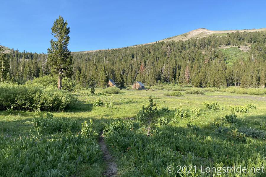
Leaving the meadows, the trail began a climb circling around the inside of a mountain valley. The area was lush green with plants and several different kinds of blooming wildflowers. Clearly, I’d hiked here before, but I had only the vaguest recollection. The fact that there was no snow at all now (save for much higher up the mountain) meant I was hiking through a vastly different landscape than last time.
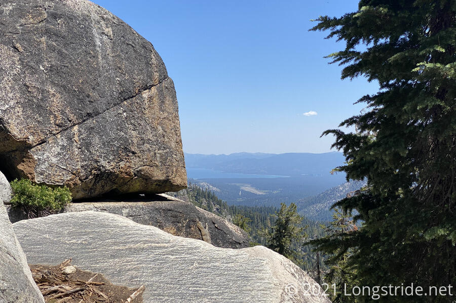
Along the way, we also got a few views of Lake Tahoe. I was a little surprised, since I didn’t recall seeing the lake until the campsite I’d stayed at while hiking this part of the PCT. I must have been too focused on snow, and also on getting as far down the trail as possible that evening.
Later, we passed by sticks on the ground spelling out “1925”; I initially presumed this was roughly 1925 km along the Pacific Crest Trail from Mexico (which would be just under 1200 miles), but that location on the PCT is less than 1100 miles from Mexico, so it’s unclear what the number was supposed to mean.
Shortly after, we passed by two women slowly hiking using four goats as pack animals. We’d previously seen them on our first day on trail. I guess traveling with goats is pretty slow, since it’d taken them ten days to hike what should take us roughly half the time. They seemed to be enjoying themselves, though, which I guess is what’s most important.
Around 11:30, we passed by the campsite I camped at before I went into South Lake Tahoe while hiking the PCT. The idea then was to have a nice, 3.5 mile downhill to the road, which would get us into town early in the day. That was a good plan then, and well executed, but now, it was way more of a steep and rocky descent than I remembered it being, and making that same hike in the afternoon sun (and without the benefit of trail legs) made for a longer and tiring hike.
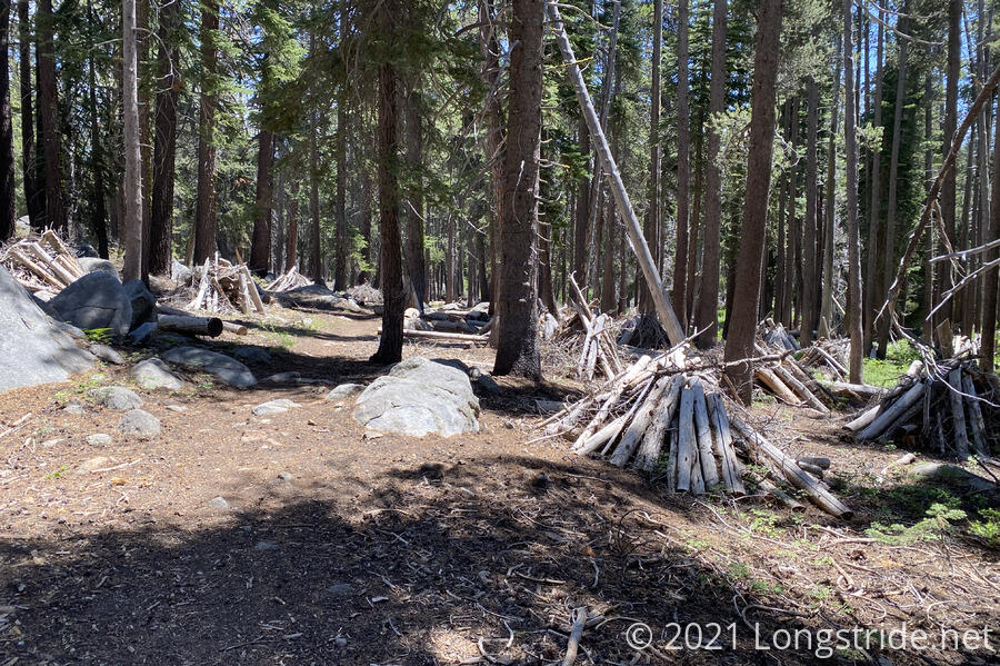
Later, we passed by dozens of downed tree branches and logs, piled up in bunches as if someone were going to start dozens of large bonfires. I assume this is an attempt at fire mediation or control, but having an incomplete picture (most especially, why) makes it hard to guess about. Maybe it’s a setup for a planned burn?
Our hiking destination for the day was the trailhead at US 50, west of South Lake Tahoe. As we hiked there, I realized that I had no recollection at all of this part of the trail, and instead remembered something completely different. What I’d remembered was the trail running parallel to US 50. Instead, the trail seemed to be on the other side of the mountain, with occasional rock dust and chips on the ground. I suspected that the trail had been re-routed (and confirmed that the route was indeed different once I got to the trailhead and compared my GPS track with the one from 2018). This was my first official PCT re-route!
Near the trailhead, we found a list of trail angels posted, who provide rides to and from town, and camping options for hikers not wanting (or unable) to stay in the town’s hostel or hotels. (The list was new since 2018, and is much appreciated!)
Because hitching from a busy highway is always a bit dicey, we called one of the trail angels on the list, and were able to arrange a ride; after dropping a hiker off on the other side of the road, and another hiker shortly up the trail at Echo Lake, Leilani returned to the trailhead to shuttle us into town.
We had a great conversation with her as she brought us into town, and before long, we were back at Pinewood Inn — Leilani was familiar with the place, having taken many hikers to there and back to the trail from there. Thanks so much, Leilani, for getting us back to town!
We quickly checked in, and retrieved our food resupply we’d gotten when we were in town a few days ago. This reduced our chores to four: get a shower; grab lunch/dinner at McDonalds; run to the grocery store to get fresh fruit and ice cream; and relax for the rest of the day.
On our way to the food store, storm clouds again appeared in the distance. By the time we’d left, the clouds had not significantly changed, and we made it back to our motel room before any rain fell.
Tomorrow: we return to the trail to enter the Desolation Wilderness, one of the most spectacular locations along both the Tahoe Rim Trail and the Pacific Crest Trail.