Today started much like yesterday, only earlier. I had another round of French toast at the Red Kettle, and then returned to my room to finish packing my pack and wait outside for the shuttle to the trailhead to resume my hike.
I got started up the Devils Slide Trail at around 8:30, and I think I actually managed to make it up to the PCT faster today than I did yesterday, even though I was carrying all of my gear. (Not having to stop for pictures will help speed me along, I guess. So does knowing the trail is not as hard as the name implies.)
After a short break at Saddle Junction, with an apple courtesy of some day hikers who were going to Tahquitz Peak, I headed down the PCT, towards San Jacinto.
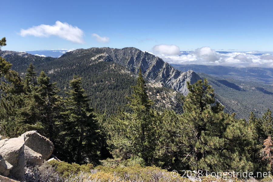
After another short break at the junction between the PCT and the San Jacinto Summit Trail, I headed up the trail towards the summit. Three miles long, with an elevation gain of nearly 2000 feet, this was not an easy trail, and weighed down with a full pack, it took forever for me to get there. A bit before 1, I arrived at another trail junction, and I took a break with three day hikers whom I had leapfrogged a few times along the way. Around then, clouds began to blow in, and it got colder and windier.
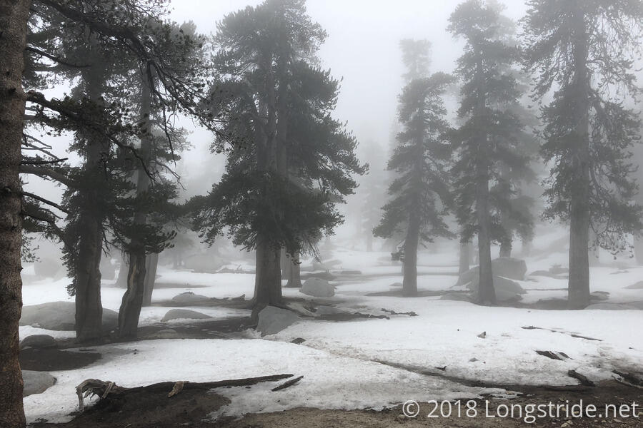
Once the clouds came in, it was foggy for the rest of the day. What started as great day for hiking turned into a slog through a wet cloud, and would probably have put more of a damper on my mood if this wasn’t vaguely typical Appalachian Trail weather — while not enjoyable, I’m somewhat used to hiking through a green tunnel, with wind, fog, and everything I have getting wet. I just didn’t really expect that out here.
As the trail climbed San Jacinto, snow on the ground started to grow, and not only was it foggy from the cloud, it was hazy from the snowpack evaporating.
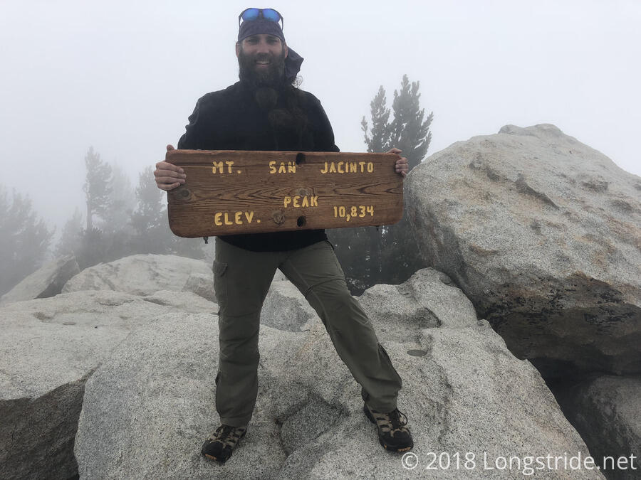
The trail to the summit was somewhat steeper than I expected, and I was moving somewhat slowly the whole day. It was over 4000 ft of elevation gain from the trailhead to the summit, so it’s not surprising I was slow; I just overestimated how quickly I’d be able to move with a full load of food. About 2,000 feet higher than yesterday’s Tahquitz peak, San Jacinto is now the highest mountain I’ve summited, and I suspect it will likely remain so until I reach Mount Whitney in the Sierra.
After the summit, I was happy that the trail was mostly downhill for the rest of the evening. I stopped to collect water at the trail’s crossing of the North Fork of the San Jacinto River, the last water for twenty miles. A multi-tiered waterfall just upstream from the trail gushed loudly, and in better weather, it would have been a nice stop to take a break.
Water collected, I pushed on to the next usable campsite, on the way, admiring one of the nicest stone staircases I’ve seen on any trail.
I made it to a campsite around 6:15, and then spent a significant amount of time setting my tent up. The ground was loose sand, made softer from the dampness in the air. With only a thin layer of sand between the surface and the rock underneath, it was pretty difficult to get my tent stakes to stay in the ground, even with large rocks on top of them to help hold them down. Continual winds didn’t help matters, either. Over the next couple of hours, I had to get out of my tent three or four times to fix stakes that pulled out in the wind. I wound up having to move dirt around and pack it down to help keep the stakes anchored. There also weren’t a lot of suitable rocks in the immediate area; I had to demolish a fire pit to get large enough rocks. My tent is still flapping around in the wind, but at least it’s not as bad as it was that night early on where it was constantly hitting me in the head.
Tomorrow: twenty miles downhill to the desert below.