Although I did not manage to set a record time for departing camp this hike, I at least managed to leave camp before 8 am, and despite ending the day with more than a few hours of daylight left, I got to where I expected to go and had plenty of time to relax at the end of a hard day of hiking.
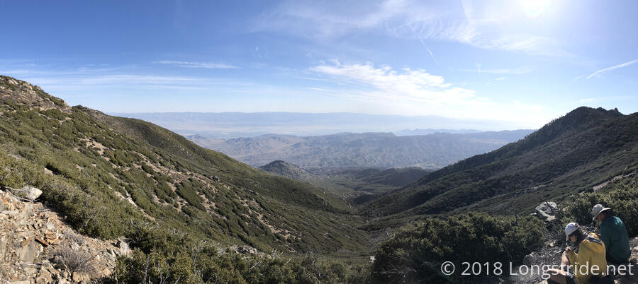
The early morning trail followed the eastern side of the mountain, granting some spectacular views of the desert to the east, with a significant haze from dust in the air. When crossing over to the western side of the mountain, the trail showed the controlled burn from yesterday was still going on. Also visible to the west was Lake Hemet, which would gradually grow larger in view as the day progressed.
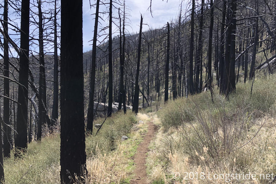
In July 2013, the Mountain Fire on San Jacinto Mountain devastated a large portion of the mountain, destroying many miles of the PCT and threatening the town of Idyllwild (which was evacuated as burning embers reached the town). The trail went through a fair amount of that burn area today, and while the trees had certainly not recovered (and won’t for a long time), the ground brush had already made a comeback.
After 5.6 miles, upon arriving at the Fobes Ranch trailhead, I took a short break with a group of other hikers, in preparation for a steep two mile climb up towards Spitler Peak. (Naturally, the PCT comes near the peak, but never summits, and as far as I could tell, there is no actual trail that goes to the summit.)
Over the past several years, trail crews have been working to rebuild the trail that was damaged during the Mountain Fire. This year, another two miles of the repair work was completed, and the PCT was reopened between the Fobes Ranch and Spitler Peak trails.
Since that section was now reopened, the Spitler Peak Alternate seemed the ideal choice for exiting the mountain. Besides getting an additional two miles of the PCT, this alternate route seemed a shorter and more interesting, involving less roadwalk, than the old Fobes Ranch Trail alternate.
So, after the short break, I began the steepest uphill so far on the PCT, and reached the Spitler Peak Trail intersection a little over an hour later. There were some nice views of the desert to the east, with different parts of it visible from the changed vantage point, but I think the view from this morning was the best.
Arriving at the intersection, I was somewhat surprised that there was no sign about the PCT closure beyond that point. Probably the closure notice is posted a little further up on the trail, but I didn’t really see the need to push forward to find it. (And, looking at the closure map, the trail is open for a short distance before reaching the closure boundary.) With absolutely no sign of any kind at the intersection, it seems a good way to confuse hikers and cause unnecessary “bonus” mileage. In any case, the path forward now was the Spitler Peak Alternate, which follows the Spitler Peak Trail off the mountain, followed by a series of road walks and mountain bike trails to get to Idyllwild.
I stopped at the intersection for a short break to talk to two hikers, before continuing on down the mountain.
The Spitler Peak Trail was relatively easy, starting off a little steep and rocky, and then turning into something (generally) very gradual and easy to hike as it wound its way down the mountain. The trail crossed a small stream with waterfalls several times. About the hardest thing to deal with on the trail was a blowdown that was blocking the trail. Rather than deal with the obstacle course, I cut the switchback; enough other people had that idea that there was a faint trail to follow.
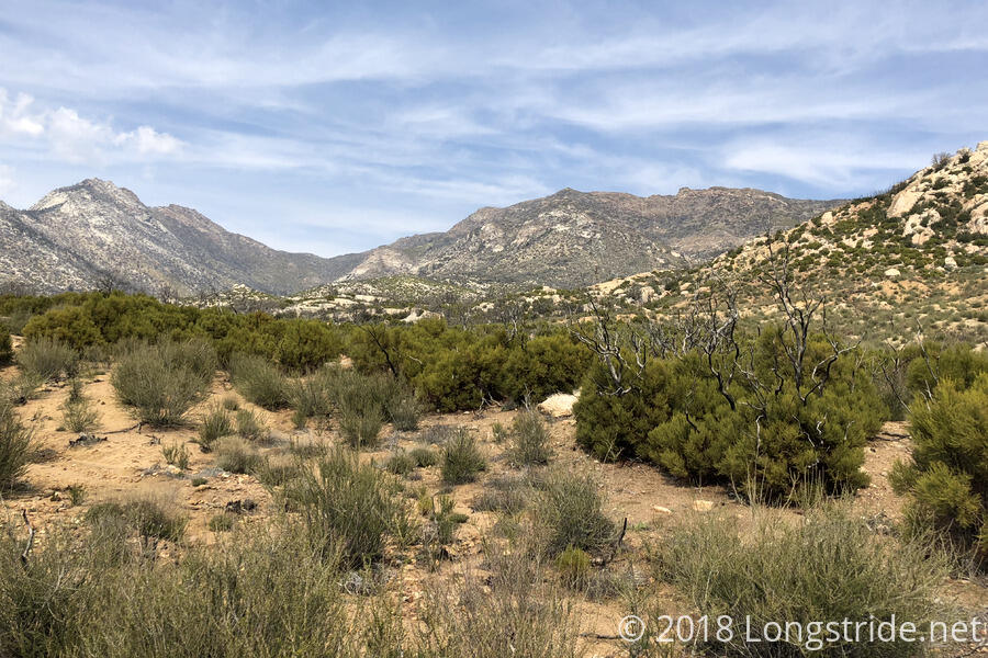
There was quite a lot of sun exposure on the trail today, as per the norm. The top part of the Spitler Peak Trail could have been reasonably well shaded, were not not for the fire. The lower mile or so of the trail returned to a rocky desert scenery. After about five miles, the trail ended at Apple Canyon Road, which the alternate then began to follow. This was a pretty lousy roadwalk, nearly two miles long, with barely any shoulder. At least there were very few people on the road.
I followed the road to beyond where the alternate turns off, to enter the Hurkey Creek Park, a large park operated by the county that has over a hundred campsites. The campground has all the amenities a hiker could want: clean water, restrooms, picnic tables, (coin-operated) showers, and trash cans. Not surprisingly, given the time of year (and day of week), few of the campsites are currently in use, and I got a spot on the far side of the campground, near a trailhead that should reconnect to the alternate route without requiring me to backtrack tomorrow morning. It took a bit of hunting to find a campsite that didn’t have confetti and debris from what must have been an epic campground-wide Easter party.
When I got here, I thought I could probably have hiked further today. Without any actual campsites along the alternate route, though, this was pretty much my only choice, unless I wanted to hike another eight miles and get into town today. That said, my feet were pretty unhappy after a multi-mile roadwalk on asphalt, so going further without a somewhat lengthy break wasn’t going to happen.
Tomorrow: Let’s see if I can get to Idyllwild before noon. It’s a bit less than seven miles, so that should be easily doable.