Today was a short but eventful day, as we crossed several dangerous snow fields on our way through the southern San Juans.
It was cold overnight, but there was practically no wind. It did drop below freezing again, so I was again cold in my sleeping bag. But, once the sun came up — no clouds, even — my tent warmed right up.
Between not eating near as much as I should, and being cold overnight, I wasn’t feeling very energetic this morning. But, I think I’m slowly getting more acclimated to the altitude.
It was a little comforting to hear Mr. Freeze say that she also wasn’t enjoying her food, and that she nearly threw up trying to eat yesterday; the same almost happened to me when I was trying to gulp down my not-very-well-cooked macaroni and cheese.
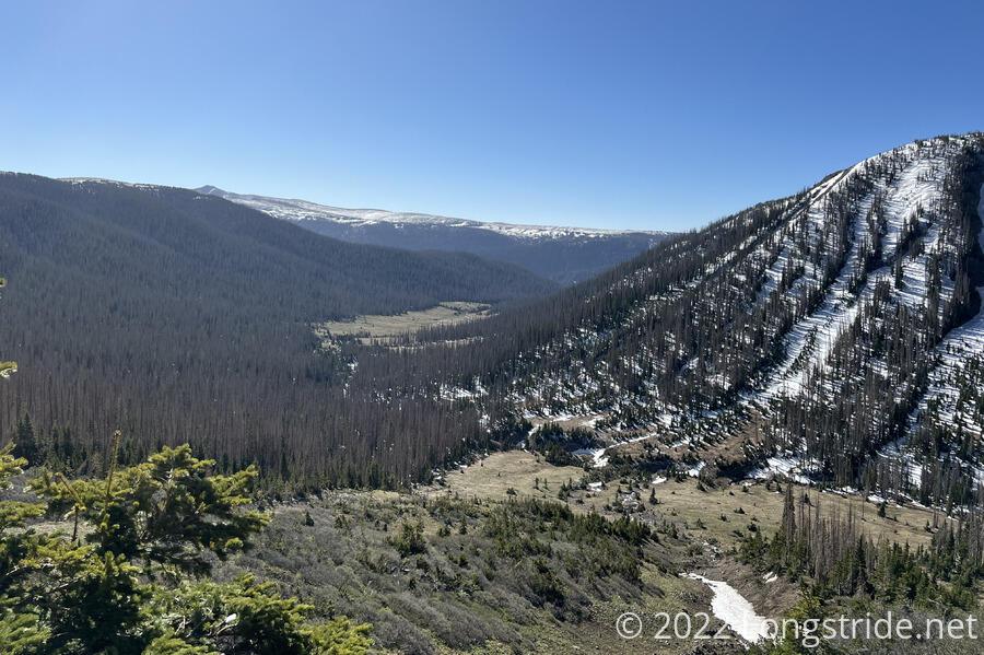
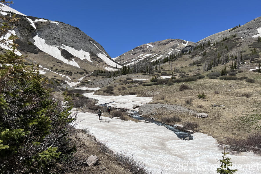
We got started around 8:30, crossing the North Fork Conejos River and ascending the north side of the river valley, heading towards a mountain pass. Compared to yesterday, there was very little snow, and we (initially) made very good progress.
Along the way, the trail crossed a waterfall with ice all around the crossing.
About half an hour after leaving, Kiernan realized he’d left his ice axe back at camp. He dropped his pack and went back to get it, with Kyra waiting for him to return. The rest of us continued on.
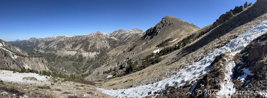
Our rapid progress came to an end after we crossed the pass. On the other side of the mountain, there was a lot more snow.
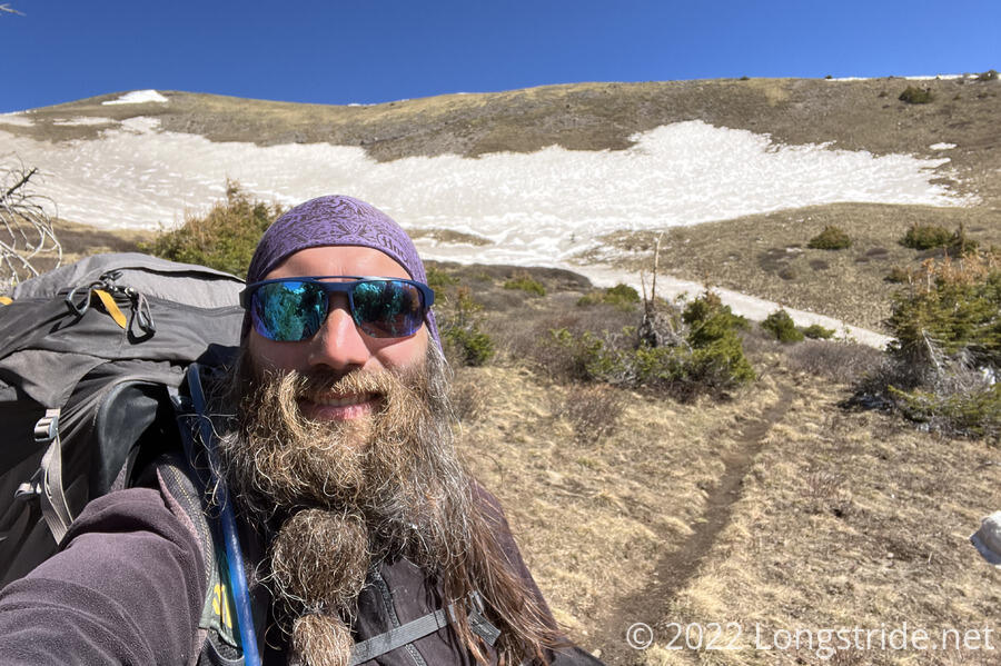
The snow difficulty today began with about a quarter mile traverse across a steep slope.
Once we made it across, she had a short reprieve, and then the snow got worse from there. We put on our microspikes. The additional traction helped considerably, but we were still slow.
After two and a half hours, we made it all of 3.7 miles, and we stopped for a half hour break. It was a rough slog to get there, the second half of that distance taking disproportionately long thanks to the snow.
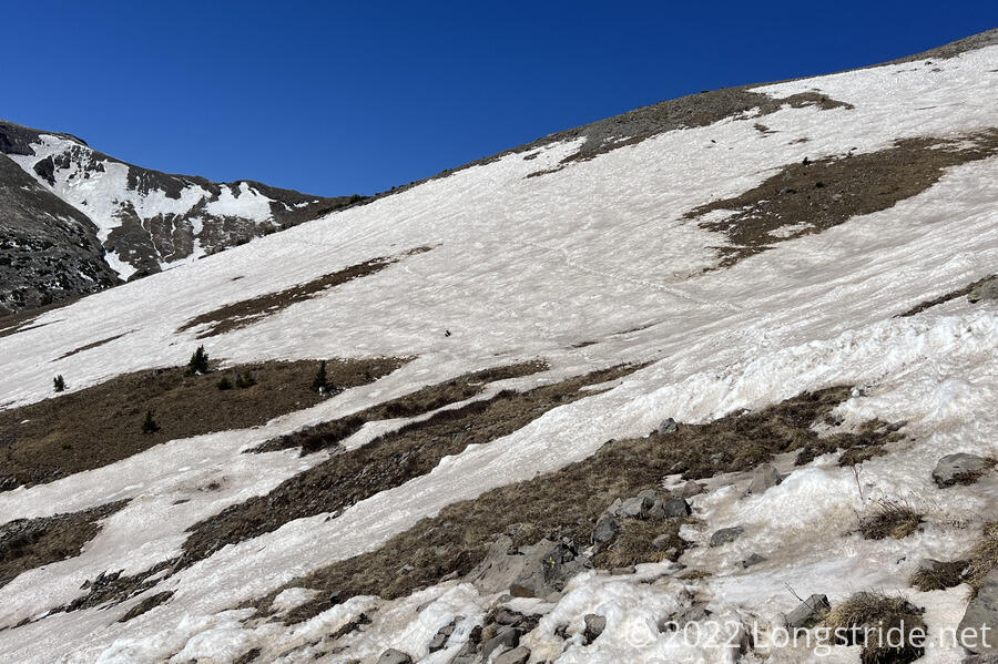
We continued along the south (north-facing) slope of the Adams Fork Conejos River valley, alternating between snow in the forest, and snow in clearings that went much of the way down to the river.
On one of those that we were trying to cross, I lost my footing and then slid maybe 100 feet down the slope. Trying to get up, I went maybe another 50 feet down. Fortunately, I didn’t have to directly climb all the way back up; there was a less-steep clearing just across from where I slid down, and I was able to walk over to that, and then climb back up to the level of the trail.
When I slid down, my water filter fell out of the back of my pack. Mr. Freeze saw this, and Patches was able to retrieve it.
We continued to arduously trudge through the snow and forest, trying not to fall again. Eventually, we made it to the Adams Fork Conejos River, crossed it, and stopped for lunch.
It was now 1 pm. We’d hiked five miles in four and a half hours. This was very slow, and yet, this felt very much like a great accomplishment.
When I was setting up to cook dinner, I discovered that one of my foldable water bottles was missing; it probably fell out when I fell.
I also discovered that one of the shoulder straps on my pack was starting to detach. The prospect of having to get a new pack while on-trail was not enticing.
When Kiernan went back to get his ice axe, Patches said we’d wait for them before climbing the next pass after. So we waited, and started growing concerned when it was taking then much longer than we’d expected it to take them.
When I was looking at the maps, I noticed a trail that followed the river, the Adams Fork Trail, a bit uphill, that connected to the CDT on the north side of the river. I mused that it’d be possible to drop down the mountain off the CDT, cross the river, and climb up to that side trail and rejoin the CDT, with more hiking on the relatively snow-free north side of the river.
If someone did that, we wouldn’t see them (above and behind us), and they wouldn’t see us through the bushes we were sitting in front of.
But, we didn’t think that the K2s would do that. So we continued waiting, and decided that if we didn’t see them, we’d camp here, and continue on tomorrow whether or not they showed up.
I thought I saw a tent in the distance; Patches went to investigate and talk to whomever was camping there. It turned out to be a rock, but it wasn’t entirely a wild goose chase: Patches found a couple of campsites while he was looking.
Around 4:30, Mr. Freeze heard voices coming from above and behind us; investigating, we found four hikers coming down the Adams Fork Trail. They’d done exactly what I suspected: dropped down from the CDT, crossed the river, and took the snow-free trail to its intersection with the CDT.
In retrospect, we probably should have dropped down and crossed the river where I’d slid down the mountain.
They hadn’t seen the K2s, but with proof that one group did this, it seemed likely that the K2s did as well. Now less worried, we packed up from where we cooked dinner and moved to the campsites Patches found.
While setting up my tent, I discovered that one of my trekking poles is slightly bent, probably during the involuntary glissade, or else from one of the many times I lost my balance and wrenched it in the snow.
It took me three tries to set up my tent. I didn’t like first spot, because there wasn’t enough dirt, so I couldn’t get my stakes in deep enough. I tried a second spot that was more protected from the wind, but there wasn’t enough space there. So I moved back to first spot. The wind had started to pick up, so Mr. Freeze helped with setting the stakes, first in the dirt and then piling rocks on and around to keep the stakes in place.
While I was setting up my tent, two more hikers arrived, Pop Tart, who camped a short distance away, and Boss, from Denmark, who camped next to us. Boss had also been hiking with Dragon Sky; she was somewhere behind, and as the hour grew late, he was a little concerned she hadn’t shown up.
Our microspikes were the heroes of the day; without them, we’d definitely have had a more eventful (that is, vastly less safe) day. We probably should have had our ice axes out as well, but our trekking poles served adequately.
It doesn’t feel as cold out as it did yesterday, and it is mercifully not windy, despite the somewhat exposed nature of our campsites.
We’re planning a longish day tomorrow to make up for not going very far today; we’ll start early tomorrow and just hike as far as we can.