My longest day in the San Juans so far set me up for an easy day into Lake City tomorrow.
Despite the non-stop wind last night, it was surprisingly warm. Rather, it wasn’t cold. I opened both tent doors on my side of the tent so that the wind would stop flapping the “closed” door, and hoped it would stay warm inside, as well as quieter. This worked until about 4 am, when it suddenly got colder, but I was warm enough in my sleeping bag to not bother with closing the doors.
Sometime early in the morning, while it was still dark, I smelled, very faintly, what smelled like a campfire. Obviously, nobody camping where I was was going to start a campfire given the fire restrictions (especially at 2 am), so my assumption was that it was a distant forest fire. This was confirmed in the morning, when I was able to see thin wisps of clouds, illuminated by the rising sun, that were reminiscent of the smoke clouds I’ve seen in past forest fires.
I left camp around quarter after seven, and for once, I wasn’t the last person to leave. There was still one tent left near the lake, but I didn’t recognize the tent, and I didn’t see who was inside of it last night, so I didn’t know who was still left.
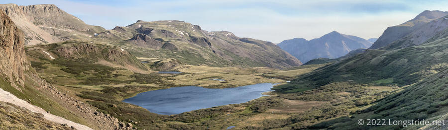
The trail started by climbing up and around a hill near the lakes, and as I climbed, I was able to get a good view looking back at the lake I camped near.
Shortly after, near a trail junction, I was a little surprised to see a whole bunch of backpacks sitting on the ground, and just beyond them, a group of probably twenty or so people sitting in a ring. It turned out to be a youth wilderness group doing a loop hike.
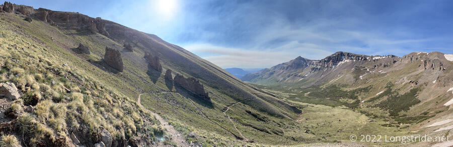
For several miles, the trail followed the side of a mountain down a river valley, first ascending, then descending, then ascending again as the trail turned north to leave the valley.
Somewhere in the middle of the trek through the valley, a thin, tall line of rocks stood out of the ground in the middle of a clearing. So far, they’ve managed to resist eroding away completely, but it’s only a matter of time…
Eventually, the trail joined a dirt road that probably once was used to support mining operations in the area. I passed by three or four derelict cabins, located near large mounds of disrupted dirt and stone. A network of other roads connected to the one the CDT was following, and while I was going through the area, an ATV drove past.
The road became surprisingly steep for a dirt road, and eventually, the CDT itself departed the road in order to add switchbacks on the way up the mountain.
The high winds from last night and the morning never really stopped, though as I went around the mountains, some of the wind was blocked. Once I made it up to the switchbacks, though, the wind came back with a vengeance. It was both a blessing and a curse. Half the time it was impeding my progress; the other half of the time, it was pushing me forward, up the hill.
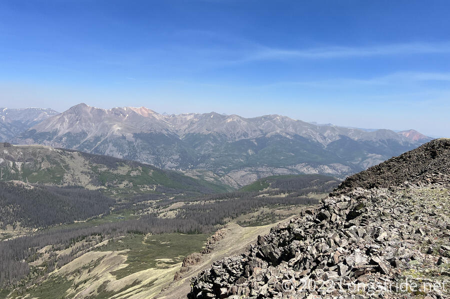
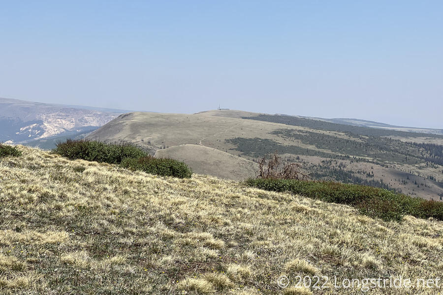
The dirt road crossed a pass and went off in the opposite direction from the trail, which continued going up the mountain. However, the CDT is not a trail that goes out of its way to summit mountains, and it veered off along side, heading off towards another pass. However, I was only about a third of a mile from the summit of a mountain called Coney Point. The remnants of an old road crossed the trail and headed towards the summit, so I decided to do something fun today: summit a mountain.
As I got close to the summit, the wind continued to pick up, and it made it more difficult to maintain my balance as I crossed a large pile of loose rocks on the way to the summit. Apparently, this mountain is no stranger to high winds; somebody constructed a short semicircular windshield out of rocks not far from the cairn that marked the summit. At 13,334 ft, this beats Flat Mountain, my previous tallest summit, by over 1,100 feet. Rather than backtracking, I was able to head off the summit more or less directly towards the trail, saving a little time.
About half an hour later, I had the opportunity to summit the otherwise unnamed “Peak 13240”. Since it was a little shorter than Coney Point, and would require an out-and-back hike with no existing trail, I decided to skip it. One detour and summit was sufficient for the day.
As the trail passed those two mountains, beyond them, on the other side of a valley, one mountain among many had sides stained red. It was a quite distinctive mountain, however, as the haze from the fire blew in on the winds, pictures of the mountain didn’t really do justice to its color.
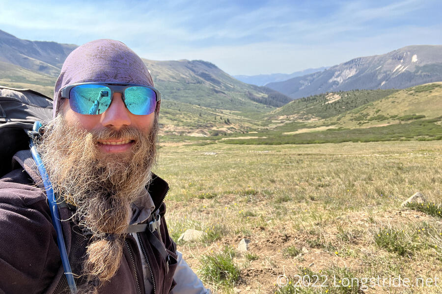
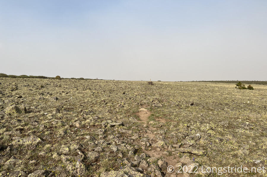
I had been well above the tree line for the entire morning. Most of the land surrounding the trail was a featureless low scrub of alpine grasses and flowers.
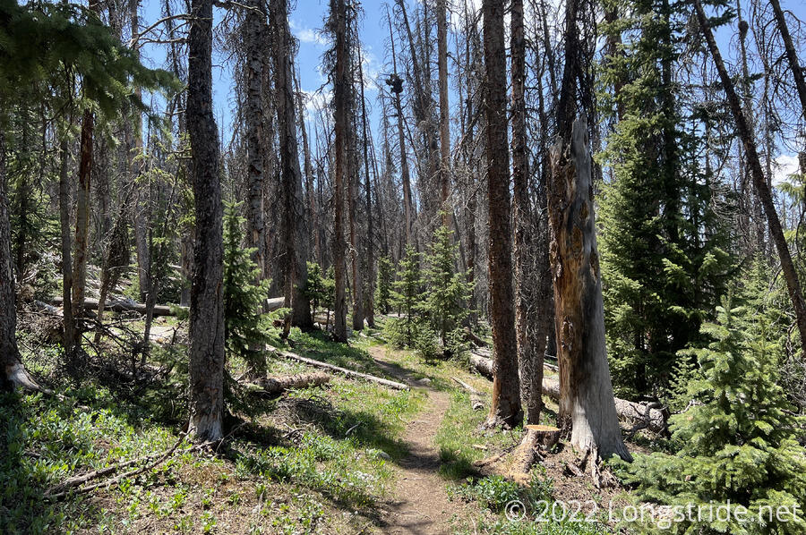
Now past the two mountains, the trail steeply descended. As it did, the body of the mountain was able to block the wind, and for once, it was calm out. I passed Tiempo, Almost, Windchime, and Cream, who were all sitting on a somewhat flat area taking a break. I continued on along a large plateau, eventually descending into willows, and then forest.
The forest gave way to a meadow, which had a small creek. Noting a shaded open area in the trees, I returned to drop my pack for a break, and get my water bag to collect water.
Apparently, I was quite focused on finding water, and I didn’t even notice that I’d passed a hiker in that open area until I returned to drop my pack. He was Soccer Mom, from Utah.
We chatted for a bit while I took a long break to cook my dinner, since this was the last water between here and Spring Creek Pass, which goes into Lake City. After a while, Jules arrived — he was the hiker still in camp when I left. After about two hours, as I was preparing to leave, Tiempo and his group passed through.
The trail was surprisingly dusty today. I don’t think I’ve seen it this dusty in Colorado before. It was just a coincidence that there was also smoke in the air, but with trail on dusty dirt roads a portion of the day, it somewhat vaguely resembled the trail in New Mexico.
There was also very little snow to deal with, only a few short areas that needed to be traversed (or walked around).
After crossing the meadow, the trail bounced up and down a few times, temporarily joining another dirt road that was a bit rough to hike on. I eventually reached another high plateau with low scrub, only this time it was full of small rocks embedded in the ground, which made hiking slow. It reminded me a bit of some of the ridges in Pennsylvania, on the Appalachian Trail.
While I probably could’ve hiked all of the way to Spring Creek Pass today, my prior experiences on the AT and the Pacific Crest Trail told me not to camp too close to roads. (Also, I was out of energy; lunch didn’t really seem to provide me with much.) So, after just over 20 miles — my longest day in the San Juans so far — I stopped at a flat area next to the trail, in a rather thin pine forest.
Not having seen anyone since they left where I took a break before I did, presumably, they all camped at the road, or at least closer to the road than I decided to go.
There’s only about 2.2 miles to go to the road; I’ll probably try to leave my campsite around 6:30 or 7 to get there to try and hitch into town with the morning traffic.