A long day of slackpacking saw me through most of the CDT’s extent in the Rocky Mountain National Forest.
CareFree and I got up relatively early this morning. However as we feared, even the relatively moderate altitude in Grand Lake (about 8400 ft) had gotten to her, and she decided to take the day off and rest.
The CDT in the Rocky Mountain National Park is mostly a large misshapen “U”. From Shadowcliff just on the outskirts of the park in the south, the trail heads roughly northeast, then makes a U-turn and heads west to the Green Mountain Trailhead, and finally, follows a highway for a bit before re-entering the Arapaho National Forest. A 4-mile shortcut cuts off the majority of the 21-mile loop, but for “completeness”, and since I would be hiking today with only a day pack, I decided to do the whole loop. And, since I’m staying at Shadowcliff one more night, I’m hiking southbound today so that I can finish at Shadowcliff, without having to find a ride back to town.
I left Shadowcliff around 7:30, heading into town to get breakfast. In contrast to the very lively town on Friday night and Saturday, it was practically dead on a Sunday morning. Breakfast at Blue Water Bakery was great. From there, I made my way back to the visitor center. After a short delay due to a misplaced set of keys, I got a ride to the Green Mountain Trailhead, about five miles outside of town. We were a little surprised that the entry gate into park was manned early on a Sunday morning (the park has a timed entry restriction, but that didn’t start until 9 am, and we got there half an hour earlier). Fortunately, I still had my annual National Park pass with me, which doesn’t expire until the end of the month, so we didn’t have to pay the entry fee, or try and convince them to let us in for free since I was just getting dropped off a mile into the park. (I’d meant to send it back home in Lordsburg, figuring I wouldn’t actually need to use it on the trail. Turns out, it was a good thing I’d forgotten.)
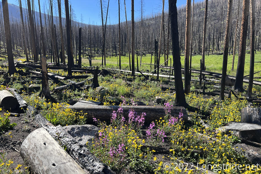
From the trailhead, I started a long, gradual climb into the mountains. The trail began in a burn area, the remnants of the 2020 East Troublesome Fire, one of Colorado’s largest. All of the trees were burnt to a crisp. In spite of the desolation, though, grasses and wildflowers already started to make a comeback, and the area was a vibrant mix of bright green grass and yellow and purple wildflowers.
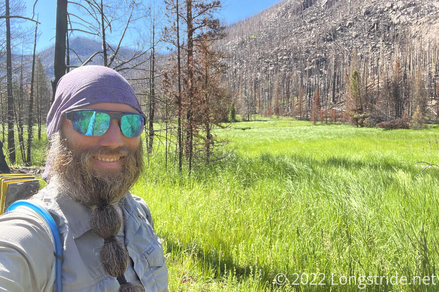
With the lack of shade due to the burnt trees, and the largely cloud-free sky, it was fairly warm out. As I headed west, away from the road and higher up into the mountains, though, there were a growing number of trees that escaped the fire, and shade gradually grew and cooled the air a little.
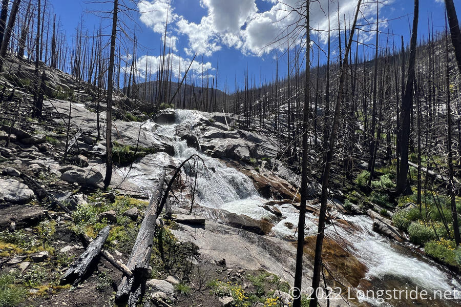
After getting up the mountain a bit from the trailhead, the trail followed alongside a meadow for a while, and then eventually began to follow Tonahutu Creek, which had carved out the valley the trail was traveling through. The trail climbed up through a rocky area, passing near Granite Falls, one of the few waterfalls near the CDT.
I stopped for a break a bit uphill, about six miles from the trailhead, and just before the trail began a steeper climb. This area was a little less fire-scarred than where I started this morning, but that didn’t stop what looked like a great place to sit down in the shade from having black charred ash everywhere.
A little further uphill, a sign for a campground indicated that llamas were permitted.
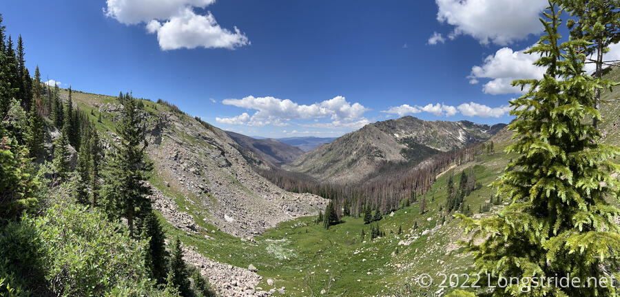
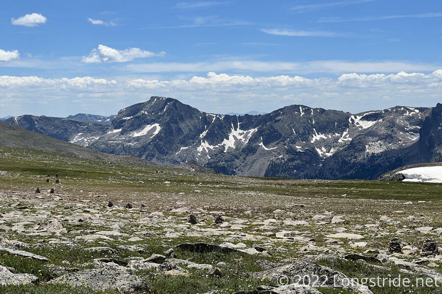
Climbing up the valley’s headwall brought me above the treeline, giving a view back down the valley. The burned area from the fire was clearly visible. A sign claiming that “mountains don’t care” warned of bad weather and whiteouts, even in summer. Fortunately, there were only a few clouds in the sky. But I would not have wanted to have been out here yesterday, in the rain and fog.
A short distance later, I ran into Dog Bite, who was hiking north. He and Plus One had been skipping around a bit, planning to get off trail in a few days to go to a family event. Afterwards, they planned to return to the trail up north in Glacier and heading south from there, bringing along Simple, who got off trail with us in Grants. (Simple went to hike on the Florida Trail, getting injured in the process, and hadn’t yet gotten back on trail as a result.) Plus One, not feeling well, had hiked back to Shadowcliff from their campground.
Climbing out of the valley, the trail turned south and flattened out a bit, as it started crossing the Bighorn Flats, a large flattish plateau with grasses and wildflowers. To the southwest, Grand and Shadow Mountain Lakes were visible, though the town of Grand Lake was not.
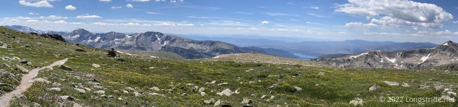
The top of the plateau was roughly halfway through today’s hike. After about 11 miles and 4,000 feet of elevation gain, I now had another 12 miles and 4,000 feet of elevation drop to get back to Shadowcliff. The hike downhill to town would be quicker, I expected, but I was glad I was doing today with a minimal day pack.
Heading downhill, the trail was marked and flanked by huge rock cairns, visible from quite a distance away. Given the size of the cairns and the warning sign, the weather here really must get pretty awful at times.
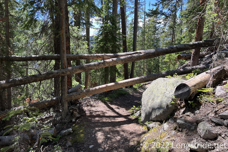
The south side of the loop, dropping off the plateau, was quite a bit steeper than the climb up, with a few sets of switchbacks to navigate a few steep areas. The steepness probably contributed to the more rocky character of the trail, as I dropped into another valley, this one made from Hallet Creek and “North Inlet”. While there were still a fair number of dead trees on this side of the mountain, the fire did not seem to have done as much damage. There were, though, quite a lot of blowdowns on one stretch of switchbacks, with nearly every level having trees that needed climbing over or ducking under. I was quite glad I only had a day pack, rather than a full pack that would have made navigating the trees very annoying.
I passed a few campgrounds on the way downhill, with signs warning of a bear encounter two weeks ago that resulted in the bear getting into someone’s food. Dog Bite and Plus One camped at one of them last night, and a bear went after their food as well, leaving bite marks and bear drool in their Ursack, but otherwise not actually getting their food. (Once I got back to Shadowcliff, Dog Bite showed me the bite marks in his Ursack; I hoped that mine would fare better.)
The trail followed the creek for a while, occasionally peeling away to follow along the edge of meadows surrounding the creek. About a mile out of town, the trail joined a dirt road, and CareFree joined me for the last bit of today’s hike.
Back at Shadowcliff, we chatted with Dog Bite and Plus One for a little while, and then went to the Sagebrush BBQ & Grill for dinner.
Given that entry into the Rocky Mountain National Park requires a timed permit after 9 am, since I did not expect to leave town tomorrow before then, I attempted to get a 9 am entry permit. Unfortunately, they were sold out, so I wound up with an 11 am permit. I guess tomorrow morning will be somewhat lazy!