Leaving Steamboat Springs, I headed north, finally on my way to Wyoming.
I wasn’t especially efficient about leaving this morning, between just generally being slow, and having terrible service at the hotel’s restaurant. But, I got everything packed up and was out the door by quarter to ten, planning for a 20+ mile day.
Getting back to the trailhead was as easy as it was to get to town yesterday: it took me longer to cross the street in front of the hotel than it did to get a ride once I stuck my thumb out.
From Muddy Pass, I continued the roadwalk from yesterday. After traveling mostly west from Grand Lake, the trail turned north on US 40, aiming me in the direction of Wyoming. I followed the highway for about two miles, back in the general direction of Steamboat Springs, and getting a better view of Rabbit Ears Peak than yesterday. Now, I could clearly see the “ears” on the mountain.

Shortly after turning off the highway onto a dirt road, I had a bit of a panic attack. I couldn’t recall actually packing my tent stakes, which I need in order to set my tent up. I dug into my pack, and found them at the very bottom (where they weren’t supposed to be). In all likelihood, they fell to the bottom yesterday when I pulled everything (else) out of my pack, and I didn’t pack them today because they weren’t out of my pack waiting to go back in. (Fortunately, if they hadn’t been there, I was still very close to the highway, and probably would have been able to get back to town very easily to deal with the problem.)
The trail continued on the dirt road for a while, and then joined an old paved road, gradually winding back up into the mountains. It was unclear to me if this was an old alignment of US 40, or if it was an old road to the car campground that was ahead. Either way, it was hard on my feet, after over twenty miles of dirt and paved roadwalk yesterday and the day before.
The trail turned off onto a dirt road at a monument for Rabbit Ears Pass, which had a parking area and a few dirt roads branching off in different directions. From the pass, I followed the dirt road through an extremely busy car campground — every site I saw was occupied, many with RVs.
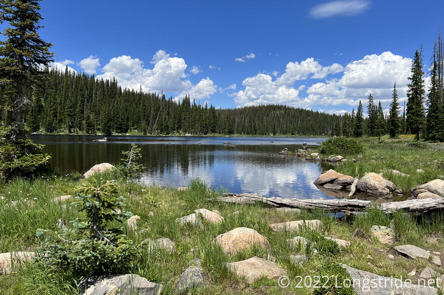
Leaving the campground, the trail followed the side of a meadow next to a lake, turning off the dirt road after crossing the lake’s inlet.
I passed quite a few day hikers, a few with dogs, and there were many more following paths in the meadow between the CDT and the lake. After a brief strenuous climb up the hill after crossing the inlet, I stopped for a break on the side of the trail, looking out onto a mosquito-infested meadow surrounded by forest. I had to shoo a dog away that had gotten too far from its owner and was a little too interested in my Snickers bar.
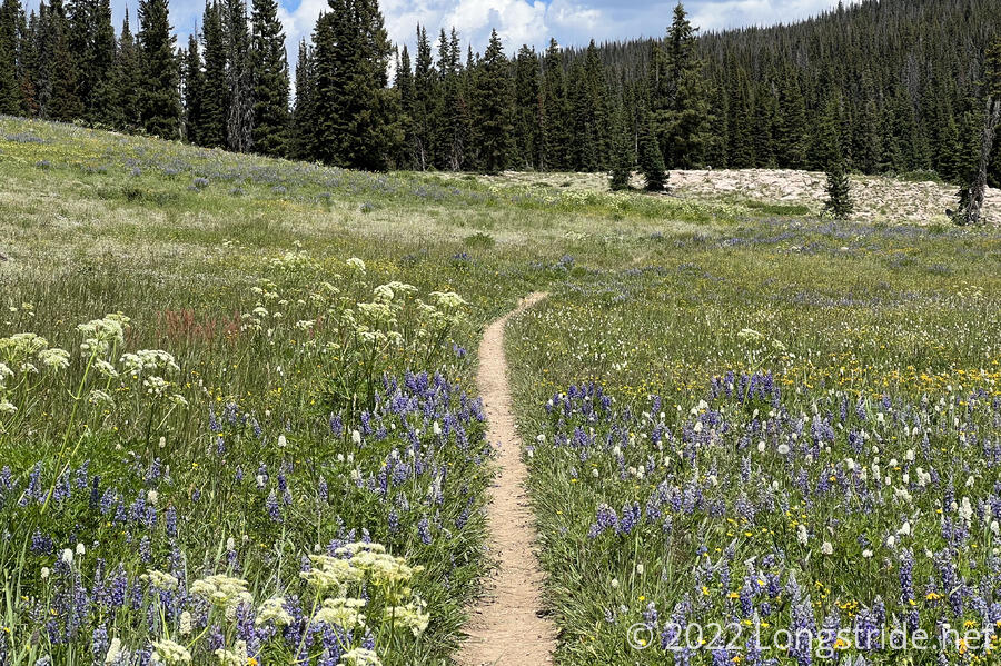
The trail continued a gradual climb, following several meadows and briefly jogging into forests along the way. A good bit of this part of the trail was lined with wildflowers, making for a very pleasant hiking experience.
For about half a mile, the trail turned onto a dirt road signed as the “Wyoming Trail”. It was unclear to me if this was indeed once an early pioneer trail to Wyoming, but if it had been, it would have been a quite beautiful area for settlers to travel through.
Leaving the road, the trail re-entered forest, leaving every now and then to pass by a meadow or lake.
Along the way, a trail runner with a dog let me know they had seen a moose ahead at an intersection, and to be cautious. Having already been closer to a moose than I’d prefer, I stayed a bit more alert to my surroundings than I normally was. Fortunately, there was no moose when I got there. Later, though I did hear (but couldn’t see) a frog near some wetlands.
While I stopped for a break in the forest, a cloud passing overhead cloud sprinkled some rain that didn’t seem to reach the ground until it had long passed by. I hoped this would be an isolated incident. (It was; I didn’t get rained on further today.)
The gradual uphill continued. Breaking the relative quiet tranquility of the forest, four motorbikes passed. A dark cloud to the west moved closer, but passed without incident. Briefly joining a dirt road near a trailhead, I saw a large police vehicle in one of the parking lots, which seemed very unusual. A bit later, I stopped for another break on the side of the trail. Another hiker, with a large dog hiked past; like before, the dog came up to me, investigating my snacks. At least both this hiker, and the one earlier, apologized, rather than trotting out the tired “it’s okay, they’re just friendly” excuse.
I’d stopped for my break just before and just out of sight of the sign for the Mt. Zirkel Wilderness. A sign at the boundary warned that the trail was entering a burned area. However, it didn’t seem like there was any sign of there being a forest fire. It wasn’t until a few miles later, as I was nearing my campsite, that I saw the first sign of there having been a fire.
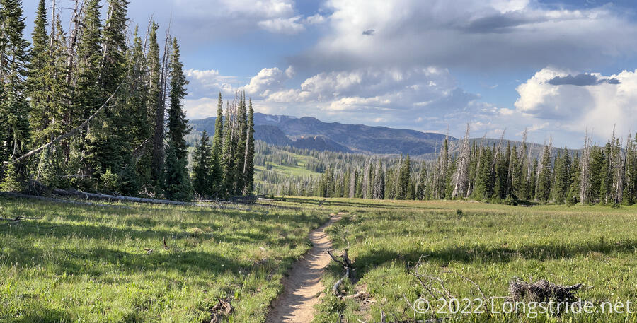
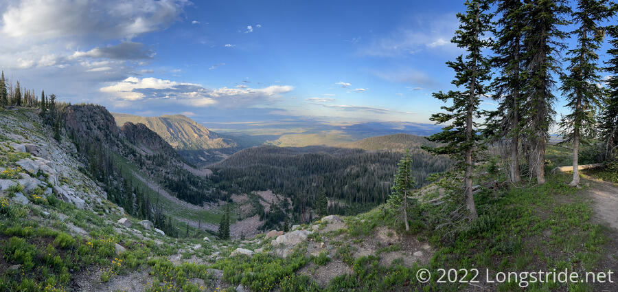
The wilderness had a quite unique appearance. It was largely a grassy meadow, interspersed with thin rows of pines.
Cresting over a hill, I saw two day-hikers heading in my direction, back to the trailhead. With the forest service, they told me that there was a woman and a dog missing, and they were part of a search party that hadn’t yet found them. (I decided that this explained why there was a police car at the trailhead.) The missing hiker apparently had set up a hammock a bit ahead adjacent to a cliff with a view, near where I’d planned to camp because of the “epic camping” described in my trail guide. Another hiker had called search and rescue when her hammock was seen to have not moved over the course of a day. I said I’d keep an eye out, but I doubted I’d locate a missing hiker unless they were in an obvious place near the trail.
A short while later, I stopped to get water at a creek crossing the trail. Thanks to the water, mosquitoes, which had been plaguing me all day by swarming me if I stopped moving for five seconds, made the break entirely not restful. I had to keep moving to keep the mosquitoes away.
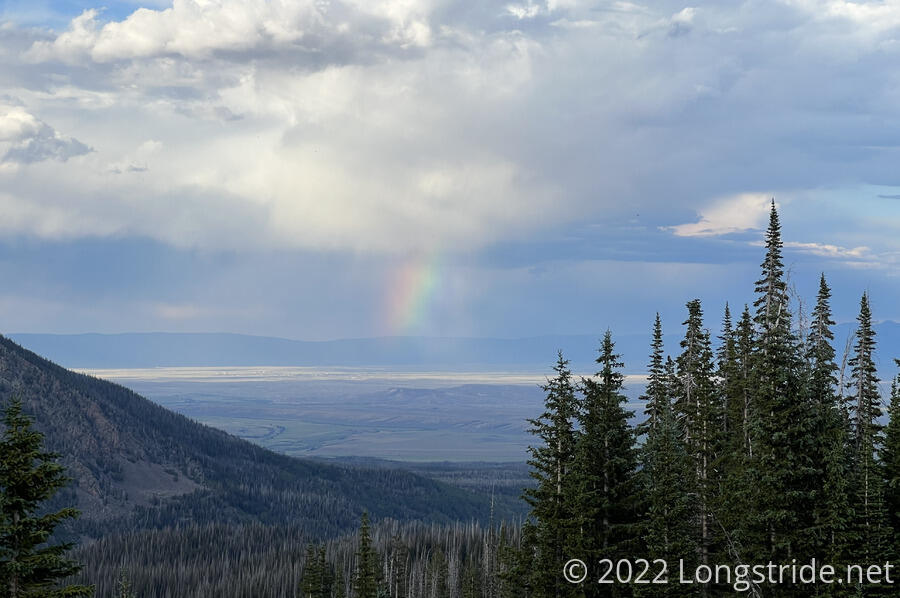
As the trail climbed and proceeded into the Wilderness, it also made its way towards a steep cliff. Looking out towards the east, a line of clouds in a valley were perfectly positioned to appear to be raining a rainbow.
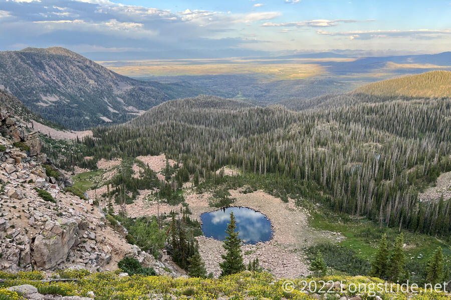
Now along the cliff I’d been planning to camp at, I had a bit of trouble finding a good campsite. There were certainly plenty of views, but no actually good places to set up at. I kept going for a bit, eventually finding the hammock that had been described to me. That spot had a great view, but I didn’t want to camp right there, given there was clearly food that was improperly stored (for bear country).
I walked back a little bit to the least bad campsite I’d come across along the cliff, and set up my tent. From my tent, there wasn’t really much of a view, but a few steps away from my tent gave a nice overlook to a round lake reflecting the clouds. The mosquitoes were still out in force, making dinner uncomfortable. I couldn’t remember another day on the CDT where mosquitoes were this consistently bad the entire day. They weren’t so bad as to need to use my bug net — only the PCT has forced me to use one — it was more that they were just consistently miserable for the whole day.
I was happy, though, to have gotten 22 miles in today, despite starting a little late. Tomorrow should hopefully be a little bit longer, and also mostly downhill.